After the front, clearing skies for a partial eclipse tonight, and pleasant weather Saturday

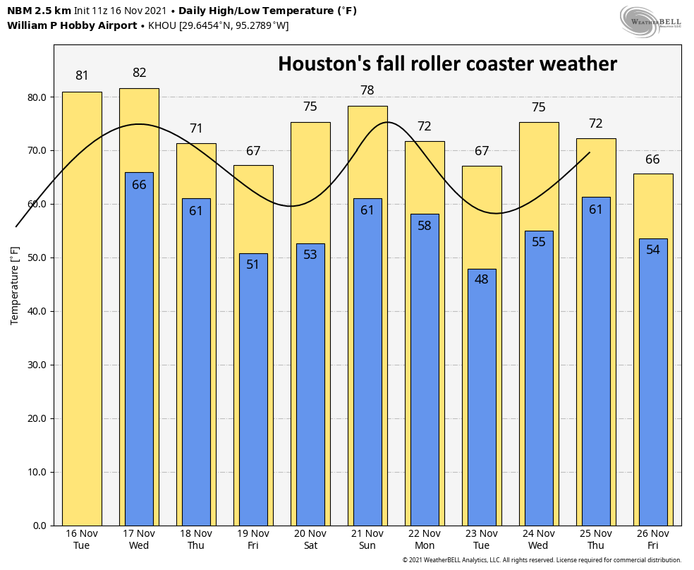
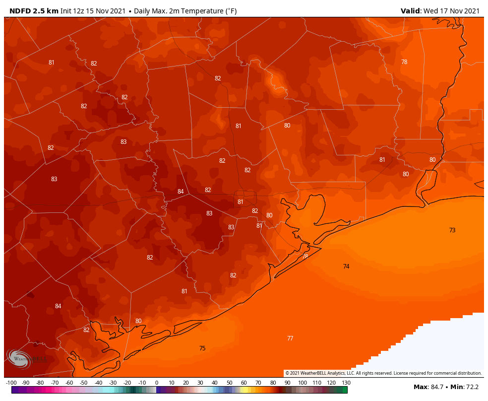
A cold front is moving through Houston this morning, and should push off the coast within about an hour of sunrise. For those who like fall weather in Houston this is a good thing—the high temperature at Hobby Airport reached 87 degrees on Wednesday, setting a record for the location. Bush International Airport, Galveston, and College Station narrowly missed setting records. But now that’s passed, with cooler and fairer weather ahead.

Thursday

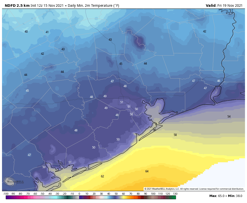
As anticipated, this morning’s frontal passage has largely been a dry affair. Drier air will move in today on winds of 10 to 15 mph from the north and northwest. Skies will be mostly cloudy through the early afternoon, helping to limit highs to about 70 degrees, but there should be some clearing later today. Skies tonight will be partly cloudy allowing lows to drop into the upper 40s, with cooler temperatures inland, and slightly warmer ones right along the coast.

Tonight’s partial lunar eclipse will peak at 3:02 am CT. (TimeandDate)

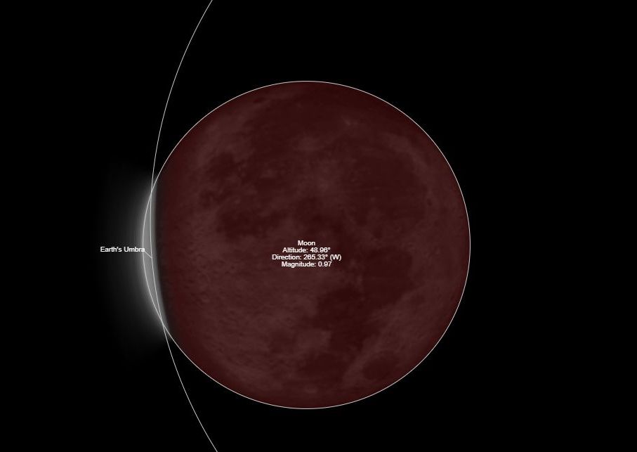
I mentioned the possibility of clouds tonight as there is a partial lunar eclipse that runs from about midnight to 6 am, with a peak at 3:02 am CT locally. At that time Earth’s shadow will darken 97 percent of the Moon’s surface. The bottom line is that there should be enough breaks in the clouds to see the eclipse if you’re up late tonight, or early on Friday.
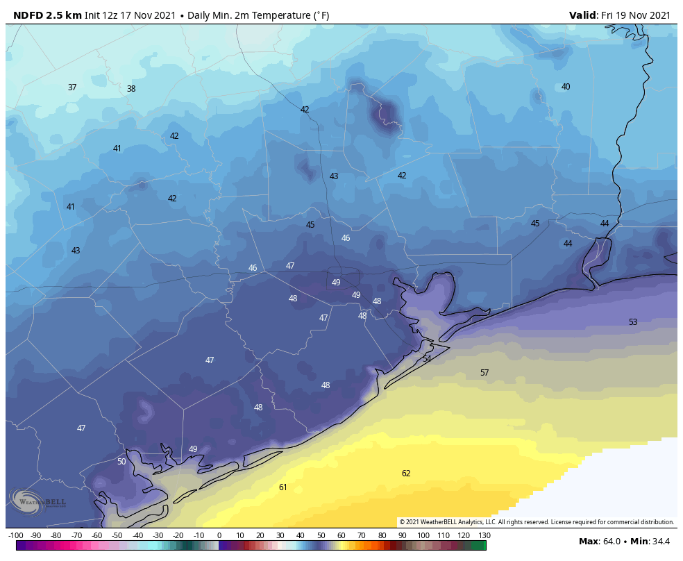
Friday

This will be a splendid late fall day, with light northerly winds and highs in the mid-60s. Skies will be mostly sunny. Lows will probably be a degree or two warmer than Thursday night.

Saturday

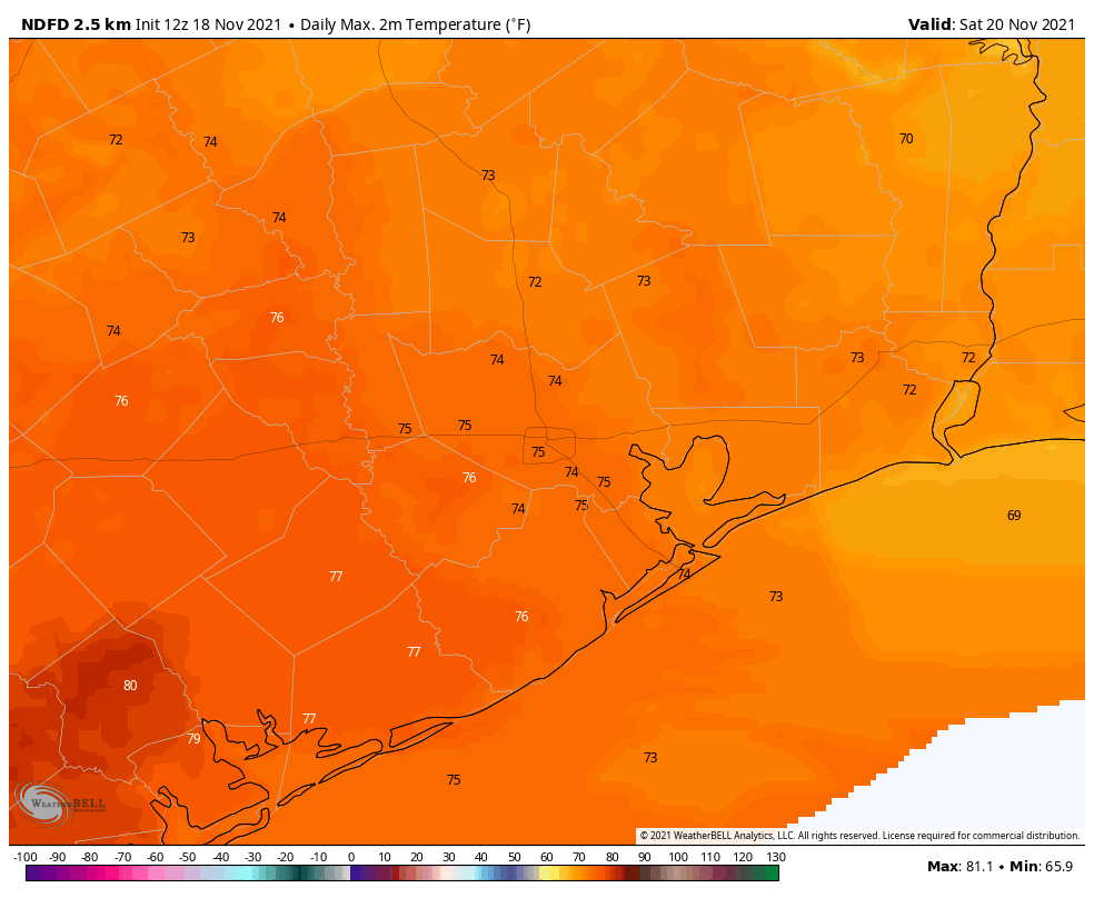
The first half of the weekend has no weather concerns. After the cool start, temperatures will warm into the mid-70s with partly to mostly sunny skies. As winds shift to come from the south, lows on Saturday night will only drop into the 60s for most of the region.

The high temperature forecast for Saturday looks rather lovely. (Weather Bell)

Sunday

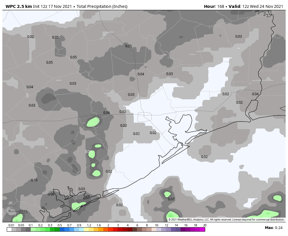
This day should see a few more clouds, and more humidity, as highs push into the upper 70s to 80 degrees. It now appears as though another front will move through on Sunday afternoon or evening, and could bring at least a broken line of showers with it. Any rain accumulations should be fairly light, however. Lows overnight should drop into the 50s, with drier air moving in.

Next week

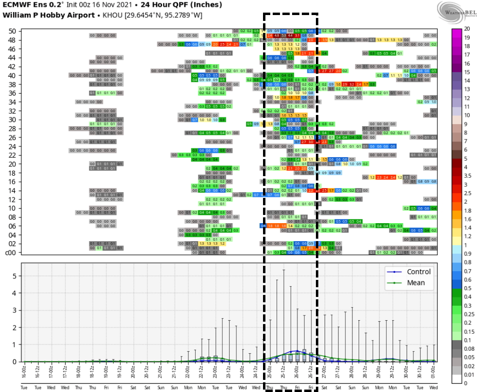
Monday and Tuesday look clear and cool next week, with highs in the upper 60s to 70 degrees. Unfortunately, we’re still anticipating a messy pattern during the middle of next week, with the passage of a cold front later on Wednesday or on Thanksgiving Day. With fairly high atmospheric moisture levels, I expect to see some rainfall along with, and possibly after the passage of this front. As we’re still a week out I don’t have too much confidence in the details, but showers and thunderstorms certainly seem like a distinct possibility at some point on Thanksgiving. Conditions will be warm ahead of the front, with temperatures dropping afterward, and lows in the 40s likely at the end of next week.

Fundraiser

Just a quick word to say that we’re still raising money for 2022 for Space City Weather with our annual fundraiser. You can buy merchandise or simply donate funds for the site. We truly appreciate your generosity.

A sticky day before fall-like weather returns to Houston

Houston will see one more warm day before more fall-like conditions return with a cold front arriving early on Thursday. This will bring a significantly drier shot of air into the region on Thursday night and Friday morning, with dewpoints dropping into the 20s and 30s. Mostly sunny and somewhat warmer conditions return for the weekend, with uncertainty ahead for the Thanksgiving holiday.

Wednesday

Before we get to the drier air, however, we’ll see fairly muggy conditions today—by November standards at least. Temperatures this morning are only slightly below 70 degrees, and with mostly sunny skies temperatures this afternoon will probably get into the low- or possibly mid-80s for some areas. I’m tempted to say this is the warmest day left in the year, but Sunday may also see highs of about 80 degrees so I’m not going to make any firm predictions. Winds will be fairly light today, generally out of the south. Lows will be sticky again tonight ahead of the front.

Thursday

As for the front, roughly speaking it should reach the College Station area around midnight or shortly thereafter, push into central Houston between 5 and 7 am CT, and reach the coast between 7 and 9 am. Some scattered showers will be possible with the front, but nothing too heavy or lasting too long. Any rains will probably end quickly as drier air moves in. Highs on Thursday should max out in the low 70s, with clearing skies during the afternoon. Winds will be out of the north and northeast at 10 to 15 mph.

Thursday night will be the coldest of the week, so if you’re participating in the Sleep Out event for Covenant House, be sure and have an extra blanket. Lows will likely drop to 50 degrees, or slightly lower, in Houston with winds out of the north at 10 to 15 mph. Skies will be partly cloudy. Further inland, lows may drop into the low 40s.

Low temperature forecast for Friday morning in Houston. (Weather Bell)

Friday

A fine late fall day, with highs in the mid-60s and mostly sunny skies. Winds will be generally light. Lows Friday night will probably be a degree or two cooler than Thursday night.

Saturday and Sunday

After a cool start, temperatures on Saturday should climb into the mid-70s with mostly sunny skies. Overnight lows will drop to about 60 degrees, and then Sunday should be warmer with highs of around 80 degrees and a mix of sunshine and clouds. Another front should arrive on Sunday night, probably around midnight but there’s still plenty of uncertainty. Overall rain chances with this front are fairly low, but not zero.

Don’t expect to see much rain between now and next Tuesday. (Weather Bell)

Next week

Monday and Tuesday should be clear and cooler before a warming trend begins again Wednesday. Then, all eyes are on the next front and its implications for Thanksgiving. We’ve had several questions about outdoor events, such as the Houston Turkey Trot on Thanksgiving morning. Due to the pandemic, many of these activities were put on hiatus last year, but are now returning. So will Mother Nature cooperate?

The big picture is fairly clear: A front will be moving toward our region on Wednesday night or Thursday morning, but we still have questions about how quick (or slow) and dry (or wet) its passage will be. At this point I’m thinking we’ll see a slower moving front, making for a gray Thanksgiving Day with a healthy chance of rain. We’re not looking at inches and inches of rain, I don’t think, but there may be enough precipitation to put a damper on outdoor events at some point during the day. After the front moves through things probably will cool down significantly, with lows at least in the 40s. But the colder air may not come until Thanksgiving night or Friday.

Our confidence in such a forecast will, of course, increase in the coming days as we feast upon additional data.

Fundraiser

I want to extend a very, very warm thank you to all who have contributed to our annual fundraiser so far. As always, your response has been tremendous. There’s still time to get your t-shirts, umbrellas, caps, tumblers, or to simply donate.

Houston’s roller coaster weather rolls onward

Good morning. As it often does during the fall, Houston is riding the roller coaster, with temperatures plunging after a front moves through, bottoming out over a period of one or two nights, and then beginning to rise again. We’re now in the middle of the pattern during which we’re rising again. Temperatures will peak on Wednesday, in the low- to mid-80s, before we drop again Thursday. Make sure your seat belts are fastened!

Up and down, up and down, so it goes around town during the fall. (Weather Bell)

Tuesday

There is some patchy fog across Houston this morning, but it will burn off quickly. Skies will otherwise be mostly sunny, with southerly winds of 5 to 10 mph. Highs will climb to about 80 degrees in Houston, with slightly warmer conditions west and southwest of the city, and slightly cooler right along the coast. Lows tonight will not drop too far, likely only into the upper 60s.

Wednesday

This will be another day an awful lot like Tuesday, albeit with temperatures possibly a degree or two warmer still. Fortunately, for those who would like to see some November-like weather in November, a front remains on track for Wednesday night. In terms of timing, it’s likely to reach the College Station area around midnight, push into the city a couple of hours later, and reach the coast around sunrise or shortly before hand. A broken line of light to moderate showers may accompany the front, but right now accumulations are likely to be less than a quarter of an inch for nearly all of us.

Thursday

In the front’s wake, skies should be mostly cloudy Thursday morning, although we should see some clearing during the afternoon hours. Highs will reach about 70 degrees, and northerly winds will be bringing drier air in throughout the day. Lows Thursday night should bottom out in the upper 40s in Houston, with cooler conditions inland, and warmer near the coast.

Lows on Friday night should be the lowest of the week. (Weather Bell)

Friday

This will be a cool, but beautiful day with sunny skies and highs in the mid- to upper-60s. Lows Friday night will probably be a couple of degrees warmer than Thursday.

Saturday and Sunday

The first half of the weekend should see continued mostly sunny skies, although highs will probably push back up into the mid-70s. This will be a fine day for outdoor activities. Sunday should be a few degrees warmer, and will likely see more clouds. It looks as though another front will arrive later on Sunday or Monday, and this will introduce a chance of showers later on Sunday, although the timing is to be determined.

There is fairly strong agreement in the European ensemble model about rain sometime from next Wednesday evening through Thanksgiving night. (Weather Bell)

Next week

The front should usher somewhat cooler and sunnier weather into the forecast for the early part of next week before a warming trend begins—the roller coaster, remember? I mentioned yesterday that models were hinting at the arrival of yet another front around Thanksgiving Day, and it still looks like this could be the case. All of the caveats for a long-range forecast apply here, but it still seems possible to me that we could see a wet front passage sometime on Thanksgiving Day or night.

Fundraiser

We’re smack dab in the middle of our annual fundraiser, during which we’re raising money to support the site, our weather app, and more. You can buy merchandise or donate here. Thanks for your generous support so far!

Here is our “early look” forecast at Thanksgiving in Houston

Good morning. This is the second week of our annual fundraiser, and you can purchase merchandise or make a donation here. Readers will often email us in the middle of summer asking if they can buy a t-shirt, but we only do this in November, when the weather is typically benign. So don’t miss out!

After a fall-like weekend our temperatures will be on the upswing to start this week before a front arrives sometime around Wednesday night. There don’t appear to be any fireworks with this front, but it should set the stage for a pleasant second half of the week. At the end of this post I’m also taking a stab at the Thanksgiving forecast—unfortunately right now it’s not one to relish. The only sure thing about the forecast for the next 10 days it that it will be stuffed with puns.

Monday

Low temperatures this morning have fallen to about 60 degrees, and with mostly sunny skies we’ll likely see highs reach about 80 degrees this afternoon, give or take. Winds will be light, out of the south, and as a result dewpoints will continue to inch upward. Overnight lows should again drop down to around 60 degrees in Houston, with warmer conditions along the coast, and moderately cooler ones inland.

Tuesday and Wednesday

These should be more fairly warm days, for November, with highs in the vicinity of 80 degrees, moderately humid air, and mostly sunny skies. Some time after midnight on Wednesday, and sunrise on Thursday, the region’s next front should arrive. This may bring some very scattered showers and thunderstorms as it passes through, but right now the overall setup does not appear to favor much rainfall. This will usher a drier and cooler air mass into the region.

Wednesday should be the warmest of the week, with highs in the low- to mid-80s for much of the region. (Weather Bell)

Thursday

Skies will be mostly cloudy to start the day, with some sunshine probably mixing in during the afternoon hours. For inland locations, highs may not reach 70 degrees, with the immediate coast likely seeing highs in the low 70s. Winds will be moderate, out of the north at 10 to 15 mph. Thursday night should see temperatures drop to 50 degrees or just below in the city, with 40s for other inland areas, 50s closer to the water.

Friday

This will be a clear and sunny day with highs likely in the mid-60s. Expect another night with similar temperatures to Thursday night, as lows drop to around 50 degrees in Houston.

Friday morning will be probably be the coldest of the week. (Weather Bell)

Saturday and Sunday

We should see another pleasant fall weekend—at least to start. With sunny skies, highs on Saturday should max out in the low 70s. Overnight lows will be a bit warmer than the previous two nights, likely dropping to around 60 degrees. Sunday should be warmer, perhaps in the mid- to upper-70s, with increasing clouds. Another front is slated to move through later on Sunday or Monday, and this could generate some rain showers on Sunday and Monday. The details are to be determined, both about the amount of rain, and strength of the front.

Thanksgiving week

We’ve been in a general pattern for awhile now of getting a front, seeing things cool down for a couple of days, subsequently warm up again, and then seeing another front. I think this pattern will continue, and this would put us in line for a warming trend in the middle of next week, around Wednesday, Nov. 24. The question then becomes how quickly the next cold front comes through, and right now the medium-range models are suggesting a possible frontal passage on Thanksgiving, plus or minus day. Some of the models also suggest there will be enough moisture for some decent rainfall. So my best guess is that Thanksgiving starts out fairly warm, but may cool down later with a wet frontal passage.

It’s still a long way to go, however. We still have 10 days to go before Thanksgiving. So hopefully this is a turkey of a forecast.