Introducing version 1.5 of the Space City Weather app, which of course you should immediately download

When we launched the Space City Weather app last year, our goal was to give Houston-area residents everything they needed to know about local weather in a fast, readable, and intuitive format. We feel like we met that goal, and judging from your reaction, so did you! We were blown away by the number of downloads, which quickly surpassed 100,000, and has continued to grow. We’re also glad to see people using the app, particularly when it was needed most during periods of severe weather.

Because that was just the beginning for the app, we asked what features you’d like to see, and to let us know about bugs and frustrations. You gave us plenty of feedback, and for the past few months we’ve been using that data to make a more perfect SCW app. In large part due to your generous support during our 2021 fundraiser, we’ve been able to make some significant upgrades.
To that end, today we’re announcing version 1.5, and we consider it a collaboration with our users. Here’s what is new:

• The Houston area is a big place, and weather in one locale can be dramatically different from conditions in another. So we’ve more than doubled the number of cities in the app to a full dozen. We now track Houston (IAH), Hobby airport, Conroe, Galveston, Katy, Tomball, Beaumont, League City, Sugar Land, Lake Jackson, Baytown and Pearland. Tap the three-line menu in the upper left of the main page to see the list, and switch locations.

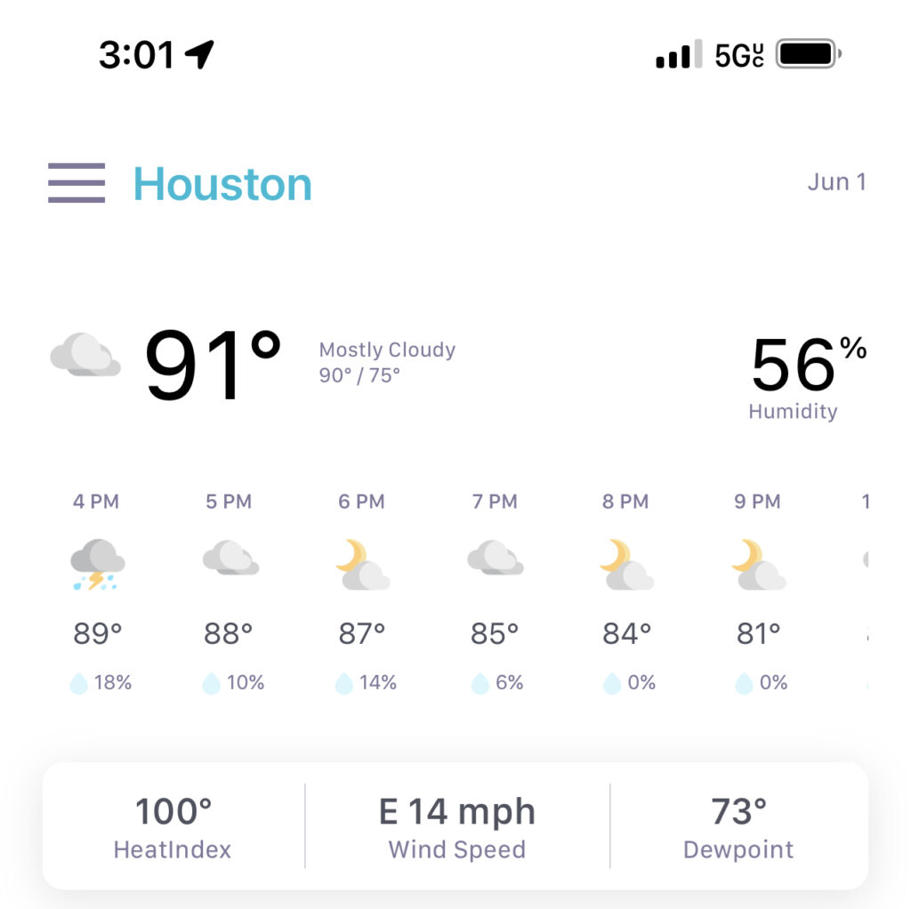
• We’ve added rain chance percentages to both the hourly and daily forecast tables on the main page.

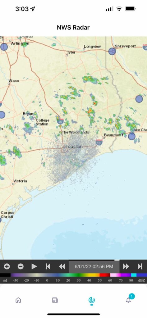
• There’s a new, live National Weather Service radar page, accessible by tapping either the radar thumbnail at the bottom of the main page or the new Radar icon at the bottom of the app. You can zoom in and out to get a closer or wider look at radar conditions.

• You can now toggle between Fahrenheit and Celsius in Settings.

• We’ve fixed some frequently reported bugs, such as Android users’ inability to zoom in and out of images.

• There are tweaks to the layout and interface to make the app more attractive and intuitive. For example, the Settings icon is now found at the top of the list of cities for quicker access. 

There are two things we have not changed. We still don’t collect your personal information or do any kind of tracking. And, of course, there’s still no hype in Eric and Matt’s blog posts. 

The new version of the app should be showing up as an update for both iOS and Android users. And if you haven’t yet installed it, you can find it in the Apple App Store and Google Play Store by searching for “Space City Weather.”
We hope you enjoy SCW 1.5. If you run into any problems, let us know via email at [email protected]. And keep those feature requests coming. We’re already thinking about what to do next!
Houston will see a slight chance of rain the next two days

Steve Earle has long been one of my favorite music artists. He grew up in San Antonio and seemed to understand a little bit about the ways of Texas rainfall. In particular, I often recall his song “The Rain Came Down,” released in 1987, when I think about Houston’s penchant for either flooding or being in a drought during the summer months. The song itself is not about weather, but there’s this one line that just so perfectly captures my feeling about Houston summers:

And the rain came down
It’ll wash you away and there ain’t never enough

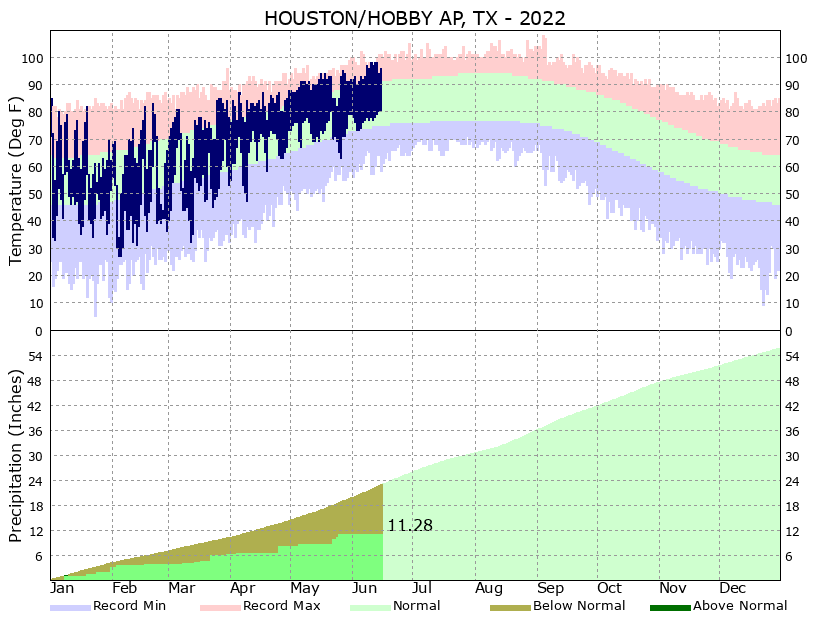
For a five year period from 2015 to 2020, it washed us away. Increasingly, this year, there ain’t ever enough. Take a look at this rainfall graphic for Hobby Airport, which shows the region receiving less than half of its normal rainfall for 2022. It’s that way for much of the region, especially for areas along and south of Interstate 10. Unfortunately, while we have a chance of rain the next two days, there continues to be little sign of the overall pattern changing.

Houston Hobby temperature and precipitation graphic for 2022. (National Weather Service)

Thursday

High pressure continues to dominate our weather, leading to continued high temperatures in the upper 90s for much of the region on Thursday. The difference today and Friday is that there will be more atmospheric moisture to work with, so it is possible the sea breeze will generate some pop-up showers and thunderstorms during the afternoon hours. Your chances today are about 20 percent, so I wish you luck. Winds will be light, out of the southeast, and you know the overnight is going to be sticky humid, don’t you?

Friday

As moisture levels peak, rain chances are probably best on Friday, reaching 25 or 30 percent. Otherwise expect more mostly sunny skies with highs in the upper 90s.

Saturday and Sunday

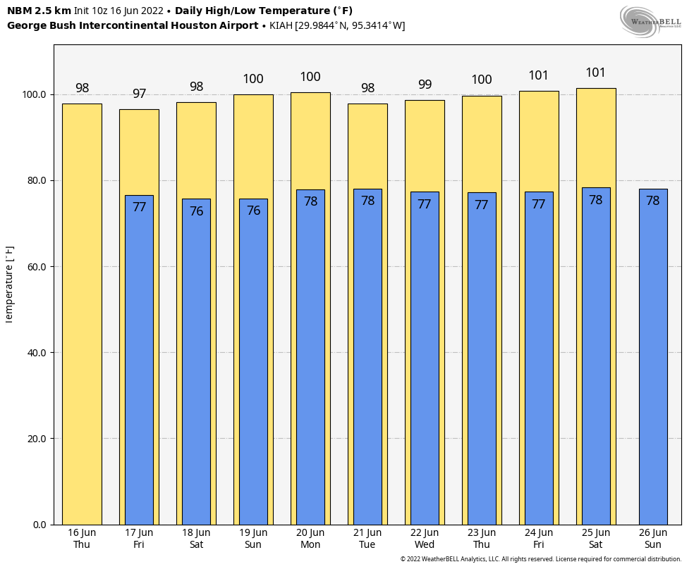
The weekend will be downright hot, with 100-degree readings possible on Saturday and the Sunday Juneteenth holiday. Rain chances don’t entirely go away, but they’re probably hovering at around 10 percent with mostly sunny skies.

Welp. (Weather Bell)

Next week

I’m afraid that, for now, there’s no reason not to expect next week to be hot, mostly sunny, and mostly devoid of rainfall.

Houston nearing the longest day of the year, with the Sun reaching its highest point in the sky

Good morning. This is Eric, and I’m back from an extended weekend at a family reunion in southeastern Missouri. I must say that I enjoyed one day with a cool morning last Friday, with a daily high in the low 80s, before high pressure pushed temperatures there into the upper 90s. So my break from the heat was short-lived, but still better than nothing. As for Houston’s weather, well, not much has changed since I left town nearly a week ago. And not much is going to change in the next week. After that? Maybe. But just maybe.

Wednesday

High pressure anchored over the southeastern United States will still be the driving factor for our weather for awhile, but high temperatures today should “only” get into the mid-90s for much of the region. Skies will be mostly sunny, with light southerly winds at 5 to 10 mph. Overnight lows won’t fall much below 80 degrees, at all, for inland areas. The coast will remain above 80 degrees.

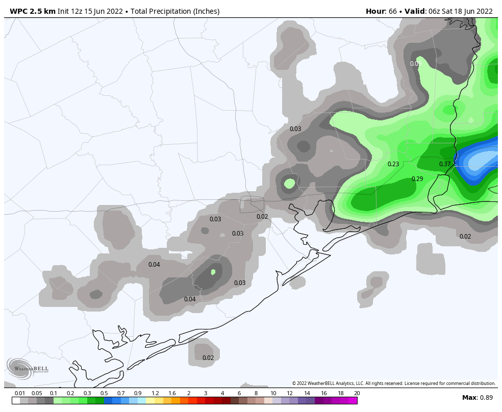
NOAA rain accumulation forecast for now through Friday. (Weather Bell)

Thursday and Friday

Most of the Houston region has yet to record even a scintilla of rainfall during the month of June and that’s unlikely to change on Thursday and Friday. However, as atmospheric moisture levels jump a bit, there will have about a 20 percent chance of rain showers each day, primarily during the afternoon hours due to the sea breeze. I think there’s even a slight chance that a few of these showers will pulse up and, however briefly, drop some heavier rain for a very few lucky areas. Will you win the rainfall lottery? Otherwise, expect highs in the mid- to upper-90s on both days with mostly sunny skies.

Saturday and Sunday

Both weekend days will be sunny and hot, with temperatures in the upper 90s. If you are out and about celebrating Juneteenth on Sunday, please do take precautions both from the heat and sunshine. We are very nearly at the longest day of the year (June 21), which means the Sun is the highest in the sky. As a matter of fact, between 1 and 2 pm during the afternoon, the Sun reaches an altitude of 84 percent, meaning those solar rays are passing through almost no atmosphere before they reach your skin. (If you’re curious, the Sun’s peak altitude during the shortest winter day in Houston is just 37 percent).

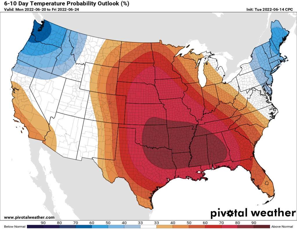
Yeah, next week looks really hot as well. (Pivotal Weather)

Next week

The overall pattern does not change much during the first half of next week, I am afraid. But after that point there is the potential for an increase moisture to move in from the Gulf of Mexico, and possibly raise the chances of rain from 0 to something measurable. Temperatures still look very hot, with highs in the upper 90s most likely.

High summer heat will not be beat

We managed 99 degrees officially again on Monday in Houston, but you may have noticed at least a little less humidity around that peak heating. It’s not much but it does help. So does air conditioning. Your author got his back before Monday afternoon, so we’ll call that a win.

Anyway, the hot weather will continue and so will the dust.

Today

Look for another day with clouds, haze, and sun. We should be able to shave a degree or two off yesterday’s 99 degrees, so look for something more in the mid to upper-90s. Another burst of Saharan dust arriving today should help us double down on the hazy conditions and poor air quality. If you are asthmatic or are sensitive to poor air quality, it would be a good idea to limit outdoor time as much as possible the next few days.

Wednesday through Friday

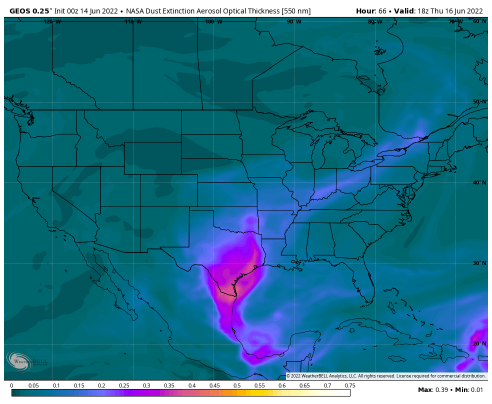
Of the next few days, only Friday carries something above a 10 percent chance of a shower. Look for sun, clouds, and continued Saharan dust, likely at its worst on Thursday.

The fancy pink color over Texas indicates another surge of Saharan dust on Thursday, which should be the worst day of the event. Improvement arrives this weekend. (Weather Bell)

High temperatures will continue in the mid to upper-90s, with lows in the 70s and 80s. Those Friday rain chances stand at around 20 percent, so a few locations could see a welcome shower or downpour but most will not.

The Saharan dust event should end on Friday, with better air quality and less haze for the upcoming weekend.

Weekend into next week

More of the same. The weak backdoor cold front (a front that comes out of the northeast…from Louisiana) that we were looking at on Sunday looks to get held up to our east. Truthfully, I just don’t see anything better than 20 percent rain chances on any given day into the middle of next week. Highs will be well into the 90s each day.

Tropics

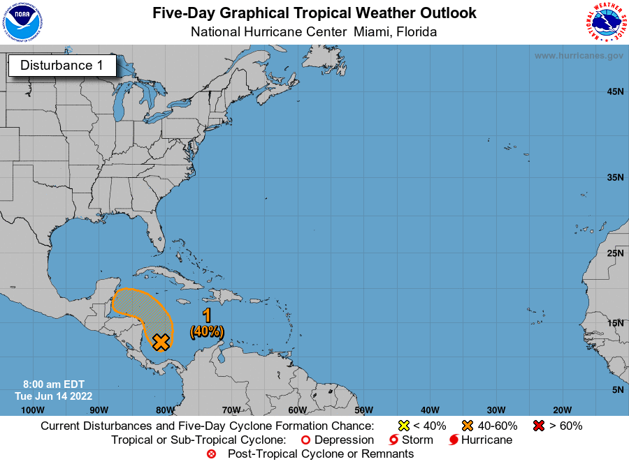
The National Hurricane Center continues to outline this area in the Caribbean for a chance at development over the next 5 days.

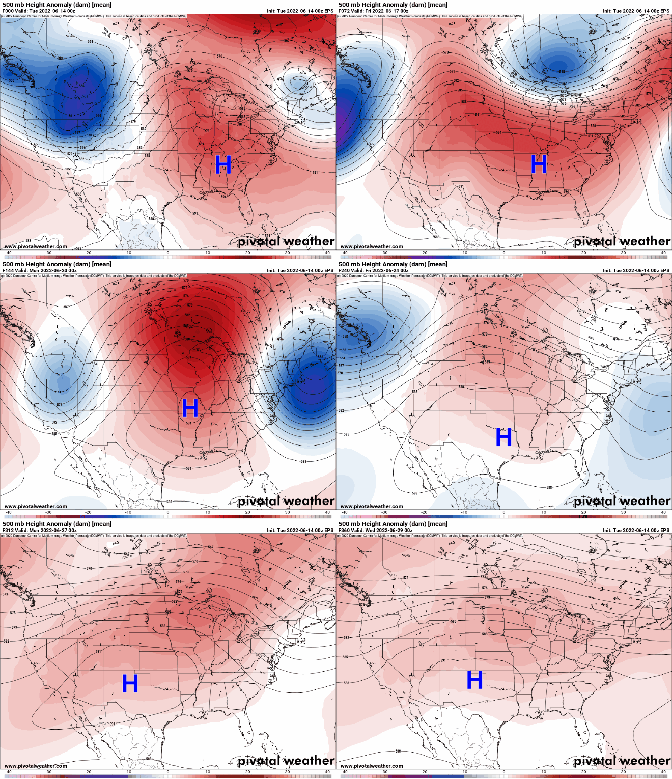
This is not a concern for Texas, and it’s rather easy to explain why. Our weather pattern over the next week (and beyond) will continue to be dominated by this fluctuating ridge of high pressure in the upper atmosphere over the Central U.S. As this system waxes, wanes, waxes, and moves around, one thing stays true: It stays in a position to basically shield Texas from any tropical nonsense right now.

If you follow the blue “H” above, an animation of the next 2 weeks of upper level conditions, you’ll see how it meanders around the Plains and Southeast, all the while generally “shielding” Texas from any tropical developments over the next two weeks.

This is both good and bad. It’s good because we could use a year off from hurricane risks. It’s bad, however, because it is likely going to cause the drought across much of Texas to expand and intensify. We could use a little surge of tropical moisture for a couple days. It appears we’re not going to line things up correctly.

Will this heat ever end?

This brings me to the last point today: Many of you are asking when this abnormally hot weather will end. Texas is always hot in summer, but we’re running consistently above average right now, more like July than June. The honest answer is that I have absolutely no idea when this will end.

We’re getting ourselves into a bit of a pickle right now, with a stubborn weather pattern that keeps reinforcing itself over the Plains. Just look at that loop above and you’ll see this. There’s a saying in meteorology that “drought begets drought,” as patterns can occasionally start acting on feedback loops. More dry air, more dry soil, more dry air, more heat, more dry air, etc. I see absolutely nothing right now that would act as a catalyst for change, so we may be stuck in this morass for the rest of June at least, if not longer. We’ve been telegraphing this for a couple months now, but prepare to hear more about drought, burn bans, and maybe more in the weeks ahead. Things can always change, of course, but we’ve got little data to predict change right now.