Parts of Pearland and Friendswood were Monday’s rainfall lottery winners. Will you win today?

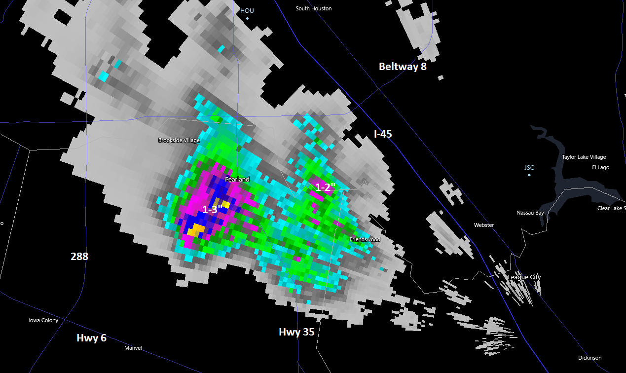
Sorry for the late post! Pearland and Friendswood were the big winners of Monday’s rainfall lottery. Pearland saw 1 to 3 inches east of 288, centered right over downtown. Friendswood saw a bit less, around 1 to 2 inches, mainly along and west of Dixie Farm Road.

Areas east of Highway 288 in Pearland and in the Friendswood area were the rainfall lottery winners on Monday. Congratulations! (RadarScope)

That was basically the only meaningful shower in our area yesterday. We will give it another go today.

Today

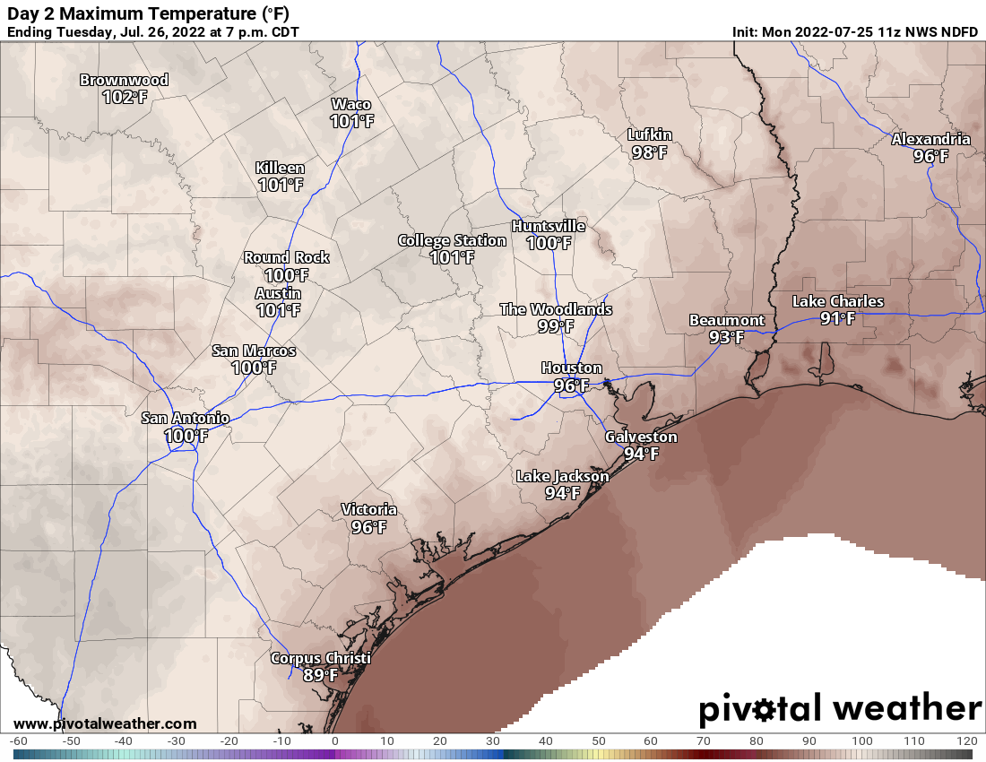
Atmospheric moisture is just a little higher today than it was yesterday. This should translate to at least a few additional showers and storms in the area. Indeed, we are already seeing at least a few showers on the radar as of this later than usual post. Much like yesterday, the heaviest action may be fairly isolated, but you could quickly go from no rain to 2 or 3 inches in the right scenario. Chances today are around 30 percent. Highs will be in the mid to upper-90s to near 100 in spots.

Wednesday through Friday

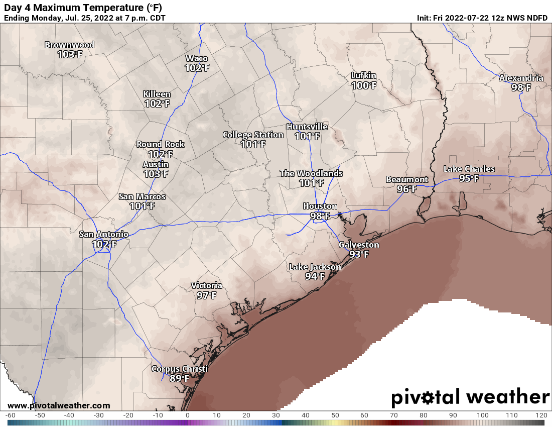
Yesterday I noted how this would probably end up being the most “normal” week we’ve had so far this summer. This is very much embodied in the forecast for Wednesday through Friday. First off, the heat will remain with us: Expect mid to upper-90s each day with 70s to near 80 each morning.

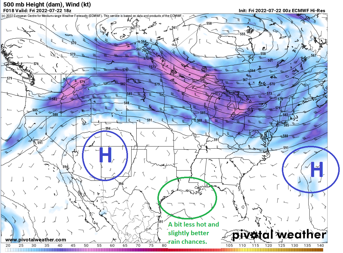
As far as rain chances go, there will be little in the way of specific predictability as to where and when rain will occur over the next few days. We know that there will be roughly a 20 to 30 percent chance each day, with storms likely starting on the edge of the sea breeze moving in from the Gulf. From there, atmospheric “bumper cars” will probably take hold, where outflow boundaries (or the rain cooled breezes that precede storms) bump into each other and form new storms on their way inland. There’s little predictability to how that all unfolds, short of us saying there’s a chance of storms each day. We may get a better sense of which days have higher rain odds than others as the week progresses.

Rainfall through Thursday morning will be very, very isolated, with many places seeing nothing, but others perhaps seeing an inch or two. (Pivotal Weather)

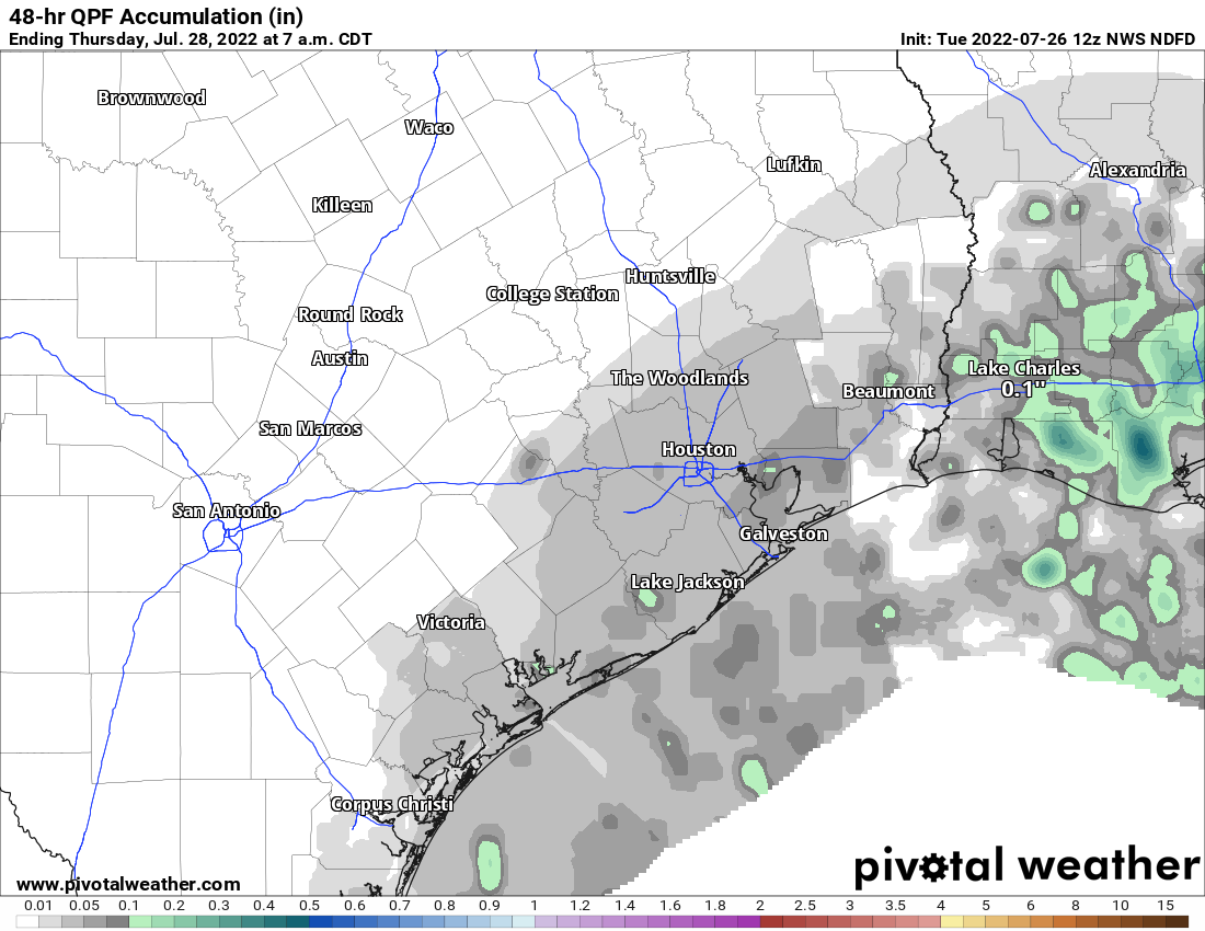
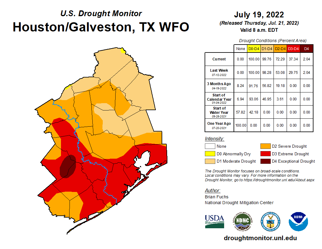
Inland areas won’t be shut out, but their rain chances are lower than in the city and south. We desperately need rain in some of those inland locales. Per the Houston National Weather Service office, the 0.21 inches of rain in College Station since June 1st makes for the driest June/July combo on record, back to 1882.

Weekend

More of the same, as it stands right now: Sun, clouds, mid to upper 90s or hotter and low-end rain chances each day.

Next week

We have not officially hit 100 degrees since Thursday. Could that change next week? Yes. High pressure is expected to re-intensify over Texas next week, which probably means we’ll lower the rain chances a bit and dial back up the heat a little more.

The upper level pattern next week as shown by the GFS ensemble is one that implies we will see weather that we are unfortunately familiar with this summer: Hot & mostly dry. (Weather Bell)

Monday and Tuesday probably start the same as the weekend, but things begin to cook for mid to late week.

Tropics

All is quiet. We’ll have our weekly Eye on the Tropics published later this afternoon explaining more about what’s happening.

Energy conservation, smart thermostats and a reminder from Reliant

Hi all. This is a sponsored post from Reliant, who asked that we share this timely information with readers about smart thermostats and energy conservation. Thanks, Eric.

Eric and Matt don’t believe in hype and at Reliant, neither do we. There has been a lot of misleading talk
in the media and online recently about smart thermostats and how energy companies use this
technology during moments when conservation is needed this summer. Requests for conservation are
not new. They are a valuable tool often used to balance supply and demand, especially during extreme
heat waves like the one we’ve been experiencing. That’s why Reliant wants to be a source of factual
information on this topic.

The main takeaway: Consumers are always in control of their thermostats

Here’s an explanation on the role smart thermostats play regarding energy conservation in Texas:

  • Reliant’s demand response programs reward customers for reducing their usage and conserving energy during periods of high electricity demand, which ultimately helps reduce the load on the Texas electricity grid and helps customers save money by consuming less. Electricity customers must sign up for and agree to participate in a demand response program.
  • At Reliant, our program is called Degrees of Difference and it rewards customers with a bill credit for the small changes they make to reduce their usage during designated events, which are communicated to customers in advance.
  • Here’s how it works: Customers with smart thermostats have the temperature automatically adjusted by no more than four degrees during these designated events, which last no more than four hours. However, customers always have ultimate control over the temperature in their homes and can override any adjustments.
  • A do-it-yourself version of this program is also available to Texans with manual thermostats who are interested in receiving bill credits for adjusting their usage.
  • Demand response programs are separate from the customer’s electricity plan and opting in or out is easy. Customers who no longer want to participate can unenroll online or by calling our call center without penalty, cancellation fees or having to cancel their existing electricity plan.
  • We’ve also reviewed other similar demand response programs across Texas and haven’t found ANY that don’t allow customers to adjust their temperature or penalize them for opting out.

With high temperatures continuing this week and beyond, we felt it necessary to be clear on how these
programs operate and remind Texans they are always in control of their energy usage.

Stay cool, SCW readers!

Houston may be embarking on our most normal week of summer so far

The Houston area has sort of settled into a happy (?) medium this weekend with moderate heat, a good bit of sunshine, but definitely at least a handful of showers each afternoon. Some locations in northern Harris County (Louetta, Champions, Klein) saw an inch to an inch and a half of rain on Sunday. A few other areas also saw wetting showers. Some saw nothing all weekend. As we go through this week, the expectation should be for fairly similar weather: Sun, heat, and at least a few showers each day. This may actually be our most “normal” week of summer so far.

Today

Today should bring us similar weather to the weekend, with at least a couple storms around this afternoon. Coverage today may be a bit underwhelming, so consider yourself fortunate if you see one. We will likely top out in the upper-90s, similar to perhaps a touch hotter than the weekend.

Tuesday

Tomorrow will see more of the same. Rain chances should be a little higher than they will be today, however, and they may be the peak of this week. Expect maybe a 20 to 30 percent chance that you’ll win the rainfall lottery. Temperatures should be mainly in the mid-90s, but they’ll be a bit hotter where it doesn’t rain and cooler where it does.

Tuesday’s temperatures should peak in the mid to upper-90s, but they’ll be more variable depending on exactly where it rains. (Pivotal Weather)

Wednesday & Thursday

The mid to late week period will also see elevated rain chances in that 20 to 30 percent range, but again each day will be like playing the rainfall lottery. Still, it’s something. Highs will be in the mid to upper-90s.

Friday & weekend

The weekend forecast stays at least a little interesting from a rain chance perspective. A front should stall to the north of the region, allowing places like Arkansas, Missouri, Oklahoma, and Kansas to get some meaningful rain. For us, the overall pattern should kick up atmospheric moisture a bit up to about the 90th percentile or a bit higher. In simple language? There will be a little more “juice” to work with, especially Friday and possibly Saturday. Coverage of storms should increase a bit on those days before declining some on Sunday.

Houston is going to lie on the western periphery of decent rain chances this week. Unfortunately, the majority of Texas will remain bone dry. (Pivotal Weather)

It would appear that hotter, low rain chance type weather may rebound next week. More on all that in the coming days.

Tropics

All in quiet. A tropical wave in the Atlantic looked as if it could develop later this week, but model support for that has plummeted in the last 36 hours. It’s still a bit hostile out there. More in tomorrow’s tropical update.

Just a quick note: Tomorrow’s posts will likely be delayed, but we’ll have something out to you by late morning. The tropics post will get pushed tomorrow later in the afternoon or evening. Thanks for your patience!

Houston’s heat persists, but could some slight relief be on the horizon?

Temperatures once again topped out at 100° officially on Thursday at Bush Airport, our 5th straight day of triple digit heat and 18th day overall in 2022. Only 1902 (19), 1980 (32), 1998 (24), 2000 (20), and 2011 (46) had more 100 degree days for the entire year.

Drought continues to worsen around the Houston area.

Extreme or exceptional drought now covers over 35 percent of the Houston region. (US Drought Monitor)

We saw level 3 (extreme) drought expand from 30 percent coverage to 37 percent coverage across the region through Tuesday. Most of the Houston metro area is in severe to extreme drought conditions now. We should see further degradation with next week’s update as well.

But, we may have at least something to watch in the longer-term forecast that could change things up. Let’s get into things.

Today & Saturday

We will see a brief respite in what has been a stifling upper level pattern this week. Texas will lie on the western periphery of a “weakness” between two ridges, one off the East Coast and one in the Southwest. This should allow for non-zero rain chances and at least slightly less hot weather both today and tomorrow.

Texas will lie between two ridges Friday and Saturday which will at least kind of allow a few more storms to pop up. (Pivotal Weather)

We’ll call it about a 20 percent chance of showers or storms, probably a tinge higher tomorrow than today, with the best odds being south and east of Houston.

Outside of modest rain chances, we’ll remain quite hot. A few places will likely try again for 100 today and tomorrow, but we should see more upper-90s in the area than we have the last few days. You’ll see temperatures drop a good 10 to 15 degrees if you’re fortunate enough to see a shower. Overnight lows will remain warm and muggy in the 70s.

Sunday & Monday

We sort of revert back to a more robust summer pattern Sunday into Monday, which should mean more 100s risk and lower rain chances.

Monday currently looks like the hottest day of the next several, with highs near or above 100° for many inland locations. Temps may ease back a little later next week. (Pivotal Weather)

I still think we could see a pop up storm or two, but I would not be betting on it for either Sunday or Monday. Highs near 100, lows in the 70s.

Tuesday through late week

Tuesday should continue hot, but there may be a slightly better chance of afternoon showers or storms. Same goes for Wednesday. I would expect highs well into the 90s to near 100 on both days. There are signs of life for late next week. At least a temporary disruption of the stagnant summer pattern seems possible. This would mean more mid-90s by day instead of 100s. More importantly, it would mean a few days of average to slightly above average rain chances. I’m hesitant to get too worked up about this, but it does appear that the upper pattern will allow the Gulf door to open more than it has been most of this summer. At least for a few days. Fingers crossed. More on that for you Monday.

Tropics

Quiet. Nothing to speak of, but there are hints of at least a possible weak system wayyyy out in the Atlantic later next week perhaps. Nothing the Gulf needs to be concerned with right now. More on that in Tuesday’s tropics post.

Speaking of next week: Just want to give you a heads up that both Eric and I are planning some time off next week to gear up for the marathon of peak hurricane season. We’ll continue posting like normal, but just bear with us if the timing is a little off on a day here or there. Thanks for understanding!