Bring some water to the Astros parade, because it will be rather warm for November

Good morning. Houston faces a sticky, and for November, very warm week ahead before a reasonably strong cold front arrives ahead of the weekend. Highs will be warmest to start the week before the region starts to see some slightly drier air from Subtropical Storm Nicole as it moves into Florida. The weekend will be downright chilly.

Monday

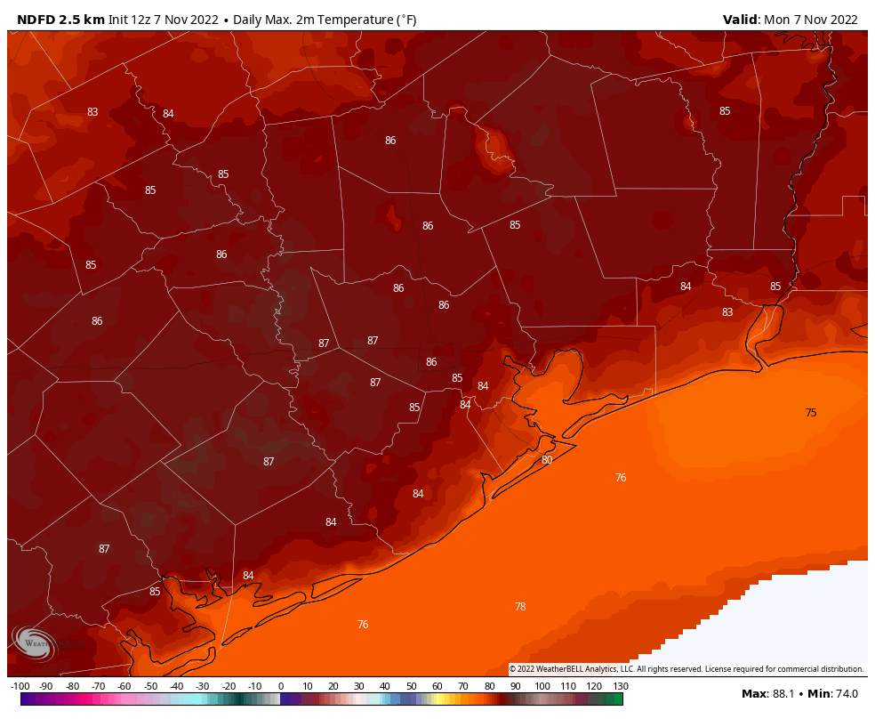
Some areas are seeing fog this morning with dewpoints and temperatures both in the low 70s, and very light winds. As the air temperature warms today, this fog should diminish. Temperatures are going all the way into the mid-80s today, as partly sunny skies this morning give way to mostly sunny skies this afternoon. There may be a few isolated showers north and west of Houston, but for the most part the metro area is going to stay dry today. If you’re headed to the Astros parade at noon in downtown Houston, please bring some water to stay hydrated with the ample humidity. Lows tonight should be a bit cooler, dropping to around 70 degrees.

High temperature forecast for Monday. (Weather Bell)

Tuesday

Some fog will again be possible to start the day. Otherwise Tuesday should be similar to Monday, with high temperatures in the mid-80s. Lows will be a degree or two cooler on Tuesday night. Rain chances are near zero.

Wednesday and Thursday

Expect more of the same warm weather, although we way see moderately drier air filtering in as the western Gulf of Mexico falls on the backside of Subtropical Storm Nicole, which will be impacting Florida this week. Accordingly, by Thursday night, lows should be dropping into the mid-60s for much of the region.
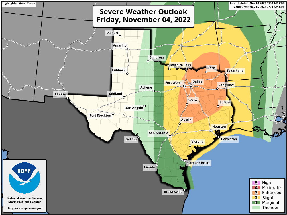
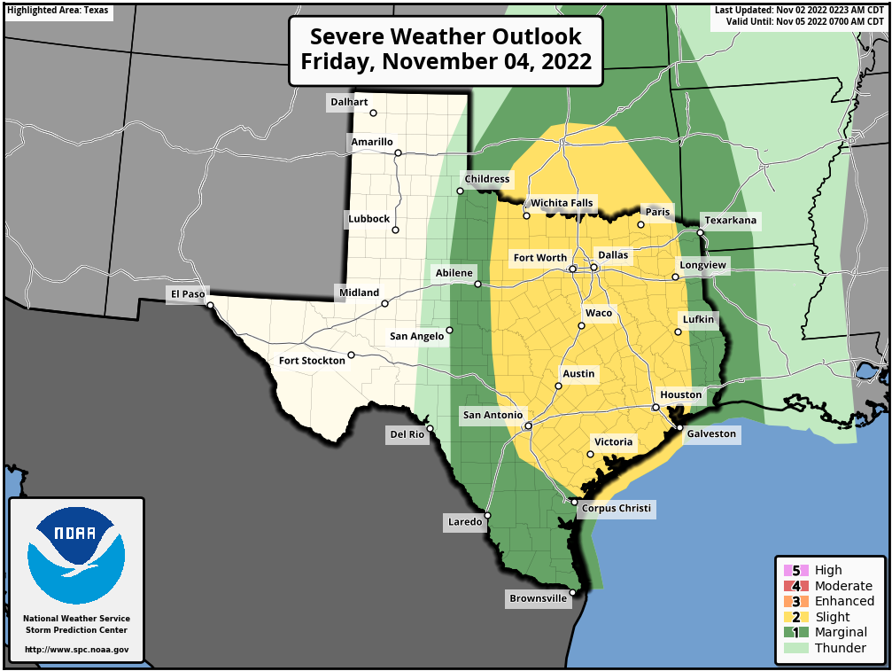
Friday

Our next cold front should arrive on Friday, probably during the daytime. The overall dynamics don’t favor much in the way of precipitation or storms at this time, but we’ll have to see if this changes. While there is unlikely to be much rainfall, I do expect plenty of colder and drier air, almost immediately. Lows on Friday night will drop to around 50 degrees.

Saturday, Sunday, and beyond

The weekend looks quite chilly, with highs in the range of 60 degrees, partly cloudy skies, and lows in the 40s. This will be some of our coldest weather this fall. Most of next week looks to remain on the chilly side, with lows continuing in the 40s. There will be some slight rain chances by Tuesday or Wednesday, perhaps. If you’ve been waiting for a longer spell of cold weather this fall, this is it.

Nicole will bring late season wind and rain to the Bahamas and southeastern United States. (NOAA)

Tropics

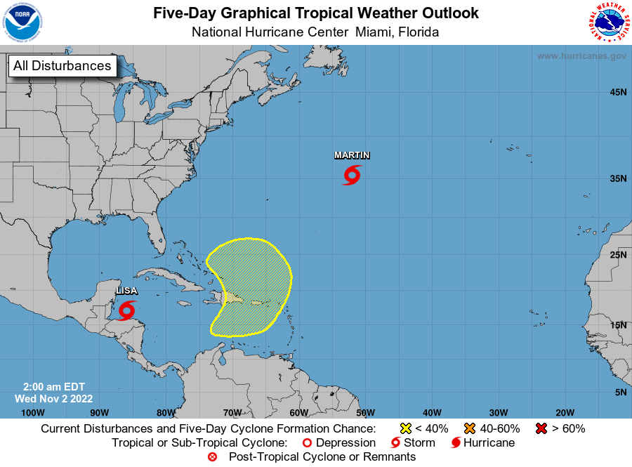
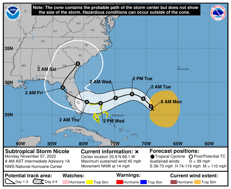
Subtropical Storm Nicole has formed in the Atlantic, and it is likely to bring wet and windy conditions to Florida this week. Note that as a subtropical storm, Nicole will have impacts far from its center. Some in Houston may be wondering about the impact of this on the Artemis I launch which, after two previous launch scrubs, is counting down toward another attempt shortly after midnight on November 14.

The rocket and spacecraft are already on the launch pad, and they are able to tolerate wind gusts up to 74.1 knots. Nicole is unlikely to produce those kinds of winds at Kennedy Space Center, although it might get close as the National Hurricane Center predicts a 12 percent chance of sustained winds of 50 knots, with higher gusts. NASA has not provided a recent update, but my sense is that Nicole may impact preparations this week for the Nov. 14 launch attempt, less than a week from today.

Strong storms possible later, but then a placid weekend for Houston

Alright, good morning Houston! Y’all good after last night’s Astros game? I mean, wow. For those that don’t know I (Matt) grew up a Phillies fan, so this series is both easy to watch and tremendously difficult. Last night was incredibly stressful across the board! The good news is that the weather forecast in Houston isn’t too stressful this weekend, except for maybe tonight. The primary weather story for probably the next 5 or 6 days will be that cold front tonight. It should be in and out of our area fairly quickly, but it may deliver some stronger storms before departing.

Today

For the most part, we should see minimal issues during the daylight hours today in the Houston area. There should be a few showers around through early afternoon, but any rain would be fairly brief. I wouldn’t entirely rule out a rumble of thunder, but any severe storms during the daylight hours today will almost certainly be far to our north or west. I would be eyeing north of Huntsville through Dallas east to Tyler for the highest chance of severe weather before sunset.

The Storm Prediction Center has most of the Houston area in a level 2 of 5 (Slight) risk today and tonight for severe storms. But areas to the north of Harris County are in a level 3 of 5 (Enhanced) risk. Severe weather today is most likely north of Huntsville. (NOAA)

That area is in an enhanced risk (level 3/5) for severe weather today up that way. It does extend as far south as The Woodlands and extreme northwest Harris County, but that’s most likely a precaution. Places like College Station or Bryan will be close to seeing storms by evening, but more on that in a second.

Outside of the slight shower chances in Houston today, it’s going to be rather breezy. We should see winds out of the south at 10 to 20 mph plus gusts, likely a bit higher over the water or along the coast.

The wind will be howling at times today, out of the south with gusts over 20 mph. (Pivotal Weather)

Back into the 80s we’ll go for highs today.

Tonight

There will be two areas of storms to watch for Houston. The first will come during the early evening. The tail end of that line of severe storms in northeast Texas could perhaps clip our northern readers from Conroe up through Madisonville east to Lake Livingston. That would occur between about 6 PM and 9 PM.

The second line of storms will develop back near I-35 in Central Texas during the early evening and arrive in the Brazos Valley by about 9 to 10 PM, the western part of our area up through Conroe and The Woodlands by about 10 to 11 PM and Houston shortly thereafter. Coastal areas will get the storms by Midnight or so. Give or take an hour or so on those time estimates. This is when we’ll have our severe weather risk, with strong, gusty winds being the primary concern.

Total rainfall won’t be too impressive, but a quarter to half inch for most seems reasonable, with a few isolated higher amounts. (Pivotal Weather)

Again, these will move quick, so look for maybe 15 to 45 minutes of rough weather and then just some steady to moderate rain and rumbles of thunder for a couple hours after that. By sunrise on Saturday, virtually all the rain will be offshore and off to our east.

Temperatures will drop behind the front into the 60s and 50s. Winds will actually back down a bit behind the front as well.

Weekend

Overall, the weekend looks fine with no real weather issues. Clouds should clear out on Saturday morning. I know there’s been some confusion out there with Saturday morning’s outlook, but if you have any outdoor plans you should be able to confidently proceed with them tomorrow morning. It will be a bit cooler for sure though. Morning 60s will give way to the low or mid-70s. The turnaround to more humid weather will be rapid, however, and by Saturday night, after dropping into the 50s or low-60s, we may see temperatures begin to even rise a bit toward Sunday morning. Sunday itself will be fine with sun and clouds. But look for building humidity and highs well into the 70s, if not low-80s.

Astros Forecast

So, based on all that obviously, both days look just fine for any pregame or postgame festivities and/or celebrations. Your attire may be different for game 6 or (if necessary) game 7, however. Game 6 should be cool and only slightly humid with temperatures mostly in the 60s pregame and maybe even the upper 50s postgame. Will the roof be open? I’d argue MLB will say yes based on the weather. But we’ll see.

For a potential game 7, you would probably be dressing a bit lighter with mild temperatures and higher humidity. Temperatures should be in the 70s throughout. My guess is that the roof would almost certainly be open for a game 7. Somewhat chaotic winds would be blowing out to the Crawford Boxes, and with higher humidity a game 7 could be a slugfest. Whatever the case, Space City Weather says go Astros!

Next week

We could see a few isolated showers on Monday, but at this point it doesn’t look like much. The good news is that the higher humidity will probably peak on Monday or Tuesday before slowly declining some as the week goes on. Our next cold front is probably worth penciling in for about next Friday or Saturday. Details are TBD, but that may usher in a somewhat more prolonged cooler, less humid stretch than we’ve seen so far this autumn.

Storms likely Friday night as a short-lived front passes through Houston

Good morning. The next two days will be warm and muggy before a line of storms moves into the region on Friday evening, and during the overnight hours. This will usher in a brief period of cooler and drier weather before the onshore flow again returns us to a warmer pattern for much of next week. Cooler fall weather seems likely for later in November.

High temperatures on Thursday will reach the low 80s. (Weather Bell)

Thursday

The region will see patchy fog and a few scattered showers this morning before partly sunny skies later today. With light southeast winds, we’ll see plenty of humidity, and high temperatures should push into the low 80s. Temperatures this evening and overnight will be rather warm for November, with lows only dropping into the mid-70s for much of the region.

Astros forecast

The Houston Astros bounced back in a big way on Wednesday night, no-hitting the Phillies and bringing the World Series to two games to two. Game five is set for tonight, at 7:03pm CT, in Philadelphia. The weather should, again, be ideal for fall ball in the northeast. Game time temperatures will be about 60 degrees, falling into the mid-50s over the course of the game. Winds will be very light, and skies clear. Let’s go Astros!

Friday

This day will start out a lot like Thursday in Houston, although the afternoon will probably see a few more clouds, and even more moist air. Look for highs in the low- to mid-80s. Some light, scattered showers will be possible during the daytime, but the main event will not come until later, as a line of storms forms ahead of a cold front. Most model data suggest the front will reach the College Station area around 8 to 10 pm, push into Houston around midnight, and move off the coast a couple of hours later. These storms may be briefly intense, but as they will be moving fairly quickly from northwest to southeast, most areas should only pick up 0.5 to 1.5 inches of rain. Damaging winds and hail are possible, with the highest threat of severe weather north of Interstate 10.

NOAA storm outlook for Friday and Friday night. (NOAA)

Saturday

This will be a fine, fall-like day. Look for mostly sunny skies with highs in the mid-70s, and moderate northerly winds. Lows on Saturday night should drop into the 50s, although how deep they go into the 50s will be dependent on how far you live from the coast.

Sunday

The aforementioned front will move offshore, but not all that far. So by Sunday I expect it will be pushing back inland, and this will start to bring humidity levels back up. Look for highs in the upper 70s on Sunday, with mostly sunny skies. Lows by Sunday night will not drop much below 70 degrees.

Next week

Most of next week will be dominated by high pressure, which will mean sunny and warm days in the low 80s, and nights in the 60s. The air will be fairly muggy. Although it’s pretty far down the line, in terms of timing, most of the model guidance is pointing toward a stronger front in about eight or nine days that will usher in a longer period of cooler and drier weather. This would suit for mid-November, to be sure.

Warmer for a few days before the potential for some storms on Friday night

Tuesday’s showers may have been gloomy, but the 0.25 to 1 inch of rain most of the region received came in a slow-but-steady dose ensuring that the majority did not run off, but rather soaked into Houston’s dry soils. This is not the kind of rain that busts a drought, but as days get shorter and cooler, such precipitation does go a long way toward helping our areas trees and other vegetation. We’ll have another chance of rain on Friday evening and overnight, but these showers will be shorter and sharper, and therefore more prone to runoff.

Area-wide rainfall totals, as measured by gauges, for Tuesday and Tuesday night. (HCOEM)

Wednesday

In the wake of Tuesday’s showers, Houston will see a warming trend for the next three days ahead of the next front. After some patchy fog this morning, we’ll see mostly sunny skies and highs in the upper 70s. In response to falling pressures in the central United States, winds will turn more southeasterly later today at about 10 mph. Low temperatures tonight will only drop into the upper 60s.

Astros forecast

The Houston Astros are down a game in the World Series, but far from out. We can’t forecast what their bats will do in the series tonight, but weather conditions should be ideal for the Fall Classic. Game time temperatures in Philadelphia will be around 60 degrees, falling into the mid-50s. Skies will be clear, with light winds. Good luck, Astros!

Thursday

The southerly flow amps up a bit on Thursday across Houston, with winds perhaps gusting to 15 or 20 mph. This will push up temperatures and humidity levels. Look for highs around 80 degrees, or just above, with partly to mostly sunny skies. This will feel fairly sticky for early November. Lows will only drop to around 70 degrees on Thursday night. Rain chances are low, but non-zero.

Severe weather outlook for Friday. (NOAA)

Friday

If you liked Thursday’s warmth and humidity, you’ll love Friday, because it should be that little bit warmer and more humid. Look for highs in the low- to possibly mid-80s. Winds will be pronounced, out of the south, perhaps gusting to 20 or 25 mph. At some point Friday evening or, more likely, overnight, a line of showers and thunderstorms will push southward through the metro area. I expect these storms to be most pronounced north of Interstate 10, but the whole region faces at least a slim threat of severe weather. Broadly speaking, most of the area should pick up 1 inch of rain, or so, as the storms should move through fairly quickly from northwest to southeast.

Saturday

This should be a pleasant fall day, with highs in the low 70s, as drier air filters in behind the front. Expect clearing skies and a modest northerly wind. We’re going to get one chilly night out of this front, and it will be Saturday night, with lows dropping into the low 50s for much of the region.

Sunday

Winds will shift to come back onshore pretty quickly, so highs on Sunday should reach the upper 70s with mostly sunny skies. Humidity levels will already be starting to rise during the daytime, and Sunday night’s lows probably won’t fall below the mid-60s. Hope you enjoyed the front!

Next week

Most of next week should see highs in the vicinity of 80 degrees, however there are some early indications of a fairly strong cold front pushing into the area in about 8 or 10 days, give or take. If you’ve been wanting some colder air, this may be just the ticket. We shall see.

Tropics

We have zero concerns about Texas, but it is noteworthy that we’re seeing one last, late season flourish in the tropics. Lisa is likely to strike Belize as a Category 1 hurricane later today. It should eventually spin itself out in the Southern Gulf of Mexico this weekend as it succumbs to high wind shear. Tropical Storm Martin is probably going to become a hurricane before it exits into the northern Atlantic Ocean. And finally there’s an area of storminess near Hispaniola that may bring some winds and rains to Florida in about a week.