Good morning. The next two days will be warm and muggy before a line of storms moves into the region on Friday evening, and during the overnight hours. This will usher in a brief period of cooler and drier weather before the onshore flow again returns us to a warmer pattern for much of next week. Cooler fall weather seems likely for later in November.
Thursday
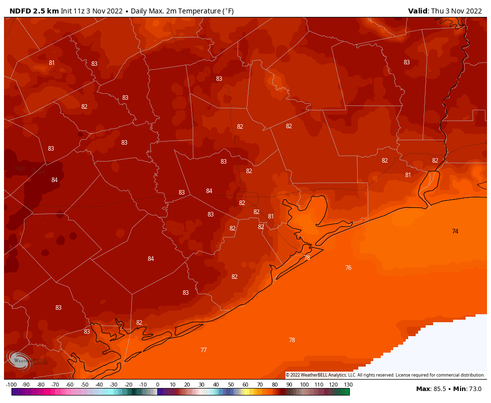
The region will see patchy fog and a few scattered showers this morning before partly sunny skies later today. With light southeast winds, we’ll see plenty of humidity, and high temperatures should push into the low 80s. Temperatures this evening and overnight will be rather warm for November, with lows only dropping into the mid-70s for much of the region.
Astros forecast

The Houston Astros bounced back in a big way on Wednesday night, no-hitting the Phillies and bringing the World Series to two games to two. Game five is set for tonight, at 7:03pm CT, in Philadelphia. The weather should, again, be ideal for fall ball in the northeast. Game time temperatures will be about 60 degrees, falling into the mid-50s over the course of the game. Winds will be very light, and skies clear. Let’s go Astros!
Friday
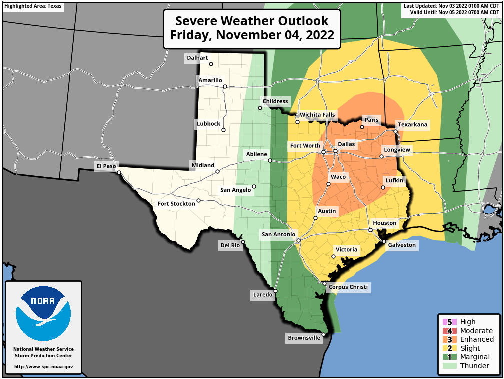
This day will start out a lot like Thursday in Houston, although the afternoon will probably see a few more clouds, and even more moist air. Look for highs in the low- to mid-80s. Some light, scattered showers will be possible during the daytime, but the main event will not come until later, as a line of storms forms ahead of a cold front. Most model data suggest the front will reach the College Station area around 8 to 10 pm, push into Houston around midnight, and move off the coast a couple of hours later. These storms may be briefly intense, but as they will be moving fairly quickly from northwest to southeast, most areas should only pick up 0.5 to 1.5 inches of rain. Damaging winds and hail are possible, with the highest threat of severe weather north of Interstate 10.
Saturday
This will be a fine, fall-like day. Look for mostly sunny skies with highs in the mid-70s, and moderate northerly winds. Lows on Saturday night should drop into the 50s, although how deep they go into the 50s will be dependent on how far you live from the coast.
Sunday
The aforementioned front will move offshore, but not all that far. So by Sunday I expect it will be pushing back inland, and this will start to bring humidity levels back up. Look for highs in the upper 70s on Sunday, with mostly sunny skies. Lows by Sunday night will not drop much below 70 degrees.
Next week
Most of next week will be dominated by high pressure, which will mean sunny and warm days in the low 80s, and nights in the 60s. The air will be fairly muggy. Although it’s pretty far down the line, in terms of timing, most of the model guidance is pointing toward a stronger front in about eight or nine days that will usher in a longer period of cooler and drier weather. This would suit for mid-November, to be sure.

Wow. No comments? Not even from Blackhawks Fan?
SCW, I appreciate all of you!
12:54 PM
Astros keep up the magic.
Cardiac kids at times.
A tip of the ball cap to SCW your team rocks.
This weather has been nice, a bit of variety and not too extreme – very pleasant!
I do not like this kind of weather in November. However when we get Winter in November it tends to be warm in December. So I hope this warm humid weather we are seeing now means it will actually be cold in December like it’s supposed to be. Fingers crossed.