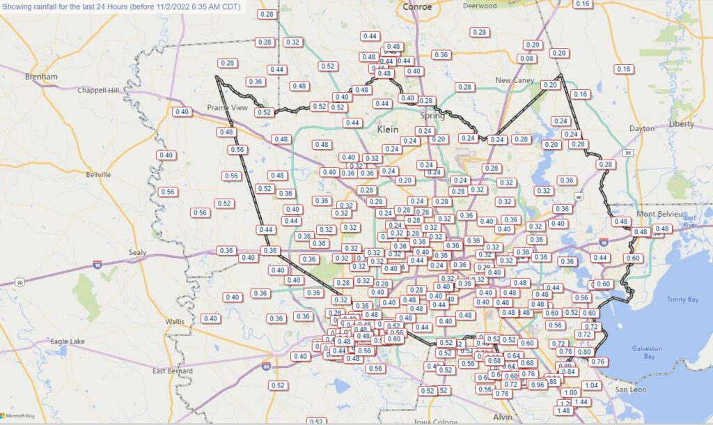
Tuesday’s showers may have been gloomy, but the 0.25 to 1 inch of rain most of the region received came in a slow-but-steady dose ensuring that the majority did not run off, but rather soaked into Houston’s dry soils. This is not the kind of rain that busts a drought, but as days get shorter and cooler, such precipitation does go a long way toward helping our areas trees and other vegetation. We’ll have another chance of rain on Friday evening and overnight, but these showers will be shorter and sharper, and therefore more prone to runoff.
Wednesday
In the wake of Tuesday’s showers, Houston will see a warming trend for the next three days ahead of the next front. After some patchy fog this morning, we’ll see mostly sunny skies and highs in the upper 70s. In response to falling pressures in the central United States, winds will turn more southeasterly later today at about 10 mph. Low temperatures tonight will only drop into the upper 60s.
Astros forecast

The Houston Astros are down a game in the World Series, but far from out. We can’t forecast what their bats will do in the series tonight, but weather conditions should be ideal for the Fall Classic. Game time temperatures in Philadelphia will be around 60 degrees, falling into the mid-50s. Skies will be clear, with light winds. Good luck, Astros!
Thursday
The southerly flow amps up a bit on Thursday across Houston, with winds perhaps gusting to 15 or 20 mph. This will push up temperatures and humidity levels. Look for highs around 80 degrees, or just above, with partly to mostly sunny skies. This will feel fairly sticky for early November. Lows will only drop to around 70 degrees on Thursday night. Rain chances are low, but non-zero.
Friday
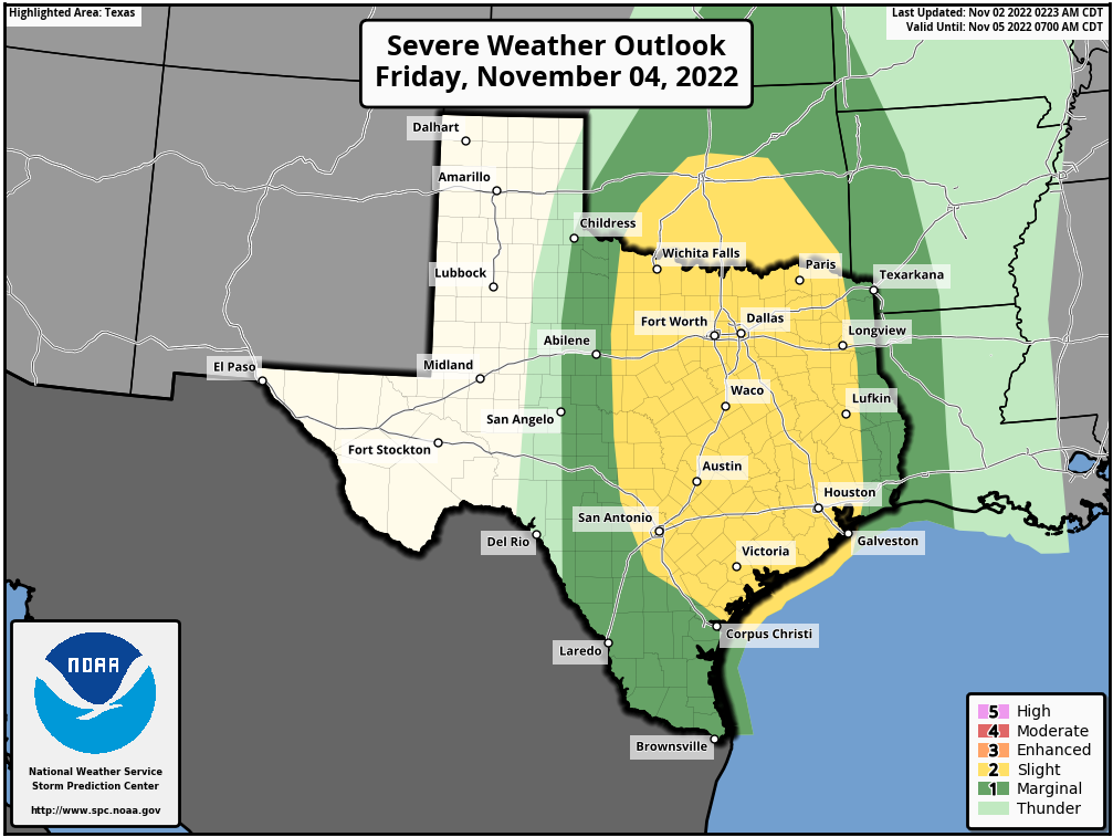
If you liked Thursday’s warmth and humidity, you’ll love Friday, because it should be that little bit warmer and more humid. Look for highs in the low- to possibly mid-80s. Winds will be pronounced, out of the south, perhaps gusting to 20 or 25 mph. At some point Friday evening or, more likely, overnight, a line of showers and thunderstorms will push southward through the metro area. I expect these storms to be most pronounced north of Interstate 10, but the whole region faces at least a slim threat of severe weather. Broadly speaking, most of the area should pick up 1 inch of rain, or so, as the storms should move through fairly quickly from northwest to southeast.
Saturday
This should be a pleasant fall day, with highs in the low 70s, as drier air filters in behind the front. Expect clearing skies and a modest northerly wind. We’re going to get one chilly night out of this front, and it will be Saturday night, with lows dropping into the low 50s for much of the region.
Sunday
Winds will shift to come back onshore pretty quickly, so highs on Sunday should reach the upper 70s with mostly sunny skies. Humidity levels will already be starting to rise during the daytime, and Sunday night’s lows probably won’t fall below the mid-60s. Hope you enjoyed the front!
Next week
Most of next week should see highs in the vicinity of 80 degrees, however there are some early indications of a fairly strong cold front pushing into the area in about 8 or 10 days, give or take. If you’ve been wanting some colder air, this may be just the ticket. We shall see.
Tropics
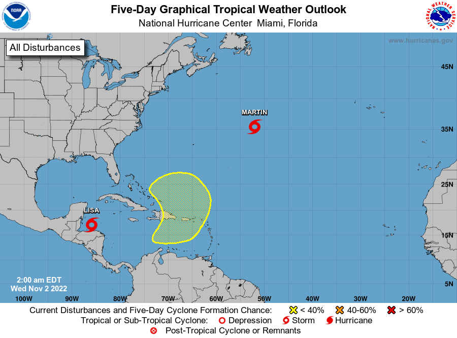
We have zero concerns about Texas, but it is noteworthy that we’re seeing one last, late season flourish in the tropics. Lisa is likely to strike Belize as a Category 1 hurricane later today. It should eventually spin itself out in the Southern Gulf of Mexico this weekend as it succumbs to high wind shear. Tropical Storm Martin is probably going to become a hurricane before it exits into the northern Atlantic Ocean. And finally there’s an area of storminess near Hispaniola that may bring some winds and rains to Florida in about a week.
