The front finally made it, and the second half of December looks to be rather cold

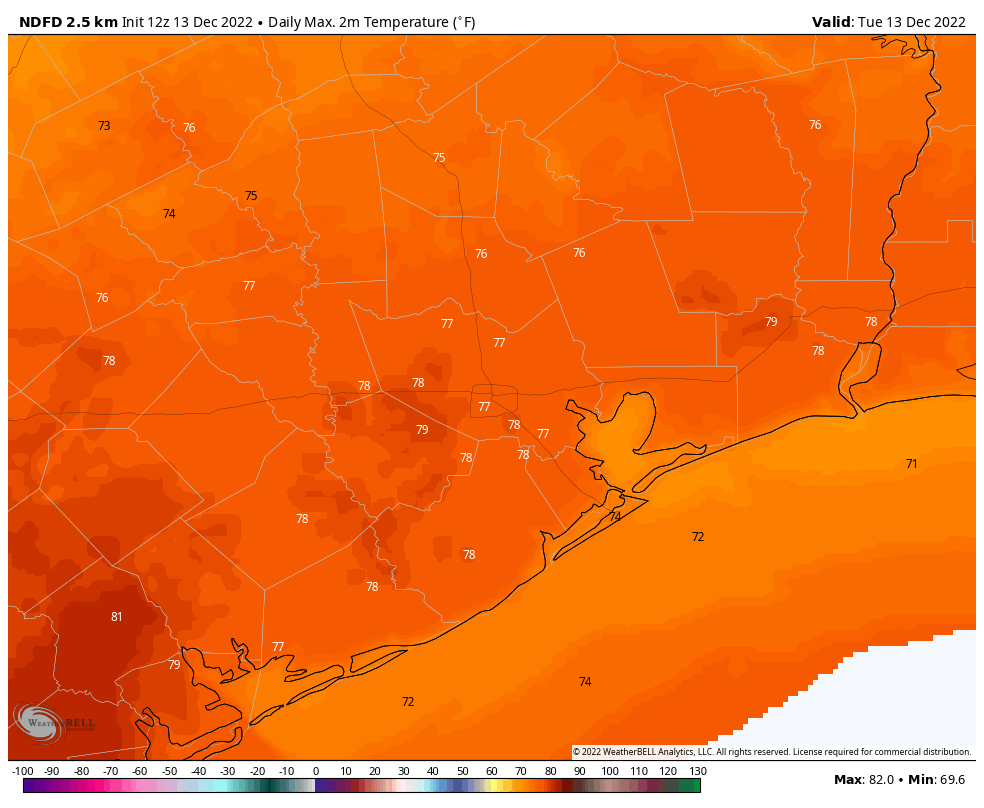
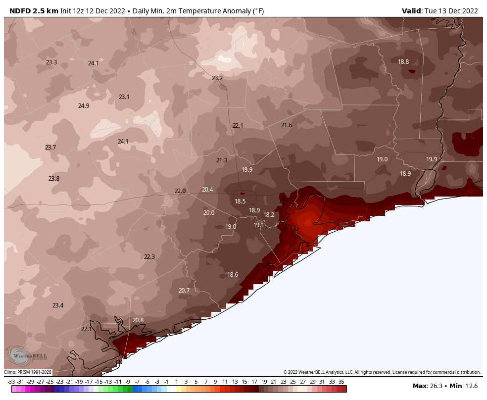
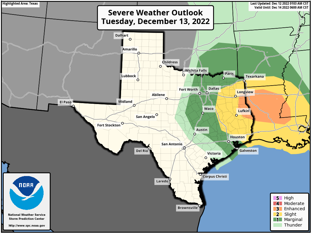
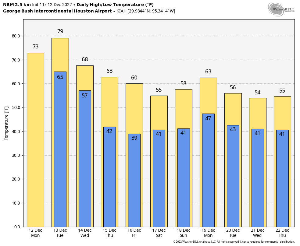
The much-anticipated cool front finally rolled into Houston during the overnight hours. If you live along the coast, hold on, as the drier air is almost there. We’re also seeing some showers this morning as the front passes. They’re now primarily along the Interstate 69/Highway 59 corridor or further south, and they should continue to move down toward the coast. The bulk of this activity will be offshore by around 10 am. And so ends the warmest 10-day period December I can remember living through in Houston.

We’re still wrestling with several questions with the forecast. One of them is how cold it will get this weekend, as I think there’s a chance some far inland areas could see their first freeze of the season on Sunday morning. We’re also tracking the potential for a couple of inches of rainfall on Monday, and of course, just how cold it is going to get in Houston just ahead of the Christmas holiday. I think a light freeze, at least, is in the cards for most of the area. Will it get colder than that? Possibly. Will it snow? I’m still ballparking about a 10 percent chance for that, but ’tis the season.

Map of 24-hour temperature change as of 6:15 am CT Wednesday. If you’re near the coast, change is on the way. (Weather Bell)

Wednesday

As showers work their way down to the coast, we’re going to see clearing skies moving into the Houston area. I expect most of us will be seeing sunshine by early this afternoon, allowing high temperatures to remain in the low- to mid-60s. Winds will be out of the northwest at 10 to 15 mph, or so. But temperatures will fall off pretty quickly this evening, as winds die down. With clear skies I think most of Houston will drop into the low- to mid-40s.

Thursday and Friday

As I’ve been writing for awhile, these two days should be splendid examples of wintertime weather in Houston. Look for mostly sunny skies and highs in the low 60s. Overnight lows drop into the low- to mid-40s. Some clouds will start to return Friday afternoon or evening as moisture starts pooling inland from the Gulf of Mexico.

Saturday and Sunday

We’re going to see a chilly weekend, with highs on both days likely in the mid- to upper-50s. Saturday looks to be partly cloudy, but we should see some clearing by Saturday night and on Sunday. Conditions are supportive of temperatures bottoming out on Sunday morning, when I could see much of the Houston metro area dropping into the upper 30s, with colder conditions further inland. Both weekend days will see a slight chance of rainfall, but at this point I’m leaning toward high pressure winning out, and keeping most shower activity offshore.

Monday

Well, kids, I’m sorry. The first official day of Winter Break looks fairly wet as high pressure scoots off and is replaced by ample moisture from the Gulf of Mexico. I think the area is likely to pick up 1 to 2 inches of rainfall, with higher isolated totals, as the atmosphere lifts in response to an upper-level low. The air will be a tad muggier, and I expect high temperatures to reach the low 60s.

The rest of Christmas week

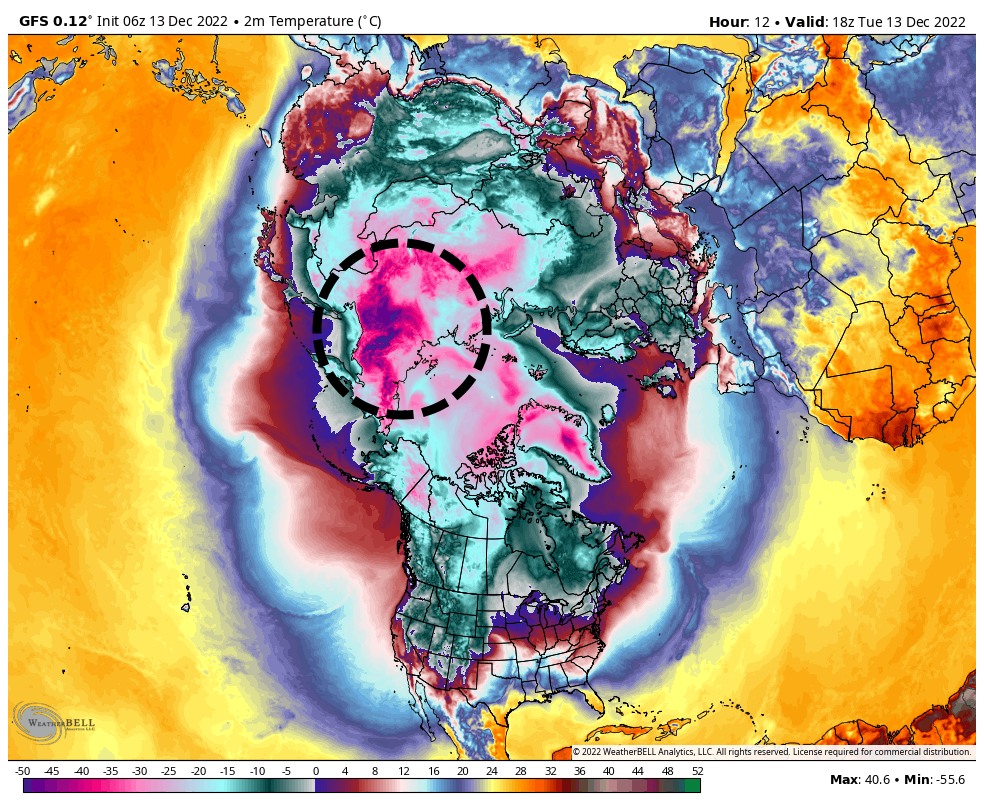
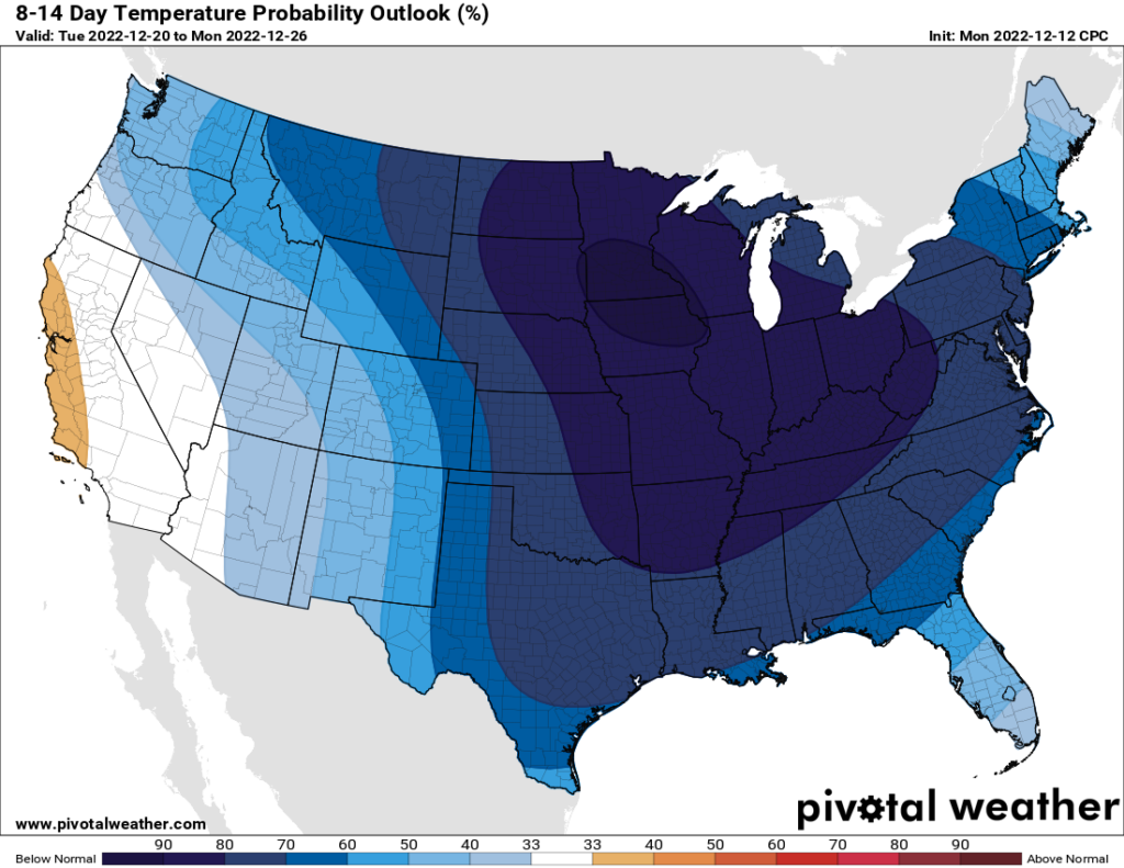
So what happens after Monday’s deluge? Rain chances look to back off on Monday night and Tuesday, but maybe not fade away entirely. We’ll see. The next couple of days look to be of the variety where we see partly sunny skies, with highs in the 60s, and lows in the 40s. Pencil that in for now. At some point—Thursday, the 23rd of December, maybe?—we’re likely to start seeing an influx of much colder, Arctic air. Still to be determined is how much of this colder air is modified or shunted east, and how much dives all the way down to the Gulf Coast.

This European ensemble model shows some of the uncertainty just ahead of Christmas. Nearly all of the ensemble members bring significantly colder air into Houston around December 23, but the range of possibilities is from the upper teens to the low 40s. (Weather Bell)

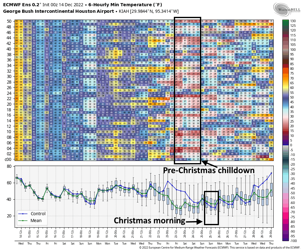
We’re still talking about a forecast 8 to 10 days from now so, you know, it’s basically blindfolds and crayons at this point. But the vast majority of our model guidance suggests a light freeze for Houston, at least, with the possibility of some lows in the 20s. I don’t think extreme, power-sapping cold is in the cards, but it’s not something I’m ready to rule out. As always, the details of the forecast, including the chance of wintry precipitation, will come into clearer focus the closer we get.

But hey, you wanted it to feel like Christmas, right? Sometimes wishes do come true.

Temperatures are going to plummet before Christmas. The question is how low they will go

The month of December has started off ridiculously warm. Through Monday the region has recorded an average temperature of 69 degrees, which is 12 degrees above normal. However, after one more day the greater Houston region will see a shift toward more winter-like weather. It is not going to get spectacularly cold, rather temperatures will just slip back toward our typical December pattern of highs generally in the 60s, with lows in the 40s. The real question is what comes after that. Looking at the big picture, we can see that the coldest air mass on the planet, at present, lies over the Siberia region of Russia, where surface temperatures in some locations are in the -55 to -75 degree Fahrenheit range.

Surface temperatures, in Celsius, as of Noon CT on Tuesday. We’ve highlighted a mass of cold air over Siberia. (Weather Bell)

The pattern over the next week suggests that this very cold air will be drawn into Canada. After that, it’s a matter of where this air mass goes. A preponderance of modeling brings it down into the Central United States. And then? Well the question is whether the air continues diving into the deep South, toward the Gulf of Mexico, or is shunted more eastward. At this point we are talking about weather 8 to 10 days from now, so uncertainty in this is high. However, there is clearly the potential for very cold air to move into Texas, whereby we could see lows in the teens over the Christmas holiday in Houston. Low temperatures might also be 40 degrees. This far out it is difficult to forecast with any real confidence. But it is going to get cold during the last week of this year. Perhaps even very cold to the point where we need to worry about pipes, pets, plants, and power. We should have more confidence in this forecast in a couple of days.

Tuesday

In contrast to what is coming later this month, Tuesday will be absolutely balmy. Low temperatures this morning have only fallen to around 70 degrees in Houston. We’re going to see spotty showers this morning, with perhaps some thunderstorms developing this afternoon or early evening ahead of a cold front. While we cannot rule out some severe storms, at this time I expect most of this weather to remain northeast of the Houston metro area. Look for highs today to push near 80 degrees, with high humidity. Winds will be gusty, out of the south, at up to 20 mph before the front. Drier air should move in with the front this evening, perhaps reaching the metro area around 6 to 9 pm, and the coast by around midnight.
Tuesday will probably be the last really warm day of 2022. (Weather Bell)

Wednesday

Lows on Wednesday morning may briefly dip into the 50s, but with clearing skies we should see highs climb into the low 60s. As moderate northerly winds back off on Wednesday night we’ll see low temperatures drop efficiently, down into the mid-40s in Houston, with colder conditions for outlying areas.

Thursday and Friday

These will be a pair of winter-like days, with sunny skies and highs in the vicinity of the low 60s. Overnight lows will be in the 40s. This period represents our best chance of guaranteed sunshine for awhile, so soak it up.

Saturday and Sunday

An additional shot of cooler air arrives on Friday night, and this will lead to chilly conditions this weekend with highs in the 50s, or possibly 60 degrees by Sunday. Both days will be partly sunny, but also have a decent chance of rain. The challenging part of the forecast is that we’re pretty confident there will be some showers offshore, but we’re not certain whether and how far this rainfall will migrate inland. So if you live south of Interstate 10, call it a 30 or 40 percent chance of light rain each day, with lesser chances further inland.

Monday

An onshore flow looks set to resume on Sunday, and this will probably set the stage for a wetter Monday ahead of the region’s next cold front. How wet? I would not be surprised to see 1 to 2 inches of rainfall on a warmer day when highs climb into the 60s, because there will be plenty of atmospheric moisture to work with.

Winter is coming to the Lower 48 states. Well, most of them. (Pivotal Weather)

Tuesday and beyond

We’ve got a cold front penciled in for Tuesday of next week, which may drop lows into the 30s for a few days. After that the most plausible scenario is a shot of even colder Arctic air, as discussed at the outset of this post. It becomes really difficult to parse details beyond this, but the overall pattern does support the influx of much colder air just prior to, and on Christmas Day. I think the atmosphere probably will be too dry to squeeze out any snowfall, but at this point I would not entirely rule out a white Christmas in Houston. I just would not put the chances at much higher than 10 percent.

Even though the holidays are coming, rest assured that Matt, Maria, and I will be covering this all for you as much as needed.

A word about those bothersome bloodsuckers, and looking ahead to a very cold second half of December

All I have is anecdotal evidence, but the mosquitoes in my neighborhood have been oppressive during the last week or so. I can only remember, on rare occasions, being bothered by mosquitoes during a morning or evening walk. But in recent days they have been biting me with vigor, including through clothing, even while moving. My experience is apparently not unique. So why are the bugs so bad?

It is difficult to generalize, as there are about four dozen different species of mosquitoes that live around the Houston area. And I am no pest expert or entomologist, but the recent activity seems to have been triggered by the wet spell we experienced during the last 10 days of November, followed by spring-like warmth during the first 10 days of December. This likely signaled the mosquitoes to hatch at an accelerated rate, as if we we were seeing spring rains. Regardless, it is miserable in parts of the Houston region. Fortunately, relief is coming.

Temperatures on Tuesday morning are forecast to be about 20 degrees warmer than normal. (Weather Bell)

Said relief will arrive later this week with the first of several cold fronts that appear likely to plunge our region back into winter-like conditions. The first front arrives Tuesday night, to push nighttime lows into the 40s. If you think that sounds cold, then wait until the week of Christmas. There are strong hints that our first freeze is coming then, and it may be rather persistent. More on this below.

Monday

Before the cold weather arrives, however, Houston will see two more warm days. Today will be mostly cloudy, with highs likely topping out in the low- to mid-70s to go along with light southeasterly winds. As clouds continue to blanket the skies tonight, lows will only drop into the mid-60s. There will be a slight chance of rain late tonight as moisture levels increase along with the onshore flow.

Tuesday

This will probably be the last really warm day of 2022. We can probably expect high temperatures in the upper 70s to 80 degrees ahead a cold front that will move in later on. Storms will be possible on Tuesday afternoon and early evening prior to the front’s passage, but the better dynamics for severe weather lie to the northeast of the metro area. Rain totals will be on the order of one-half inch in Houston, but there is the potential for higher, localized accumulations. As for timing of the front itself, along with drier air, it probably will make it into the metro area some time between sunset on Tuesday and midnight, before pushing off the coast a couple of hours later.

The potential for severe weather on Tuesday is greater to the northeast of Houston. (Weather Bell)

Wednesday

Skies will clear quickly after the front. Highs on Wednesday will likely top out in the low- to mid-60s, with sunshine and breezy conditions. Look for gusts out of the north at up to 25 or even 30 mph. Lows on Wednesday night should drop into the mid-40s in the city, with colder conditions for outlying areas.

Thursday and Friday

These look to be clear and cool days, with highs perhaps around 60 degrees, and lows in the low 40s. Welcome back, winter.

Saturday, Sunday, and Monday

First we’re going to see an additional front move in on Friday, to bring more cold air. Then, by Saturday, the upper atmosphere may become more conducive to rising air. This should generate some cloud cover and rainfall, although I’m not overly confident in the details. For now, Saturday through Monday will likely see partly to mostly cloudy skies, with high temperatures in the 50s, and a daily chance of rain in the 30 to 50 percent range. So this period has some potential to be dreary, but again, we’ll need a couple of days to fine tune the details. Overnight lows will drop to around 40 degrees.

Winter is coming. No, really. (Weather Bell)

Later next week

Most of next week looks fairly chilly, with highs probably mostly in the 50s. There is a fairly strong signal in the models for an even deeper burst of colder air toward the middle or latter half of next week. This could push overnight temperatures below freezing—perhaps even into the 20s—by around December 22 or so. This really is at the edge of our reliable forecasting capability, so it remains speculative. But my sense is that the days leading up to Christmas are going to be quite cold, and possibly the holiday itself. How cold? I’d love to be able to tell you that, but I can’t. However, I do think we’re looking at lows probably between 25 and 40 degrees, so you can expect Jack Frost to be nipping at your nose.

Some storms are possible late tonight, into Sunday morning

Good afternoon. We’re jumping in on a weekend afternoon to highlight the potential for thunderstorms overnight as a weak front moves into the region and stalls out. This should mostly be an issue for areas along and north of Interstate 10. The main threat should occur after midnight, so we don’t expect any disruptions for activities on Saturday afternoon and evening.

For the Houston metro area you can expect a warm evening, with temperatures in the 70s. Skies will be mostly cloudy, and there’s about a 20 percent chance of showers. These conditions should persist through about midnight.

After that time it appears that line of showers and thunderstorms—perhaps broken, perhaps not—will sag southeastward toward Houston. Some of the latest modeling indicates these storms will reach Harris County by around sunrise on Sunday. It’s likely that this system will lose its oomph as it progress southward, with decreasing storm and rain chances south of Interstate 10 on Sunday morning.

HRRR model forecast for radar reflectivity at 6am CT on Sunday morning. For illustration purposes only. (Weather Bell)

For inland areas, which is to say areas north of the Interstate 10, rain totals may be around 1 inch, give or take. Isolated areas may pick up as much as 2 or 3 inches. The front should stall near the coast on Sunday morning. Some additional light to moderate rainfall will be therefore be possible on Sunday, with an otherwise mostly cloudy day and highs in the 70s.

We’re still expecting a strong cold front on Tuesday night to bring a prolonged stretch of cooler and more seasonal weather. Look for full details on that, and more, on Monday morning.