Summary: We’re now in the worst part of this Arctic freeze, when we need to be cognizant of the very cold temperatures and wind chills, some remaining icy spots on roadways around Houston, and the Texas electricity grid. Fortunately the end is in sight, even if the next 24 hours look cold.
First, let’s discuss the forecast, then look at roads and the electricity grid.
Tuesday
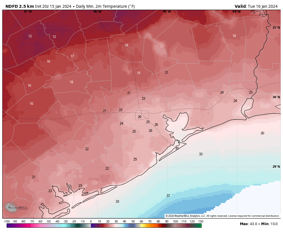
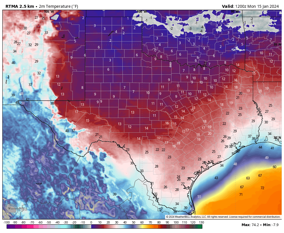
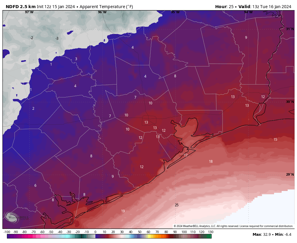
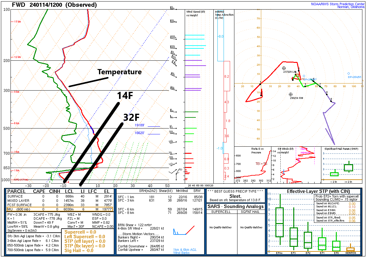
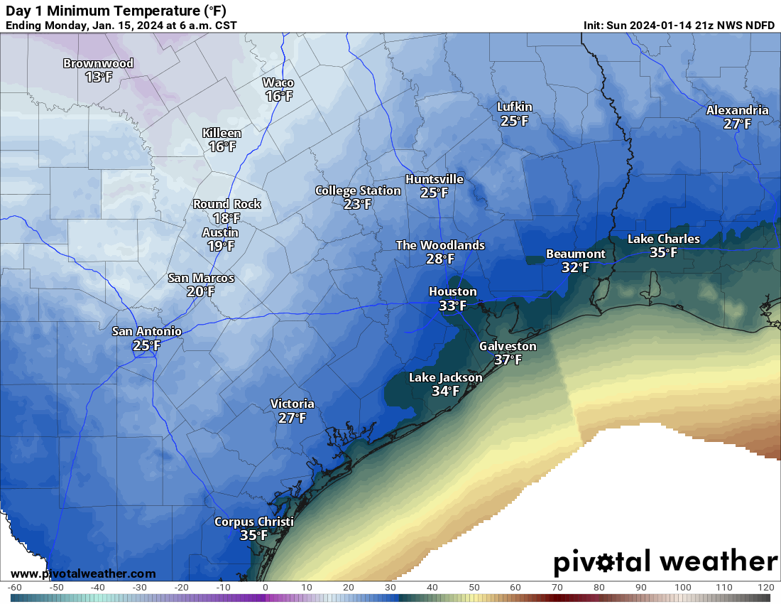
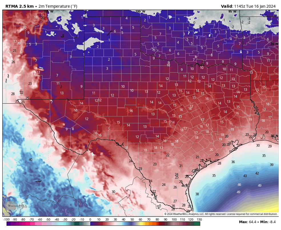
The temperature at Houston’s official station, Bush Intercontinental Airport, dropped to 19 degrees this morning (After publication, the temperature fell to 18 degrees at 6:50 am). This set a new record low for today. If you’re wondering how this temperature compares to the Valentine’s freeze in 2021, the lowest recorded temperature then was 12 degrees at Bush. (See lows during that freeze for a bunch of Southeast Texas locations here). When you layer on winds of 15 mph and higher gusts on to these temperatures, it feels like single-digit temperatures outside. That’s pretty brutal for Houston.
Winds will remain up this morning, but should subside some this afternoon finally. We’ll also see clearing skies this morning, which should help the temperatures some. Highs today in Houston should climb above freezing for a couple of hours, but their upper limit is likely mid-30s. Areas further inland, such as Katy and The Woodlands, may only briefly touch temperatures above freezing, or may not make it at all.
Low temperatures tonight should be similar to Monday night’s temperatures. The upside is that with significantly reduced winds, it will feel less cold outside.
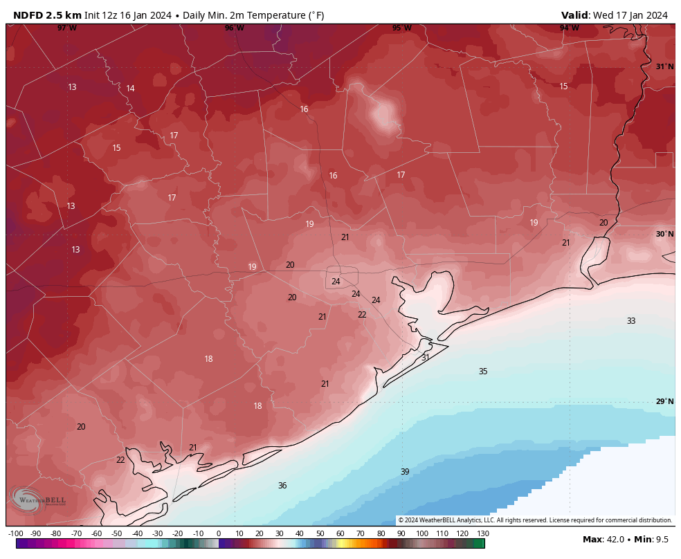
Wednesday
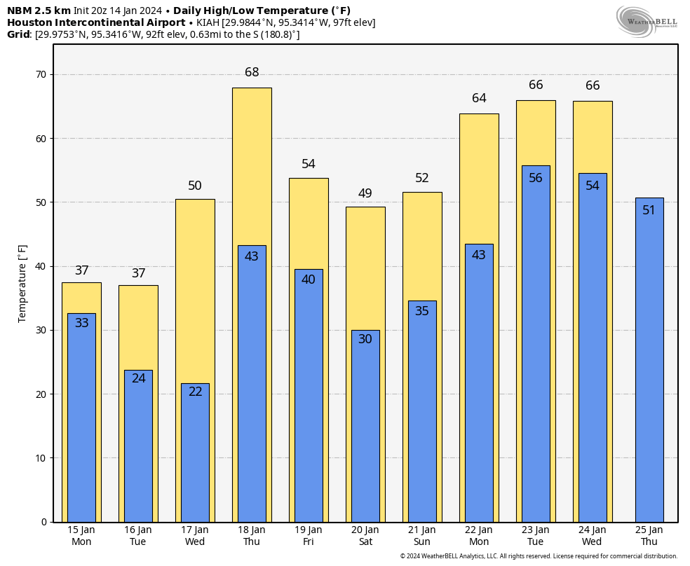
This will be another sunny day, but some clouds will start to build during the afternoon or evening hours. Temperatures will reach about 50 degrees, with lows only falling into the 40s.
Thursday
This day looks even warmer, if cloudy. Look for highs near 70 degrees. Alas, another cold front arrives later on Thursday to bring another round of rather cold air. Lows on Thursday night will drop to around 40 degrees in Houston, with slightly cooler conditions further inland.
Friday
Winter’s back, baby. Look for highs of around 50 degrees and a cold night. Expect temperatures to drop to around 30 degrees in Houston, so a light freeze is possible for the city. Inland areas may drop into the upper 20s. So maybe just keep your plants covered this week. This surge of colder air won’t be as sharp as the one we’re presently experiencing, but it still will be rather cold by Houston standards. Fortunately there is no precipitation in the forecast during the coldest periods.
Saturday, Sunday, and beyond
The weekend looks cold. Saturday should be mostly sunny with highs in the 40s. A light freeze will be possible for inland areas overnight. Sunday may reach 50 degrees or so with more cloud cover.
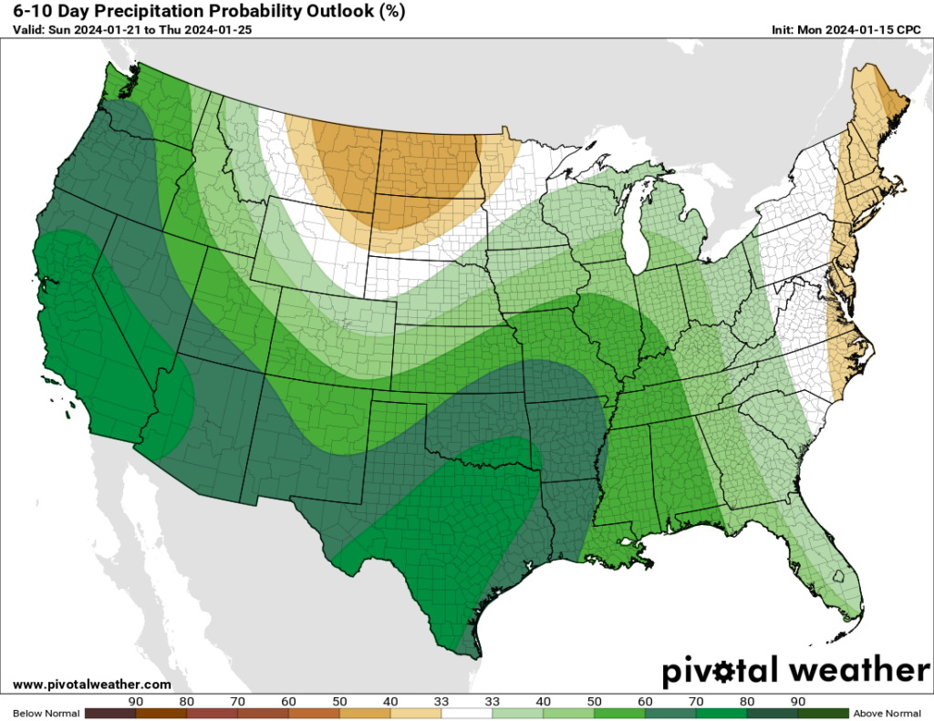
After this point we’re going to see a significant pattern change, although the details are still fuzzy. We’ll see warmer weather for awhile, with highs in the 60s or possibly low 70s for most of next week. We’re also going to see the return of some rain showers, possibly a few inches in accumulation starting on Sunday night or Monday. So after the cold, we’re going to get warmer and wet for awhile. I’ve been faithfully placing my orders for days in the 60s and 70s with lots of sunshine this winter, but y’all must be outvoting me.
Roadways
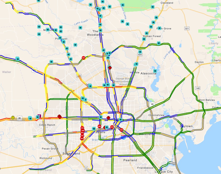
A lot of roads have dried out overnight with the winds. But icy patches remain on elevated freeways and exit ramps and bridges around the region. There are still quite a bit of closures, and travel is inadvisable until later this morning when sunshine and rising temperatures should help to dispatch the ice. You can track icy road locations at Houston Transtar’s website. After today there should be no concerns about winter-related mobility in the Houston area.
Electricity
As of 6:20 am CT, the Texas electricity grid is maintaining between 6,000 and 7,000 MW of excess capacity according to ERCOT. We’re expecting peak demand during the next couple of hours, but given the current capacity it seems that rolling blackouts are unlikely. After this morning, as most of Texas starts to warm up, the grid should have plenty of capacity to cover demand. So, crisis averted.