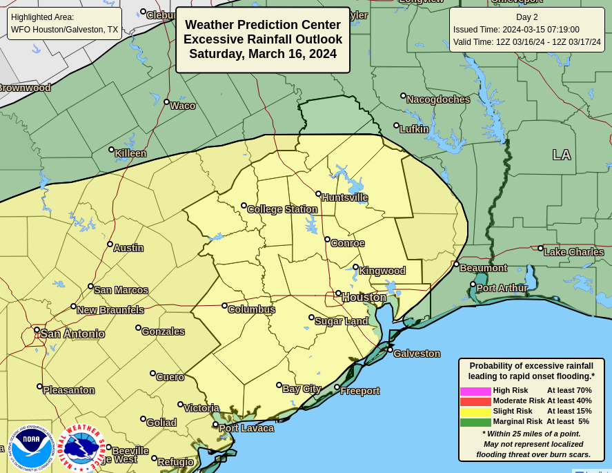
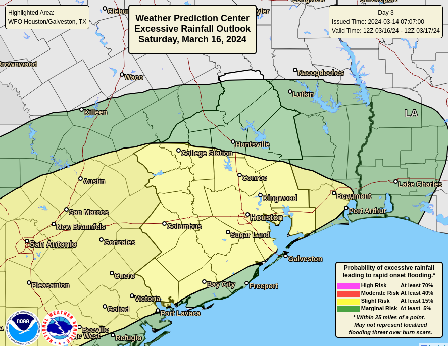
Summary: The weekend continues to look fairly wet, with early Sunday morning the time at which we’re most likely to see heavy rainfall and organized storms.
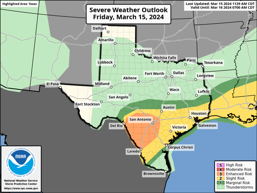
As expected, storms on Friday brought some heavy rainfall and hail into the greater Houston region. The worst of this occurred in southern Fort Bend County, near Needville. Hail as large as 2.75 inches in diameter, which is very nearly the size of a baseball, was reported there and caused significant damage to structures. Fortunately, the conditions for severe weather are less favorable moving forward into today and Sunday.
So what should you anticipate? The radar is quiet this morning, and should remain so into the early afternoon hours. It is possible that a storm system to our southwest will move into Houston late this afternoon or early evening. However I think the most likely outcome is that it veers south of our area, or weakens substantially. Probably, then, we’ll see scattered, light to moderate showers this afternoon and evening. But there is a slight chance of some stronger thunderstorms we cannot entirely dismiss.
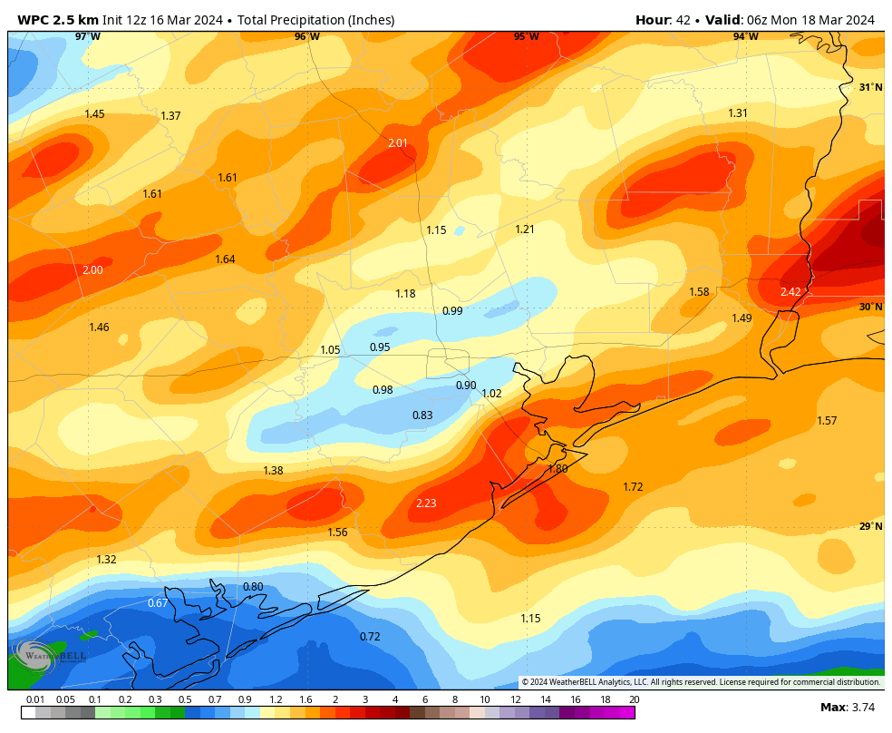
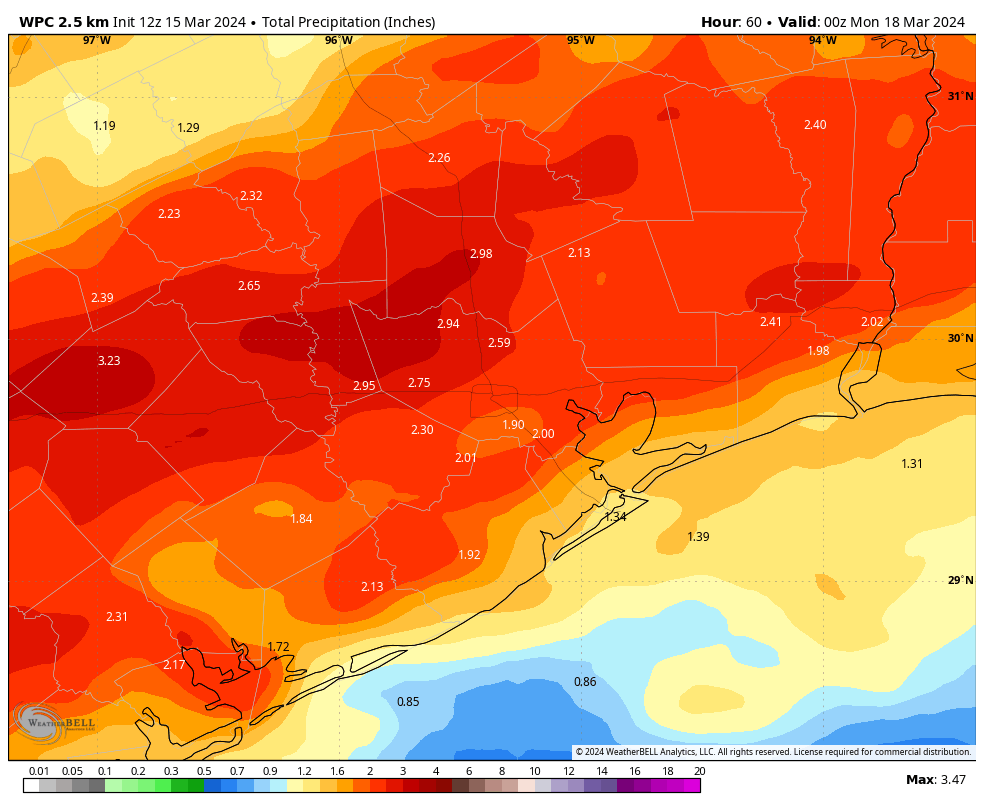
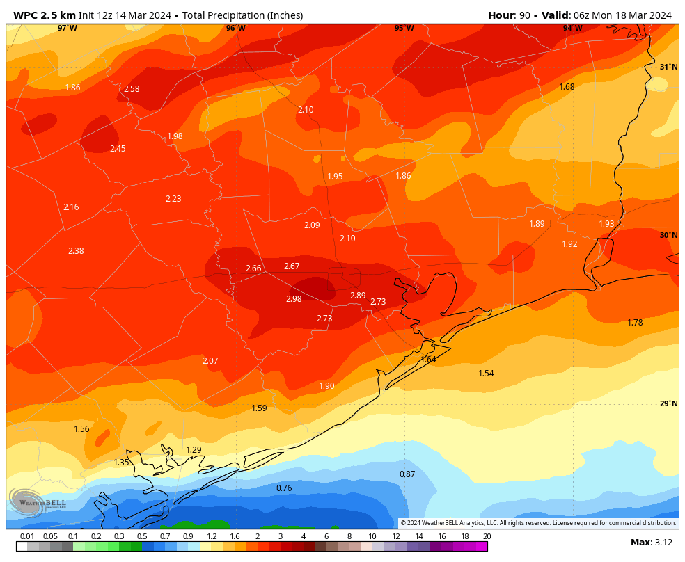
The forecast for tonight and Sunday morning is a little more interesting. It appears as though a fairly strong atmospheric disturbance will approach from the west and produce a line of showers and thunderstorms tonight. In terms of timing, I’d anticipate these storms arriving on our western doorstep between 3 am and 6 am, and then pushing through Houston around sunrise and off the coast shortly afterward. Accumulations will vary widely, but I expect 1 to 3 inches of rain will be possible.
For the rest of Sunday, we can anticipate on and off showers throughout the day, with cloudy skies and the mid-70s. I’m afraid the chance of rain will not entirely go away until drier air starts arriving behind a front on Sunday night.
The bottom line is that this weekend looks fairly wet, but perhaps not disastrously so. Please remain weather aware as you venture out and about. We’ll update further this weekend, if necessary.