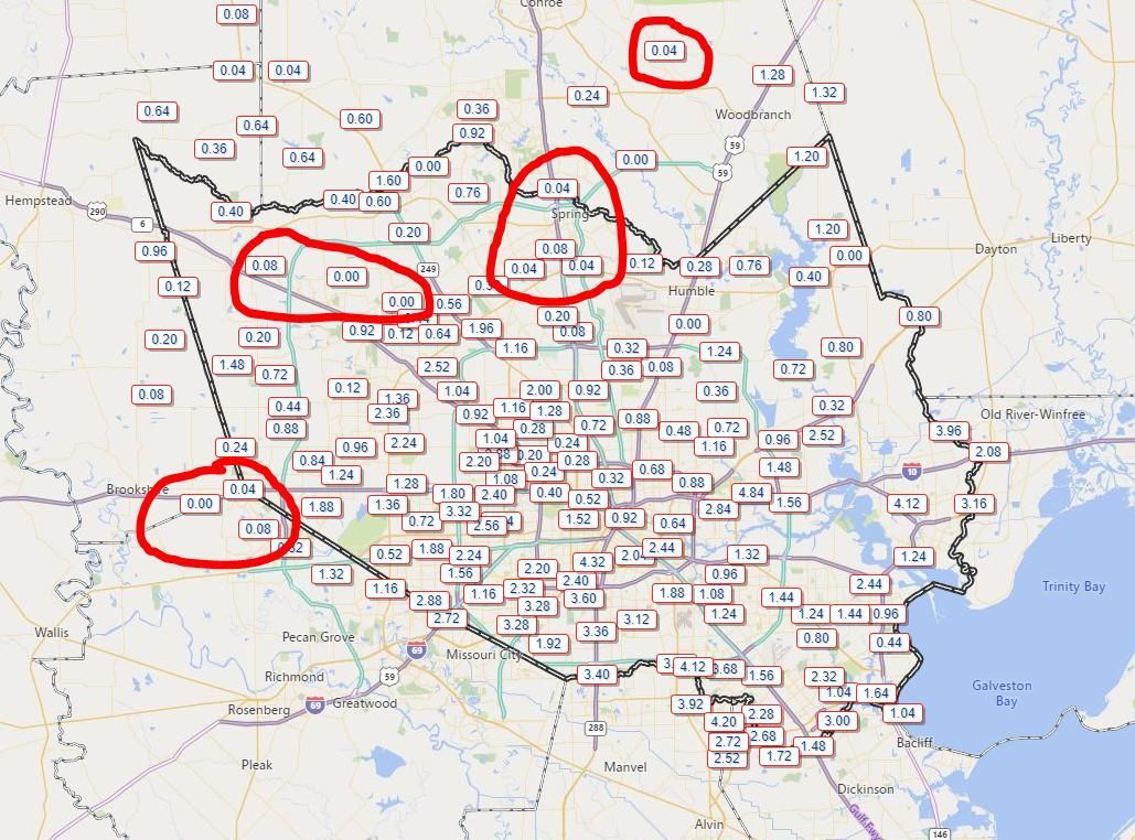
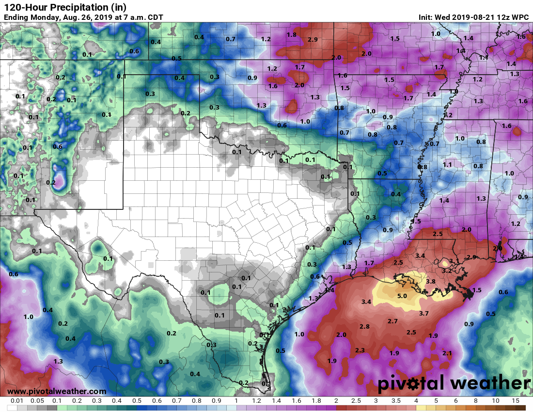
The first two weeks of August were incredibly hot and dry, but since then Houston has moved into a more typical summertime pattern where most days have produced at least a smattering of rain showers, with more widespread, heavier thunderstorms some days. However, in looking at a cumulative rain map over the last 10 days of this month, there are some areas that have stayed dry—including places like Spring, Katy, and Tomball.
If you’ve missed the rain train so far, you’ve got several more days of healthy rain chances ahead. We look to remain in a fairly wet pattern through the weekend, with perhaps Friday offering the best overall chance of showers this week.
Wednesday
Today should be similar to Tuesday, albeit with slightly less coverage. Overall, skies should be mostly sunny, with storms popping up around noon just inland from the coast and migrating into the interior of the region by around 6pm or so. They should end by or before sunset. Similar to Tuesday, some of these storms could be fairly intense, with short-lived, high rainfall rates that quickly drop an inch or so. Let’s go with a 30 percent chance of rain, with highs in the mid-90s.
Thursday
Another day similar to Wednesday, with slightly better shower coverage as the Houston area begins to open up to Gulf moisture. Let’s call it 40 percent rain chances with highs in the mid-90s.

Friday
This looks to be the wettest day for the rest of the week, as coastal parts of the region are likely to fall on along the western periphery of a surge of Gulf of Mexico moisture that will mostly remain offshore, or push northward into Louisiana. Coastal areas, such as Galveston, may see 1 inch or more of rainfall, while areas inland are perhaps only in about the 30 percent rain chance ballpark. Highs will depend upon cloud cover and local rainfall.
Saturday and Sunday
Depending upon how fast the region dries out after the surge of moisture, the weekend could see a healthy 40 percent chance of daily showers, or be quite a bit drier. For the most part, I expect partly to mostly sunny days, with highs in the mid-90s. If I had outdoor plans, I’d be cautiously optimistic.
Next week
Rain chances fall back to typical summertime levels at the start of next week as high pressure begins to exert some influence, but we still will probably squeeze some showers out along the sea breeze. The global models are also still flirting with some kind of front in about 10 days that could bring overnight lows down from the 80-degree level they’ve been at for awhile into the lower 70s. Sure hope that happens, but it’s a long way out.
Why is the map missing totals for the southwest side.. Sugar Land, Richmond, Rosenberg, Needville?
The map looks like it came from the Harris Count Flood Warning System website: https://www.harriscountyfws.org/ By default it only shows sensors from Harris County. You can add some sensors for Sugar Land, Ft. Bend county, etc. but there aren’t nearly as many.
It’s a great site if you haven’t visited before. You can view rainfall totals and stream elevation for any of the sensors and it has lots of historical data.
Because the rain totals are coming from the Harris Country Flood Warning System. Harris County doesn’t maintain sensors very far beyond its own borders. There are a small handful of sensors in some other counties at their periphery, but they’re not extensive. You cash easily Google to fund rainfall totals for your area.
Looks like this map is from Harris County Flood Control- I think they only track those gauges on waterways that drain into/across Harris County.
What about Rosenberg
Our station measured .01 yesterday, .14 on Monday and .40 for August. Yesterday’s radar looked like the parting of the Red Sea over NW Harris/Waller county. Crazy
And I’ve had over 2 inches the past week. Dreams of not having to cut the grass this weekend shattered.
So are those potential lows 10 days out representative of possibly moving to slightly cooler weather earlier than normal or just a temporary respite? Summer temps can’t get out the door quick enough for me.
I see there is a fish storm out there…more like a wish storm to get their numbers up.