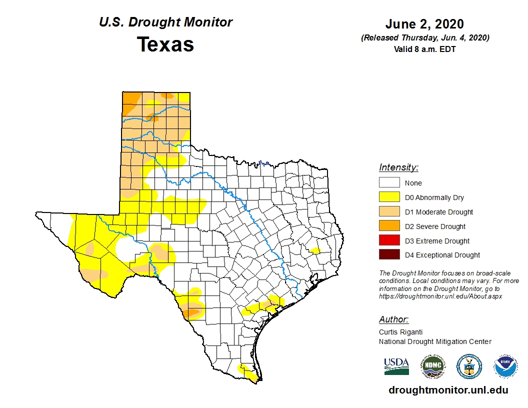
A few areas south of Houston saw some light to moderate showers on Monday, and the region will have one more shot at rain early on Wednesday morning. But after that conditions look really dry for at least a week or 10 days. Fortunately, the entire Houston metro area is at present drought-free. In fact, most of Texas is doing quite well for early June, with just 1.3 percent of the state in a “severe” drought or worse. This is a pretty decent posture in which to head into the hot summer months.
As local residents will know, during the middle of summer Houston often gets stuck beneath domes of high pressure for which it will not rain for days and days. Oftentimes, this pattern will only break with the incursion of tropical moisture. And then we enter the feast-or-famine state in which we can go from a drought to flooding within a couple of hours. So it goes along the Gulf Coast, during the summer. (At present we see no indications of tropical activity in the Gulf after Cristobal).
Tuesday
Speaking of heat, today will be hot and humid, so take care this afternoon when temperatures push into the upper 90s and the heat index soars into the 100s. Skies will be partly sunny, with light winds from the south. Weather conditions today will be a “proper” summer day in that it will mirror the kind of weather we typically see at the peak of heating in Houston, during late July and much of August. You’ve been warned.

Wednesday
Something pretty remarkable will happen late Tuesday night and Wednesday morning—a cold front will push into Houston. “Cold” is really not the operative word here, but “dry” is. Check out what will be on our doorstep Tuesday shortly before midnight in this map of dewpoints. (These are not temperatures, but rather a measure of the temperature at which moisture condenses. But believe me, the difference between a dewpoint of 75 degrees and 50 degrees is enormous).
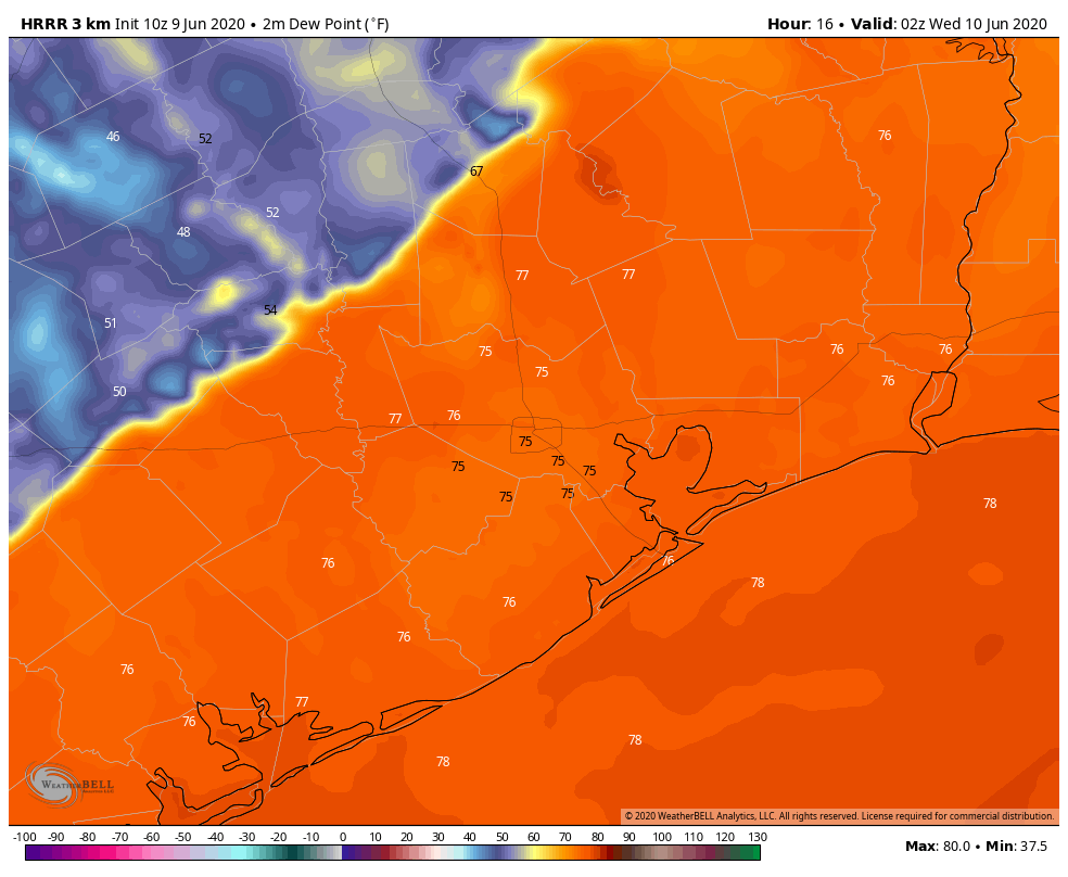
The front should push through Houston during the overnight hours, with drier dewpoints arriving in Houston during the mid-morning hours. Some scattered showers and thunderstorms may accompany the frontal passage, but right now we don’t expect anything too explosive. Highs Wednesday should reach the low 90s. As the sun drops toward the horizon, we’ll start to see great weather for June, as temperatures fall to around 70 in Houston, and into the 60s north and west of the city.
Thursday and Friday
Expect a pair of sunny, warm days with highs in the low 90s, and nights with lows down around 70. We’ll continue to see lovely, drier air.
Saturday and Sunday
We should see more of the same, albeit with a little more warmer air, and a little bit more humidity. It still should not be full-on summer. Expect sunny skies.
Next week
Warmer, more humid weather returns for most of next week. Look for highs probably in the mid-90s with plenty of humidity. Rain chances look low to non-existent for most of next week, which is why we mentioned the drought outlook at the top of this post.
Love it! You guys do a great job!
Thanks guys! Is there somewhere on you site I can refer to that explains dew point?
“Domes of high pressure” tend to push damaging tropical weather away from our area, correct? If so, I’ll vote for these domes! It would be nice to have a dome keep all the strong tropical cyclone weather out in the middle of the Atlantic until the end of hurricane season.
Be careful what you wish for. The summer of 2011 was dominated by high pressure with very, very little rain, resulting in extremely high temps and extreme drought. During August of that year, 30 of 31 days saw highs of 100 degrees or more. The city went to mandatory water rationing for many weeks and hundreds of thosands of trees perished. That was truly a hellish summer.
Sounds way better than a massive hurricane slamming into us. Hurricanes are way more hellish
Depends on your perspective. Folks who survived the Bastrop fires, farmers & ranchers would disagree.
Good point. I remember actually smelling the smoke and seeing the haze all the way in downtown Houston.