Good morning. After a wonderful Wednesday we will see one more sunny day before a potentially stormy Friday. The inclement weather on Friday should lead to a spectacular spring weekend for May, with sunshine and highs possibly in the 70s for both days and abundant dry air. If you missed our weekly Weather Wednesday video yesterday, you can find it on YouTube.
Thursday
After starting out with temperatures in the mid-60s this morning, the script for today calls for highs to warm into the low- to mid-80s. Winds will shift to come from the south later today, and may become a bit gusty, up to about 20mph. Clouds will begin to return later this afternoon, or during the overnight hours, and this combined with returning moisture will keep low temperatures from dropping below the low 70s for the metro area.
Friday
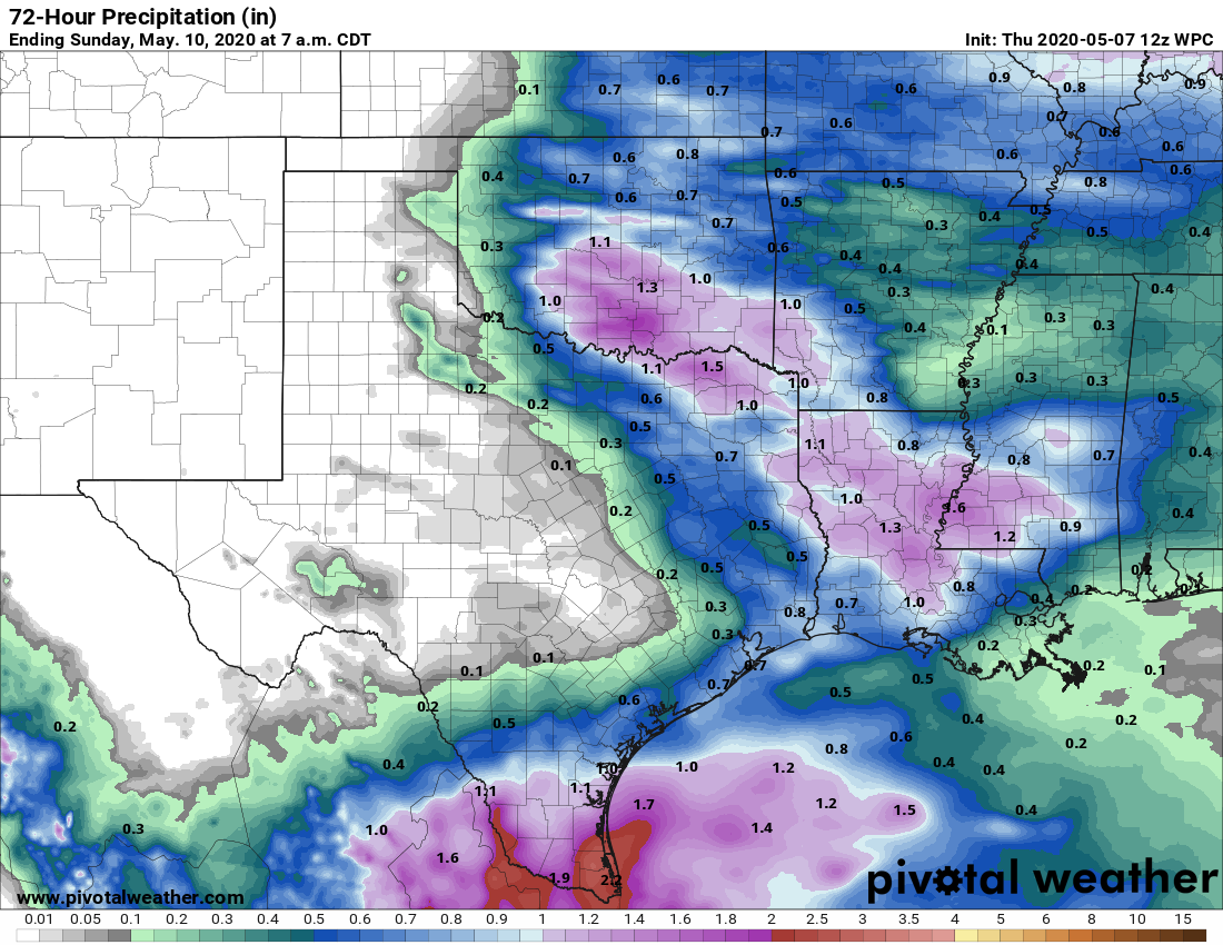
Our increasingly warm weather will be shaken up on Friday by the arrival of a cold front that should push through Houston from the northwest to southeast during the afternoon and evening hours. Right now it appears this will start out as a thin, broken line of showers that may intensify as it moves toward the coast. Once the front hits the sea breeze, some stronger thunderstorms may flare up in central and southern parts of the region. There is a slight risk for severe weather in the form of hail and damaging winds.
Another facet of this front is that it is going to move fairly rapidly until it doesn’t. This means that at some point, probably near or just off the coast, it’s going to stall for a bit. Right now we think that probably allows showers to linger for a bit during the overnight hours on Friday along the coast.

Saturday
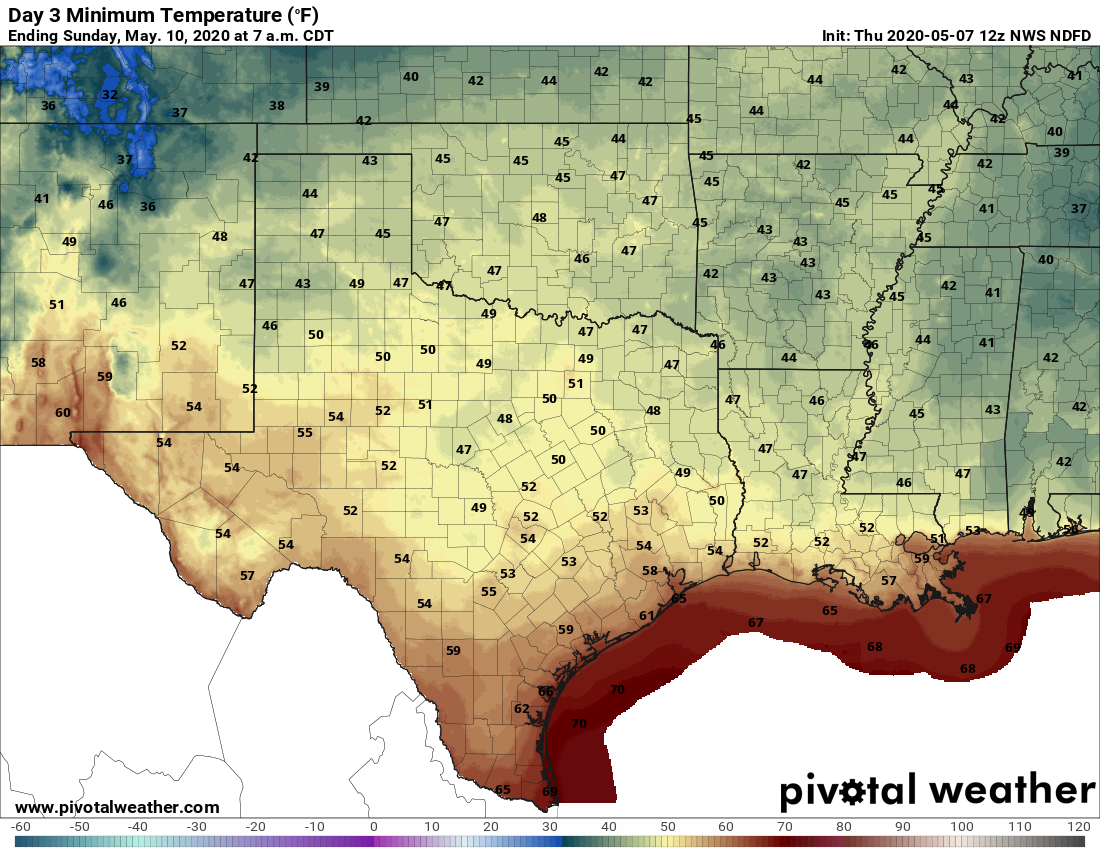
Expect mostly cloudy skies in the wake of Friday’s cool front, and this should help to moderate temperatures. In fact, much of the area will probably see high temperatures only in the low 70s, which is really quite cool for this time of year—when highs average out in the mid-80s. (The record low maximum temperature for May 9 is 67 degrees, set back in 1924. We won’t threaten that). Lows Saturday night should drop into the 50s for most of the metro area.
Mother’s Day
Wow this will be a great day! After a cool start expect high temperatures to push up to around 80 degrees under mostly sunny skies. This mild weather will be followed by another night where lows drop just below 60 degrees for most inland areas while remaining warmer along the coast. Let’s face it, moms have had it pretty tough this spring between the stay-at-home orders, working from home, worrying about job losses, home-schooling and so much more. We love you! (And so, apparently, does Mother Nature. At least for one day).
Next week
As one might expect in May, a warming trend will begin on Monday, pushing high temperatures from the low 80s to at least the upper 80s by the middle of next week with partly to mostly sunny days. Our next really significant chance of rain probably will not come until next weekend.
“Another facet of this front is that it is going to move fairly rapidly until it doesn’t.”
Always set yourself up for success…..
The link to the Youtube video takes me to the Washington Post. I didn’t know they were covering our weathr.
I was just going to post that – somebody switched out the weather map for a WaPo article…. I don’t like WaPo… I LOVE Matt and Eric!!
Eric, why does the link go to a Washington Post article on immigration?
Yeah, the link is to a Post article about the border wall… and how our weather patterns are affecting the construction! 🤣
Here is the link https://www.youtube.com/watch?v=jANwPTASIic