In brief: Houston’s sunny and hot weather continues, but we’re watching for modest impacts from a dying front on Saturday or Saturday night. Rain chances from this front are not great, but they’re the best we’ve seen in awhile around here.
Overview
High pressure will dominate for a few more days before a weak front squeezes into Texas on Saturday or Saturday night. This will bring us a brief shot at some showers (and possibly a thunderstorm or two, but probably not), and possibly a few hours of slightly lower humidity. The timing of the front is important here. Following this we’ll be back to hot and sunny weather for the majority of next week, although temperatures might be 1 or 2 degrees cooler than this week. Maybe. It’s gonna be August so you know it will be miserable.
Friday
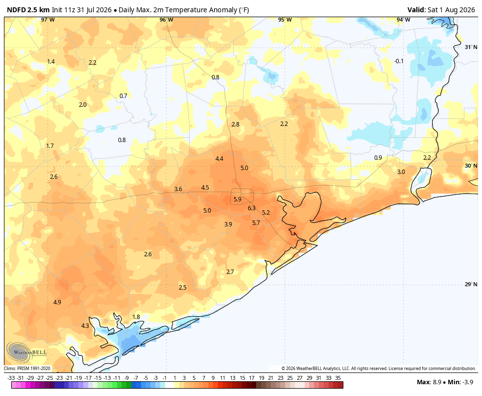
Today will be like the rest of this week so far: highs in the upper 90s to 100 degrees, sunny, humid, and hot. Light winds this morning will turn gusty later this afternoon and into the evening hours. Lows remain sultry, only dropping to around 80 degrees or slightly below.
Saturday
Weakening high pressure will allow a front to slip into Texas on Friday and Saturday, and by Saturday afternoon or evening it should approach the greater Houston area. The timing is important, because if the front reaches the metro area during the afternoon or early evening there will be plenty of heat for it to help generate some showers and thunderstorms. If not, then there will be less coverage. For now let’s go with rain chances in the vicinity of 30 percent during the period of Saturday afternoon through the overnight hours. Aside from this, Saturday is still going to be hot, sunny, and humid.
Sunday and Monday
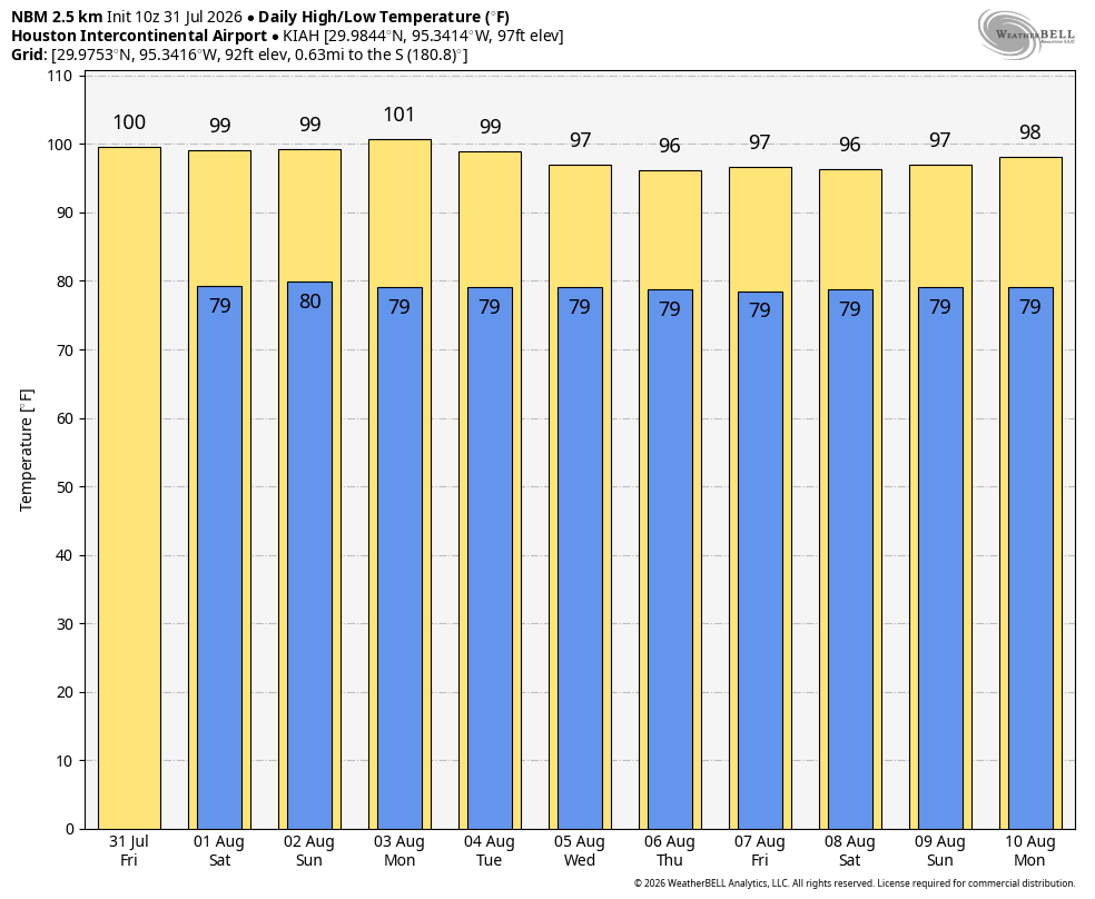
These will be hot days with highs in the vicinity of 100 degrees. The wrinkle is that our air mass might be slightly less humid due to the front’s arrival. Not knock-your-socks-off lower humidity, but the kind of thing you may be able to feel on Sunday morning or evening. Or not. Rain chances both days are near zero.
Next week
Houston’s weather turns slightly more normal-ish for August next week, with highs in the mid-90s to upper-90s most likely, and perhaps a 10 or 20 percent chance of afternoon showers. In general, this is pretty miserable. But because this is August, it’s pretty much the norm around these parts.
Have a wonderful weekend, everyone. We’ll see you on Monday morning.
