In brief: In today’s post we discuss the quietude in the Atlantic tropics, and when that could begin to change. Also, our heat continues for as far as the eye can see, although there are some slight rain chances out there.
A quick look at the Atlantic
Nearly a week after Tropical Storm Bertha moved into Texas the overall picture in the Atlantic tropics remains very quiet. It is possible that a weak system forms off the Eastern Seaboard of the United States next week, but it likely would be moving away from land. The Gulf and Caribbean remain very quiet, and this is due in part to rather high wind shear levels across these basins.
Overall, things look good for the next couple of weeks, which is about how long we can reasonably expect to forecast out. It will be about that time, August 10 or so, that historically the Atlantic tropics start to take off. This is the point in the season when tropical waves start to move off the West African coast into the Atlantic, and strengthen into tropical storms and hurricanes as they propagate westward across the ocean in what is known as the “main development region.”
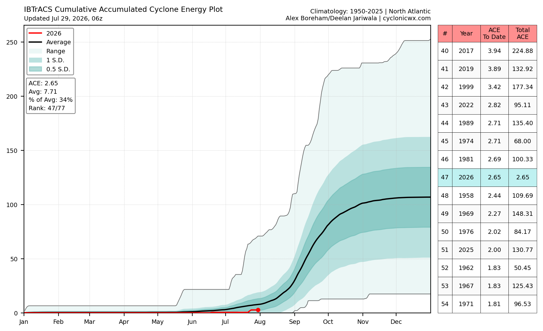
You can see this burst in activity in the above plot of “accumulated cyclone energy,” which starts to spike later in August and activity remains high into early October. This year (note the red line) activity is significantly below normal, just 34 percent of a typical total. That’s a great start, and to be clear we expect an overall fairly quiet season given a strengthening El Niño, but the bulk of this season lies ahead. We will need to get through August and most of September before giving an all clear for the year in Texas.
Wednesday
The high temperature at Bush Intercontinental Airport reached 97 degrees on Tuesday, and that should be the region’s coolest day for awhile. Highs today will probably reach around 100 degrees, with plenty of humidity and mostly clear skies. Of (slight) note there is about a 10 percent chance of showers or isolated thunderstorms this afternoon due to a potential break in the capping inversion. Winds pick up out of the south later this afternoon. Lows tonight will be around 80, or just below.
Thursday through the weekend
Our hot weather continues. Expect highs in the vicinity of 100 degrees, or the low 100s, for most of the Houston region away from the coast. Near the Gulf waters, highs will be a few degrees cooler. The models continue to indicate a decent chance of rain on Saturday night or Sunday, perhaps 30 percent. Is this a mirage? We’ll see. But mostly we’re going to be sunny and hot.
Next week
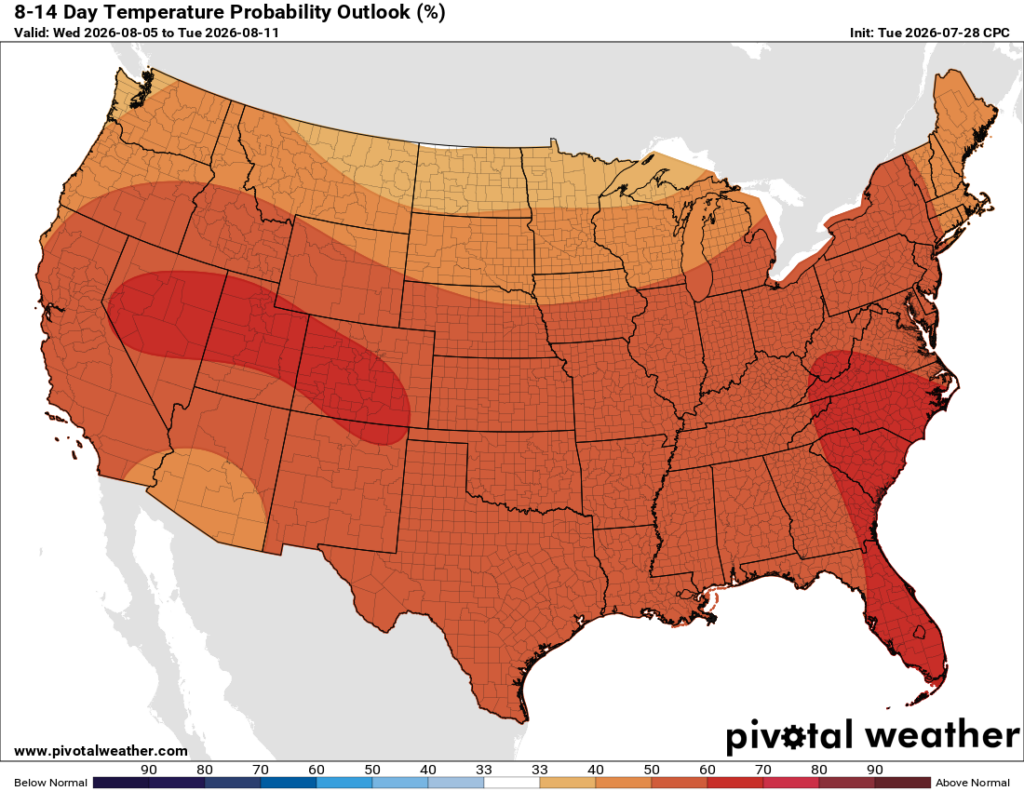
For now, I’m leaning toward the “not much changes next week” scenario. Welcome to high summer, y’all.
