Good morning. We are into the final week of August, and this brings both good and bad news. The good news is that we’re much closer to the end of summer than the beginning. Based upon our climate normals, the warmest stretch of summer in Houston lasts from July 31 through August 8, when the average temperature is 85.8 degrees. (That’s simply an average of the daily high and low temperature). We are, reasonably, about one month from when we can expect fall’s first significant cool front.
The bad news is that we still have about a full month of summer left, and it coincides with the absolute peak of hurricane season for Texas. Although we see no immediate threats to the greater Houston region (read more below), the next few weeks do look active for the Gulf of Mexico. So we’re asking you to hang on for one more month, after which we’ll escape the heat of summer and the main threat of tropical activity.
Monday
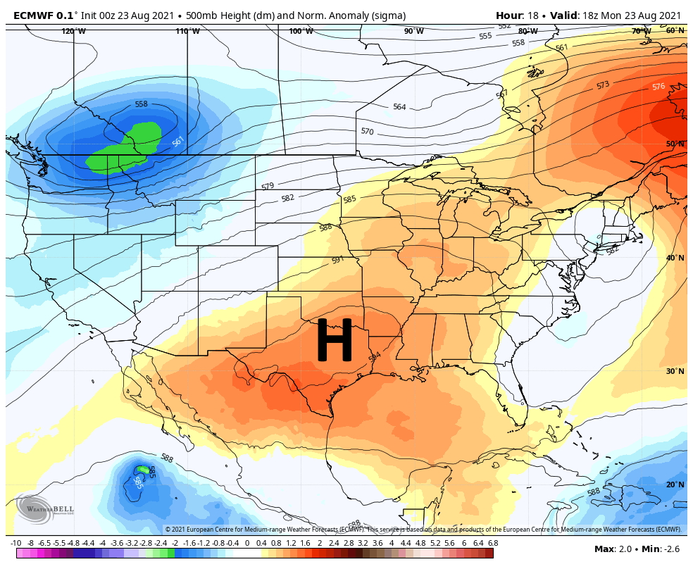
Monday will see a continuation of conditions the region experienced over the weekend, which is to say hot and sunny. High temperatures for inland areas could well flirt with 100 degrees, and even coastal areas should be solidly in the low- to mid-90s. Skies will be mostly sunny, with only light southerly winds. This will be a day for care during the hottest, afternoon hours. Overnight lows should be in the upper 70s.
Tuesday
Another hot and sunny day, with high temperatures in the upper 90s. Winds will again be calm.
Wednesday and Thursday
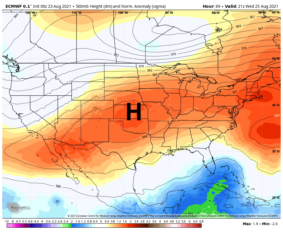
Our overall pattern should begin to change by the middle of the week, as high pressure lifts away from the area. This should bring a few clouds to our skies, and introduce rain chances of perhaps 30 to 40 percent each day during the afternoon hours. This may also help to moderate temperatures slightly, from the upper 90s to mid-90s.
Friday, Saturday, and Sunday
The weekend forecast is far from settled, but for now it appears as though the combination of low pressure and increasing levels of tropical moisture should combine for healthy rain chances, especially by Sunday. For now I’d guess we’ll see highs in the low 90s, with partly sunny skies, and at least a 50 percent chance of rain showers each day. Under some scenarios, heavy rain is possible by Sunday, but that will depend to some extent on tropical development, discussed below.
Tropics
After Tropical Storm Henri moved into the northeastern United States this weekend, there are no active systems over water. However that could change later this week as a tropical wave moves into the Caribbean Sea. The National Hurricane Center gives this wave a 30 percent chance of developing into a tropical depression or storm within the next five days.
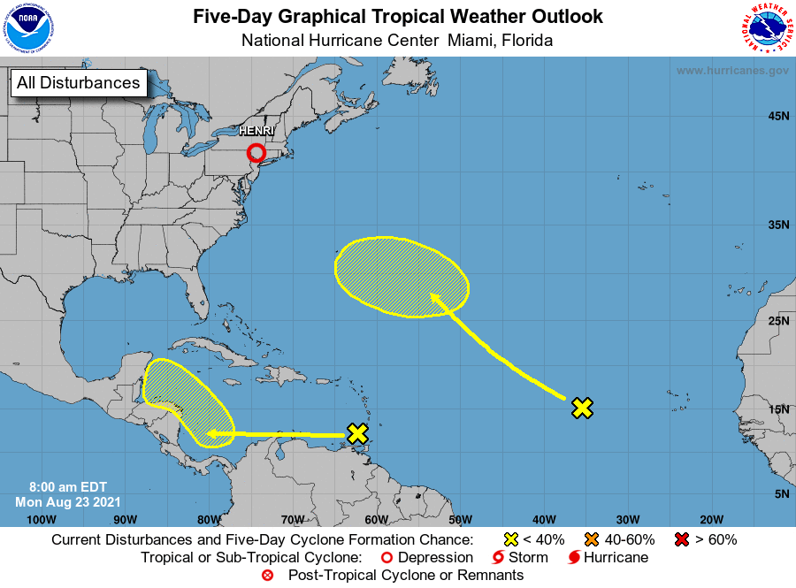
The global models are generally pretty bullish on this system eventually developing in the Southern Gulf of Mexico this weekend, and it’s something we’ll be watching closely as it will influence our rain chances this weekend. For now the bulk of these models suggest the storm will come ashore somewhere along the Mexican mainland, south of the Texas border. Although it is far too early to have much confidence in this, such a scenairo would also be unfortunate, give the recent landfall of Hurricane Grace near the resort town of Tecolutla.
After this system, there are hints of more potential activity in the Gulf of Mexico about two weeks from now, which would be consistent with early September. As we said above, the next month is the peak of hurricane season for Texas, so have a plan and be prepared.
Sorry if you have already mentioned it: what is the lest day (in September) when there has been a hurricane affecting the TX coast?
We’ve had Hurricanes in October too.
Meaning we’ve had a hurricane his Houston in October. I believe 1989 was one time that it happened.
We’ve had hurricanes “threaten” Texas in October too. One of my favorite memories is Hurricane Lili in 2002. I was in HS living in the Golden Triangle. There were evacuation order issued but of course it curved to Louisiana!
Oh yes. October 15, 1989. My husband took me to New Orleans to see a Saints-Jets game for our anniversary. Hurricane Jerry was supposed to head straight at New Orleans. We left the game in the 3rd quarter to get back to Houston before the storm. Unfortunately, Jerry changed predicted paths and headed pretty much right at Houston. Our plane flew through the outer bands. I never want to do that again. Scariest experience ever.
It’s 9/24. IIRC only 3 hurricanes have hit TX after that date in the last 150 years. So not impossible, but the odds go waaaayyy down.
Hurricanes have hit the upper TX coast up through October. It’s rare, but not unprecedented. I’d say we’re safe after about Mid September in most years
Hurricane Rita was Sept 23 2005
Hurricane Jerry hit Galveston in mid October 1989
Okay our Generac has been on back order for a few months and we’ve been sweating the hurricane season.. But they’re delivering it this week, so I’m hoping by spending the money on this thing it ensures that we probably won’t have another hurricane impact us for another 10 years.! All bets are off on the power grid, though! 😳
who did you use for your Generac purchase? I’ve had one quote but looking for another.
We used ARK Generators
We used an independent mechanical contractor. KD Mechanical out of La Marque. He bought ours out of San Antonio and it was here in 2-weeks (22kW Guardian with Transfer Switch). Did a great job with the install and was less than any of the actual Generac distributors.
Just one more month of this? Really?
AAARRRRGGGGHHHHHH !!!!!!!!!!!!!!
According to the Houston Chronicle, the peak normal high 96 degrees Fahrenheit temperature and the peak normal low 76 degrees F. temperatures at Bush Airport falls on July 29th to August 12th.
Very helpful discussion about the tropics. Thank you.
One more month until calmer seas and better weather. This is why I only read Space City Weather. Yes, there’s a chance in October, but this is a much better headline than reading “One month left!!! Anything can happen!! Prepare for the worst!!”
I saw something today about GFS models showing a fairly sizable storm hitting SE Texas on or around Sept. 5. Any thoughts on this? Any credibility to it?
He said there is some hints of potential activity around then. Having seen the GFS, it’s really pulling something from nothing right now. Until something develops, it’s hard to know anything will come of it. Best bet is to stay alert for the next few weeks.
And now it’s the Euro showing almost 20 inches hitting Houston. I think the GFS and Euro keep bouncing back and forth on this.
The models show a new high building in as the system enters the gulf thus, for now, keeping anything south of us.