In brief: We’re less than two days before the landfall of Beryl and there are still plenty of questions about the severity of impacts in Houston. This post will attempt to answer those that we can. In terms of planning, it is becoming increasingly clear that Monday, perhaps from the pre-dawn hours into early afternoon, will be the most impactful time for severe weather.
Status of Beryl on Saturday afternoon
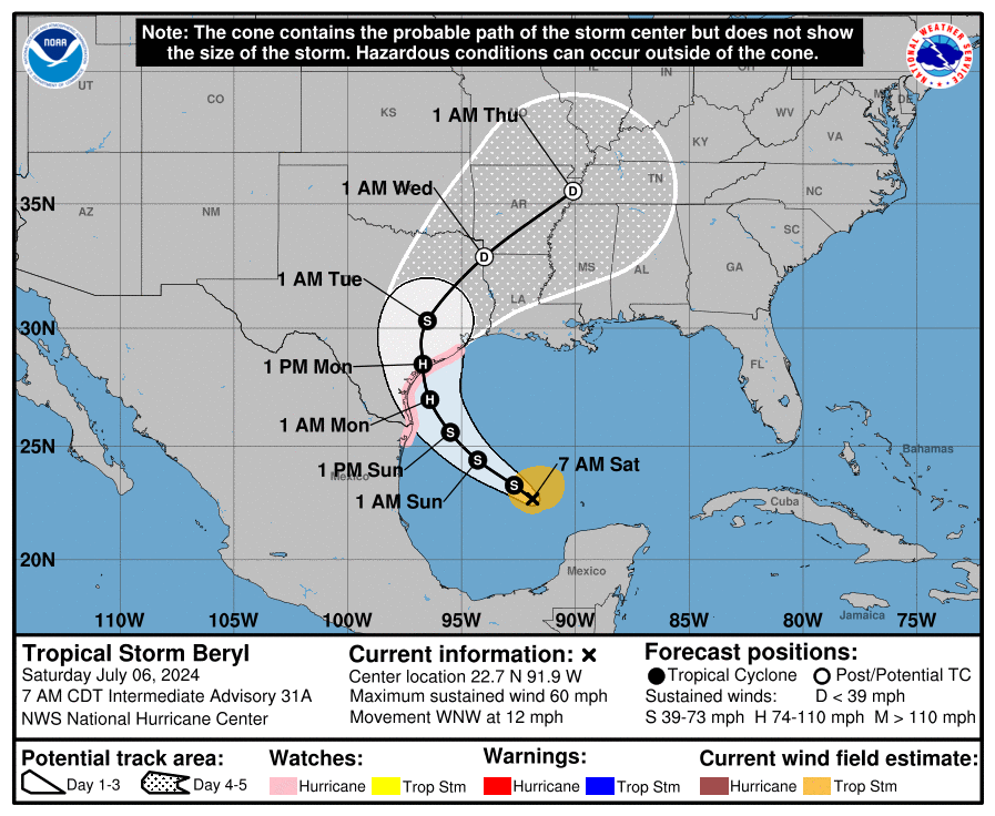
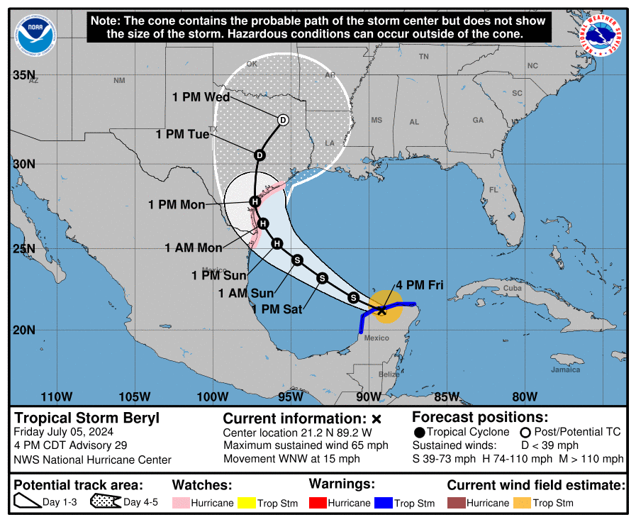
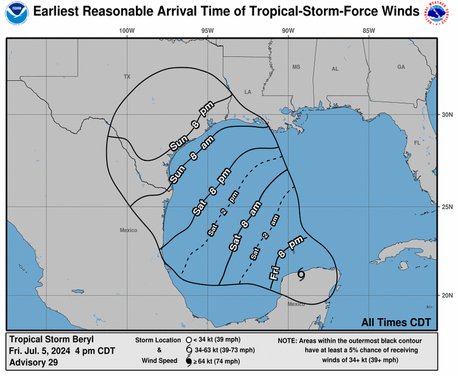
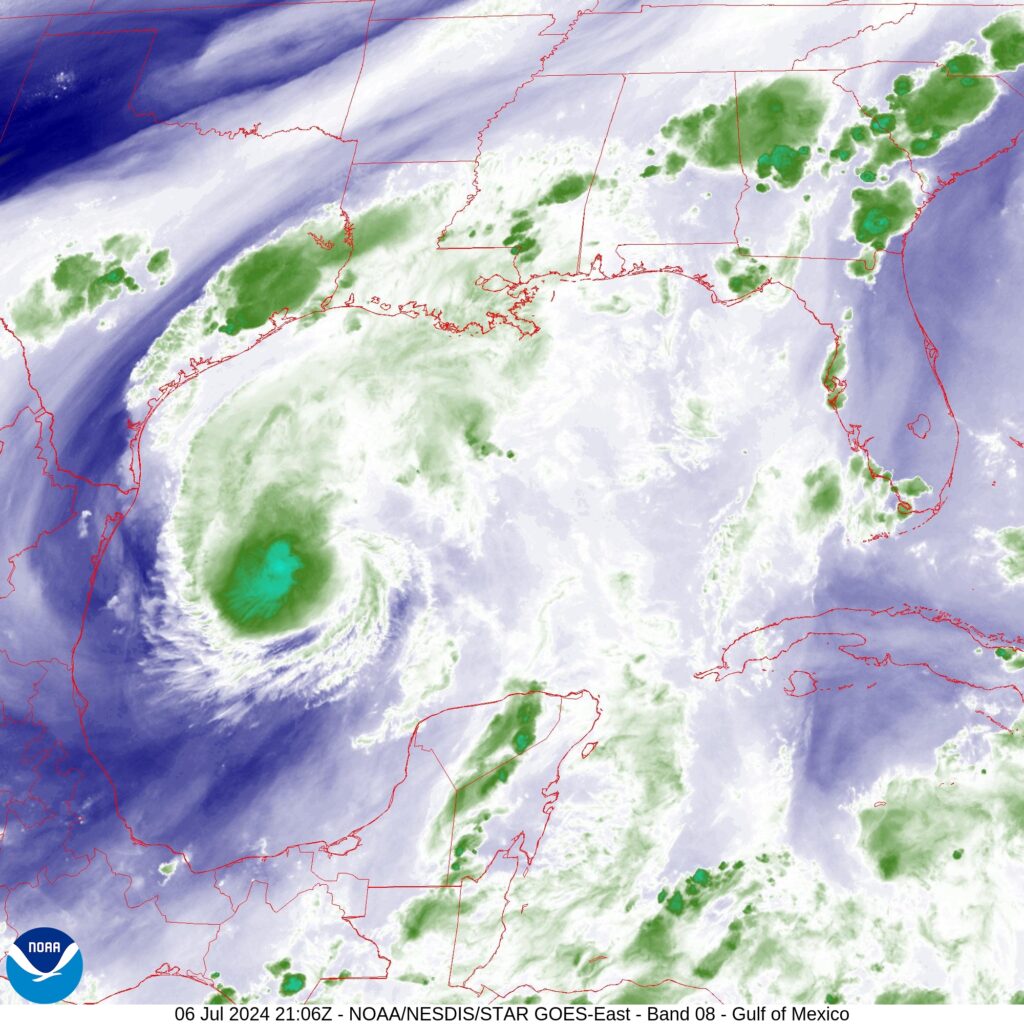
Good afternoon. As of 4 pm CT, Beryl remains a strong tropical storm with 60 mph winds and a slowly dropping central pressure. It’s movement is northwest, and it remains on course to make landfall in Texas on Monday, likely during the morning hours. There remains a fair bit of uncertainty about precisely what winds, surge, and rainfall the greater Houston area will experience.
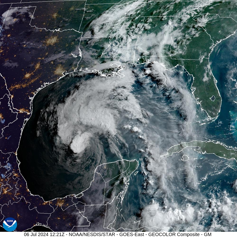
You’ve probably noticed the showers and thunderstorms—there has been a lot of thunder and a lot of excited dogs down my way—this afternoon. These storms are not directly related to Hurricane Beryl, but rather are due to a dying front meeting up with the sea breeze and having a party with the peak heating of the day. These storms should sag toward the southwest this evening before fading out by or before sunset. After that we can expect a quiet night, I think.
Starting on Sunday, perhaps by noon, we may see our first rains from the outer bands of Beryl. However, there should be few mobility issues with making final preparations before the hurricane reaches the Texas coast. I expect stronger winds to begin reaching the coastal areas on Sunday evening, so if you live in places such as Galveston Island or Freeport, you’ll probably not want to be out too late. After midnight our region will start to feel the full effects of Beryl, and which I’ll talk about below.
However, before jumping into the forecast I want to share a couple of housekeeping notes.
Housekeeping notes
Find us: There are lots of ways to find and follow Space City Weather online, and to be sure you know when we post updates. We’ve created a page to help you find us on social media, via our (absolutely free) app for your phones and tablets, an email newsletter, and more.
Video Q&A: I’m planning to conduct a Facebook Live on Sunday at 1 pm CT. The purpose of this will be to answer your questions over the course of about 20 minutes (or longer, if there are more questions). You can queue up questions in the comments below, or on Facebook. We’ll also be taking questions live, during the event, which will take place on our Facebook page.
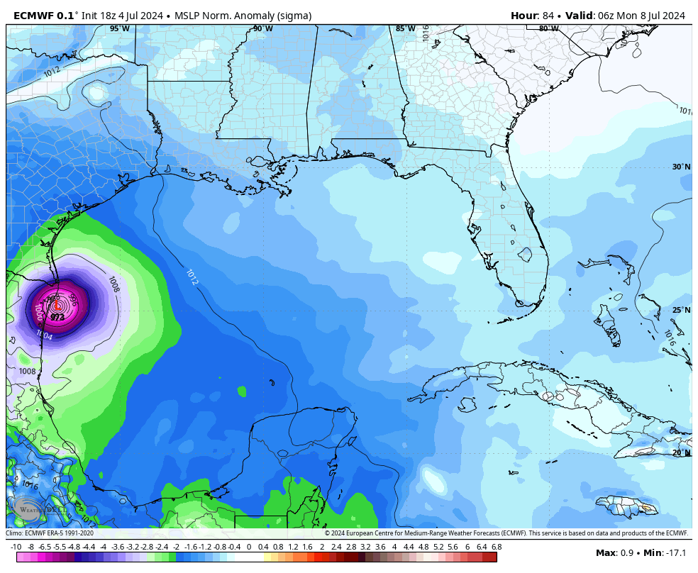
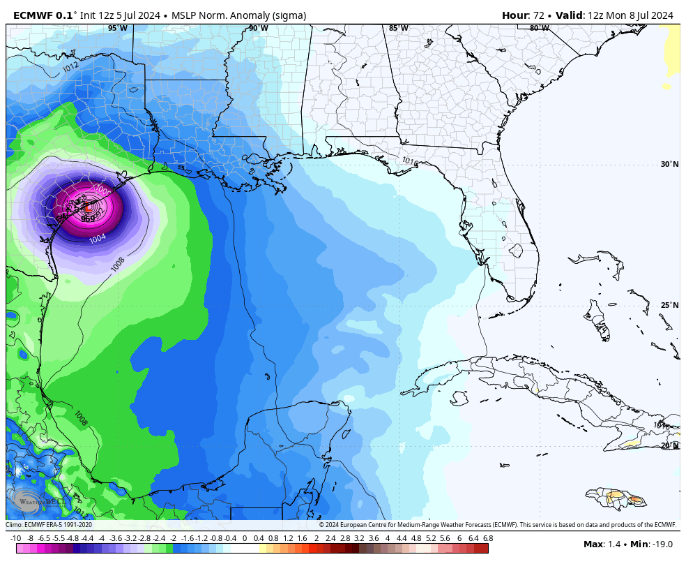
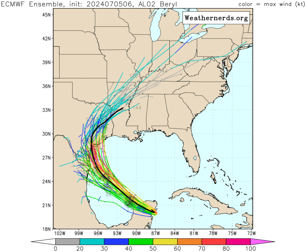
Beryl’s track and intensity
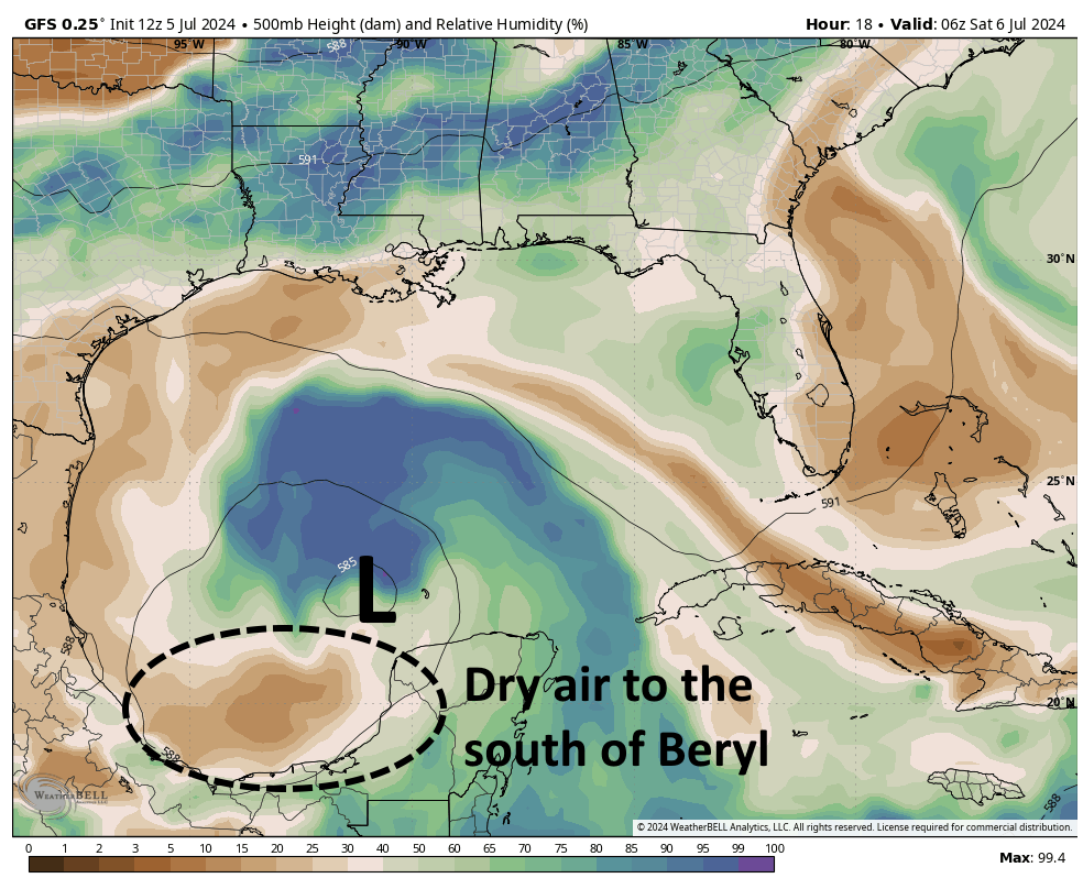
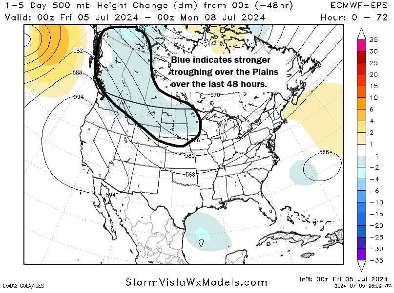
As expected, Beryl is spending most of today fending off dry air to its south, and wind shear to its southwest. The storm is starting to develop better organized thunderstorms, however, and it should slowly begin to intensify tonight. Sunday and Sunday night will present a more favorable opportunity for intensification, and the National Hurricane Center brings Category 1 hurricane to the coast on Monday morning. However, the storm could be a bit stronger than this as historically we have seen hurricanes quickly gain intensity as the near the Texas shore.
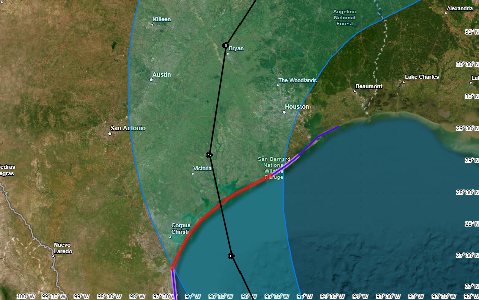
We are now only about 36 to 48 hours away from a final landfall along the upper Texas coast. But there remains a decent amount of uncertainty in the final landfall location, and even 50 or 100 miles matter since the storm is going to come inland relatively close to Houston. Our forecast models are pretty good, but we’re talking about relatively small errors that can still be caused by a wobble or two.
What I’m trying to say is that Houston is sort of on the edge: Depending on which way Beryl goes in the last day and a half we could see anything from fairly minor winds to near hurricane-force gusts; and a few inches of rainfall up to 10 inches or more. So my main message here is to be prepared for some serious disruptions in power and mobility on Monday, and if we’re lucky these issues will turn out to be minor. The forecast conditions outlined below are consistent with the latest operational forecast from the National Hurricane Center, which is the most likely (but not certain) outcome.
Timing and severity of Beryl’s impacts on Houston
There are three main impacts from Beryl, winds, storm surge, and heavy rainfall. Let’s go through the latest thinking on each of them.
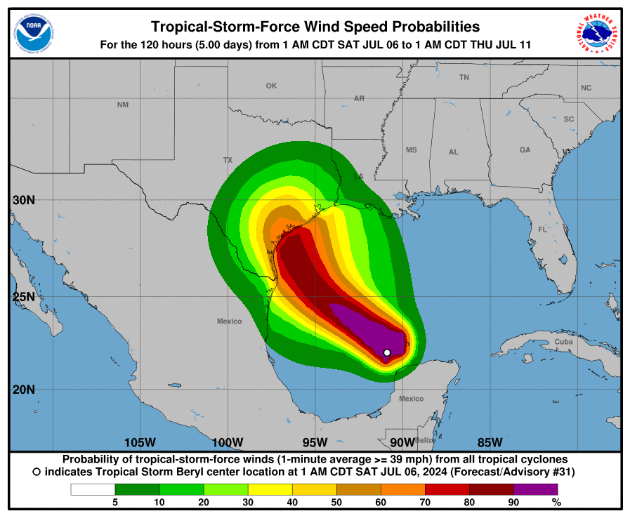
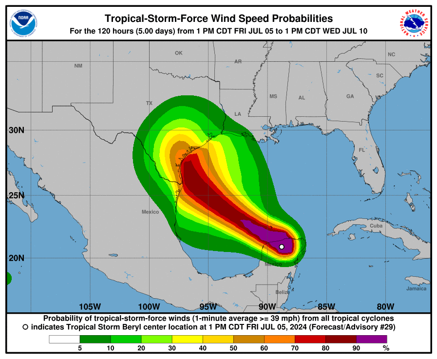
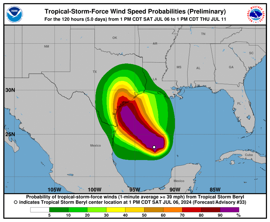
Winds: Tropical storm-force winds could reach the upper Texas coast by Sunday evening. Generally, areas along and west of Interstate 45 have the best chance of experiencing tropical storm force winds of 39 mph or greater, with higher gusts. In terms of potential power outages, I’m most concerned about Brazoria and Fort Bend Counties, and areas generally south and west of Houston. Again, the extent of our concerns about power losses will be driven by the potential for last second wobbles which will (or will not) bring the core of stronger winds closer to Houston.
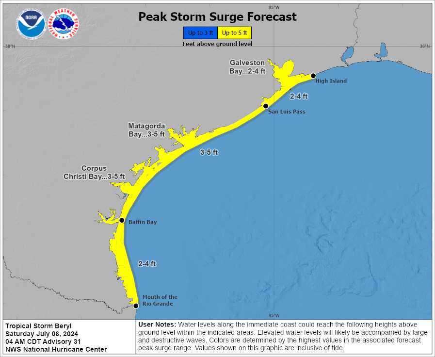
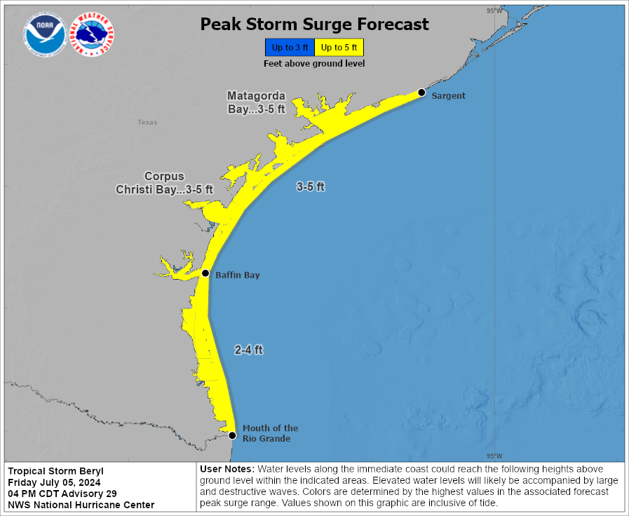
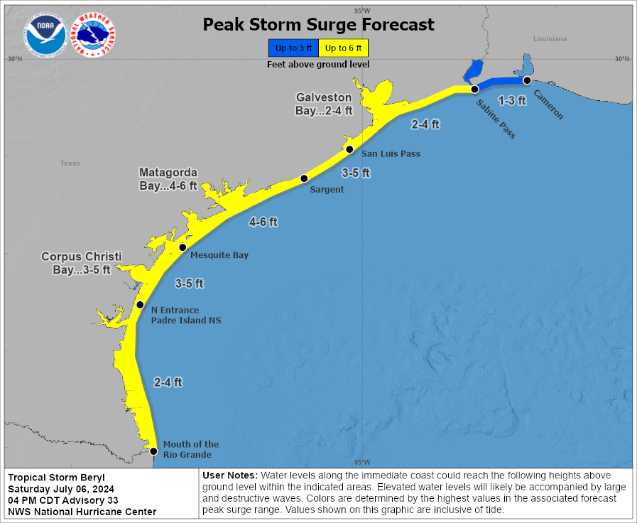
Storm surge: Our thinking on storm surge has not changed much, with 3 to 5 feet expected along Galveston Island, and 2 to 4 feet possible in Galveston Bay. This surge is likely to peak on Monday morning, as Beryl nears land, and on top of high tide. Tide timings vary by location, but generally the highest water levels should be anticipated between 6 am and 9 am CT.
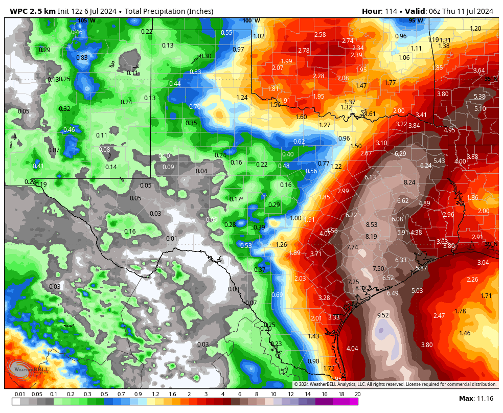
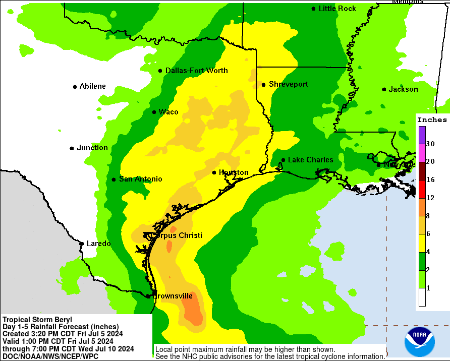
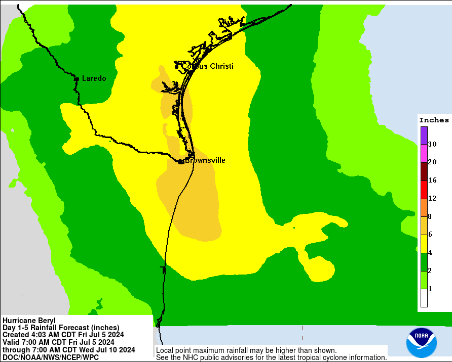
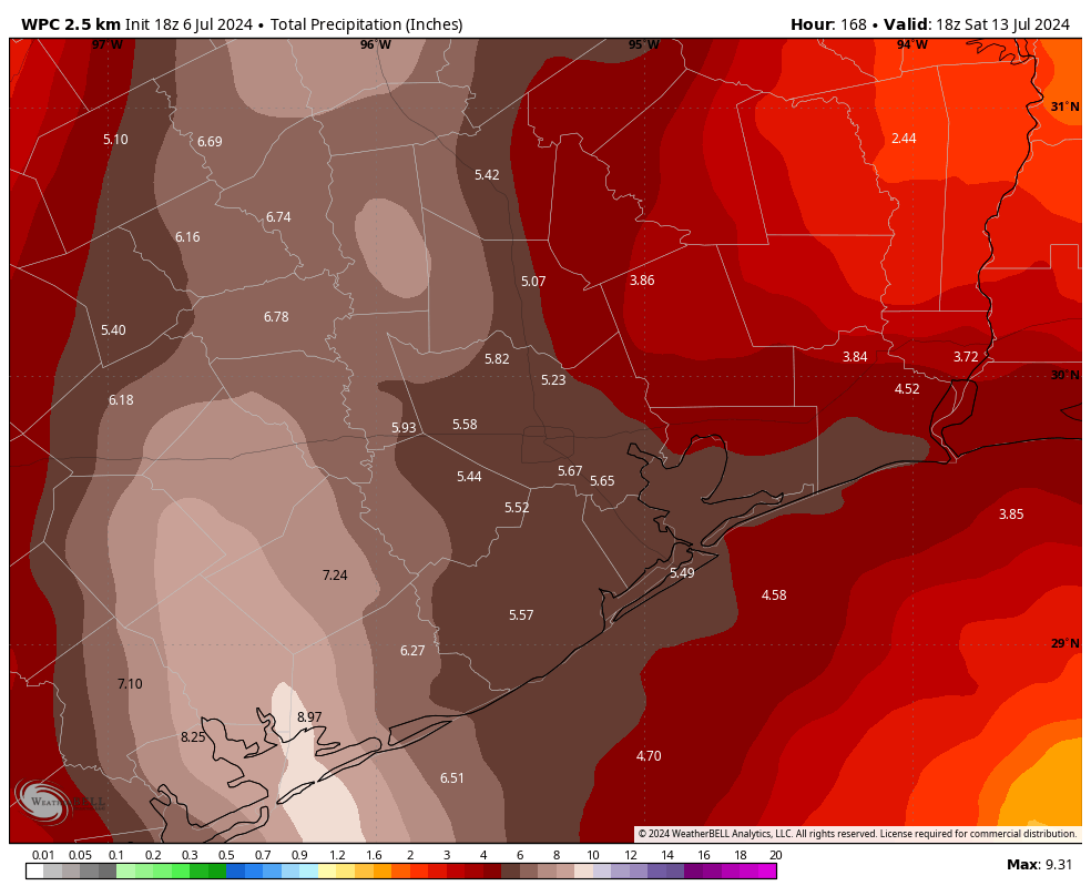
Rainfall: We’ve issued a Stage 2 flood alert for the entire Houston metro area, but like with Beryl’s winds, the risk for flooding is greatest along and west of Interstate 45. My best guess is that the strongest band of thunderstorms will move through Houston sometime on Monday morning, perhaps between sunrise and around noon. This likely will produce the most intense rainfall, and the greatest potential for rapidly flooding streets. If you have plans to be out and about Monday morning, please be very weather aware. In terms of accumulations I think most of the area will pick up 4 to 8 inches of rain, which is mostly manageable. However, due to the tropical nature of this rainfall (which leads to high rainfall rates) some isolated areas may pick up as much as 12 or even 15 inches. That’s … less manageable.
A note about flight cancellations
I mentioned this about three weeks ago, but I wanted to reiterate that we hear you on flight cancellations. It’s a major concern with inclement weather. I totally get the anxiety. However, neither Matt nor I are aviation meteorologists or pilots. Unfortunately, we don’t have any special expertise or insight into the decision-making at airports that lead to flight stoppages, nor the cancellation of flights. We try to be helpful, but we’re never going to be able to give you the certainty on this issue that readers want. With all that said, my general expectation is that heavy rain or winds may well disrupt and even cancel some flights on Monday or (less likely) Tuesday.
Our next update
We’ll be back late this evening, probably between 10 and 11 pm CT, with a short update on track, intensity, and some thoughts on whether Houston is likely to experience milder or more serious effects from Beryl. We will, of course, have full coverage on Sunday.