Good morning. Although the coldest weather for Houston will actually come over the next two nights, much of the rest of Texas is experiencing the lowest temperatures of this Arctic outbreak right now. Because of this, the Electric Reliability Council of Texas, or ERCOT is asking Texans to conserve power from 6 am to 10 am CT on Monday. Expect another call for conservation on Tuesday morning.
The agency has not said whether it will institute rolling blackouts if demand exceeds power reserves, but that certainly seems possible. You can track power grid status in real time, here. Please note that, at this time, there is no reason to believe that we will see extended blackouts like we experienced during the deep freeze in February 2021.
Now, let’s jump into the forecast.
Monday
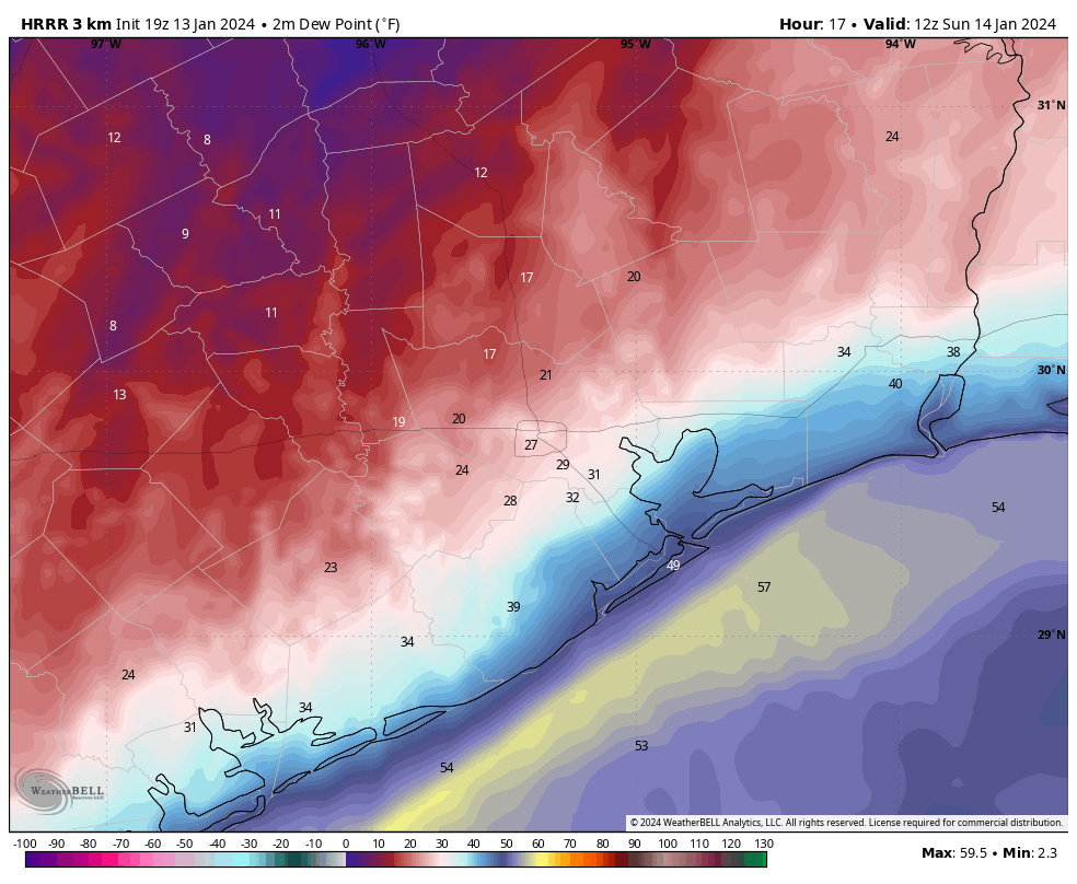
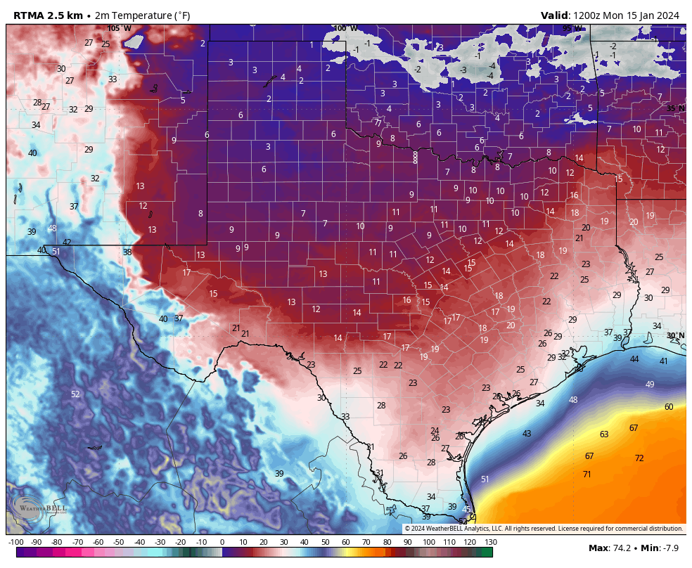
We’re starting the new week in a chilly posture, with areas inland of Interstate 10 generally experiencing a freeze. For far inland areas, such as Brenham and College Station, temperatures are already well into hard freeze territory. In Houston’s urban core temperatures are holding at or just above freezing. Arctic air will continue surging into the region today, and temperatures are likely to hover at about freezing levels, or just above or below, for much of the day.
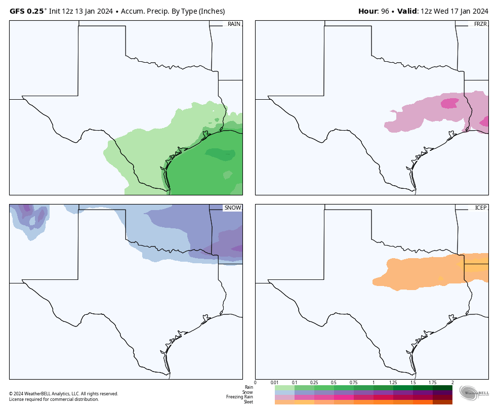
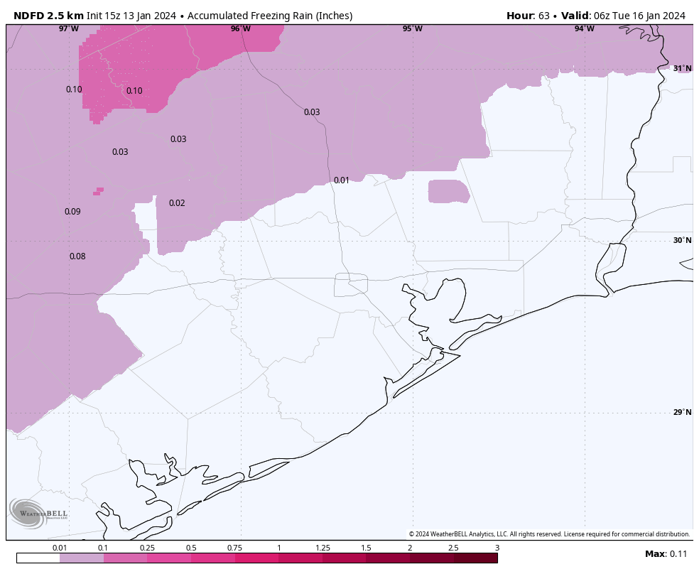
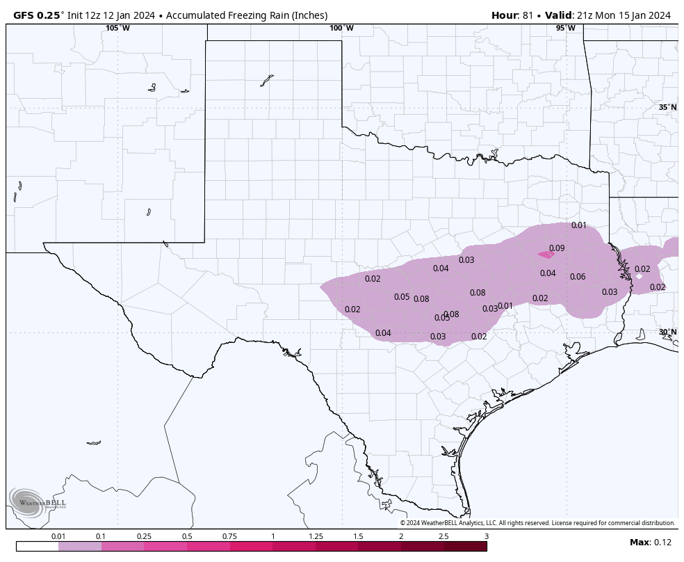
The big question, of course, is precipitation and the extent to which we see freezing rain. We expect to see a mix of very light precipitation and drizzle today in the Houston metro area, with accumulations on the order of a few hundredths of an inch. With temperatures hovering near freezing levels, some of this is bound to fall as freezing rain, leading to concerns about icing on bridges and overpasses. Overall, we don’t anticipate a major ice storm or anything like that in our region, but icy conditions are something to be cognizant of today if you’re out and about. You can check local roadway conditions at Houston Transtar, where icy conditions will be reported. Statewide conditions can be found at Drive Texas. As expected there are a flurry of ice issues well north of the Houston area, particularly around the Dallas area and East Texas. Travel to those locations is not recommended today.
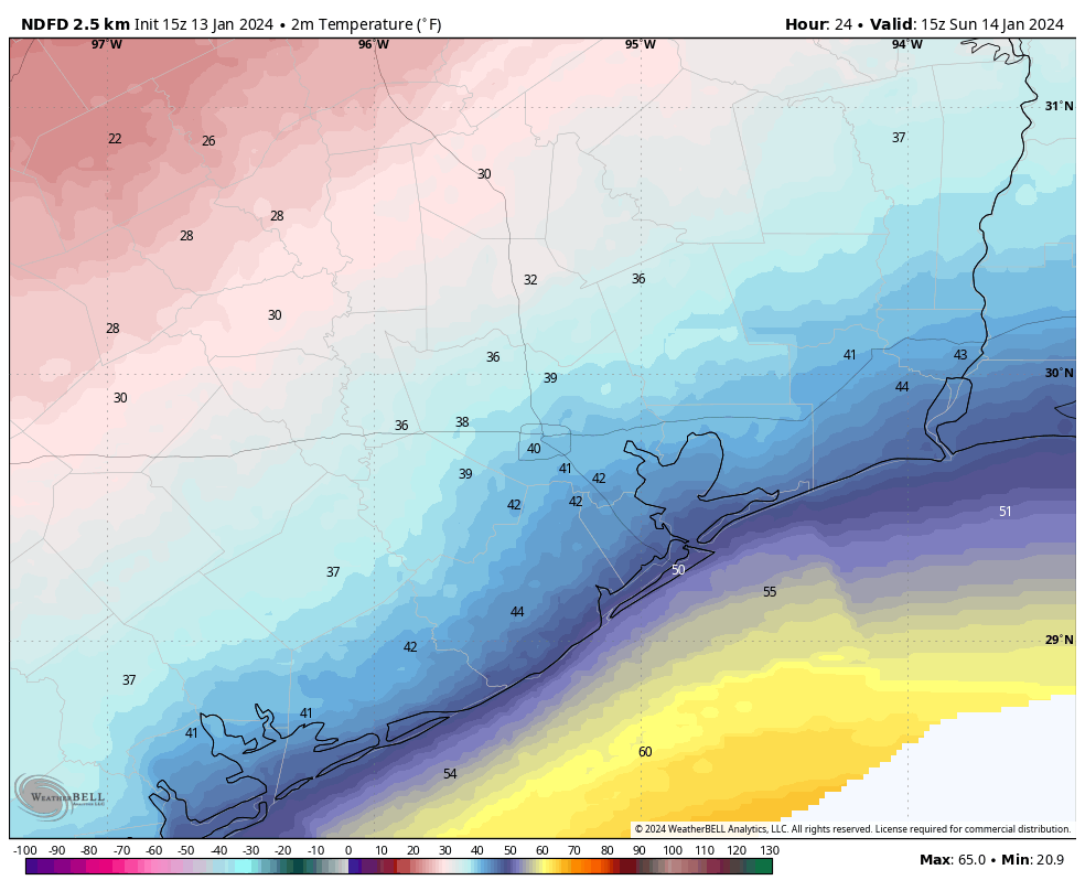
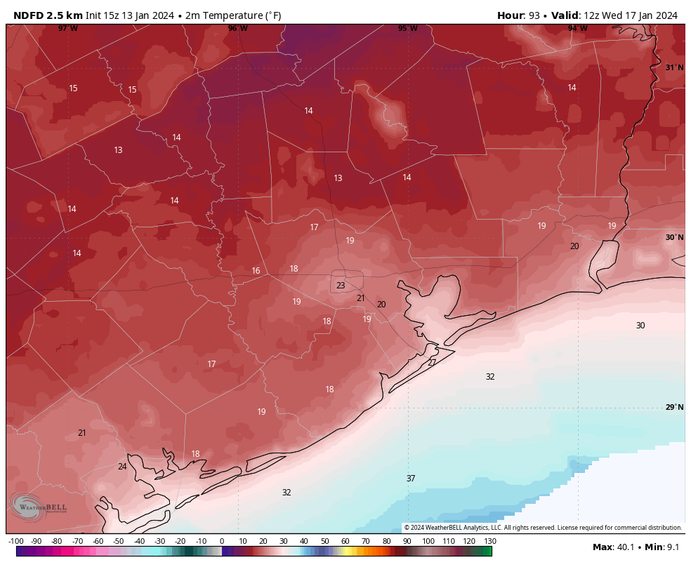
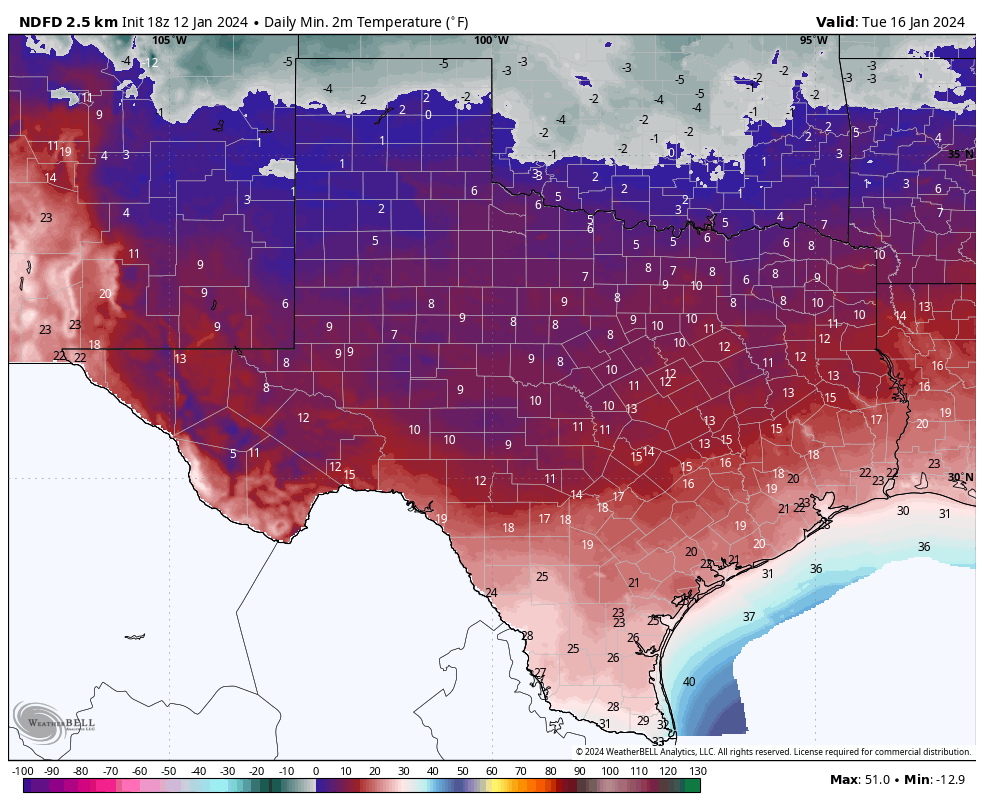
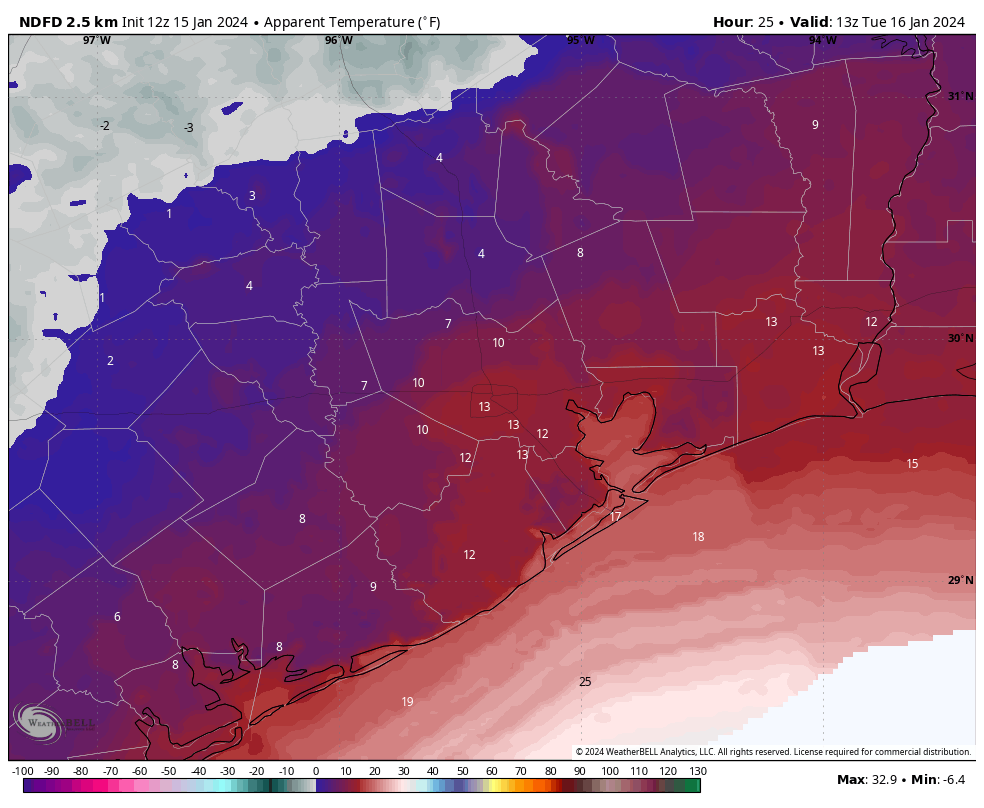
Tonight will be quite cold, especially with a northerly winds of 15 to 20 mph (higher at the coast) piling on wind chill. Air temperatures will drop into the mid-20s in Houston, with colder conditions further inland (a hard freeze) and slightly warmer conditions near the coast. Even Galveston could experience a light freeze. Tuesday morning will feel very cold outside:
As for roads, I think the combination of dry air and windy conditions will remove any moisture and ice. So my best guess is that while conditions will be very cold tonight and into Tuesday, roads should be dry. That is dependent on how much precipitation we get today, of course. We’ll update these icy roads predictions later this afternoon.
Tuesday
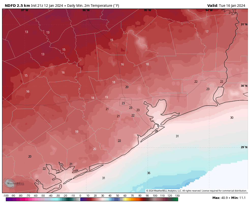
After the cold start to the day, highs may reach the low- to mid-30s in Houston underneath sunny skies, but those persistent winds will keep a chill in the air. Areas well inland are likely to remain below freezing throughout the day. As winds die down on Tuesday night, we’ll see ideal conditions for cooling. Expect lows to bottom out from 20 to 25 degrees in the urban core of Houston, with colder temperatures inland.
Wednesday
After a very cold start, highs should warm to about 50 degrees on Wednesday with sunny skies. Lows on Wednesday night should remain comfortably in the 40s.
Thursday
A warmer day, with highs in the upper 60s and partly sunny skies. Another fairly robust front arrives on Thursday night-ish, returning colder conditions to the area.
Friday, Saturday, and Sunday
We are going to experience highs in the upper 40s or lower 50s through the weekend, with mostly sunny skies. Lows may reach freezing on Saturday morning in Houston, but it should be a light freeze.