As the city breaks heat records a weak front arrives today, with tropical rain possible next week

There’s a lot going on with today’s forecast, so let’s get into it. We’re going to focus on four different features: Ongoing, record-setting heat across the area; a weak front moving into Houston today and its effects; the return of extreme heat and humidity this weekend; and finally a bit of a reprieve and increased rain chances next week due to a tropical wave.

Heat streak

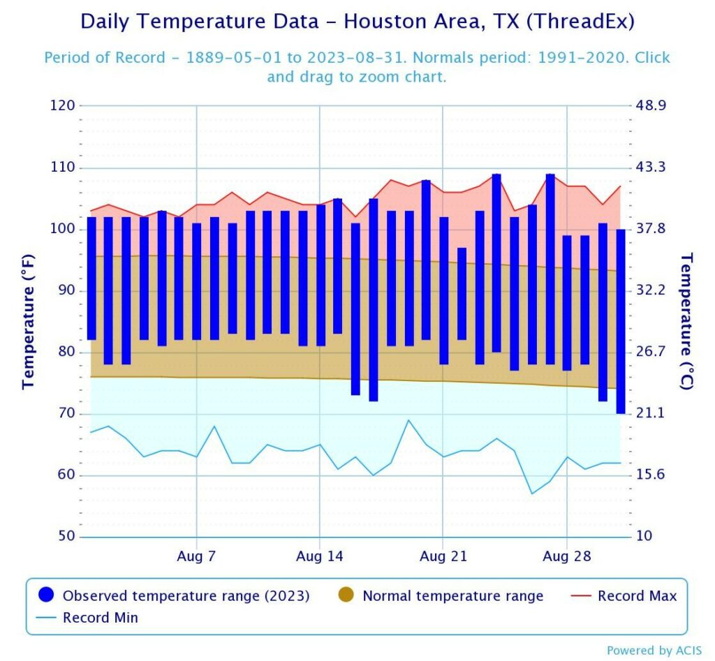
After recording a high temperature of 103 degrees on Monday, Houston’s Hobby Airport extended its string of 100-degree days to 11 in a row. The previous record for the airport location, which has kept records for nearly a century dating back to 1930, was nine consecutive days, set back in 1962. Due to its proximity to the coast, Hobby Airport tends to have fewer 100-degree days than the city’s other major climate location, Houston’s Intercontinental Airport. There is a slight chance of breaking the streak on Wednesday, but if not it likely will extend into the weekend.

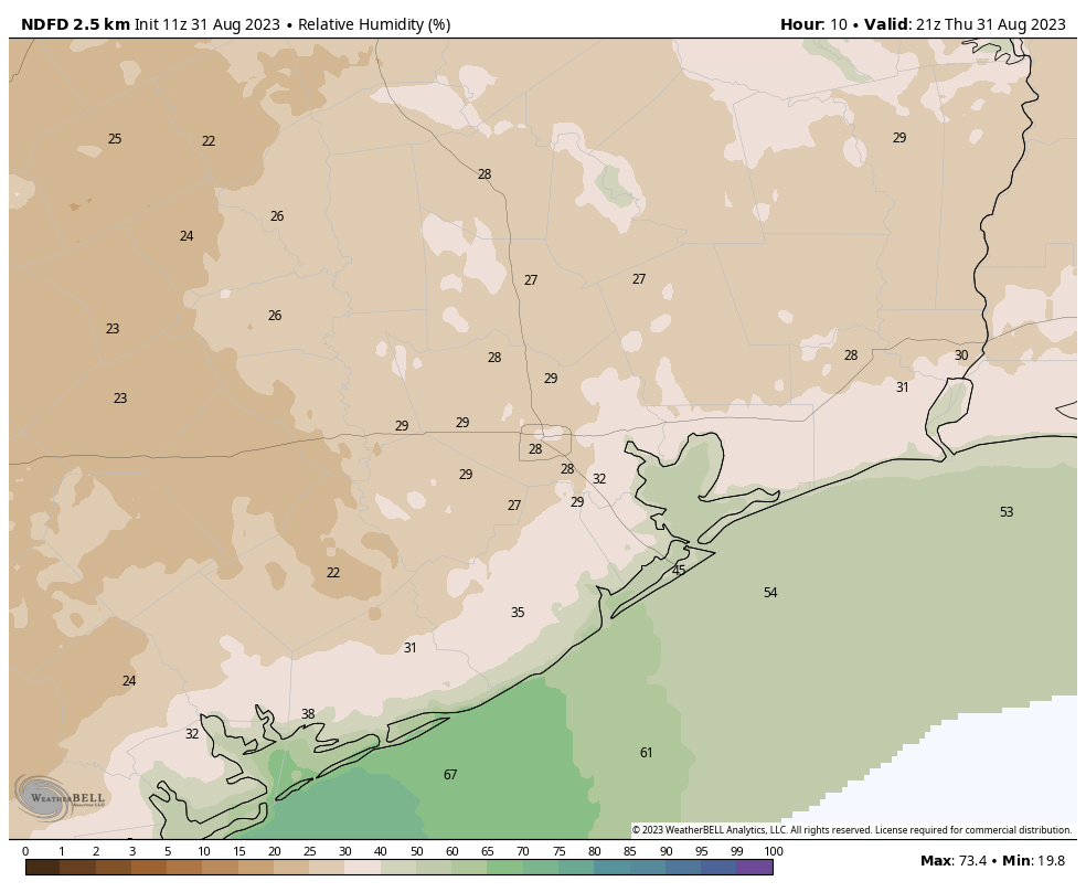
Current forecast for the extent of the front, based on dewpoints, at sunrise on Wednesday. (Weather Bell)

Weak front

An honest-to-goodness cool front will push into the Houston metro area today. Since it is mid-August, there is not much cooling behind the front, but it will bring some drier air. The front will move in to the region this afternoon, and get hung up around Interstate 10 this evening. During this time there will be stark contrast in dewpoints. If you’re in The Woodlands, for example, the air temperature this evening will be quite warm, but the dewpoints should be low and it will feel rather dry outside. For coastal areas, it will be more of the same—hot and humid. The front should make another push overnight, reaching nearly all the way down to the coast by Wednesday morning. Getting outside around sunrise on Wednesday may be your best chance to enjoy a different feeling in the air before the front retreats north on Wednesday night.

Tuesday

As noted above, the front will bring drier air to the northern half of the metro area today, but air temperatures will still be in low 100s area wide. One concern with the front is that the drier air will lead to fire conditions for the northern parts of the metro area, with relative humidity dropping. This, combined with the dry grass and other fuel on the ground, will burn quickly. A Fire Weather Watch is in effect for this northern tier of counties through 9 pm. With the drier air, overnight lows will drop into the upper 70s for much of the area tonight.

Locations of a Fire Weather Watch today. (National Weather Service)

Wednesday

Most of the region will see drier air on Wednesday. Highs will still reach 100 degrees, but at least it will be a drier heat. Rain chances will be near zero, with sunny skies. Humidity levels will start to rapidly recover on Wednesday night, as the front makes its exit.

Thursday and Friday

Unfortunately, we’re going right back into the heat-and-humidity pressure cooker to end the week. Look for highs in the low 100s, with sunny skies and rain chances below 10 percent.

Saturday and Sunday

It looks like another hot and sunny weekend for the region, with highs of 100 degrees to the low 100s. Rain chances may tick up slightly on Sunday.

Next week

The forecast for next week will see our attention diverted to the Gulf of Mexico, where a tropical wave is expected to develop this weekend and progress westward toward Texas. The following plot, from the European model’s ensemble forecast, shows about a one-in-three chance of a tropical depression in the Gulf of Mexico by next Monday or Tuesday. I think that probably overstates the case, but the point is that some tropical moisture will be moving toward Texas early next week. Whether that impacts the southern part of the state, or the upper Texas coast (that’s Houston and Beaumont), remains very much an open question.

The European model ensemble suggests a tropical wave or depression will be in the Western Gulf of Mexico by Tuesday. (Weather Bell)

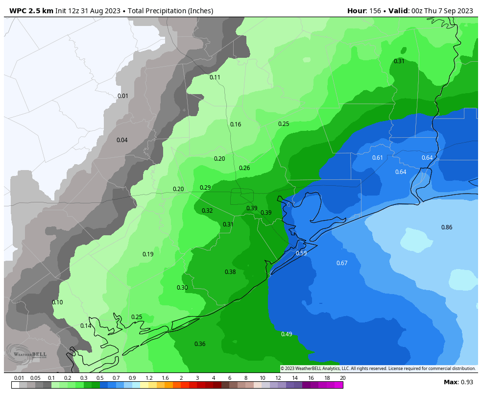
What it does mean is that our rain chances will go up next week. The result could be everything from a smattering of showers to a solid 2 to 4 inches of rainfall, we just can’t say for sure. Depending on how widespread showers are, of course, temperatures may also fall some. So have some hope, but also prepare for disappointment. This one could go either way, but it is the best chance we’ve had for relief for a long time.

Expect a weak front this week, and some glimmers of hope on the horizon

Good morning. It’s been a long, blistering hot, and largely rain-free summer in Houston, but we’re probably through the worst of it. Several readers have emailed in to ask for a comparison to 2011, and to put this summer’s heat into perspective, and we’re going to do that. But the proper thing is to probably wait until the end of August for an apples-to-apples comparison. A lot of that year’s heat was really baked in during August.

So, on to the forecast. This week is still going to be hot, but there’s a slightly twist. There will be a modest reprieve mid-week with some drier air that you won’t want to miss. And looking ahead to next week, things may really start to change a bit and bring us out of this scorching pattern.

Yes, those are non-extreme wet bulb globe temperatures in the forecast. (Weather Bell)

Monday

Well, sorry, but today is not going to yield much change. We are again looking at high temperatures of around 100 degrees, plus or minus, with sweltering humidity. Winds will be slight, generally from the southwest, at 5 to 10 mph. Rain chances are about 10 percent, so not impossible, but if you get a pop-up shower you should definitely go out and play the lottery. Lows tonight drop to around 80 degrees as winds pick up some.

Tuesday

A honest-to-goodness cool front is going to arrive on Tuesday, but you really need to set your expectations accordingly. One, it’s mid-August, so there is no much (any) oomph in terms of cooler air. In fact, highs on Tuesday are going to be just as warm as Monday, in the low 100s with sunny skies. However, there will be drier air, with dewpoints dropping into the mid-50s on Tuesday night. The real question is just how far the dry air gets. I don’t think it will drop all the way to the coast, as the front itself will likely get hung up between the coast and Interstate 10. The forecast map below approximates the extent of the dry air.

In terms of wanting to “feel” a change in the weather, your best bet is probably around sunrise on Wednesday morning. Stepping outside won’t exactly feel refreshing, but at this point it’s going to beat the heck out of what has come so far this summer. Lows on Tuesday night will drop into the upper 70s for the most part.

Here is the dewpoint forecast for 7 am CT on Wednesday morning. It offers a good approximation for how far the front with its modestly drier air will reach. Dewpoints in the 50s will definitely feel less humid. (Weather Bell)

Wednesday

As noted above, this day should start with drier air for most of the region, and this will linger into the daytime. Expect highs of around 100 degrees, but at least you can act smugly like an Arizonian, and tell your friends, “At least it’s a dry heat.” Which it will be. Sort of.

Thursday and Friday

Alas the dry air will be fleeting, and we’re going to see the return of more humid days with highs in the low 100s.

Saturday and Sunday

The weekend looks hot and sunny as well. At this point rain chances are probably in the 10 to 20 percent range.

Next week

I almost hate to write this, because I don’t want to jinx things. Overall, the pattern shows some relaxation in high pressure next week, and the opening of the door to an atmospheric flow more favorable to rainfall. Right now these rains look most likely in the Monday through Wednesday time period, but because we’re just more than one week out from this, it’s difficult to put much definition on it. So I have some hope right now, but I don’t have details. But goodness knows we need some rainfall so I’ll be keeping tabs on this.

At least there’s this: We have finally passed the peak of summer

I’m going to be real up front. The Houston-area forecast calls for more of the same very hot and sunny weather, with a lack of rain, through the middle of August. So at this point of the summer we’re grasping at straws. The one hopeful bit of news I can offer is that, on Tuesday, the Greater Houston region passed through the climatological midpoint of summer. Quite simply, this means that historically yesterday was the hottest day of the year.

Most of the Houston passed its climatologically “hottest” day of the year on Tuesday. We’re now (slowly) rolling downhill toward fall. (Brian Brettschneider)

That does not mean our weather is going to change right away, it really just means that we are headed in the right direction toward fall. We are about one month away from being able to realistically start looking for our first fall front. Typically this comes at some point during the second half of September, but this varies widely. Anyway, if you’re tired of the unrelenting heat, just know that it will eventually relent.

Over the last couple of days we have also been talking about increasing wildfire risk. In recognition of this, both Harris County and Fort Bend County issued burn bans on Tuesday. The burn ban, essentially, means that no outdoor burning is allowed, except in an enclosure that contains all flames and/or sparks. At this point all of the Houston region’s counties, with the exception of Brazoria County, are under a burn ban. Expect these to remain in place at least for a couple of weeks, if not longer.

Wednesday

Excessive heat remains the name of the game for the greater Houston area. High temperatures today will reach about 100 degrees in Houston, with slightly higher conditions for inland areas, and slightly cooler nearer the coast. The only really noticeable change has been somewhat stronger daytime winds, up to about 10 mph from the south, with higher gusts. Skies will, of course, be sunny, with a less than 10 percent chance of rain. It is the same as it has been since the start of August.

Thursday and Friday

More of the same.

Saturday and Sunday

With high pressure remaining in place, there really is little change. If anything, temperatures may tick up a degree or so this weekend. So, super hot.

Our afternoon heat will remain at extreme levels through the weekend, at least. (Weather Bell)

Next week

The early part of next week should bring more of the same. Realistically, we don’t have much hope for a pattern change for at least the next 10 days. After that there are some hopeful signs in some of the models, in terms of potentially better rain chances and somewhat cooler days. However I have to be honest, the current pattern is pretty well locked into place.

The tropics

We have not written much about the Atlantic hurricane season because there has not been much to say, and certainly no threats to the Gulf of Mexico. That continues to be the case, but we’re reaching the point where we can start to expect some uptick in activity in the Atlantic basin. If you want all of the nitty gritty, daily details, be sure to check out our sister site, The Eyewall.

With the persistence of heat and drought, wildfire risks are on the rise

Good morning. Alas, our forecast remains largely unchanged. High pressure is dominant today. High pressure will be dominant tomorrow. And that persistent ridge is going to remain into place at least through early next week and very likely beyond. This means a couple of things:

  • First of all, please continue to practice heat safety. It is hot, hot, hot during the midday hours and you should know the signs of heat related illnesses.
  • Secondly, we’re continuing to see high to very high fire danger conditions across much of the Houston region, especially for Montgomery County and areas further inland. The state has seen dozens of wildfires recently, and the number is on the uptick.

Also, I want to mention again that we’ve released an updated version of the Space City Weather app for mobile phones and tablets, and it is one we’re really proud of because it brings a lot of the features you’ve requested. It’s also the one way to ensure that you never miss a post during inclement weather. Which, presumably, we’ll have one day again in the future. You can find the app in both Apple’s App Store and the Google Play Store

Fire danger forecast for Wednesday and Thursday of this week. (Texas A&M Forest Service)

Tuesday

At this point, do I really need to write it out? It feels like we’re in the movie Groundhog Day. Highs today will be around 100 degrees, or slightly above. Skies will be mostly sunny. Winds will be out of the south, at about 10 mph, picking up a bit during the evening and overnight hours. Rain chances are 5 to 10 percent. Low temperatures tonight will drop into the low 80s.

Wednesday through Friday

Absolutely no change.

Saturday and Sunday

It’s still difficult to discern a meaningful change in the sensible weather.

High heat continues next week. (Pivotal Weather)

Next week

I’ve saved the bad news for last. Whereas a couple of days ago we had some hope that this persistent high-pressure pattern may break down somewhat as we got toward the middle of August, at this point I’m just not seeing it. Sure, we might see some rain chances return by Tuesday or Wednesday of next week. But the odds of meaningful rainfall at this point remain low. And temperatures still look blazing hot for the foreseeable future.