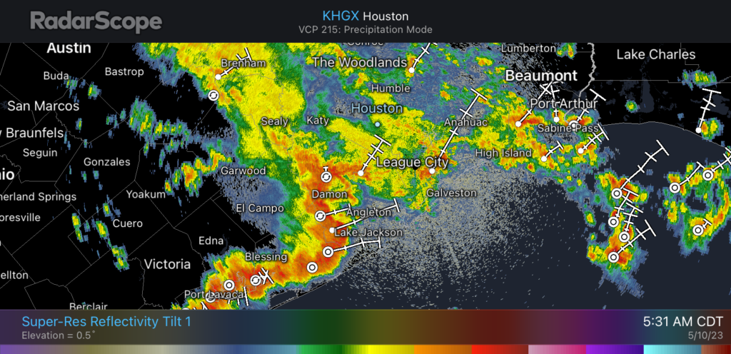
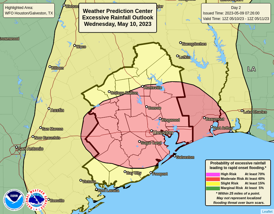
Good morning. As anticipated, a line of strong storms has developed to the west of Houston this morning, roughly from College Station all the way south to Corpus Christi. We expect these storms to continue to build slowly to the east, and into Houston later this morning and the afternoon hours. There remains a lot of uncertainty about how much punch these storms will have as they progress closer to, and into the Houston metro area. But we now have enough concerns about the potential for heavy rain to issue a Stage 1 flood alert out of concern for street flooding today and tonight.

The most problematic time for rainfall will be from the mid-morning hours today through the afternoon. However, at this time we can’t rule out the additional development of showers tonight, and on Sunday, as a series of disturbances plow through our moist atmosphere. Please check the radar before heading out, and if you have outdoor activities on the schedule for this weekend, have a back-up plan. And since it’s Mothers Day weekend, I know many of you do have plans.
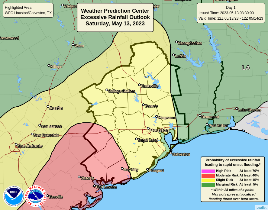
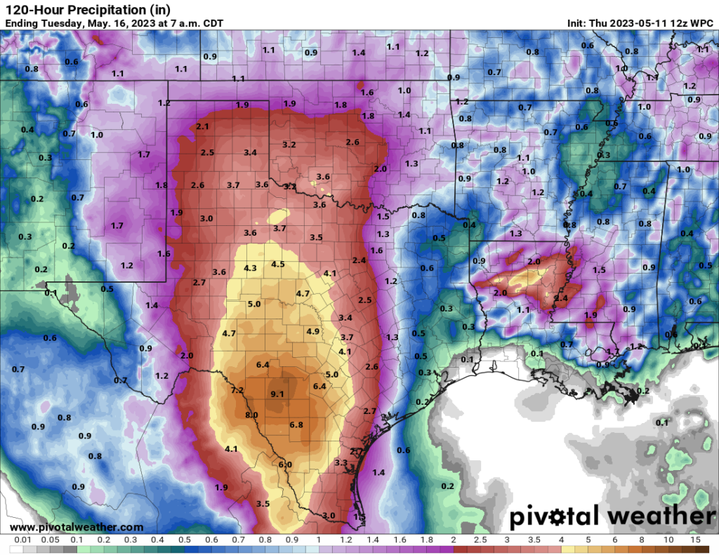
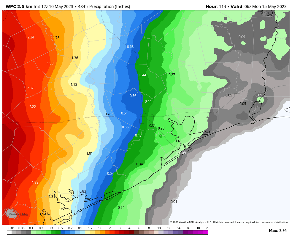
Overall, I expect most of the region to see 0.5 to 2 inches of rainfall this weekend, but areas west and southwest of Houston have a greater risk of heavy rainfall, and isolated areas may see 2 to 6 inches of rainfall. Due to the aforementioned uncertainty about this weekend’s weather, Matt and I will continue to keep an eye on things. We apologize to all the moms out there for the lousy weather this weekend.