Houston to warm up before another front on Thursday

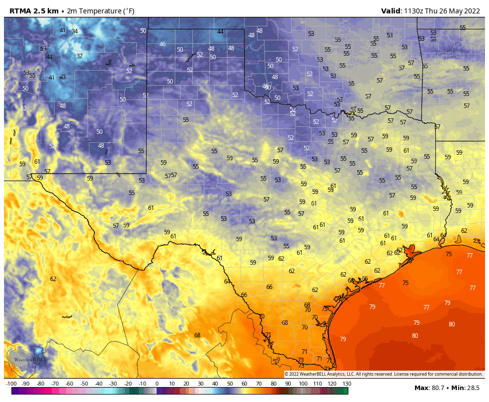
Good morning. For much of the region, temperatures this morning have only dropped to 50 degrees, and the next two nights will be even warmer. However, by Thursday another front will reach the area, bringing sunnier and chilly weather for the weekend. Also, if you’re interested in an update on our app, see the bottom of this post.

Tuesday

Winds are light out of the southeast this morning, but they’ll pick up today as the onshore flow really gets pumping. Expect gusts to reach about 20 mph. This influx of moisture will lead to partly to mostly cloudy skies today, with highs reaching about 70 degrees. Lows tonight will only drop into the upper 50s to 60 degrees, with even warmer conditions right along the coast. Some light rain is possible near the coast late tonight.

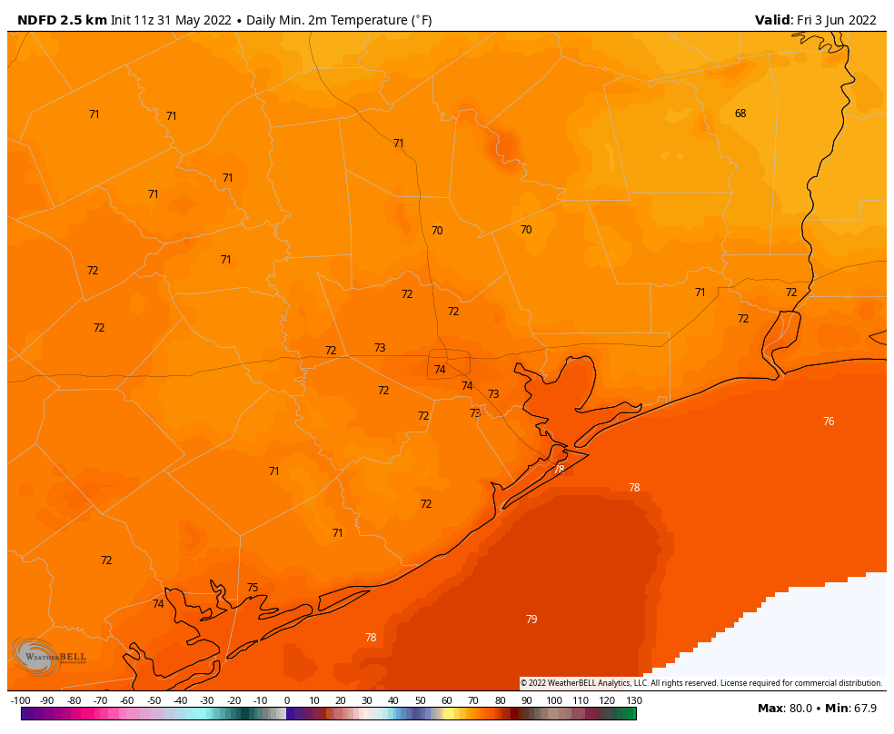
Highs Wednesday will be quite warm for Houston. (Weather Bell)

Wednesday

The potential for light, scattered showers will continue on Wednesday morning, with the possible additional development of some fog near the coast. The day itself will be windy, with southerly gusts as high as 25 to 30 mph really amping up moisture levels. Highs on Wednesday will reach the mid-70s for much of the area, and with dewpoints in the 60s you will start to feel some humidity. Skies will be mostly cloudy, with a continue chance of light rain. Low temperatures on Wednesday night will only drop into the upper 60s, with a chance of scattered showers and perhaps a few thunderstorms.

Severe weather outlook for Wednesday and Wednesday night. (NOAA)

Thursday

This day will start out muggy, ahead of the front. There is a chance of thunderstorms on Thursday morning. However, my sense is that the atmosphere will be capped enough that for most of us there will just be some fairly brief showers before the front reaches our northwest areas during the morning hours, the city around noon, and the coast during the afternoon hours. Highs ahead of the front will be in the 70s, with dewpoints and temperatures dropping after its passage. Skies will clear during the afternoon hours, allowing temperatures to drop into the upper 30s on Thursday night for all areas but the coast.

Friday, Saturday, and Sunday

We’ll see mostly sunny skies on Friday and Saturday in the wake of the front, with highs in the upper 50s for most areas on Friday, and lowers 60s on Saturday, probably. Sunday is a bit warmer, slotting somewhere in the 60s with rising dewpoints. The first half of next week should see highs in the 70s before the likely arrival of the next front.

App Update

We’re starting to work on the next update of our app, which will feature several frequently requested changes, including the addition of more regions in the drop-down menu of cities, a much improved radar, an option for metric units, and more in addition to bug fixes. What I’d like your feedback on is which cities to include for the 7-day forecast and current conditions. The following map shows the current options in the drop-down menu (red) and proposed additions (in purple). If there’s somewhere where we’re missing, please let me know in the comments below. Thank you!

Map of existing locations in the Space City Weather app (red) and proposed locations (purple).

One year after the historic Texas freeze, our weather this week looks mostly pleasant

Good morning. One year ago today temperatures plunged across the region as an Arctic front moved into the Houston region. This marked the beginning of our coldest weather in decades, as ice covered roads, temperatures dropped into the low teens, and millions lost power and shivered inside their homes. It was an absolute disaster. Fortunately, we’re not going to see its like again this winter. Instead, this week, we’ll see a mix of weather, with a little bit of something for everyone.

Have a warm heart on this cold start to Valentine’s Day. (Weather Bell)

Monday

Winds are calm this morning, but will pick up from the south-southwest as high pressure shifts eastward from Houston. This will help lead to a warming trend across the region, with highs generally reaching the upper 60s this afternoon beneath mostly sunny skies. Southerly winds will be light tonight, with low temperatures dropping into the upper 40s.

Tuesday

As atmospheric moisture levels begin to rise along with the southerly flow, some patchy fog is possible on Tuesday morning. Skies will see a mix of sunshine and clouds, with highs likely reaching about 70 degrees. Winds from the south will start to become more vigorous, with some gusts up to 20 to 25 mph possible, during the afternoon hours. Overnight lows will only drop to around 60 degrees.

Wednesday

As dewpoints continue to rise in response to the warm, southerly flow, expect a decent chance of fog. An upper level system with an associated front will be stirring up the atmosphere on Wednesday. This should make for another day with a breezy southerly wind, and partly to mostly cloudy skies. Some rain is possible too, although the better chances will probably come Wednesday night as the front draws near. Storms are possible to the north of the city, with better chances near Dallas. Lows Wednesday night should only drop into the low 60s.

Storm outlook for Wednesday and Wednesday night. (NOAA)

Thursday

The rains, which will generally be light and and result in a tenth of an inch or two of accumulations, should end Thursday morning before a front blows through. This front should reach areas northwest of Houston before noon, the city itself around noon, and the coast during the afternoon. Winds will be gusty in the wake of the front, out of the north, with clearing skies. Temperatures on Thursday afternoon will drop into the 50s for most locations, and into the upper 30s by Friday morning.

Friday, Saturday, and Sunday

The weekend will be cooler, with calmer winds, and mostly sunny skies. Expect highs to reach the upper 50s on Friday, with another night of lows in the upper 30s to 40 degrees in Houston. Saturday and Sunday should both see highs in the 60s. Overall it should be a rather pleasant winter weekend. Expect a fairly robust warming trend as we get into next week, with highs reaching the upper 70s by mid-week, probably.

Splendid and sunny weather continues, but for a brief interruption on Saturday

Houston experienced spectacular weather on Wednesday, and this pattern will continue until a cold front shakes things up a bit this weekend. Still, the overall plan is for nearly continuous sunshine through the early part of next week.

Thursday

Lows are generally in the low 40s this morning, but with mostly sunny skies this afternoon highs will reach 70 degrees, or just a tad warmer, for most locations. Winds will be light, from the west, at perhaps 5 mph. A few clouds may form tonight, with lows likely dropping into the low-to-mid 40s—a few degrees warmer than Wednesday night.

High temperatures on Friday could be the region’s warmest since mid-January. (Weather Bell)

Friday

As temperatures on Friday morning fall to near dewpoints, a few areas of light fog are possible. But then we should quickly see mostly sunny skies, and this will allow high temperatures to reach 70 to 75 degrees. Winds will again be fairly light. Overnight lows may only drop to around 50 degrees in Houston.

Saturday

Unfortunately, after the entire work week saw sunny and sedate weather, we’ve got a front to deal with on Saturday, likely before noon. Effectively this means that areas inland of Highway 59/Interstate 69 may only warm into the 50s before the front’s arrival, and coastal areas the low 60s. Some light rain is possible with the front, especially nearer the coast where more moisture is available. Still, any showers will probably be briefly lived. Winds should gust to 20 to 25 mph on Saturday afternoon, in the front’s wake. As drier air moves in Saturday afternoon, skies should clear out during the late afternoon or evening hours. Overnight lows probably will drop into the upper 30s in Houston, with a light freeze possible for areas far north and west of the city.

Sunday morning will be quite chilly across the region. (Weather Bell)

Sunday

This should be a fine winter day, with relatively light winds, sunshine, and highs in the upper 50s to 60 degrees. Sunday night should be a degree or two warmer than Saturday night.

Next week

We’ll see a warming trend, with temperatures rebounding to 70 degrees by Tuesday. Then we’ll see a pattern change as clouds begin to build and rain chances return. This will happen as the atmosphere sees a series of disturbances rotated through, and moisture levels start to increase. We’re not looking at anything crazy, I don’t think, with probably 0.25 to 0.75 inch of rain for most. I’d pencil in our next front for Thursday, which will perhaps knock lows back into the low 40s, give or take.

Welcome to the spectacular sunshine show

Houston’s weather on Tuesday was spectacular, and there’s more of it ahead. We’ll continue to see sunny skies and mild winter temperatures until Saturday, when a front blows through. And then, shortly after this, we’ll see more sunshine and fantastic winter weather.

It is a cold February morning across the Lone Star State. (Weather Bell)

Wednesday

Most of the region is seeing lows in the upper 30s this morning. But with light southerly and westerly winds, and abundant sunshine, we should warm nicely to about 70 degrees this afternoon. Low temperatures overnight should be a few degrees warmer than Tuesday night, with much of Houston settling into the low 40s.

Thursday and Friday

The spectacular sunshine show continues, as does a slow warming trend. Both of these days should see highs of around 70 degrees, but overnight lows will creep up into the mid-40s by Friday morning, and perhaps around 50 degrees by Saturday morning. Winds both days should be light out of the south or southwest.

Saturday

There’s finally some agreement among the models in a frontal passage on Saturday around noon, or during the morning hours. For inland locations, then, highs may top out in the 50s, while coastal areas hit 60 degrees before the front arrives. Most likely this will be a dry passage, as the air simply won’t be holding enough moisture to really generate much in the way of rainfall. Winds will be noticeable, from the north, with the front’s passage. Expect gusts of 20 to 25 mph during the afternoon and evening hours. Lows Saturday night will probably drop into the upper 30s for Houston, with slightly warmer conditions along the coast.

Sunday

This should be a fine, sunny winter day with highs in the mid-50s. Winds should not be too much of a factor. Expect lows on Sunday night to be a degree or two warmer than Saturday night.

The “0”s in the chart above represent ensemble forecasts for zero cloud cover for Houston. Which is to say, expect ample sunshine for the next week. (Weather Bell)

Next week

Another week, with more sunshine, is likely. Houston will probably warm back to around 70 degrees on Wednesday before another front brings a decent chance of rain seven or eight days from now.