Ten things I’m thankful for on the eve of a stormy Thanksgiving

Before we get to the forecast for the remainder of this week, I want to offer a few words on some of the things I’m most thankful for as we head into the Thanksgiving holiday.

  • Matt Lanza: the best damn partner one could ever ask for to operate the site
  • That first fall cold front
  • My family, who (almost) always understand when I need to “post an update” to the site
  • Tacos, fajitas, and margaritas
  • September 24: The date after which we can breathe a little easier about hurricanes
  • Houston’s parks and trees
  • Astronauts, flight controllers, and the people who build spaceships
  • Rock and roll, jazz, and Steve Earle
  • Our long-time sponsor, Reliant
  • Most importantly: our readers, who always have a kind word and genuine appreciation for our efforts

Alright, let’s get to the forecast. We’re still looking at a warm Wednesday, followed by a messy Thanksgiving as a fairly strong front blows through the area. Read on for the details.

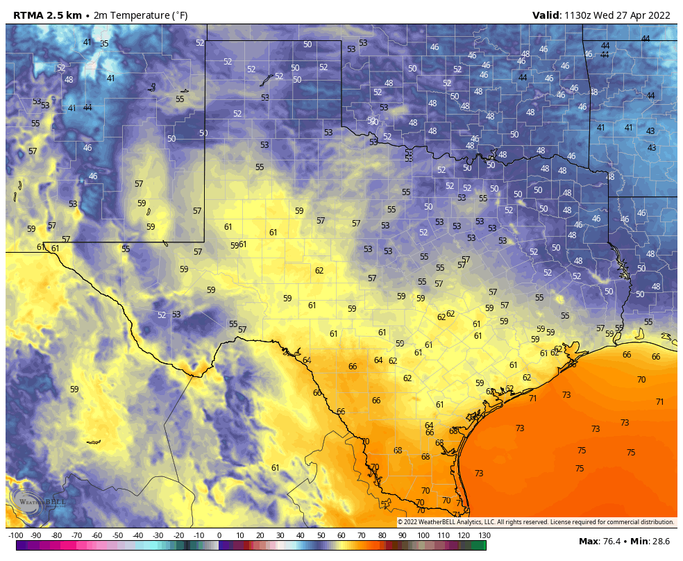
Conditions on Wednesday will be warm, and increasingly humid. (Weather Bell)

Wednesday

Temperatures are generally in the low 60s this morning, and we’re going to rise near 80 degrees this afternoon with a mix of sunshine and clouds. Winds will be noticeable, out of the south, gusting up to 20 mph. This southerly flow will be helping to amp up atmospheric moisture levels, and dewpoints will be on the rise this afternoon and tonight. Temperatures will not fall much below 70 degrees tonight, and some light showers will be possible after midnight, mainly to the west and north of Houston.

NAM model forecast for winds shows the front’s forecast position at 2pm CT on Thanksgiving. (Weather Bell)

Thursday

As we have been saying for awhile, a robust cold front will move through Houston on Thanksgiving. Rain chances will start to pick up after sunrise on Thursday, and peak with the passage of the front. While the conditions favor showers and thunderstorms, the ingredients do not appear to line up for severe weather, so the main threat should be briefly heavy rainfall. Rains will probably be heaviest just ahead of the front, which should reach north and west areas—such as Katy, Tomball, and The Woodlands — between 10 am and Noon, the downtown area from Noon to 2 pm, and push off the coast during the afternoon hours. Overall rainfall accumulations still look to be 1 to 2 inches of rainfall for most areas, with isolated higher amounts. Rain chances should end shortly after the front’s passage.

Temperature wise, it will be a sticky morning in the low 70s, with temperatures dropping in the wake of the front into the 60s, and down to around 50 overnight in Houston. Winds may gust out of the north up to about 20 mph Thursday night. (Despite the holiday we’ll have a post tomorrow updating all of this.)

NOAA rain accumulation forecast for now through Thursday. (Weather Bell)

Friday

This day looks clear and cool, with mostly sunny skies and highs around 60 degrees. Friday night should see lows in the upper 40s in Houston, with cooler conditions inland and a bit warmer near the coast.

Saturday and Sunday

Unlike weekends over the last month or so, this one won’t be spotless. Saturday should be a cloudy and cool day, with highs of around 60 degrees. Due to a southwesterly flow later on Saturday, we probably will see some rain showers develop on Saturday afternoon or evening, and persist on and off into Sunday morning. Right now accumulations will be probably be on the order of 0.25 to 1 inch for most areas, with the greater likelihood of rain along the coast. Showers should end on Sunday morning and we may see some clearing skies during the afternoon hours. Highs will be in the 60s, with lows dropping into the 40s.

Next week

This fall-like weather will persist at least into the middle of next week, with highs in the 60s and 70s, and lows in the 40s and 50s. We’ll see a moderate warming trend before another front, perhaps on Friday or Saturday of next week.

Fundraiser

A few days remain in our annual fundraiser, during which you can purchase merchandise or simply donate to support Space City Weather for 2022. Thank you!

Stylish weather for Harry Styles, but the Thanksgiving forecast is decidedly dowdy

Good morning. After a chilly start this morning, with temperatures in the upper 40s across much of the region, we’ll see a warming trend over the next two days. Then a cold front on Thanksgiving will bring rain and sharply dropping temperatures Thursday night. This next front should then linger longer, with cooler nights sticking around for awhile.

Tuesday

Here’s the most important thing to know about the weather today: The Harry Styles concert is a go. This concert was postponed once, during 2020, due to the pandemic. Then it was rescheduled for September 13, but had to be postponed again as that was the night Hurricane Nicholas made landfall. (It’s difficult for me to believe, but Nicholas and its winds were only a little more than two month ago). Well, Harry is back, and the weather could not be nicer.

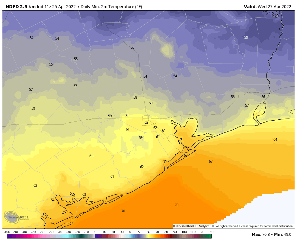
Harry Styles goes on stage at 8 pm CT Tuesday. Here are the temperatures as you’re walking in the door. (Weather Bell)

High temperatures will reach about 70 degrees today beneath sunny skies, with light winds out of the southeast. With the return of this onshore flow, temperatures will be more mild tonight, dropping into the upper 50s. There is no chance of rain.

Wednesday

Temperatures will continue to warm on Wednesday, with highs likely pushing into the upper 70s. As southeasterly winds persist, moisture levels will rise, and we’ll see partly cloudy skies. Overnight lows on Wednesday will only drop into the mid- to upper-60s for most. Some light showers, generally north and west of Houston, will be possible after midnight.

Thanksgiving

The holiday will dawn warm and muggy, and it seems like some fog may be possible as dewpoints match temperatures in the morning. There are still questions about timing, but my best guess right now is that a fairly organized line of storms sweeps through the area from northwest to southeast, reaching College Station around sunrise, central Houston by or before noon, and pushing off the coast some time during the afternoon. These showers, thunderstorms, and winds could briefly be intense as these storms pass through, bringing accumulations of 1 to 2 inches. You’ll want to have some cover as they pass.

Rain accumulation forecast for Thanksgiving Day in Houston. (Weather Bell)

Drier air will blow in pretty quickly after the storms move through, with gusts out of the north likely reaching 20 mph or higher. Lows Thursday night will drop into the upper 40s for all but the urban core of Houston and coastal areas.

Friday

This will be a chilly day, with partly to mostly sunny skies, and highs of around 60 degrees. Temperatures Friday night should be the coldest of the week, dropping into the upper 30s for inland areas such as parts of Montgomery County, with 40s across much of the remainder of the area.

Saturday, Sunday, and beyond

The forecast for the weekend is now coming into better focus. Saturday should be cloudy, with highs of around 60 degrees. A passing disturbance may bring some rainfall later on Saturday or Saturday night—the only good thing about this is that it will give me a chance to write “cold November rain” as lows drop into the 40s. Rain chances probably will decrease on Sunday, with partly sunny skies and highs in the upper 60s.

Those Saturday morning lows will be quite cold! (Weather Bell)

Most of next week should see highs around 70 degrees, with lows in the 50s. Rain chances remain low until the latter half of the week. Fall is going to stick around for awhile with this front.

Fundraiser

We’re in the home stretch of our annual fundraiser, but there’s still a few more days to stock up on merchandise or make a donation! Thank you so much.

A forecast to ruffle one’s feathers: Thanksgiving looks a bit messy

Good morning! We’re entering the last full week of our annual fundraiser, which is your one opportunity each year to support the work we do. Click here to buy merchandise or make a donation. Thank you for your help!

Temperatures have generally dropped into the upper 50s this morning in the wake of a cool front. A warmup will begin Wednesday, and we’ll see a pair of warmer days in the middle of the week before another cooldown ahead of next weekend. Unfortunately the forecast for the Thanksgiving holiday still looks messy, with widespread showers likely due to an abundance of atmospheric moisture. Read on for full details.

Monday

Skies will be partly sunny today as winds blowing at about 10 mph continue to bring in drier northerly air. This will cap highs at about 70 degrees and set the stage for a chilly night. lows should drop into the 40s for most of the region except for the urban core of Houston and coastal areas.

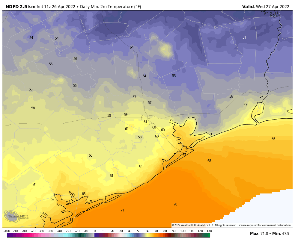
Low temperature forecast for Monday night. (Weather Bell)

Tuesday

This will be a fine, fine day with highs of around 70 degrees, sunny skies, and light winds turning southerly. Temperatures on Tuesday night will be about 10 degrees warmer due to the onshore flow resuming, but there will still be a slight chill in the air.

Wednesday

Conditions will be warmer and somewhat muggier on Wednesday with an entrenched southerly flow. Even so, highs will likely only top out in the upper 70s. (If the high temperature does reach 80 degrees, I think it will be our region’s last 80-degree day for awhile). Although we’ll see more clouds on Wednesday, I think rains should hold off until at least late Wednesday night. Overnight lows will only drop into the upper 60s. If you’re traveling in advance of the Thanksgiving holiday, it looks like there will be few problem spots across the country.

Thanksgiving Day

There’s going to be a grand total of one messy day this week, weather-wise, and wouldn’t you know it’s going to be on the Thanksgiving holiday. Temperatures will start off warm, and will likely rise into the mid-70s. Right now there are still some questions about timing, but it appears likely that the majority of our region will see 1 to 2 inches of rainfall between sunrise and sunset on Thanksgiving, with showers and thunderstorms progressing from northwest to southeast across Houston. The majority of the rain should be offshore by Thursday evening, with colder and drier air moving in behind. Lows on Thursday night should drop to around 50 degrees, so bring a sweater if you’re going Black Friday shopping.

NOAA rain accumulation forecast for now through Thanksgiving. (Weather Bell)

Friday, Saturday, and Sunday

Friday should be mostly sunny and cooler, with highs in the 60s, and Friday night should be chilly, in the 40s area-wide. Unfortunately we’re not entirely sure what to expect this weekend. Highs probably will be in the 60s, but there is the potential for an atmospheric disturbance or two to rotate through. For now I’m rolling with a 30 percent chance of rain each day, but we’ll have to fine-tune that as we go along.

If you’re interested, Maria and I will be discussing the Thanksgiving weather in a little bit greater depth this morning at 9 am in a Facebook live.

After the front, clearing skies for a partial eclipse tonight, and pleasant weather Saturday

A cold front is moving through Houston this morning, and should push off the coast within about an hour of sunrise. For those who like fall weather in Houston this is a good thing—the high temperature at Hobby Airport reached 87 degrees on Wednesday, setting a record for the location. Bush International Airport, Galveston, and College Station narrowly missed setting records. But now that’s passed, with cooler and fairer weather ahead.

Thursday

As anticipated, this morning’s frontal passage has largely been a dry affair. Drier air will move in today on winds of 10 to 15 mph from the north and northwest. Skies will be mostly cloudy through the early afternoon, helping to limit highs to about 70 degrees, but there should be some clearing later today. Skies tonight will be partly cloudy allowing lows to drop into the upper 40s, with cooler temperatures inland, and slightly warmer ones right along the coast.

Tonight’s partial lunar eclipse will peak at 3:02 am CT. (TimeandDate)

I mentioned the possibility of clouds tonight as there is a partial lunar eclipse that runs from about midnight to 6 am, with a peak at 3:02 am CT locally. At that time Earth’s shadow will darken 97 percent of the Moon’s surface. The bottom line is that there should be enough breaks in the clouds to see the eclipse if you’re up late tonight, or early on Friday.

Friday

This will be a splendid late fall day, with light northerly winds and highs in the mid-60s. Skies will be mostly sunny. Lows will probably be a degree or two warmer than Thursday night.

Saturday

The first half of the weekend has no weather concerns. After the cool start, temperatures will warm into the mid-70s with partly to mostly sunny skies. As winds shift to come from the south, lows on Saturday night will only drop into the 60s for most of the region.

The high temperature forecast for Saturday looks rather lovely. (Weather Bell)

Sunday

This day should see a few more clouds, and more humidity, as highs push into the upper 70s to 80 degrees. It now appears as though another front will move through on Sunday afternoon or evening, and could bring at least a broken line of showers with it. Any rain accumulations should be fairly light, however. Lows overnight should drop into the 50s, with drier air moving in.

Next week

Monday and Tuesday look clear and cool next week, with highs in the upper 60s to 70 degrees. Unfortunately, we’re still anticipating a messy pattern during the middle of next week, with the passage of a cold front later on Wednesday or on Thanksgiving Day. With fairly high atmospheric moisture levels, I expect to see some rainfall along with, and possibly after the passage of this front. As we’re still a week out I don’t have too much confidence in the details, but showers and thunderstorms certainly seem like a distinct possibility at some point on Thanksgiving. Conditions will be warm ahead of the front, with temperatures dropping afterward, and lows in the 40s likely at the end of next week.

Fundraiser

Just a quick word to say that we’re still raising money for 2022 for Space City Weather with our annual fundraiser. You can buy merchandise or simply donate funds for the site. We truly appreciate your generosity.