Very cold night for late April on tap for Houston

Good morning. A strong system that brought snow the parts of Colorado on Monday will push through Texas today and reach the Houston area tonight. High temperatures in west Texas today will be in the 50s—way below normal for late April—and the front will still have a good punch when it pushes into Houston this evening. Some areas of the metro area will fall into the 40s on Wednesday morning, and this could be the last time for that until at least October.

Tuesday

Before the front arrives, however, today will be fairly warm. With light, westerly winds and sunny skies we’ll see high temperatures today shoot up into the low- to mid-80s. This will be facilitated by a fairly dry air mass which, while it will certainly feel more comfortable than humidity, will nonetheless allow the air to heat up more rapidly. The front will reach the city around sunset and the coast around midnight, with winds gusting out of the north at perhaps 20 to 25 mph.

Low temperatures on Wednesday morning in Houston. (Weather Bell)

Wednesday

Areas north of Interstate 10 will start in the 40s on Wednesday morning, and with northerly winds the “apparent” temperature for parts of Montgomery and Waller counties will be in the 30s. (The record low for Bush Intercontinental Airport for April 21, the city’s official weather station, is 42 degrees set in 1978). The bottom line, is that yes, you may want to bundle up when you head out the door on Wednesday morning. With sunny skies, temperatures should rebound to around 70 degrees, but a northerly wind of 10 to 15 mph will blow all day. Lows Wednesday night will be about 5 degrees warmer than Tuesday night.

Thursday

As high pressure exits to the west, winds will shift to come from the east and then southeast on Thursday. This will return moisture to the atmosphere fairly quickly, and begin to form clouds. Highs will probably top out in the low 70s, but overnight lows will not drop much, likely into the upper 60s for most. A few light showers will be possible south of Houston on Thursday, with slightly better chances overnight.

Friday

Showers and some thunderstorms are likely on Friday. Moisture levels in the atmosphere will support moderate to heavy rainfall for some locations, and there will be enough instability for thunderstorms to develop. It’s a little too early to have much confidence in details, but the most likely time period for this heavier rain will come from around noon on Friday into early Saturday. As for accumulations, I’d guess most areas will see 0.5 to 2 inches of rainfall, with the potential for higher totals north of Interstate 10. This forecast will definitely need fine-tuning in the days ahead. Highs will otherwise be in the upper 70s.

NOAA forecast for rainfall totals through Saturday morning. (Weather Bell)

Saturday and Sunday

Rains should end on Saturday morning, likely before sunrise for most of us as a weak front moves into the region. This should help to clear out skies and push highs on Saturday into the mid-80s. Lows will drop to around 60 degrees on Saturday night. Sunday and Monday will probably be similar in regard to temperatures, with mostly sunny skies.

Houston to enjoy a spectacular spring week

As Matt suggested in Friday’s post, Houston had a chance this week to see some fantastic spring time weather. And I’m here to tell you, it’s happening.

Normally, during the latter part of April in Houston, we start to get a taste of summertime in Houston. It’s not all that rare to experience high temperatures in the low 90s, and highs generally reach the low 80s. We feel the humidity, too, and nights are warmer, in the 60s or even 70s. Well, that’s not what we’re going to experience this week. Instead, we’ll enjoy glorious, dry weather through Thursday. This is the kind of weather you’d love to bottle up and save for August, but we know that’s not going to happen. So now is the time to enjoy it.

Lows should get down into the 40s on Wednesday morning for most areas. (Weather Bell)

Monday

Northeast winds this morning will turn more easterly, and this will allow for warmer conditions today, with highs in the mid-70s. We expect clouds to thin out, and leave us with mostly sunny skies. Monday night should be a few degrees warmer than Sunday night, with lows falling into the mid-50s in Houston.

Tuesday

With sunny skies and westerly winds, high temperatures will reach the upper 70s to about 80 degrees on Tuesday. But with dewpoints comfortably in the 50s, the air will still feel quite dry. The evening will remain warm before a reinforcing cool front arrives during the overnight hours, likely reaching central Houston before midnight, and pushing off the coast before sunrise on Wednesday. The atmosphere will be fairly dry, so I don’t expect any rain with the front.

Wednesday and Thursday

Chilly! Lows on Wednesday will start out in the upper 40s for some areas, and in the upper 50s near the coast. Under sunny skies, expect highs to reach the low 70s, with another cool night. Thursday will see a few clouds mix in, with temperatures again in the low 70s for most areas.

Friday

By Friday, the onshore flow will be back, and the next front should be approaching Houston. Skies will be mostly cloudy, with highs in the mid-70s. Most areas should see rain during the daytime and evening hours, and I’m hopeful that we’ll see accumulations of around 1 inch for much of Houston. We’ll see. Anyway, rain chances will begin to end Friday night and should wrap up by mid-morning on Saturday.

NOAA rain accumulation forecast for now through Saturday morning. (Weather Bell)

Saturday and Sunday

The weekend forecast looks fine. The only caveat is the timing of the front, if it comes in later it could upset our forecast for Saturday. But for now, we expect partly sunny skies and high temperatures in the low 80s on Saturday, and mostly sunny skies on Sunday with a high of around 80 degrees. Lows should be around 60 degrees in Houston, cooler inland and warmer at the coast.

Two more days of unsettled weather before a robust front blows in

Houston’s weather will remain unsettled for a couple of more days, with the potential for briefly heavy rainfall, before a stronger cold front arrives on Saturday and brings significantly drier air with it. This will bring one of the last extended periods of spring-like weather to us this season, so enjoy!

Thursday

Although a weak front has limped through Houston and off the coast—winds are generally out of the north to northeast across the region—the atmosphere remains unstable. Therefore we’ll likely continue to see at least a handful of storms moving from west to east across the region today. These will bring showers and possibly a few strong thunderstorms to some areas, while others of us see mostly clouds. Highs today will be in the mid-70s, and lows tonight should drop into the 60s for most, with low 70s right along the coast.

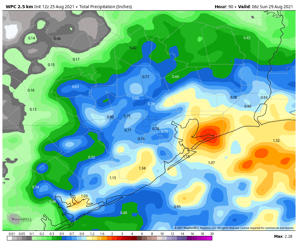
NOAA rainfall accumulation map for Thursday morning through Saturday. (Weather Bell)

Friday

Winds will shift to come from the south as the onshore flow resumes. This, combined with an approaching front, will set the stage for pretty healthy rain chances on Friday afternoon and Friday night. The greatest accumulations are likely north of Interstate 10, where much of the region should see 0.5 to 1.0 inch of rain, with isolated areas seeing more. Totals south of I-10 will likely see 0.5 inch of rain or less, on average. The front itself should move into Houston late Friday night or early Saturday morning, reaching the coast by sunrise. As a result, overnight lows will range from the 50s, well inland, to around 70 right on the coast.

Saturday

In the wake of the front, I think we’ll see rain showers ending by around sunrise, give or take an hour. Winds will kick up, gusting up to 25 or 30 mph out of the north before dying back during the evening hours. With mostly cloudy skies, I expect highs to max out in the upper 60s for most areas, with lows Saturday night dropping into the low-50s in Houston, with cooler conditions inland, and slightly warmer ones along the coast.

Low temperature forecast for Sunday morning. (Weather Bell)

Sunday

A pleasant, springtime day with highs in the upper 60s and at least partly sunny skies. Sunday night’s lows will be similar to Saturday night, or possibly a couple of degrees cooler.

Next week

We can probably expect the first half of next week to remain dry, with highs in the 70s, and cool nights. After that time the onshore flow will resume, launching a warming trend before there’s the potential for another front to push into Houston late next week.

More rainy days ahead before a significantly cooler weekend

Good morning. Houston received its first round of mostly light to moderate rainfall on Tuesday evening and during the overnight hours, and we’ll have another good chance again today, and then again later on Friday. We should also be done with 80-degree days for awhile after today, as well.

Wednesday

We’re still awaiting the arrival of a weak front this morning, but instability associated with this system is continuing to generate showers with some embedded thunderstorms. I’m afraid there is really no consistency in the high resolution models for where rainfall will be greatest today, and my confidence on accumulations is low. Most areas will see between 0 and 1 inch of rain through tonight, but we can’t rule out a few bullseyes with greater totals. Highs today will reach about 80 degrees, with mostly cloudy skies. The front will sag southward into the region later on, reaching The Woodlands around midnight, and pushing down to the coast around sunrise.

Due to the front, low temperatures on Thursday morning will depend on where you live. (Weather Bell)

Thursday

Things probably will calm down somewhat on Thursday, but we can’t be sure the rain is entirely going to go away. Skies will remain mostly cloudy, and with a mostly light northeasterly wind, highs will likely shakeout somewhere in the mid-70s. Overnight lows will drop into the mid-60s.

Friday

This will be another cloudy day, with highs likely slotting somewhere into the 70s. The first half of the day should be fairly sedate before rain chances start to increase during the afternoon and evening hours with the arrival of another cold front overnight. This will again bring a period of showers with embedded thunderstorms into the region, and again I think accumulations will range from 0 to 1 inches for most areas. Lows Friday night will be dependent on the front’s position.

Saturday

The front should reach the coast by around sunrise, or shortly after, on Saturday. This will usher drier air into the region and should preclude all but a few scattered showers during the afternoon hours. Expect mostly cloudy skies with highs in the upper 60s to low 70s. Things should get fairly breezy after the front blows through, with gusts of 25 or 30 mph possible during the daytime. Temperatures will drop down to about 50 degrees on Saturday night in Houston, with colder conditions inland, and a bit warmer along the coast.

Several nights of lows in the 50s for Houston? Yes please. (Weather Bell)

Sunday and beyond

Skies will start to clear out some on Sunday, and highs will likely reach the upper 60s to 70 degrees. With lesser winds, this should be a fine spring day, and certainly one of our last days this cool, with sunshine, this season. I think we’ll remain in a pattern of highs in the 70s and lows in the 50s through the early part of next week before a warming trend begins. Summer is not too far away, so this will offer a nice blast of spring before things turn perma-humid for us.