In brief: It’s a new week, and we’re starting it off with our coldest weather of the season. Houston dipped into the 40s for the first time this season, and we discuss how late that is. Also, we should get even colder tonight, followed by a pleasant fall week.
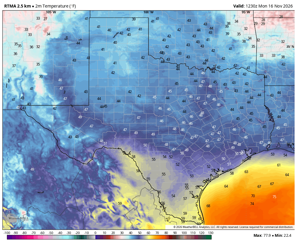
Lordy, lordy, we’re finally in the forties
Your definition of “cold” is probably different from mine, and that’s just fine. I grew up in Michigan but have lost all of my cold tolerance after more than three decades of living in the great state of Texas. So for me it starts to feel cold outside when the mercury reaches the 40s. This is fireplace and sweater weather. We’re finally there.
I ran the numbers this morning to find out if we’re late for this kind of cold weather, and it turns out yes, we are. On average, Houston records its first sub-50 degree night on October 21, so more than three weeks ago. The latest ever mark for the first fall night in the 40s came back in 1958, on November 19. So we’re going to scrape under that record, if only barely.
Fundraiser, week two
We’re kicking off the second week of our annual fundraiser this morning. We’ve had a great response so far, and are working our way toward raising the funds we need to keep Space City Weather online, regularly update and improve our app, and pay our bills. If you’re interested in helping out, you can make donations or buy merch here.
Monday
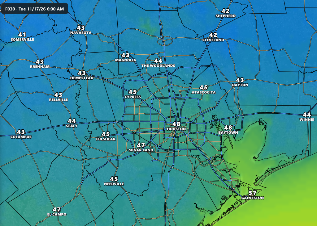
The low temperature at Bush Intercontinental Airport this morning is 49 degrees, and we may tick a degree lower before we start rising. Overall it should be a chilly day, highs rising to only around 60 degrees, or slightly higher, with cloudy skies becoming at least partly sunny this afternoon. North-northeast winds gusting to 15 to 20 mph will add to the chill in the air. The rains are over, however, probably at least until the weekend. With clearing skies we should see lows tonight fall a couple of degrees lower, so some inland locations will fall into the low- to mid-40s, whereas urban Houston should stay in the upper 40s.
Tuesday
This will be a splendid, sunny day with highs in the upper 60s and light northeasterly winds. Overnight lows will drop into the lower 50s in Houston.
Wednesday, Thursday, and Friday
These days will bring mild weather, with partly to sunny skies, thanks to high pressure holding sway. Highs on Wednesday will likely be in the the mid-70s, rising to the upper 70s by Friday. Nights will see lows in the upper 50s to about 60 degrees in Houston, with cooler conditions for outlying areas, and slightly warmer nights near the coast. Rain chances remain near zero.
Saturday and Sunday
We’ll see a mix of sunshine and clouds this weekend, with highs in the vicinity of 75 to 80 degrees. Lows will be in the vicinity of 60 degrees, with some humidity. The overall pattern is not super clear, but with increasing atmospheric moisture levels we could see some spotty rain showers on Saturday or Sunday. However, I’m not ready to make any firm predictions yet.
Next week
Then we get to the week of Thanksgiving. I’ll do a deeper dive into this in tomorrow’s post. At some point early next week, perhaps Monday night, perhaps Tuesday, a front will arrive and likely bring some precipitation with it. This will bring temperatures down toward more normal levels for the mid- and late part of next week. By the period of Thanksgiving I think we’ll be somewhere in the range of highs in the 60s and lows in the 50s. Again, I’ll delve deeper into the data tomorrow to see if there’s anything we can confidently forecast.
