Good morning. Houston will see three warm days before a front arrives on Wednesday to usher in clear and cool conditions for the New Year. Perhaps the most noteworthy feature this week will be the potential for heavy rain and storms on Wednesday and Wednesday night along with the slow-moving front, with much of the area receiving 2 to 3 inches of rainfall. We cannot entirely rule out this precipitation turning into a wintry mix north of Houston later on Thursday.

Monday
As winds continue to blow from the southeast, our atmosphere will continue to moisten today. This will result in increasing cloud cover, and highs generally in the low 70s. A cold front will approach our area tonight, but stall out well north of the metro area. As a result, temperatures should again fall to around 60 degrees in Houston—warmer near the coast, and cooler inland.
Tuesday
Another warm day, for December, a lot like Monday. Expect mostly cloudy skies, with highs in the low 70s. Winds will be fairly gusty, out of the southeast at 10 to 15 mph, with higher gusts. Lows Tuesday night will again be fairly sticky.
Wednesday and Thursday
Wednesday will start out with partly cloudy skies and another warm morning, as the front approaches. During the morning and early afternoon we likely will see light, scattered showers. Rain chances will increase during the afternoon, evening and overnight hours as the front slowly moves from west to east. This is where the forecast breaks down some, as the feature approaching the Houston area will be cutoff from the main atmosphere circulation, and thus will probably move more slowly.
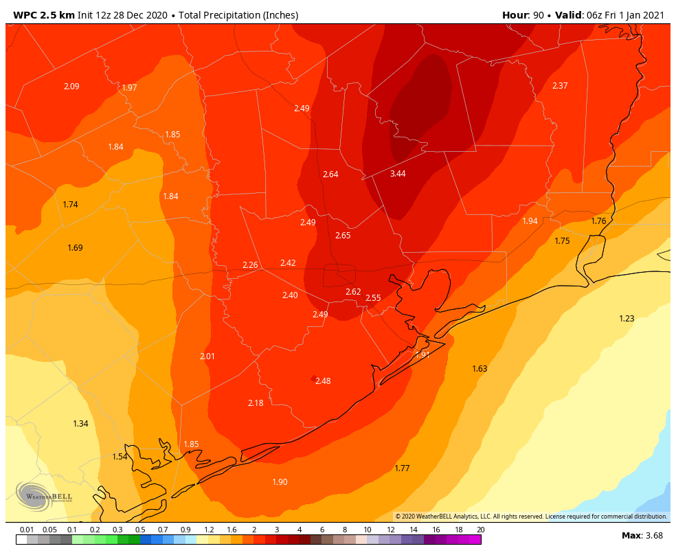
As this system approaches our warm and moist atmosphere, it will create conditions where some strong storms will be possible on Wednesday night into Thursday. Most of the area should see a solid 2 to 3 inches of rain during this period, but we can’t rule out a few isolated areas with 5 inches. Details on this forecast will improve by Tuesday, as higher-resolution models come into play.
As colder and drier air comes into play on Thursday, rain chances will end over much of the metro area later in the day. However, a few showers may linger north of Houston, and as the colder air moves in on Thursday evening, the chance of some sleet or a few flurries in a place like Montgomery County is above zero, but only slightly. Thursday night—New Year’s Eve—will be cold across the region, with much of Houston reaching freezing, or near freezing conditions.
New Year’s Day
The first day of 2021 should be mostly sunny and cold, with highs only reaching the upper 50s, most likely. We’ll see another chilly night on Friday night.
Saturday and Sunday
The weekend looks splendid, with sunny skies, and highs in the upper 50s to low 60s, and nighttime temperatures down around 40 degrees. A sign, perhaps, that 2021 will hold more promise that this year now ending?