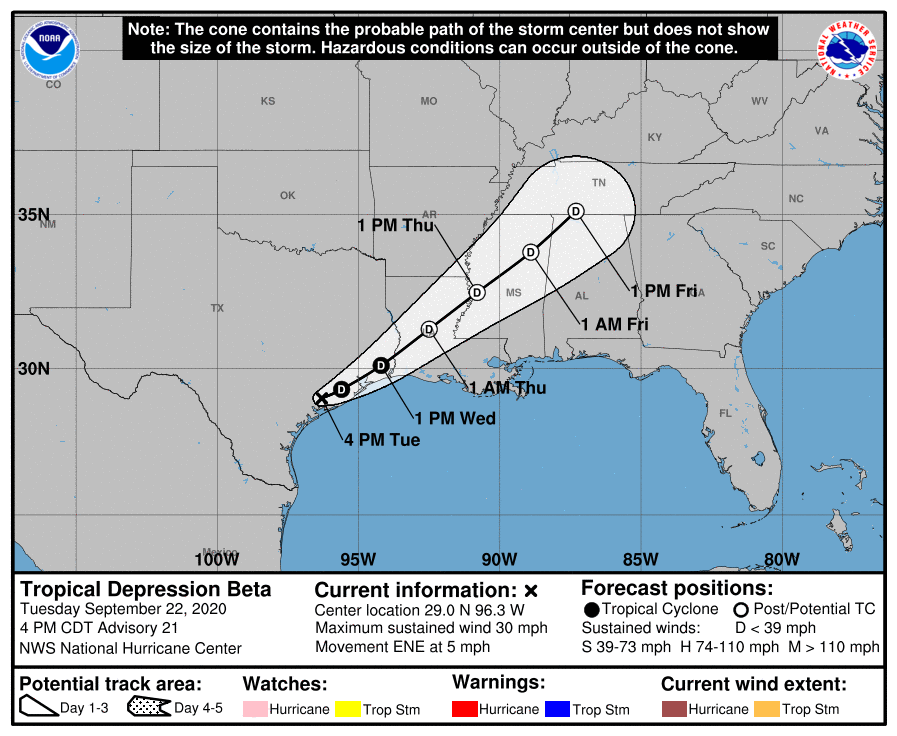
8:00 pm CT Tuesday Update: Our forecast from earlier remains largely on track this evening. We are seeing the threat of heavy rainfall shift from south and central Houston toward the north, and eventually northeast. This is happening as the remains of Beta are tracking toward the northeast. At this time its ragged center is approaching Lake Jackson, and should move beyond Houston sometime on Wednesday morning.
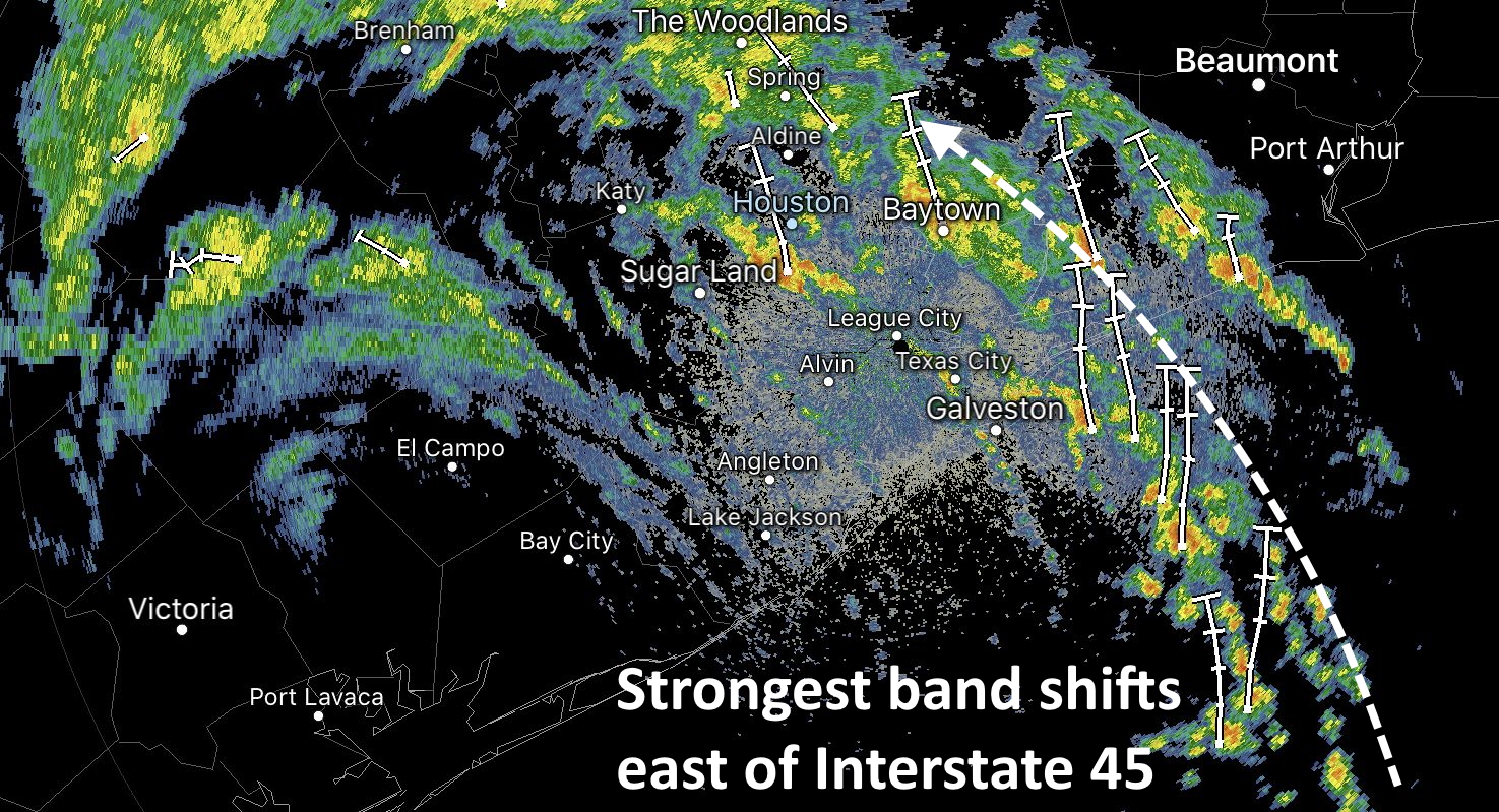
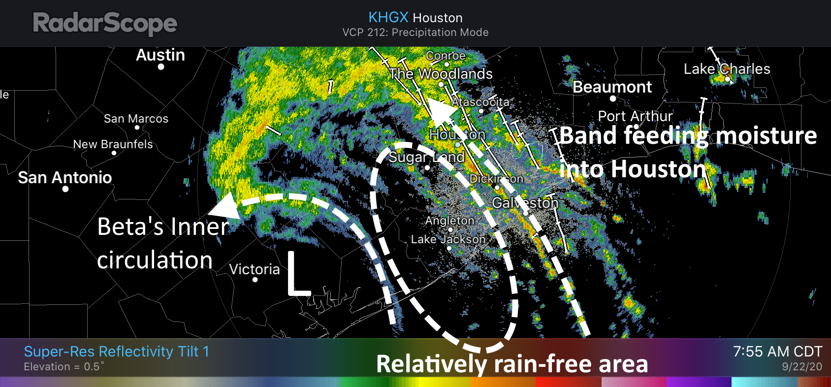
A thin band of heavy rainfall is essentially stretched from Bolivar Peninsula through Baytown, Aldine, and Jersey Village. A few of the strongest thunderstorms in this band are producing rain at 2 inches per hour, but most of the band is dropping rain at lower rates. We are starting to see rises along White Oak Bayou as a result of these rains, but so far it remains within its banks. We’ll keep an eye on it.
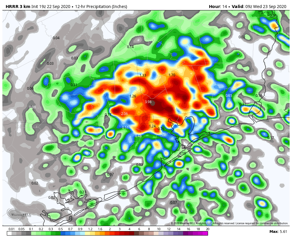
These storms should slowly shift north and east as Beta’s center continues to move onward. This threat of overnight rainfall is pretty well captured in the most recent run of the NAM model, which depicts rain totals between 7pm CT Tuesday night and 7am Wednesday morning.
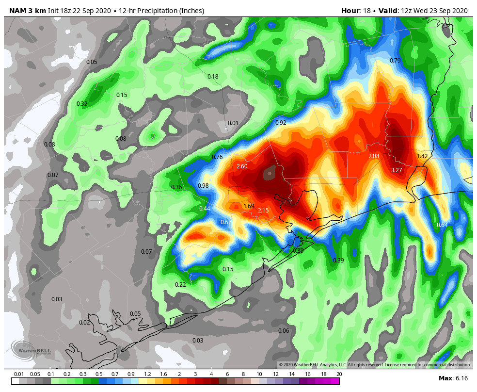
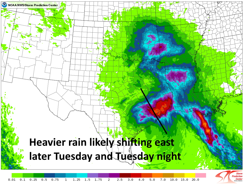
As you can see, we generally expect the areas hardest hit on Monday night—south and southwest of Houston—to avoid a lot of heavy rainfall. The northeast quadrant of Harris County has largely been spared over the last two days, with most areas seeing less than 2 inches of rain. Therefore the potential of 4 to 6 inches of rain dropping tonight north and east of Houston is something those areas should be able to accommodate.
Our best high resolution models still suggest the heaviest rain will push east of Interstate 45 by around midnight tonight, or shortly thereafter, and it should move entirely east of Harris County by around sunrise on Wednesday. The threat later on Wednesday morning will shift into East Texas, possibly including Beaumont and Port Arthur.
The most important message tonight is that if you don’t have to go out, you should remain home. The remnants of Beta will be pushing through the area, and tropical rainfall rates can pulse up and quickly flood streets. So stay home, and wait for better weather tomorrow. It’s definitely coming.
Our next post will come by or before 11 pm CT Tuesday night.