10:00am CT Update: The National Hurricane Center upgraded this system to Tropical Depression 14 on Thursday morning. Our forecast below remains accurate. Matt will be providing a big-picture update this afternoon.
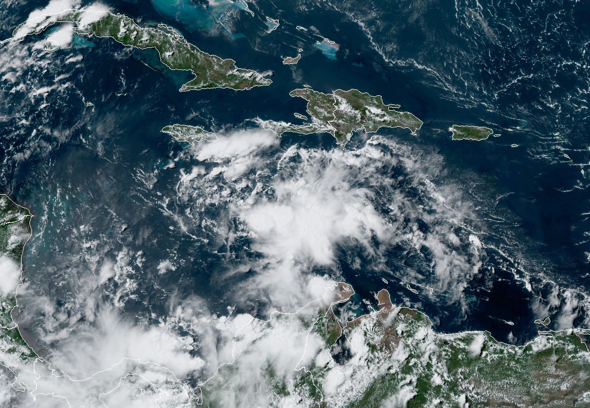
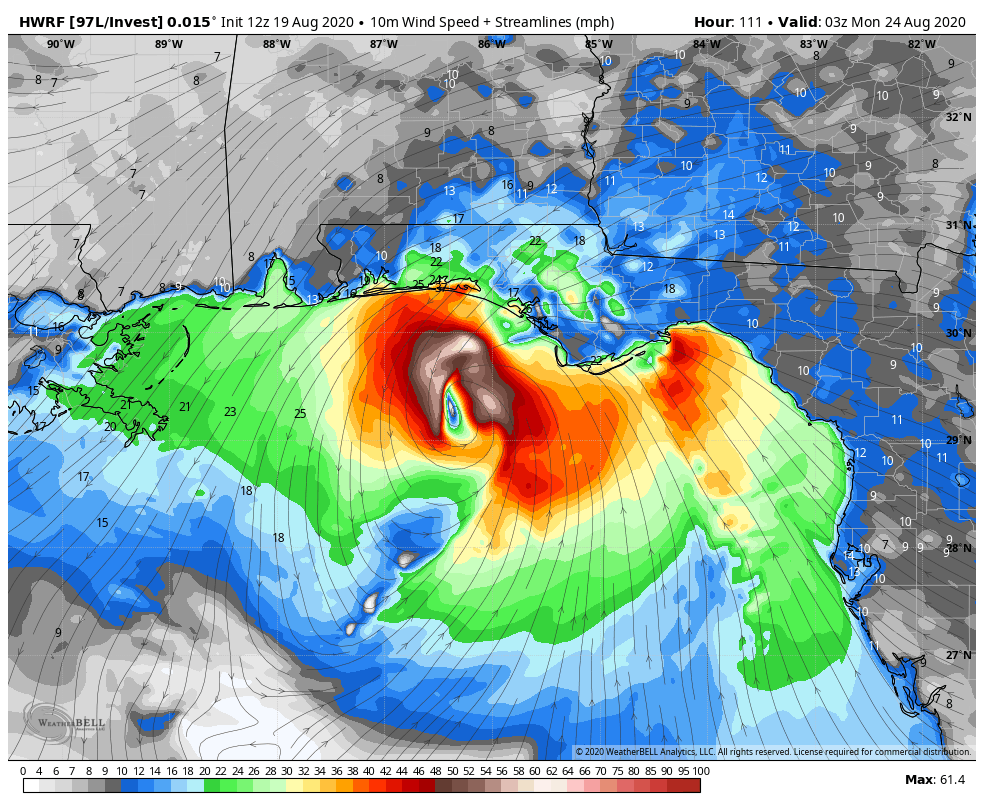
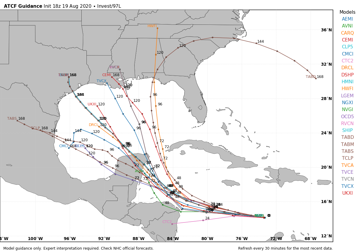
Original post: This update will consist of both a short weather outlook about the rest of this week, and a longer section on the threat posed by the tropics. In short, the latest model guidance suggests an increased likelihood that Invest 97L may impact Texas, although much uncertainty remains. We’ll also have to keep an eye on Invest 98L, although this seems a bit more of a distant threat.
Thursday
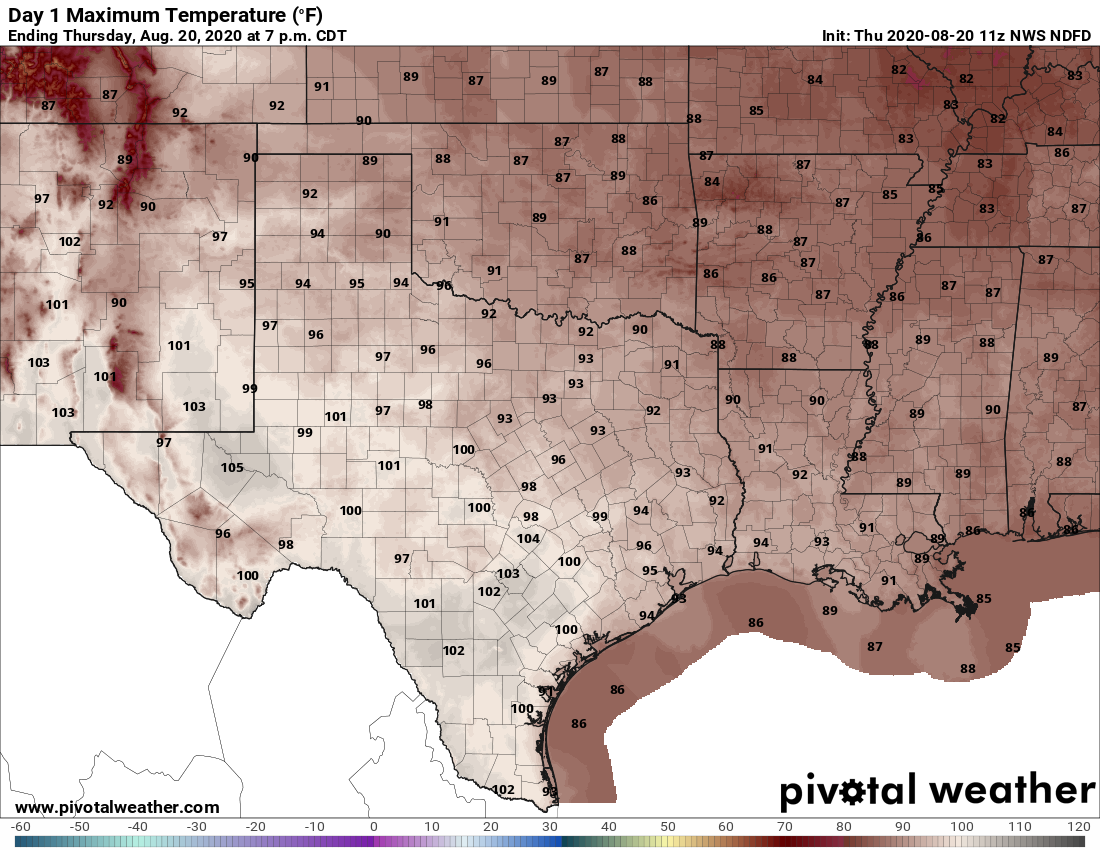
Today’s weather will be a lot like Wednesday’s, which is to say hot and sunny, with high temperatures in the mid- to upper-90s. With slightly drier air in the region, conditions won’t feel quite so humid this morning or this evening, but as an easterly, and southeasterly wind develops this afternoon we’ll feel the beginnings of an onshore flow. A few stray showers may develop near the coast today. Low temperatures will fall into the mid- to upper-70s.
Friday, Saturday, and Sunday
Honestly, we don’t anticipate a whole lot changes with our weather and this August-like pattern, except that the onshore flow will return more humidity at the surface. We’re going to see hot days in the mid-to-upper 90s with oodles of sunshine and only very slight rain chances with coastal counties the most likely areas to see precipitation.
Next week
Our weather next week will depend to a large extent on Invest 97L, but the bottom line is that we may see increasing rain chances by Monday or Monday night. This is probably a good time now to talk tropics.
