Good morning. Today is an important day for our republic, the one day a year when two halves come together to create something great. This tradition dates to the 1700s, and people often take time off from work to partake in this custom, walking up to a counter and making their choice around lunchtime. I am speaking, of course, of National Sandwich Day. Also, please do make sure you go vote in our election today, as the weather will provide no excuses.
Election Day
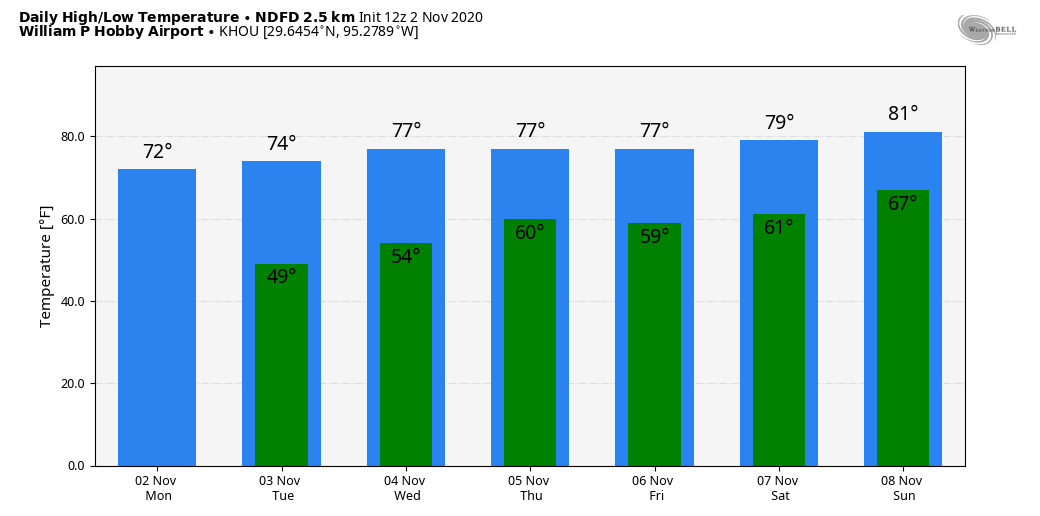
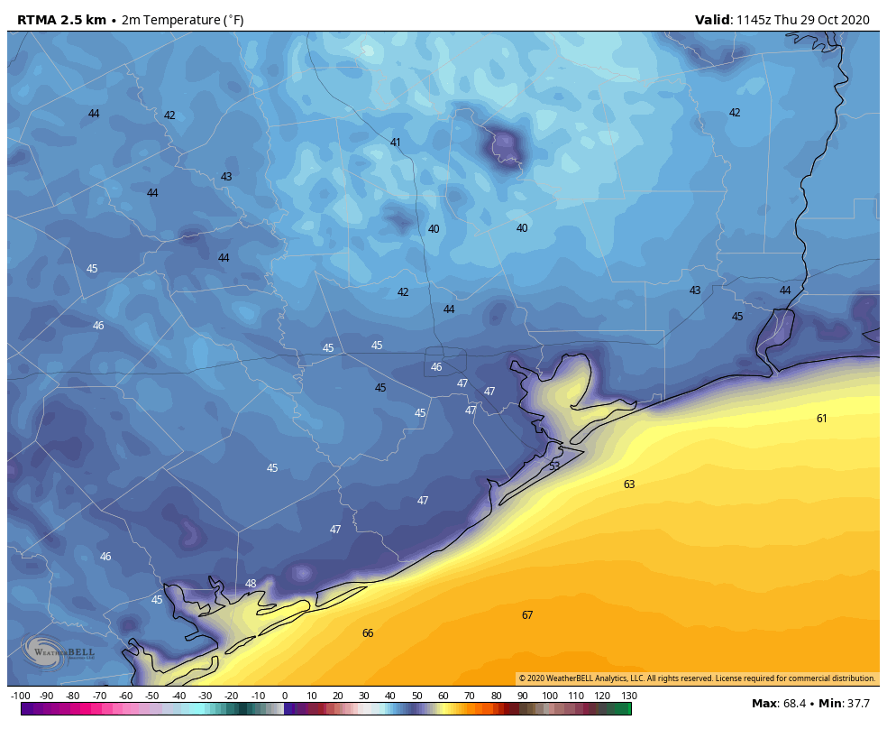
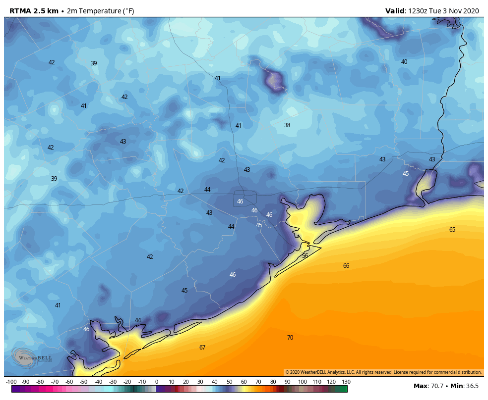
Temperatures this morning in Houston, in the low 40s for inland areas and upper 40s in the city, will probably be the region’s coolest for the next week. We’ll warm up fairly quickly, however, and the weather today will be, in a word, perfect. Highs will reach into the mid-70s, under mostly sunny skies. Winds will be light out of the east. Overnight lows on Tuesday night should be a few degrees warmer.
Wednesday, Thursday, and Friday
These will be pleasant days, under the influence of a light east and southeasterly flow. In general, we expect mostly sunny skies, highs in the upper 70s to 80, and lows of around 60 in Houston—cooler inland, and warmer along the coast.
Saturday and Sunday
By this weekend a more pronounced southerly flow will raise humidity levels. Ultimately, high temperatures should hang around 80 degrees, but both Saturday and Sunday nights should be warmer, probably in the mid- or upper-60s.
Next week
This warming trend should continue until around Tuesday or Wednesday of next week, when some sort of front will trundle into the area. I still don’t have confidence in its timing or strength, but there is some hope it will bring us our first real chance of rainfall in quite some time.
Tropics
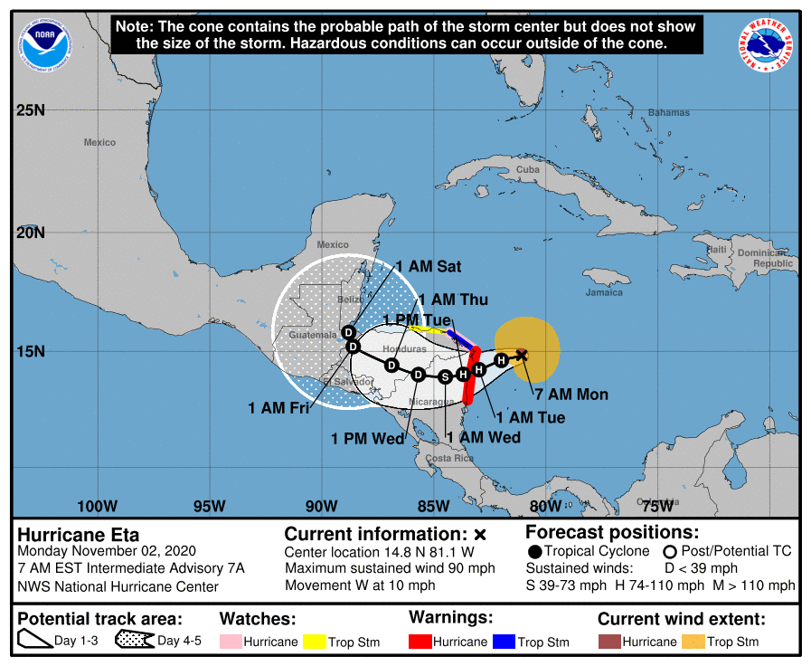
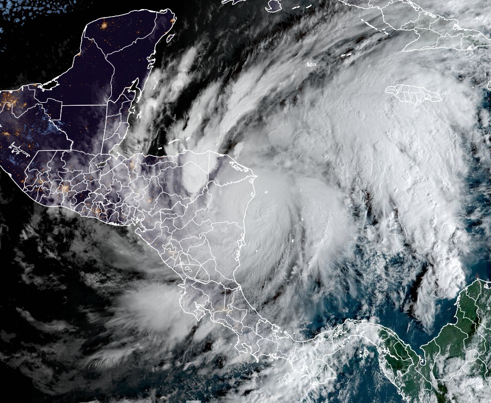
If you have not been paying attention to Hurricane Eta, it absolutely exploded in terms of intensity on Monday, and it will come ashore into Nicaragua today with Category-4 or -5 intensity winds. In addition, the storm will deliver devastating flooding in Nicaragua and Honduras. The storm is eerily similar in intensity to Hurricane Mitch, in 1998, which caused more than 11,000 fatalities.
By this weekend, after wreaking carnage in Central America, Eta should reemerge into the northwest Caribbean Sea, after which time it may threaten Cuba, Florida, or possibly the eastern Gulf of Mexico. It’s just too early to say much more.