Good morning. Yesterday we launched our 2020 fundraiser, and the response has been tremendous so far. It really is humbling to find out, at the end of each year, how much the greater Houston community supports this site—and it energizes Matt and I to keep doing what we do. So thank you very much. As for our forecast, well, it’s changed a bit for the week ahead with more drier air making it into the area than anticipated. (Not that we’re complaining).
Tuesday
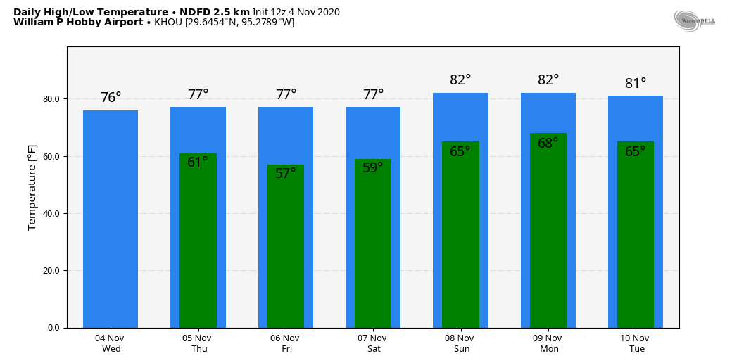
Conditions are quite warm this morning, especially for November, as lows have not fallen below 70 degrees for much of the area. An increase in atmospheric moisture should allow for a decent chance of rain today, with perhaps 30 percent of the area seeing light to moderate showers. Otherwise, high temperatures should rise into the mid-80s under partly sunny skies. The good news is that a much-discussed weak front is now expected to make it all the way to the coast on Tuesday night or Wednesday morning.
Wednesday, Thursday, and Friday
The weak front will bring moderately drier air into the region, and while this will not have too much effect on daytime temperatures—still likely to be in the low 80s beneath sunny skies—nights will be more pleasant for the second half of the week. Look for lows down near 60 in the city of Houston, with warmer temperatures along the coast, and cooler weather inland. Rain chances will be near zero.
Saturday and Sunday
Most of this weekend will probably continue to bring sunshine and warm temperatures in the low 80s. A front will also push through the area, but I can’t tell you now whether that is going to happen on Saturday night, or Sunday night. Also, while we definitely need rain, unfortunately this front does not appear to be of the rainmaking type—at least not at this vantage point. Things could still change.
Next week
Our weather for much of next week looks splendid in the wake of the front, with highs in the 70s and lows generally in the 50s.
Tropics
The 2020 Atlantic hurricane season just will not quit. On Monday, Subtropical Storm Theta formed in the far Atlantic Ocean, and it may eventually threaten Europe with winds and heavy rains. This means we have broken the all-time record for named tropical systems in the Atlantic this year, with 29. Fitting, I’d say, for this year.
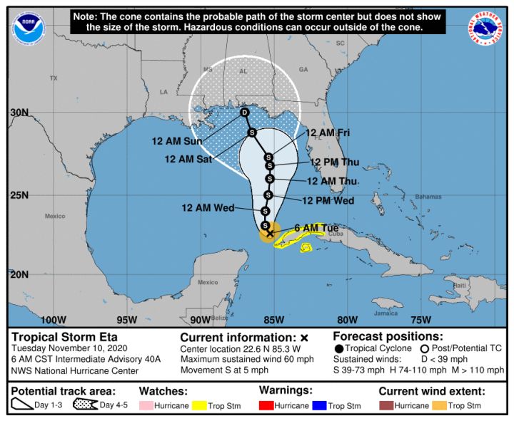
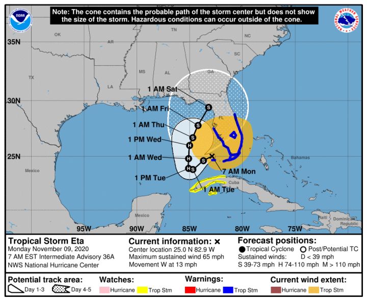
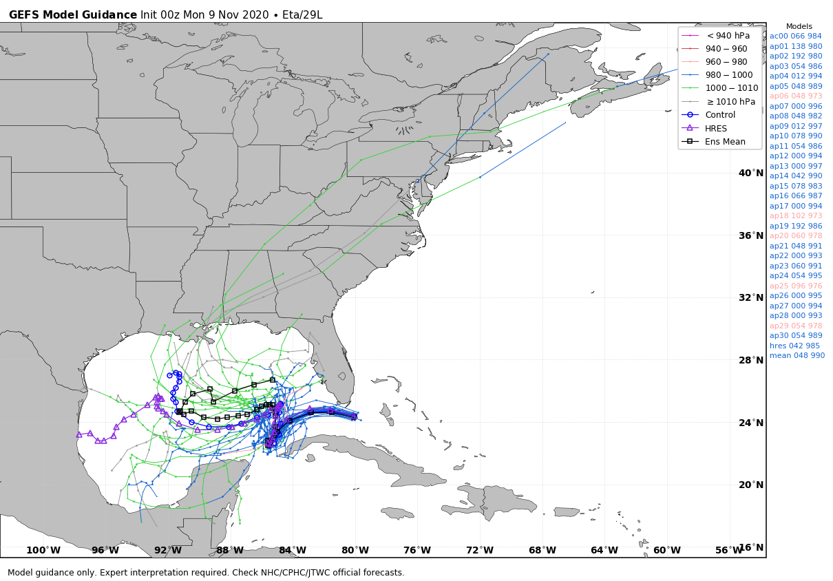
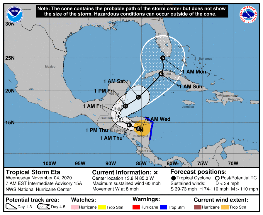
Closer to home, where there is virtually no confidence in the track for Tropical Storm Eta. My personal guess is that it will eventually succumb to wind shear and dry air over the eastern Gulf of Mexico, and not make landfall again. But that is solely a guess—the tropics have continually surprised us this year. All I can say for sure is that Texas need not worry about Eta.