For most of Houston, it’s been two weeks since substantial rain fell across the area. Compounding the problem has been that most days since then have been sunny and hot, allowing for ideal drying of soils. While rains earlier this spring have helped keep Houston out of a drought, the top layer of soils in the region is nonetheless very dry due to recent weather conditions. The map below shows the “percentile” level of moisture in the top 1-inch of soil across Texas. Much of the Houston area is at the 10th percentile or lower, based upon observations by NASA’s GRACE satellite, and a few areas are at 5 percent or lower.
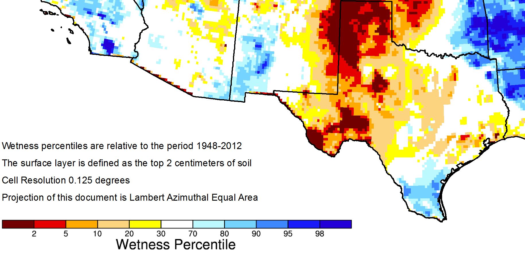
These conditions have not yet sunk deeper into the ground, which would indicate a true drought. But were we to see another week or two of this hot and dry weather, the region would likely enter a drought. Fortunately, it does not appear as though that will happen given the modest pattern change ahead for this weekend.
Thursday
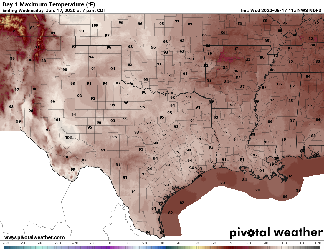
There are no surprises in store with today’s forecast. We can expect hot, humid, and sunny weather, with highs in the low- to mid-90s, light southerly winds, and almost no chance of rain. Lows will be in the mid-70s.
Friday
As high pressure dominates for one more day, we should not expect any substantial changes for Friday’s forecast either. Continued hot and sunny.