Oh, hey, look at this—another warm and humid morning in the middle of March. Temperatures across much of the region on Wednesday morning have not fallen below 70 degrees. We’ll have a couple more days in this pattern before a front arrives to bring some cooler weather along with some much needed rainfall. This rain, along with some wind gusts of 30 mph or higher on Friday, should help with the region’s still extremely high tree pollen.
Wednesday
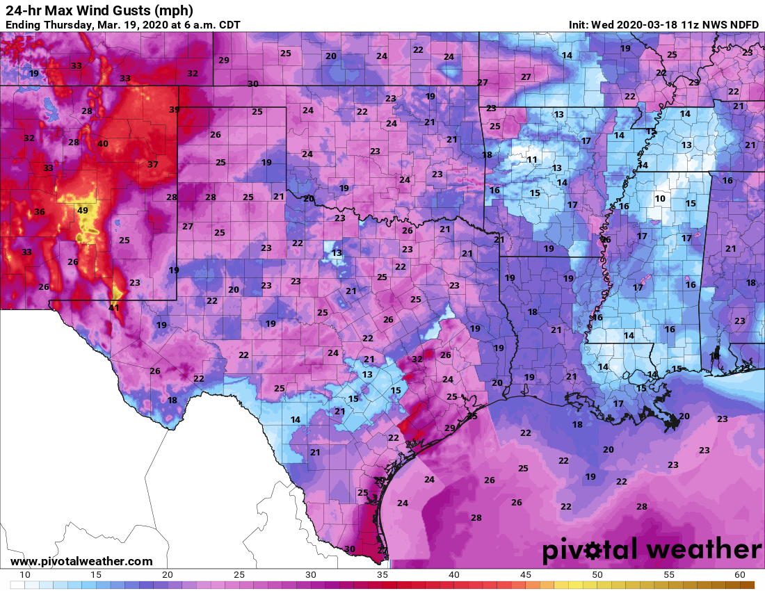
Highs will go back up to about 80 degrees today, although afternoon temperatures will depend upon the extent of sunshine. Like on Tuesday, when we saw some welcome breaks in the clouds, we may see some sun amidst the gray skies today. One noticeable difference will be winds, which may gust up to 25 mph this afternoon. There will be a slight chance of overnight showers as temperatures fall to around 70 degrees.
Winds may be a bit gusty on Wednesday. (Pivotal Weather)
Thursday
In all honesty, Thursday’s forecast is pretty much a carbon copy of Wednesday. A capping inversion should again act to limit any showers and thunderstorms as highs again reach about 80 degrees for the region.
Situation update: Today, all clubs and bars in Houston and Harris County will close for at least 15 days. Restaurants will provide take-out service only. Residents are advised to remain home unless they are grocery shopping, visiting a physician, or on other essential business. These are very difficult measures both socially and economically, but as we explained Sunday, at this point they are essential to help manage the spread of COVID-19. Now, on to the weather.
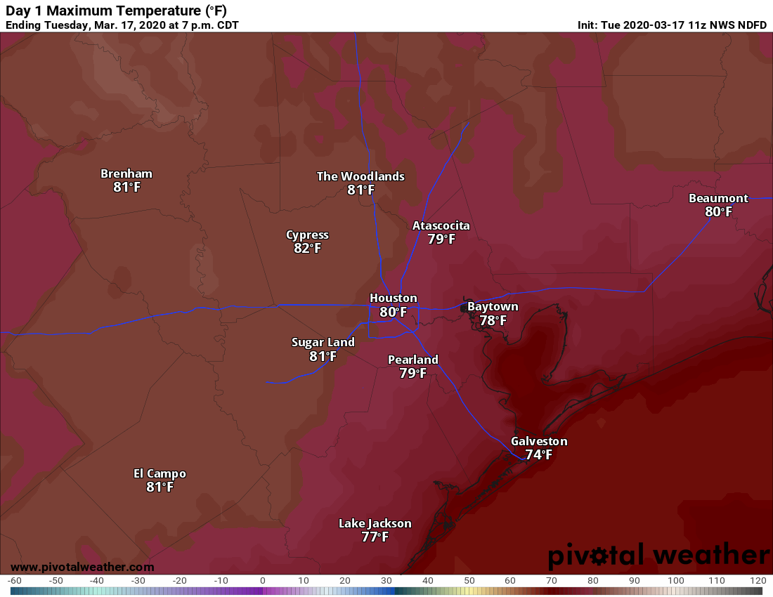
High temperatures on Tuesday will be plenty warm for mid-March. (Pivotal Weather)
Tuesday
St. Patrick’s Day in Houston will be warm, humid, and cloudy. We have been in this same pattern, more or less, for more than a week and it’s not going to change until Friday. There is some patchy fog this morning that will burn off later today, with some light southeast winds at the surface, blowing at about 10 mph. Highs will reach around 80 degrees, with lows Tuesday night falling only to around 70 degrees. A capping inversion should keep a lid on any rain chances. Expect pressures to increase for firing the head coach-general manager of the Houston Texans after trading an amazing wide receiver for a second-round pick, a bad contract, and six rolls of toilet paper.
Wednesday
Did you read Tuesday’s forecast? Good, because it’s pretty much the same, although winds from the southeast may be a tad gusty. (And yeah, we’re still going to want Bill O’Brien fired on Wednesday, too).
Houston saw some blips of sunshine Sunday, which is a good thing because most of this week looks cloudy. Our region will also remain quite warm, with high temperatures of around 80 degrees, until a front arrives later this week. Not only should this front help cool the region down; the combination of moderately stronger winds and rainfall should help to control some of the very high oak pollen levels in the air that may have stuffed you up in recent days.
Monday
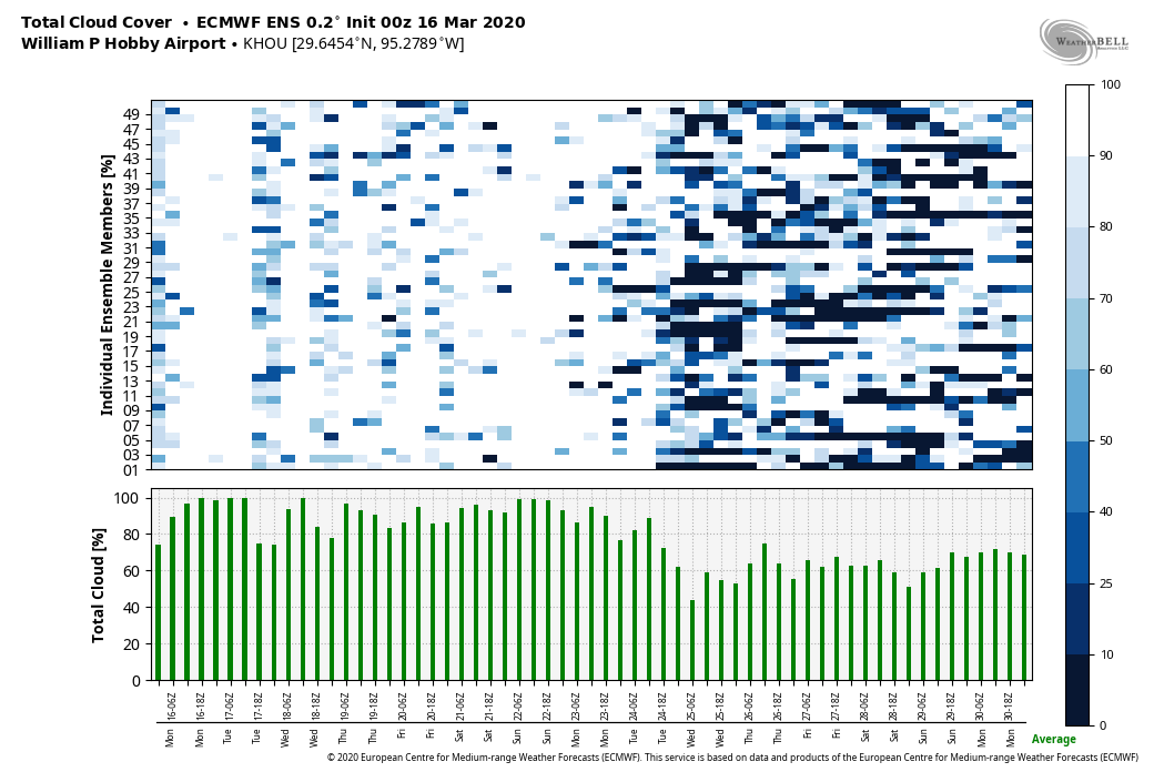
Houston remains trapped under a pattern—most predominantly high pressure over the Gulf of Mexico—that is essentially drawing a current of air from the southwest into the region. This explains our moist, warm air. And today will be no different, with mostly cloudy skies, highs near 80 degrees, and light winds at the surface of about 5 to 10 mph from the south. We can’t rule out a slight chance of afternoon showers, but most of the region will stay dry. Overnight lows will only fall into the upper 60s.
Sunny skies (indicated by dark colors on this ensemble forecast) will be few and far between this week in Houston. (Weather Bell)
Tuesday
A kink in the atmosphere may nudge up rain chances on Tuesday, but I still think most of the area will just see mostly cloudy skies, rather than rainfall. Highs will likely reach the low 80s.
Space City Weather is, and always will be, a weather site. We have no pretensions beyond providing the most reliable forecasts we can, and to help greater Houston residents make decisions about what is best for themselves and their families in times of inclement weather. With that said, we have received numerous questions about the coronavirus, and requests for a site similar to Space City Weather to provide health information for this epidemic. Alas, neither Matt nor I are biologists, physicians, epidemiologists, or even medical journalists, so we are not going to do that. However, in this post, I want to provide some general thoughts about this issue from the perspective of someone well versed in crises (i.e. hurricanes) and public reactions.
We are taking this serious, and so should you.
Social Distancing—the time is now
This is probably the best proven tool we have at this time to fight the coronavirus—and the only one you can take personal control of. This is why schools are canceled, and likely will be for awhile. This is why sports have been suspended, and the rodeo canceled. These are absolutely the right decisions, and the earlier they are enacted, the better it will be for our ability to control the spread of the coronavirus, and give our health care system the time and resources to help those who fall severely ill.
Important to remember that #Covid-19 epidemic control measures may only delay cases, not prevent. However, this helps limit surge and gives hospitals time to prepare and manage. It’s the difference between finding an ICU bed & ventilator or being treated in the parking lot tent. pic.twitter.com/VOyfBcLMus
But we need to go further than canceling mass gatherings. Practicing social distancing in your own life means staying home as much as possible, and maintaining a gap of six feet or more between yourself and others outside the home. Fewer interactions and added distance when you must go into public spaces lowers the chance of exposure. Moreover, if you do get infected, social distancing lowers the chance of spreading the virus.
Practically, this means you should not go to bars or restaurants if possible—take-out or cooking at home are better options. Church services should be temporarily moved online. None of this is popular or economical palatable, but the more of this we do, the more we slow the spread of coronavirus. (If you want to support a favorite business, buy a gift certificate to use for later). A combination of social distancing and aggressive testing by South Korea has provided a model for how democracies can control this disease. We must emulate this, or face drastic consequences.
Hoarding
Every time a significant tropical event threatens Houston, we see runs on the grocery stores—bottled water being the highest priority item. With coronavirus, toilet paper has emerged as the highest priority item. It is not clear why this is, but for goodness sake there is no toilet paper shortage in the United States and panic buying and hoarding only increases the anxieties of everyone else. If you’re buying cases of toilet paper when you already have an adequate supply, you are—I have vowed never to curse on this web site as children read it, so I won’t here—a scoundrel, dastard, villain and worse. Do not do this.
The coronavirus outbreak will be vastly different than a hurricane. And while we do not know what to expect, it is clear that we are not going to see the kinds of natural barriers (like wind and flooding) that will prevent trucks from driving, and grocery stores from remaining open.
Be good neighbors
As is the case during a hurricane, check on neighbors (while practicing social distancing!) If they need help, help them with supplies. Basically, look out for more than yourself.
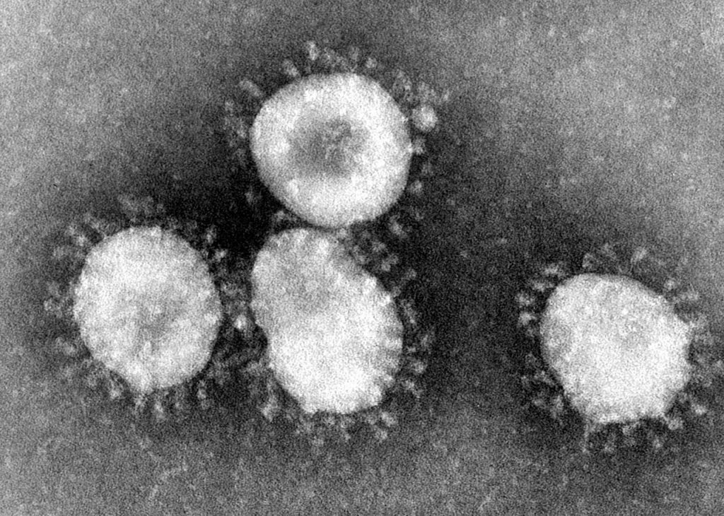
Coronaviruses have a halo, or crown-like appearance when viewed under an electron microscope. (CDC/Dr. Fred Murphy)
The fact is, with this virus and disease, we are all in this together. The virus spread quickly from China, to the rest of Asia and Europe, and it is now circulating widely in the United States because we have a global culture. We humans travel everywhere. And we are all in this together. It is not us versus them, or one political party versus another. We are all humans, sharing the same world, with a limited set of resources, facing this. We are better together.
Appreciation
During severe weather, countless people in this region express their appreciation for our efforts. So in this time of need, let Matt and I do the same for everyone who is working to keep the region going—that means those people who are stocking grocery shelves, driving delivery trucks, working in pharmacies, preparing take-out meals in restaurants, picking up the trash, keeping the lights turned on, farmers, and more. The list of those providing essential services goes on, and on. Thank you. And then there are the health care providers and first responders, preparing for disaster, facing the uncertainty, and putting themselves directly in harm’s way. Your sacrifice and dedication are admirable. Thank you so very, very much.
More information
If you have more questions about coronavirus, this comprehensive, continually updated guide by my colleague at Ars Technica, Beth Mole, is a great place to start. She’s a microbiologist and fine writer, and seeks to take the same calm but prudent approach to this issue that we do to weather.
We’ll be back with a full forecast tomorrow morning.