Houston will experience warm daytime conditions this week, especially through Wednesday as highs push up into the low- or even mid-90s, under sunny skies and the influence of high pressure and slightly drier air. The upside of this is that nights to start the week should see lows dip into the upper 60s for everywhere but the coast. Rain chances probably will not return until Friday at the earliest.
Monday
After starting out just below 70 degrees, highs today should climb into the low 90s for most of the region with very light, westerly winds. Skies will be sunny so we’re pretty much guaranteed a spectacular sunset for the metro area. Low temperatures on Monday night should be similar to Sunday night—which is to say quite pleasant for this time of year with the drier air allowing for a more rapid drop as the sun dips below the horizon.
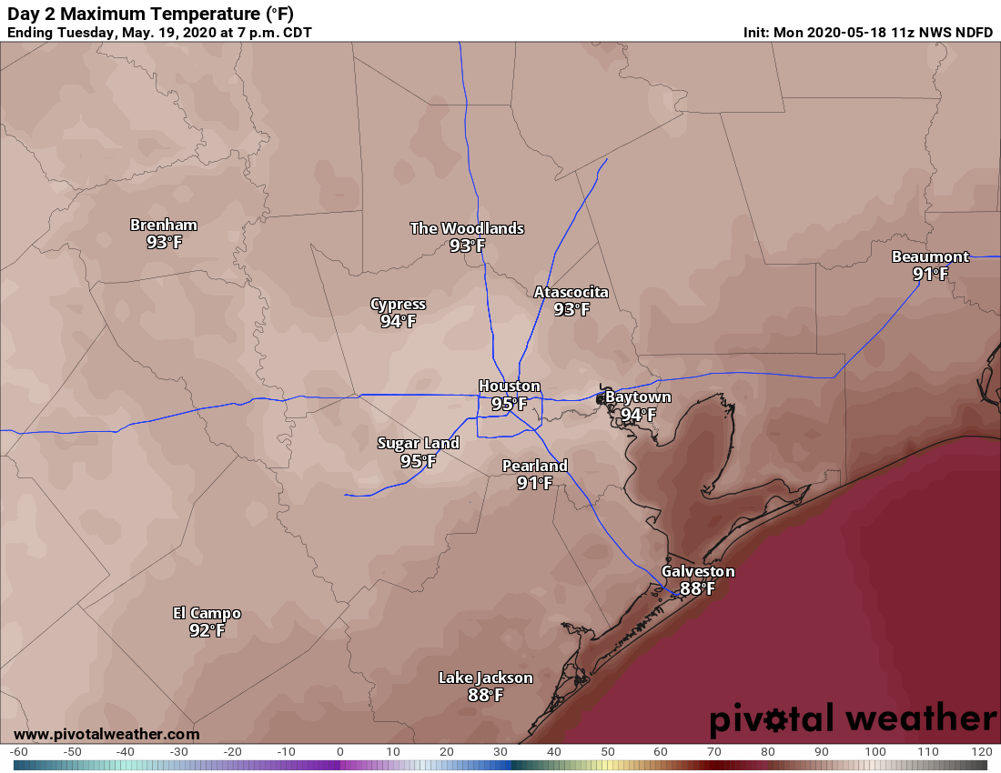
Tuesday
This probably will be the warmest day of the week with a warm southwesterly flow and just enough dry air left for temperatures to really pop during the afternoon hours. Expect highs in the mid-90s for much of the city, almost certainly the warmest weather we’ve seen in 2020. Houston’s record high for May 19 is 95 degrees, which is definitely in reach. Make sure to take precautions when outside for extended periods of time.