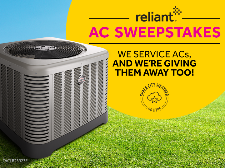
A clear and crisp Thanksgiving lies ahead for Houston

It’s chilly this morning across Houston, with lows in the low 40s for inland areas, and low 50s closer to the coast. For most of this week we can expect continued fall-like weather thanks to a series of cold fronts. The Thanksgiving holiday should see near perfect fall-like weather.

Monday

Houston will see a mix of sunshine and clouds today, which should keep high temperatures in the upper 60s for the most part. Monday night should be about 10 degrees warmer than Sunday night, as southeasterly winds return to the area.

Monday morning is one of the chilliest we’ve seen in Texas this fall. (Weather Bell)

Tuesday

As moisture flows back to the area, humidity levels will tick up some—but the region won’t have too long to warm back up before another front arrives. Highs on Tuesday should reach into the mid-70s, but the bigger question is whether we’ll squeeze out any showers later during the day, or overnight hours. For now, it seems like most of of the rain showers will occur offshore, or immediately along the coast. There is about a 30 percent chance of some light rain for inland areas. Lows Tuesday night will reach into the low 50s for inland areas, and low 60s along the coast.

See full post

Three more warm days until fall returns to Houston

Houston faces three more warm days before a cool front knocks us out of this warm weather pattern and into much more fall-like conditions for most of next week. The forecast for Thanksgiving remains about as clear as gravy.

Thursday and Friday

We’ll see some possibly foggy mornings each day, and then warm days with highs of around 80 degrees. We can’t rule out some scattered, light rain on Thursday afternoon, but chances of this are pretty small. Nights will be muggy, with lows only falling into the upper 60s. On Friday southerly winds could be fairly gusty across the area.

Not much, if any, rainfall is expected between now and Tuesday morning. (NOAA)

Saturday

A cold front is coming on Saturday, but the day will start out warm, and highs will probably reach about 80 degrees for most of the area. I’d peg the front’s arrival at sometime in the afternoon for most of the city, with it perhaps moving off the coast around sunset. Some scattered showers are possible with the front’s passage, but any accumulations should be slight. A northerly wind will bring immediately cooler and drier air into the region and overnight lows should fall to around 50 degrees.

See full post

A front reaches Houston on Saturday, cooler for Thanksgiving week

Perhaps you’re traveling out of town via an airport. Perhaps you’re having 30 family members over to your home. Perhaps you just want to toss the football around in the back yard, as is customary on Thanksgiving. Whatever the circumstance, weather matters during Thanksgiving week. And for now, it looks pretty festive for Houston—rather than an 80-degree sweat fest that we’ve had in some recent years.

Texas is warm this morning, and will remain so until the weekend when a front moves through. (Weather Bell)

Wednesday through Friday

Houston’s weather will gradually warm up to end the work week, with overnight lows rising from about 60 degrees in the city on Wednesday morning to the upper 60s by Saturday morning. Mornings will see at least some patchy fog due to muggy air and near dead calm winds. High temperatures will remain pegged at about 80 degrees, with partly to mostly sunny skies. Can’t entirely rule out a few light showers later this week, but I’d bet heavily against rain for most people.

See full post

Mild this week in Houston, with a healthy front this weekend

Good morning. Houston will experience a bit of a warming trend before a cold front shakes things up this weekend. After that, conditions should feel more fall like for the remainder of November.

Tuesday and Wednesday

Drier, easterly winds will give way to a more southerly flow tonight, and that will allow for humidity levels to rise Tuesday night and into Wednesday. Aside from that, conditions won’t change too much, with highs near 80 degrees under mostly sunny skies, and overnight lows in the low 60s for inland areas, and mid- to upper-60s along the coast.

In this temperature anomaly plot from the GFS, the mercury creeps up well above normal before a front on Saturday. (Weather Bell)

Thursday and Friday

These will be the warmest days of the week, as high temperatures climb into the low 80s, and overnight lows reach near 70 degrees along the coast. We’ll see some low rain chances, but any precipitation that falls will be slight, and short-lived.

See full post