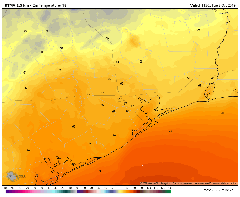
Houston is enjoying another moderately cool morning, with lows generally in the 60s for most of the region. This brief respite from summer will gradually end today, but a stronger taste of fall arrives on Friday. The weekend looks pretty amazing after a breezy front blows through.
Wednesday
An easterly breeze will shift to come out of the south the morning, and this will herald the return of the onshore flow. Conditions today will still be fairly moderate, temperature-wise, with highs generally climbing into the mid-80s. However we’re not going to see as much cooling this evening with the absence of drier air. Lows for most of Houston probably will only get into the low- to mid-70s.
Thursday
Welcome back, summer! This will be a mostly sunny day, with high temperatures of around 90 degrees. Thursday night will be muggy, too, with lows on the mid- to upper-70s.
Friday
This day will have the week’s most dynamic weather. This will be a classic cold front passage, with a boundary barreling through the Houston region, likely during the morning hours. We can expect at least scattered, if not widespread, showers with the front, and perhaps a few thunderstorms. But they should pass pretty quickly as the front sweeps toward the coast by around noon or shortly thereafter.