Good morning. Before we get into the forecast—which looks quite wet for much of next week—I wanted to mention the red and brown grime people noticed on their cars Thursday morning. It can be traced to a large dust cloud over northern Mexico, from which dust was transported in the atmosphere about 1 to 2 miles above the surface by a vigorous southwesterly flow, and then deposited by Wednesday night’s light rain over Houston.
Friday
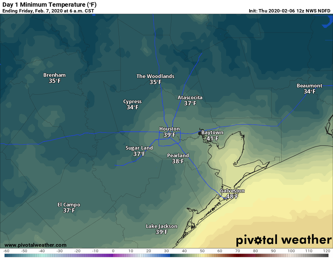
Well, much of next week’s forecast is pretty grim. But after a chill start this morning (northern areas such as Conroe and Cleveland recorded a freeze with the clear skies) the rest of Friday will be quite grand. With mostly sunny skies we should expect to see high temperatures of around 70 degrees. The only blemish on the day will be winds building from the southwest, possibly gusting as high as 20 mph. Skies Friday night will be mostly clear, with lows getting down to around 50 in Houston—cooler north, and warmer along the coast.
Saturday
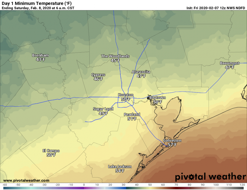
The morning will likely dawn with full sunshine, but I think we’ll see a mix of clouds and sun later throughout the day. Some very light rainfall will be possible during the afternoon hours, but I expect most everyone will stay dry. High temperatures will again get up to around 70 degrees. I’d expect temperatures on Saturday night to be about 10 degrees warmer than Friday night, as we enter a warmer, wetter, and more humid period for the region.