Our wet, but not too wet, and cool, but not too cold pattern will continue for the foreseeable future in the Houston metro area. One thing we can guarantee is that while the Sun does exist, there will be little direct evidence of it over the next week. Clouds, and more clouds, will rule the skies.
Thursday
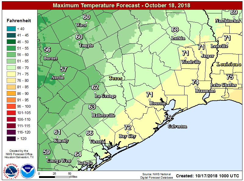
We’ve seen some light to moderate showers in Montgomery County early this morning, but these should exit the region to the north shortly after sunrise. Scattered showers will be possible today, but accumulations should be slight. High temperatures will be warmer than in recent days, likely around 70 degrees, although any regions that do see short breaks could push into the mid-70s. For the most part, just another gray day.
Friday and Saturday
The story heading into the weekend will be surging moisture levels along the Texas coast, and moving inland. For now, the most likely scenario is that these heavier showers remain well to the south of Houston, most likely in the Corpus Christi area, and staying well to the west of Houston. (The hard hit Austin region, where Lake Travis is nearing record levels, could well see more heavy rain this weekend.)
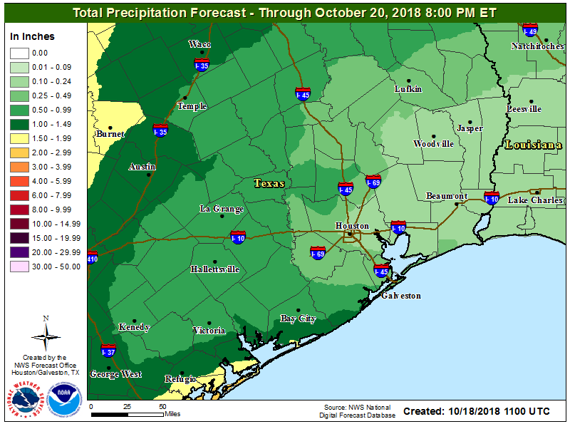
For Houston this means a healthy chance (probably around 50 percent) of showers on Friday and Saturday as this moisture moves inland and meets up with an oncoming cold front. For our city and surrounding areas, accumulations are likely to be measured in a few tenths of an inch, but we can’t rule out some heavier isolated storms.