Houston wrapped up five very wet days on Saturday evening, as a weak cold front finally ushered an extremely moist air mass off to the east of the region, and stabilized the atmosphere. Before discussing out more sedate weather ahead, first let’s look back at the five-day rain totals, and whether the flood scale we implemented this month was effective.
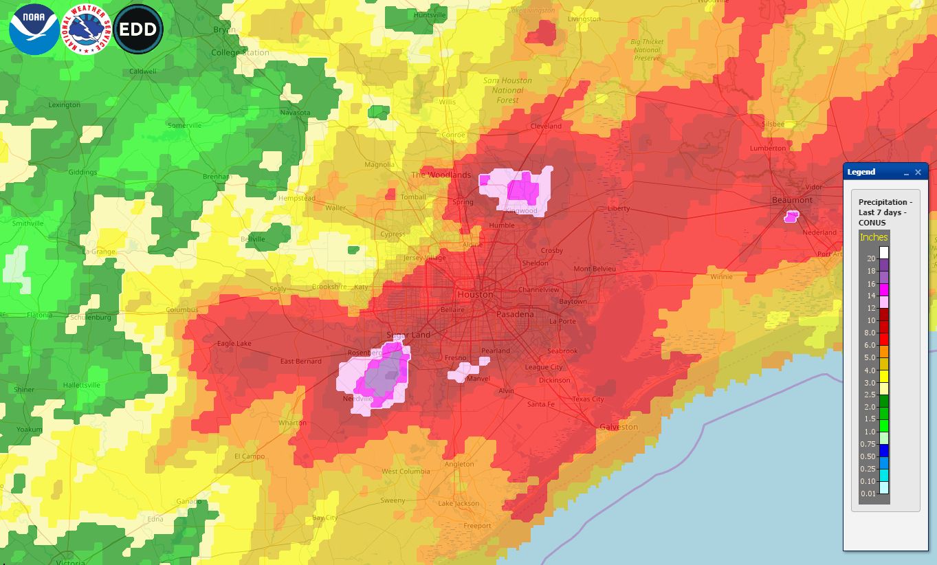
This map shows rain totals for the last seven days, and encapsulates the rain event that lasted from last Tuesday through Saturday. The greatest rain totals fell near Sugar Land, in the southwest part of the region, Kingwood, to the northeast, and Beaumont. One area near Sugar Land received 18+ inches, while the bright purple areas indicate 14+ inches. Overall, most of the Houston metro area received 6 to 12 inches of rain. Interestingly, one does not have to go all that far from the metro area to find a region, in this case Brenham, that received less than 2 inches of rain. This gives you some idea of the challenge of forecasting these kinds of precipitation events.
Flood scale
We introduced a flood scale to provide readers with a general expectation about upcoming flood events. Initially, we rated this five-day event as a “Stage 2 flood,” but after the intensity of Tuesday’s storms—which turned out to be the worst of the five days—we bumped these floods up to a Stage 3 event on Wednesday.

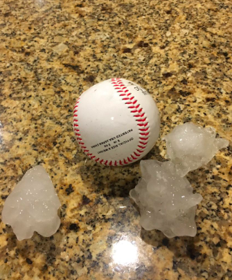
This feels about right in hindsight, given the five-day accumulations over some locations, but we’d welcome any comments or thoughts you have about the scale as we continue to refine it. Thursday night’s hail was also notable, and Matt may have some more to say about that the next day or two. Now, on to the forecast.
Monday
After last week’s storms, this week’s weather will be somewhat anti-climatic. Monday should be especially nice, with mostly sunny skies, highs in the low 80s, and for May, fairly dry air. Some clouds, along with southeast winds, return tonight with lows in the mid-60s. This would have been a great weekend day.