The radar is mostly quiet this morning across the region, but that will soon change with the onset of showers and thunderstorms later today. From there on we will enter a very wet, and somewhat unpredictable period, during which rainfall should peak from Thursday evening through Saturday. Below, we do our best to assess this mess, and use our new flood scale for the first time.
Tuesday
Generally, we expect rain showers and thunderstorms to develop south and west of Houston this morning, and then migrate north of I-10 later today. But admittedly, that is just a guess. The high-resolution models we use to predict the development of these small-scale storm systems have been failing us of late, so we don’t have great confidence in these storms. Accumulations of 0.5 to 1.5 inches are possible for some areas today, while parts of the region are likely to see no rainfall at all. Highs will only reach about 80 degrees. Lighter rain will be possible Tuesday night, but most of the region should see a break.
Wednesday
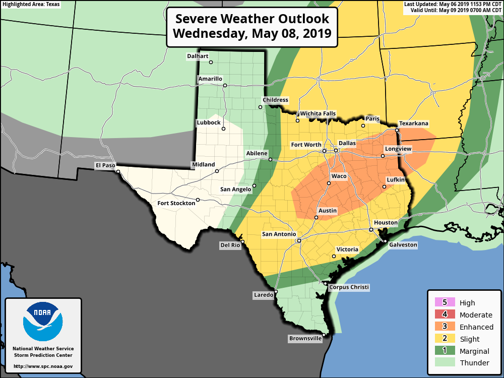
The weather story for Wednesday will be the propagation of an upper-level system across northern Texas, which will drive the potential for severe weather over parts of Texas, including Austin, and East Texas (see map above). It remains to be seen how close these storms come to the Houston metro area, but Waller, Walker, and Montgomery counties could well see damaging winds and hail in addition to 1 to 2 inches of rainfall. Southern parts of the Houston region may not see too much rain Wednesday.