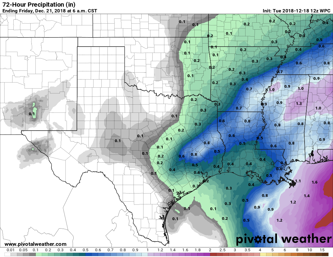
As of 6:15am, a few showers are lingering near The Woodlands and College Station, but for the most part this system should be moving to the northeast, away from the Houston area. Some scattered showers are possible today, but for the most part this should be it for the rain through the weekend.
Wednesday
Today will be sort of a waiting game, as the showers clear the area, but a related cold front lags about 24 hours behind. Highs should get into the mid- to upper-60s this afternoon, and skies could become partly to even mostly sunny later. Lows for much of the night probably will stay in the mid-50s until the front arrives before sunrise on Thursday.
Thursday
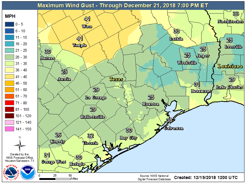
The front will blow in with purpose—its passage will likely be dry—and we’ll pretty quickly notice the cooler air and blustery conditions. Despite sunny skies, highs on Thursday may not reach 60 degrees, and it will be quite chilly with winds gusting above 20 to 25mph. Pack a windbreaker on your way out the door. Thursday night will probably be the coldest of the week, with lows in the mid-40s in the city, colder up north, and warmer along the coast.
Friday
Another sunny day, with highs likely around 60 degrees. The absence of a bracing northerly wind will make it feel nicer, however. Overnight lows may be a degree or two warmer than Thursday night, so still chilly.