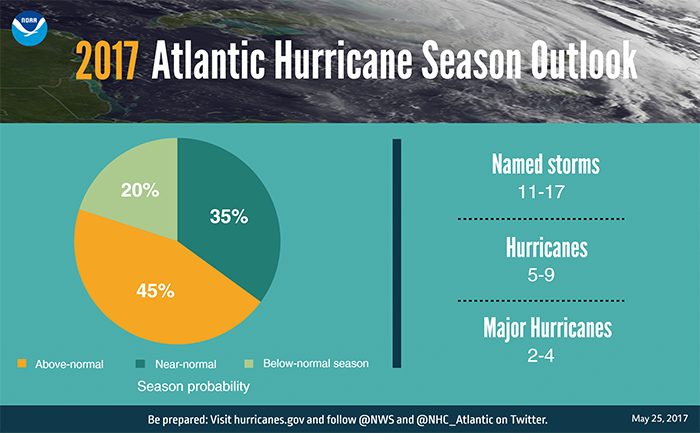
Welcome to the beginning of the 2017 Atlantic hurricane season! This year I’m thrilled to announce that Space City Weather has teamed up with an Extreme Weather Partner, Reliant, for the entire six-month season. And that’s a good thing, because although we don’t put too much stock into seasonal forecasts, there are some reasons to believe this season may be fairly active across the Atlantic Ocean, Gulf of Mexico, and Caribbean Sea.
As part of our agreement, Matt and I will be writing a handful of posts during the next six months about extreme weather, and some of the options residents have to prepare for hurricanes, power outages, and other weather-related problems that can arise in Houston. Beginning with this one, these will clearly be marked as sponsored posts, but will be written by us, for you.
Outages
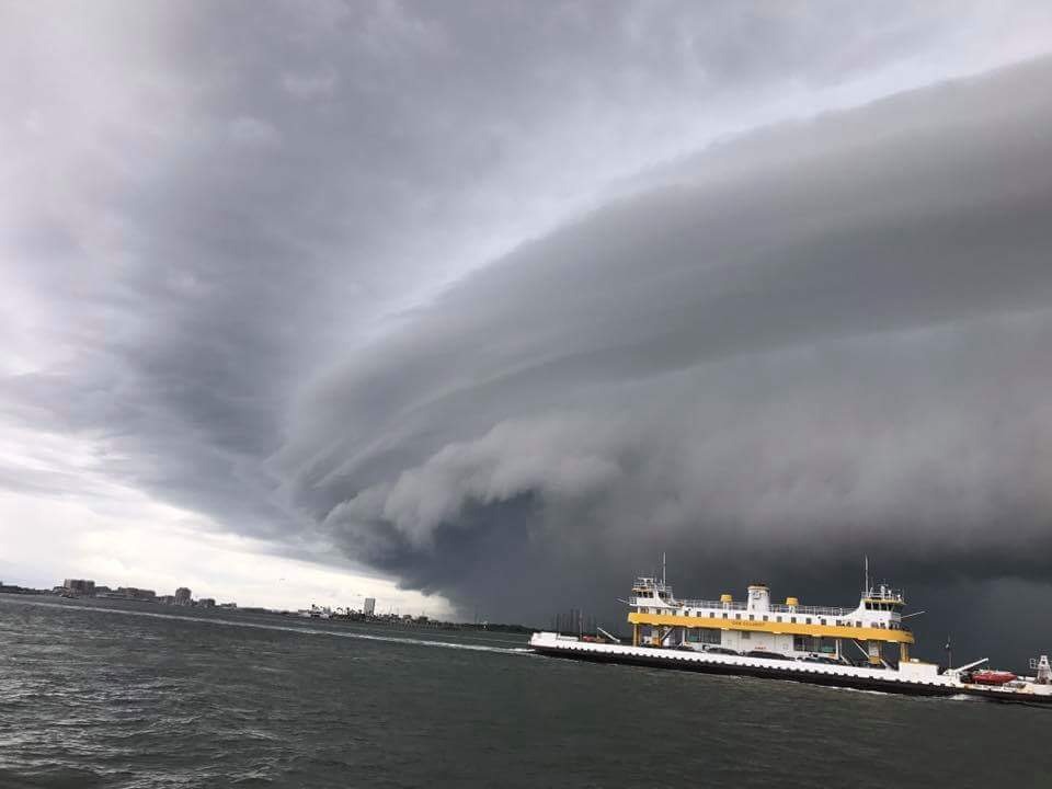
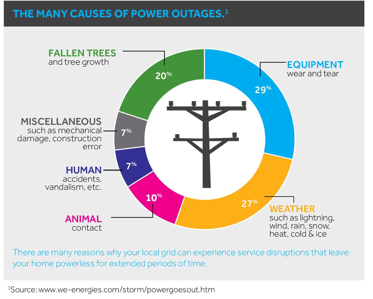
To kick off hurricane season, we’re going to delve into the topic of power outages and generators. Aside from life-threatening hazards and damage to one’s home or business, outages are among the most significant inconveniences during inclement weather. Anyone who lived in Houston during the aftermath of Hurricane Ike will know this well. Outages can be dangerous, too, as people sometimes attempt to operate gasoline-powered generators indoors, or take other extreme measures.
When the power goes out, thanks to the Internet, it is now easy to report the outage and get an update on when service is most likely to be restored. For most of Houston, the “poles and wires” infrastructure that delivers power to customers is CenterPoint Energy. They are the conduit for power provided by retail electricity providers like Reliant.