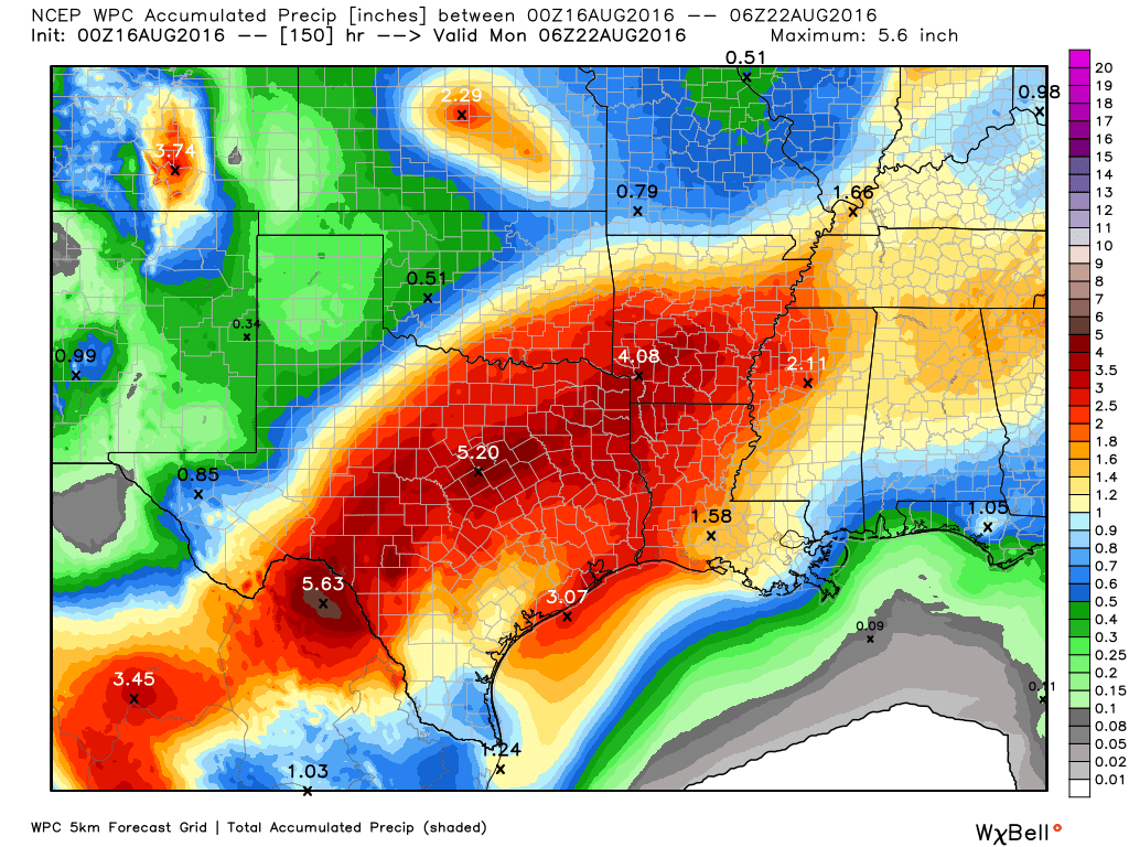
Houston experienced another wet day Monday, but with nearly all of the metro area receiving 2 inches of rain or less the water levels were manageable, and flooding limited as bayous were able to fall back down to near-normal levels.
As a bonus, highs generally only climbed in the mid- to upper 80s, and lows fell into the mid-70s this morning across much of the region. It feels—almost—nice outside. Especially for August.
Today
The greater Houston region remains under a flash flood watch through this evening, and it’s not hard to understand why. Although bayous are generally low, area soils are now wet, and any rain that falls will flow directly into bayous. With atmospheric moisture levels still quite high, it will be possible for some isolated areas to pick up an additional 3 to 5 inches today, the National Weather Service warns.
With that said, most of Houston will likely see a day similar to Monday—mostly cloudy skies punctuated by some relatively short-lived but potentially intense thunderstorms. I’m hopeful we will not see widespread flooding, but given the moisture in the atmosphere we can’t rule it out. Be sure and enjoy those highs in the 80s.
Wednesday and Thursday
Atmospheric moisture levels will slowly fall, and along with it we should see slightly fewer daily showers, and those that form should have a bit less intensity. We’re still likely to see rainfall, but the threat of significant flooding should decrease as we get further into the work week. Highs will remain seasonally cool, in the mid- to upper-80s.
Friday through Monday
Higher pressures will move into the Houston area by Friday or Saturday, which should begin to limit shower activity. I’d still expect a decent chance of showers and thunderstorms during the late morning and afternoon hours, with daytime heating, but they should be less organized. Nevertheless the clouds and rain chances should limit highs to the upper 80s to low 90s—a very nice change from the extremely hot start to August.
Tropics
As I noted yesterday, the Atlantic tropics are about to start heating up again, and we could have Tropical Storm Fiona in a couple of days in the deep Atlantic. Fortunately, it appears highly likely this system will recurve before approaching the Caribbean Sea, and be of no threat to land.
Expect more storms to come behind Fiona in the next couple of weeks.
Posted at 7:15am CT on Tuesday by Eric
My son is driving back to Dallas Thursday. What does it look like traveling up 45?
Should be fine, IMO. He may hit some rain but nothing too terrible as long as he stays on the freeway.
I know it’s still way early, but does your “crystal ball” mention fall-like temps any time soon?…lol.
Hopefully in about a month.