This post summarizes the historically wet period from the spring of 2015 through the summer of 2016 for the greater Houston area. Not only did the region set a record for total rainfall, it also experienced an astounding six significant rainfall events in just a little more than 12 months. Read on for a full analysis.
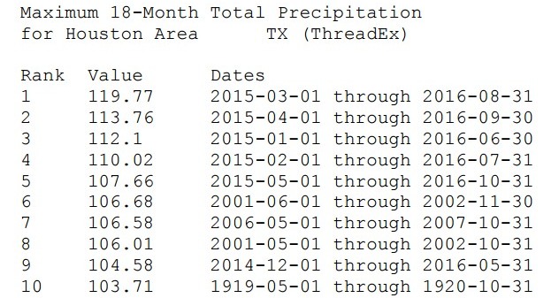
Based upon data from the National Weather Service, the 18-month period from March 1, 2015, through August 31, 2016, ranks as the wettest 18-month period on record for the city of Houston. In fact, the table below shows that each of the top-five wettest 18 month periods in Houston came during the last two years. Prior to 2015, Houston’s wettest consecutive 18 months had yielded a total of 106.68 inches. The March 1, 2015, through August 31, 2016 period annihilated that record by more than a foot of rain, with a total of 119.77 inches.
Here’s the data:


