Grim, gray weather has persisted across the Houston metro area on Saturday, but by far the heaviest rains have developed along the coast, where as much as 10 inches of rain have fallen in the last 24 hours. The following map shows estimated satellite rainfall accumulations through the middle of Saturday afternoon:
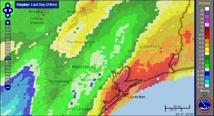
Officially, at of 4:15pm CT, the city of Galveston has recorded 6.14 inches of rain on Saturday, and when the city reaches 6.31 inches it will surpass Dec. 17, 1995, as the wettest December day ever recorded on the island.
Rest of today
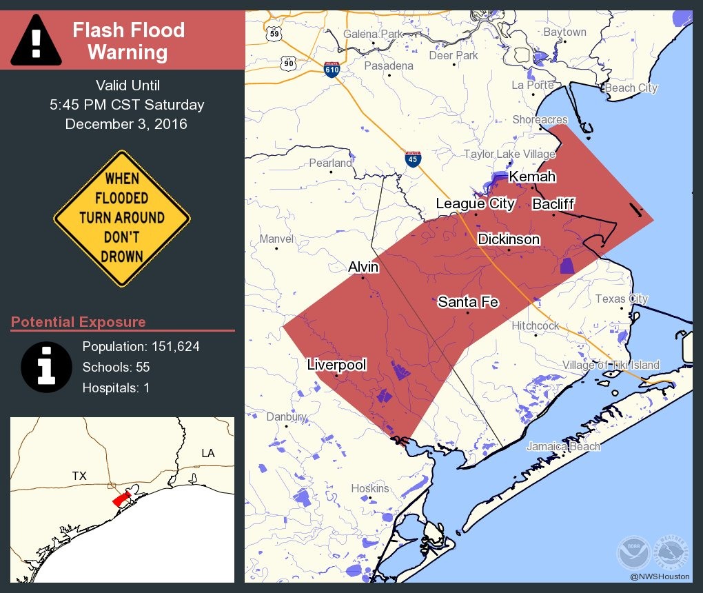
A flash flood watch remains in effect for the entire area through Sunday evening, but as we’ve seen the heaviest rains have set up along the coastal counties, that’s where the biggest concern lies. Accordingly a flash flood warning is in effect through 5:45pm CT on Saturday for northwestern Galveston, and northeastern Brazoria counties. Grounds there are now fully saturated.