Rainfall this afternoon was quite vigorous across the Houston area, with a few places seeing as much as an inch of rain in about 15 minutes’ time.
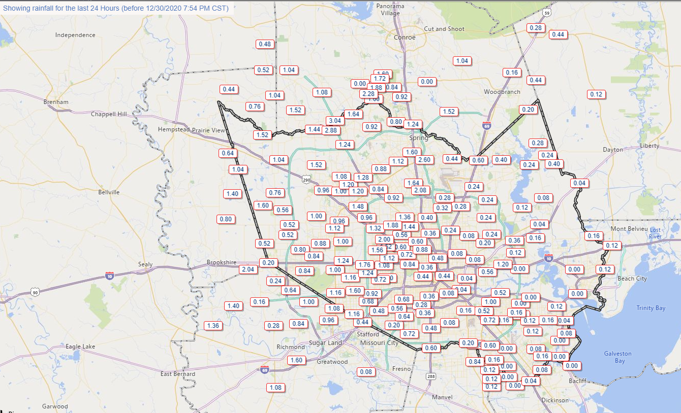
This has added up with the gauge at Spring Creek and SH 249 for instance already over 3 inches of rain today. For most areas, this has been manageable with just some minor street flooding.
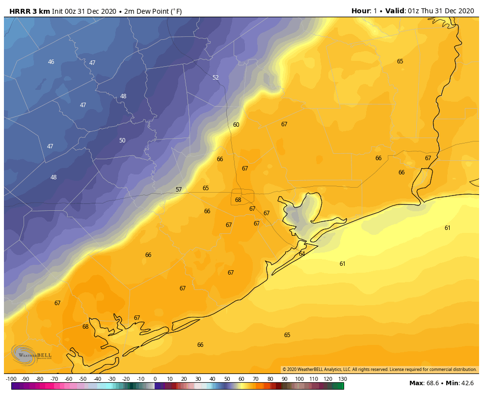
The trouble tonight is that the front is going to approach and stall west of I-45 for a time. You can see this well on the HRRR model for example, which is showing the front (roughly the boundary between warmer and cooler colors here) stalled out over Harris County tonight and into tomorrow morning. This animation runs from 7 PM Wednesday to Noon Thursday.
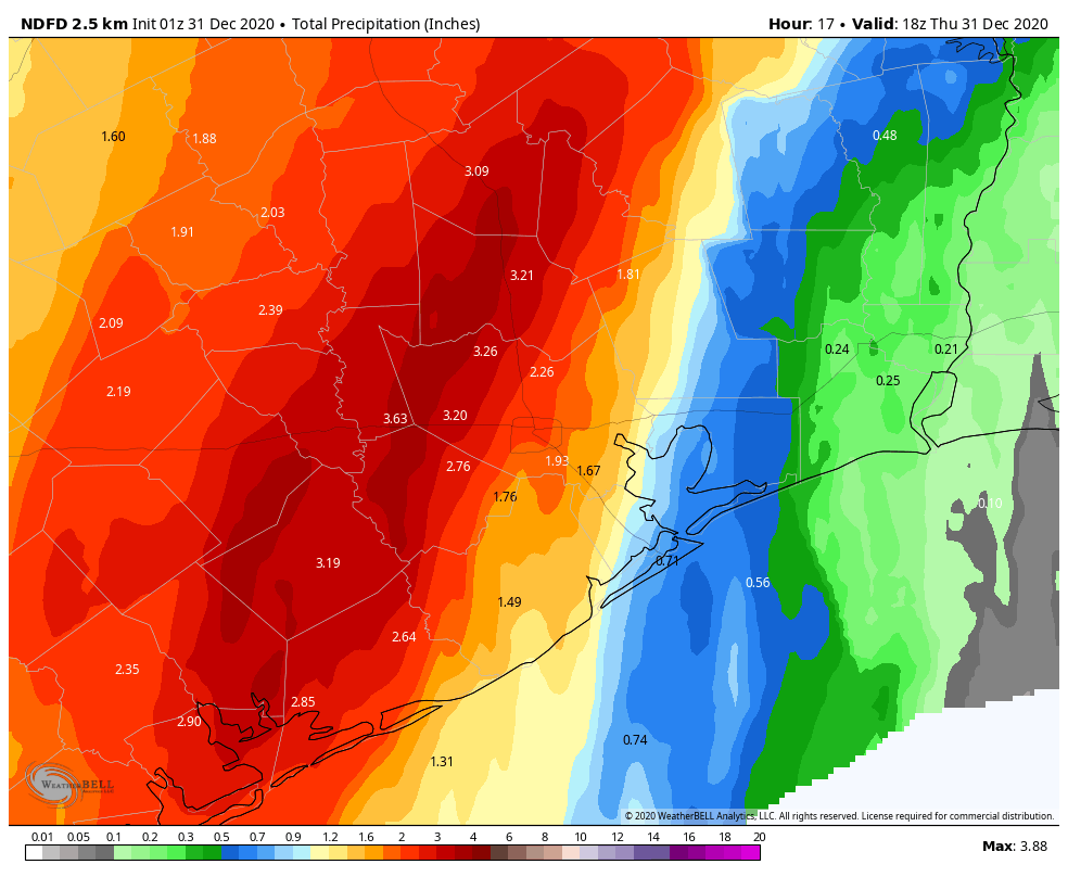
In this time, repeated rounds of rainfall, some heavy, will impact areas primarily west of I-45 (until you get north of Conroe). Additional rainfall during this time on top of what has already fallen, will average about an inch or so east of Houston and 1 to 4 inches west of the city (presume about 1 to 3 inches in the city itself). There will likely be some pockets of higher amounts up to 5 or 6 inches or so west of Houston. Those higher amounts would be most likely in western Harris, western Montgomery, Grimes, Fort Bend, Wharton, or Waller Counties.
This could lead to some localized flooding, and for that reason, we are going to implement the Space City Weather Flood Scale at Stage 1 for tonight and Thursday.
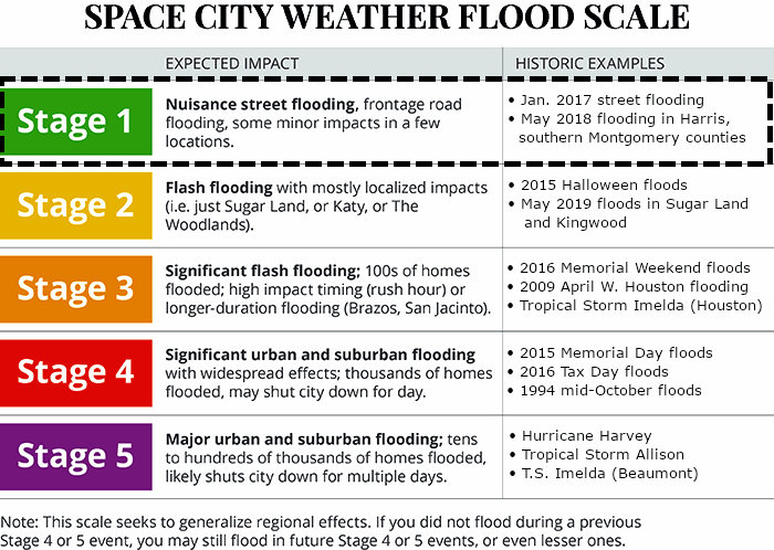
We will go with a Stage 1 event for the western half of the area, which generally means mostly nuisance street flooding. But there will likely be rises on area creeks as well, particularly Willow Creek, upper Spring Creek, and upper Little Cypress Creek. So we will watch and escalate if necessary, but we think this will behave for the most part in our area. Still, please exercise caution, especially if you have to be out for whatever reason tonight and tomorrow morning. A Flash Flood Watch is posted for Houston and points west through tomorrow afternoon.
Rain should rapidly end from southwest to northeast across the region tomorrow afternoon and evening.
In addition to the rainfall, we did see a tornado warning at one point for Harris and Fort Bend Counties this afternoon. We think the severe threat will be fairly minor tonight, but we can’t entirely rule out a storm or two trying to get a little excitable, particularly if it can develop east of the front. For folks in Galveston, Chambers, and Liberty Counties, this would be the primary way you would see rain tonight, from a rogue storm or shower ahead of the main action to the west. Not too serious a concern right now, but something we’ll keep tabs on.
More from Eric in the morning!