Sorry for a later update than I would have hoped. Cable/internet outage due to storms and daddy duty called!
Lots of rain in and around the Houston area today, so we want to provide you a quick refresh on what’s going on with this rain, the tropics, and what to expect to start your week.
Monday & Tuesday rain
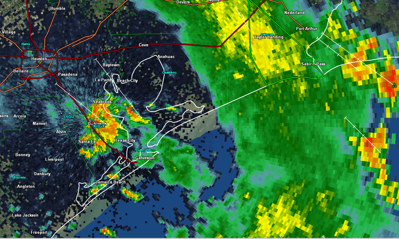
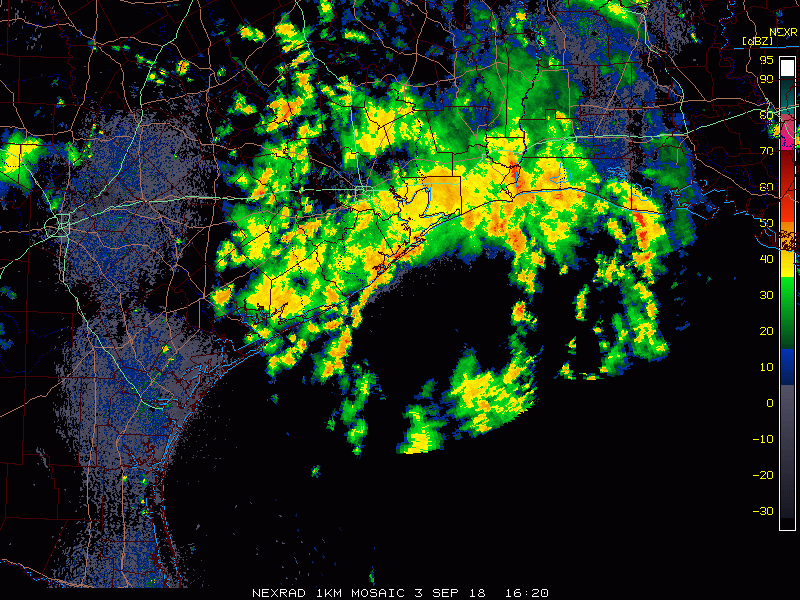
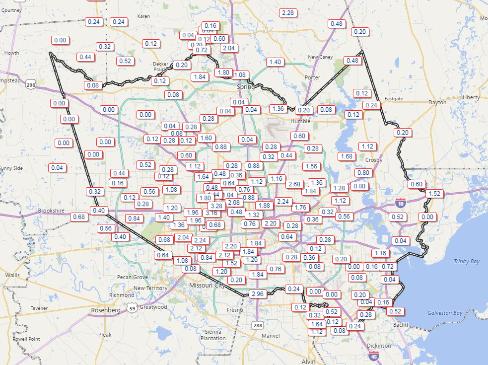
Radar as of this evening shows rain winding down across the area. Total rainfall over the last two days has been variable, with some places seeing minimal amounts and others seeing 2-3″ or even a little more.
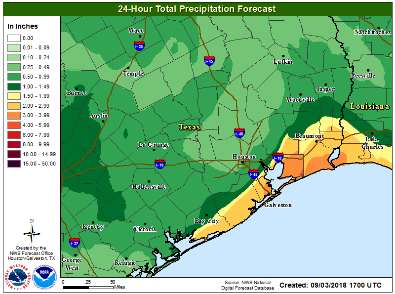
Expect a mostly quiet night tonight. But, as we go into tomorrow, a number of things may come together to produce another round of heavy rainfall in the area. Eric will have more on the timing and the where tomorrow morning, but I would have the umbrella by the door tonight at the ready before you head out for work or school.
Look for more showers and thunderstorms in the area Monday night or Tuesday. It’s tough at this timescale to narrow down specifics, but suffice to say, locally heavy rainfall will be possible. A Flood Watch isn’t posted for the area, but depending on how we do tomorrow, we may need one Tuesday. Street flooding is the main concern with this event.
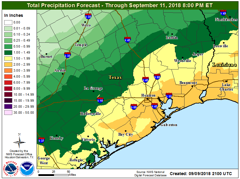
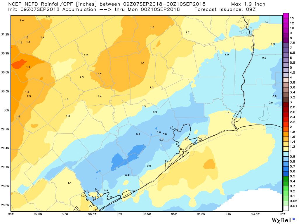
How much rain? On average, we expect most folks will see another 1-3″ on top of what’s fallen. Since “average” is just a combination of extremes, that means some folks may see less than an inch and others may see four or five inches of rainfall. Again, we don’t expect widespread problems and street flooding is the biggest concern right now.