Eye on the Tropics: July Lull

Since our post last week, Tropical Storms Bonnie and Colin have formed and exited the Atlantic basin. Looking ahead, those should be the last storms for a bit.

Tropical outlook in a sentence

Over the next week (or longer), we are not expecting any new systems of note in the tropical Atlantic.

Bonnie & Colin

This time last week, we noted that PTC #2 would likely become Bonnie and “has a chance to become a hurricane as it approaches Central America, but it probably has equal chances of not being one too.” As it turns out, the latter was correct. Bonnie’s forward speed and a bit of shear was just too much to overcome, and the cyclone never organized until it moved into the Pacific. Since it held itself together across Central America, it retained the name Bonnie, and is heading out to sea.

Bonnie finally did become a hurricane, and it’s marching out to sea in the Pacific Ocean. (NOAA)

Meanwhile, Colin formed briefly off the Carolina coast, somewhat of a surprise from last Tuesday’s post. Colin didn’t last long, about 24 hours from Saturday through Sunday, and it dumped a few inches of rain in parts of the Carolinas.

2022 to date

With Colin’s development, that puts us at 3 tropical storms as of July 5th. They’ve combined for an “accumulated cyclone energy” of about 2.8, which is right on normal for this point of the season.

The accumulated cyclone energy of the 2022 Atlantic hurricane season is right at normal for the moment, while our 3 named storms is more typical of early August. (Colorado State University)

ACE tallies up how long a storm maintains a certain intensity during its lifetime. The bigger the storm, the bigger the ACE, and obviously the more of those storms in a season, the higher the value will be. Typically, our 3rd storm does not form until early August, so from that point of view, we’re cranking. But they’ve all been fairly weak systems, so overall our season is off to a mostly normal start, which is nice for a change.

That said, note from the chart above that we still have roughly 97.7 percent of the season ahead of us from an ACE standpoint. Again, it’s normal for the early season to be generally weak.

Looking ahead

Over the next 7 to 10 days, we are not expecting any tropical development in the Atlantic. As always, you could get a Colin scenario, where something brief and weak can spin up close to home. Short of that, however, it appears dust and minimal tropical waves of note will be the story over the next week and probably a bit longer. Dust tends to indicate dry air is present, which is not something tropical storms care for. This is also the time of year we expect widespread dust over the Atlantic basin.

Yellow, orange, and red colors indicate Saharan dust over a broad chunk of the Atlantic Ocean, something not terribly uncommon for this portion of the season. (University of Wisconsin SSEC)

Some of the typical things we’d look for to kickstart tropical activity are sitting out there on the horizon per the models, so I would expect maybe the last week to 10 days of July to provide some items to watch, but that’s purely speculative right now. For now, enjoy the quiet we have and use it as an opportunity to ensure you’re set for the August and September gauntlet.

Recapping Houston and Galveston’s hottest June on record, as rain chances dwindle after today

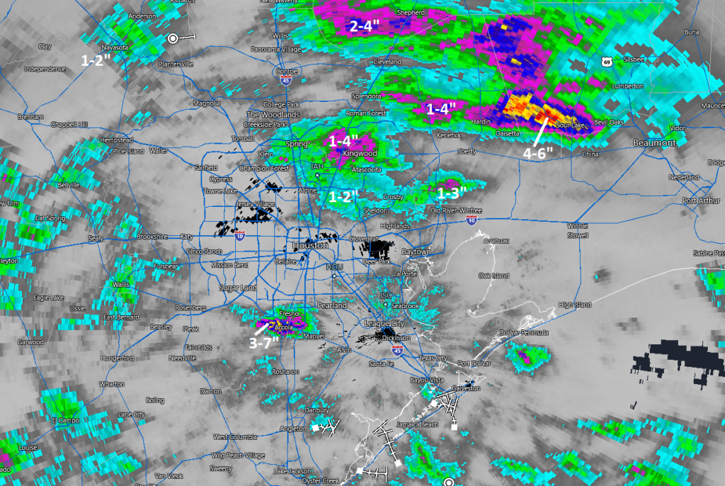
Good morning. It’s pretty evident that the heaviest rain will fall to our east today. That said, there are still storms and heavy ones at that in the area. A storm east of downtown dumped nearly 3 inches of rain in an hour as of 6:20 AM, where Brays Bayou crosses Lawndale Street on the East side. That amount of rain that fast can cause street flooding, so do keep this in mind this morning as these downpours lift north and east across the area. You may encounter street flooding, so please use caution and don’t drive through flooded roadways.

Radar as of 6:25 AM shows heavy downpours on the eastern side of the city, with the most heavy rain closer to Beaumont and Port Arthur. (RadarScope)

So with all that being said, obviously, this will probably end up a very disappointing system for our region as a whole, especially if you live on the west side. Coastal areas did well yesterday, and today’s rain will certainly be welcome. But still. While we aren’t heading back into the pattern we had in June, at least not as extreme, it will turn hotter and drier again. We’ll have some daily rain chances to cling to each day, but that’s a proverbial drop in the bucket in terms of what is needed to eradicate drought.

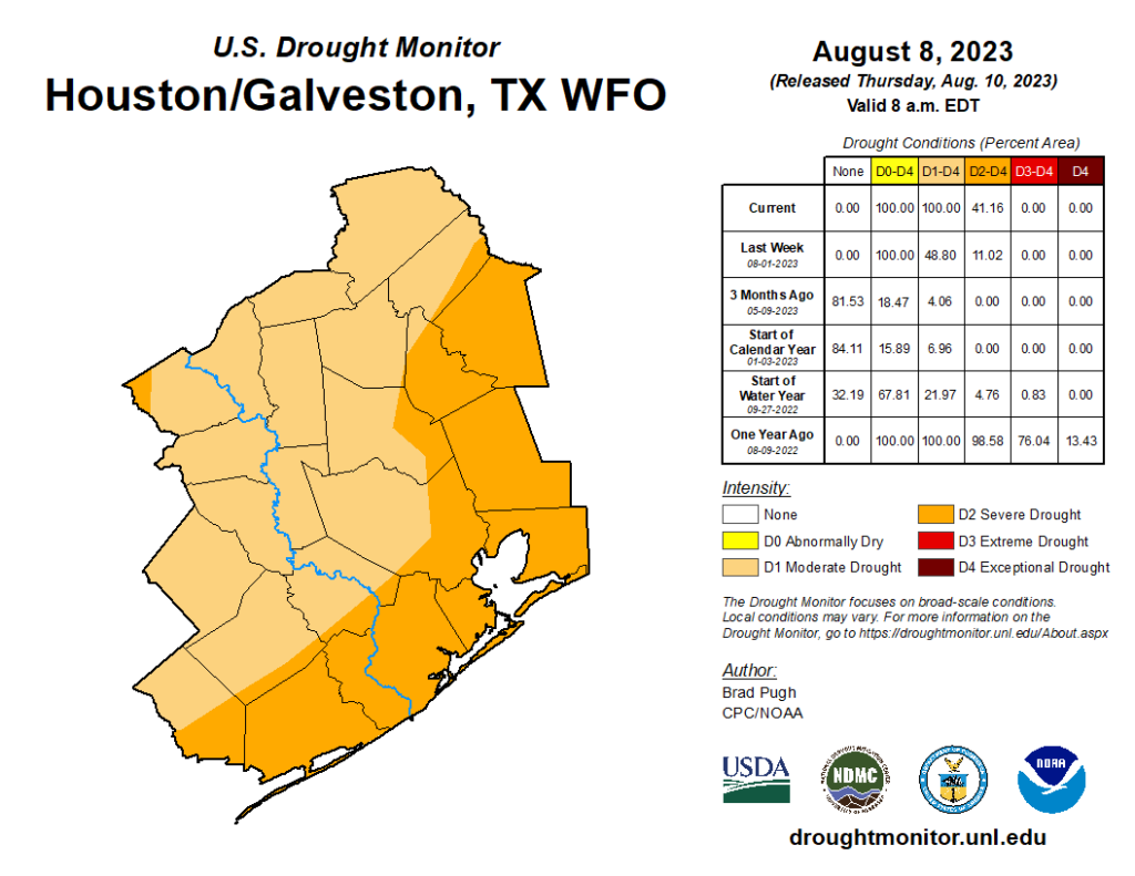
Speaking of, the drought monitor update from yesterday, which includes rain through Tuesday showed that drought had expanded to cover virtually the entire Houston region now, a very large increase in such a short time.

Drought coverage expanded to officially include almost the entire region, with the significant drought continuing south of I-10. Rains since this past Tuesday will help a bit but may not cut back coverage much. (US Drought Monitor)

Depending on how the next few weeks evolve, this could start to become a very bad drought for our region, or just sort of hang in place “as is” for awhile. I’m personally not particularly optimistic given both nearer-term guidance and longer-range guidance, which continues to suggest below average rainfall. With the holiday weekend celebrations ahead, please be mindful of burn bans (which cover almost the entire state), and please be extra cautious with fireworks this year. I have not heard of any local fireworks bans beyond already existing regulations, but that doesn’t mean dry ground can’t ignite in some accidental situations. So the best advice is to use more caution than usual this year.

Rest of today

This morning’s rain and localized downpours will continue off and on through the morning, likely shifting east and weakening this afternoon. Most areas east of I-45 will see some rain, but amounts will widely vary from another 1 to 3 inches in spots to just a few tenths in others. West of I-45, you will see isolated showers or storms, with many spots seeing nothing. The exception will be south of Houston. Areas across much of Brazoria and Galveston Counties will continue to see scattered storms into early afternoon.

Readers checking us out from Beaumont & Port Arthur will note some very heavy rain, especially in Port Arthur this morning. I would presume street flooding is likely to begin there soon on a wider scale basis. Use caution in that area this morning.

We only managed 82° officially yesterday at Bush Airport, about 6 degrees warmer than the record coolest high temp for the date. Clouds today should hold us back again. Look for low to perhaps mid 80s.

Weekend

With the tropical low lifting away, we’ll gradually slip back into a more normal summer pattern. Look for a chance of scattered showers or storms tomorrow, but coverage likely won’t exceed 30 or 40 percent and again focused to the east of downtown Houston. Sunday sees even lower rain chances, probably below 20 percent. Look for highs to recover into the low or middle 90s, with lows back into the upper 70s.

Next week

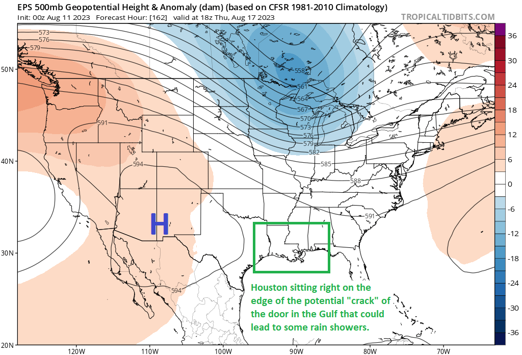
The weather pattern next week is likely to be dominated initially by a moderately strong ridge of high pressure over Texas. This should keep us mainly dry through Tuesday with mid to upper 90s. On Wednesday and Thursday, we’re likely to see the high pressure relocate into the Rockies. Normally, this would open up the Gulf more and allow for higher rain chances. In this case, the high also expands significantly.

A 600 decameter ridge over Colorado next weekend means we’ll likely stay hot and mostly dry after a brief uptick in rain chances mid to late week. (Weather Bell)

This will give us maybe a day or two of increased rain chances Wednesday and Thursday, but probably no better than 30 percent or so. Otherwise, look for mid to upper-90s to persist, and perhaps drier weather into the weekend. Seeing a 600 decameter ridge on the map above is really impressive for a 50 member ensemble mean. This means that the model is highly confident in a very strong heat pattern for the interior West, likely expanding to include most of Texas heading toward the week of the 11th. It won’t be as hot relative to normal as June saw, but it will still be very, very hot.

June recap

We’ll close with this: June 2022 was the hottest in Houston’s recorded history. Our average temperature in June was 86.7°, which broke 2011’s record by a half degree (86.2°).

It was also the hottest June on record in Galveston by over a full degree. June 2022 saw 87.5° for an average temperature, compared to 86.2° in June 2011. 87.5° for a month is hotter than any July on record as well. In fact, June 2022 will end up being the 4th hottest month of any month on record in Galveston. Of the 60 possible high and warm low temperature records Galveston could have set in June, they set or tied 19 of them, over 30 percent. Galveston’s records extend back to 1874.

A number of factors all play into these records: An extremely warm Gulf of Mexico, the drought, a stagnant weather pattern, urbanization, and, yes, climate change. Hopefully July is better behaved.

Eye on the Tropics: Let’s get this party started

Welcome to our first edition of Eye on the Tropics for the 2022 hurricane season. Each Tuesday, Eric or myself will get you caught up on the big picture in the Atlantic basin. From now into August, it gives us a space to expand on some tropical thoughts a bit more expansively than we can in our morning posts. Usually by mid-August there’s enough happening each day to include in our regular emails. Until that time, though, we’ll cover the bases on Tuesday.

Tropical outlook in a sentence

We have a fairly active Atlantic basin, especially for late June, and although no storm is expected to be significant we have something to watch close to home with Invest 95L in the Gulf of Mexico.

2022 to date

Through this morning, we have had one named storm this season. We were up to the “D” storm by this point in the season in both 2021 and 2020. Good omen? Perhaps, but this is really just normal for June. It’s typically not that active of a month. We normally see storm two in mid-July. So instead of being a month or more ahead of schedule this year, we’re only about two or three weeks fast. Progress!

Gulf system (Invest 95L)

Eric had a very thorough and fine write-up on this system and how much rain it could bring to Texas this morning. I won’t reinvent the wheel here, and I encourage you to read his post for the latest.

Potential Tropical Cyclone 2

Elsewhere, we have nothing to worry about in the tropics, but things are active. A common question we get this time of year involves people planning trips to various tropical paradises. They want to know if they have to worry about “that thing out there.” That’s why we’re here!

Potential Tropical Cyclone #2 will approach Trinidad later today and it should scrape the coast of Venezuela on its way toward Central America. (NOAA)

Potential Tropical Cyclone Number Two is located just east of Trinidad and Tobago. That’s a mouthful, but in simple language: It’s a system that meets tropical storm criteria (winds of 39 mph or higher) near land, but lacks a defined center just yet. It’s moving steadily westward, potentially on a collision course with <checks notes> Venezuela. Not a lot of history of storms in June and July this far south. In fact, if PTC 2 can develop into an actual tropical storm, it would be one of the farthest south this early on record.

A map of all known June and July storms traveling within 60 nautical miles of where PTC 2 is expected to go near Trinidad and Venezuela later this week. It’s not many. (NOAA)

The good news is that track forecast confidence is very high with this storm now. We have very little serious deviation between models or ensemble members, which gives us good support for a predictable outcome. In this case, it involves PTC 2 hauling due west, with maybe just a slight northward component. But ultimately, it’s likely on a collision course with Nicaragua or perhaps Honduras. As confident as we are on track, the opposite is true about intensity. Given its historically hostile location (the eastern Caribbean), the time of year, its proximity to land, and the fact that it’s moving around 20 mph or faster, there are a lot of extraneous factors that could impact the storm’s intensity negatively. Yes, this has a chance to become a hurricane as it approaches Central America, but it probably has equal chances of not being one too.

If your travels take you to the islands or Mexico, you probably have no issues to worry about. Elsewhere in Central America, it’s worth continuing to watch. The good news is that this thing is moving fast enough that it will probably emerge into the Pacific Ocean fairly quickly. So hopefully that leads to minimal flooding issues in Central America.

To note: The next name on the list after Alex is Bonnie. So if PTC 2 can develop, it will get that name. Sadly, the “C” storm is not Clyde, it’s Colin.

Other Atlantic items

The National Hurricane Center is offering 20 percent odds that another tropical wave can develop in the Atlantic over the next 2 to 5 days.

PTC 2 at left and the 20 percent chance wave at right in the Atlantic earlier this morning. (Weathernerds.org)

At this point, model support is pretty mediocre on this one, unlike PTC 2, which had pretty robust model support. So, while we’ll continue to watch this wave, honestly, there’s nothing intelligible we can say about its future at this time. Unlikely to develop, but there’s a small chance. We’ll see where we are next week.

Beyond that, there’s nothing on our radar for the next 10 days or so. Hopefully we can enjoy another July lull this year after a fairly busy start to the month. More next week!

Do abnormally hot Houston Junes typically lead to an abnormally hot rest of summer?

Good morning! The thermometer topped out at 101 degrees yesterday officially in Houston, which tied the record for June 23rd, last set in 2009. It’s hot, it’s going to continue, but we still think next week will be slightly, if not much improved. More on all that in a second.

The most common questions we have been getting of late are two-fold: “How similar is this summer to 2011?” (the epic drought summer), and “Does a hot June portend a hot July and August?” Let’s start with the 2011 comparison.

First off, while the drought is not as severe, 2022 has been hotter than 2011. The May 1-June 23 period checks in at an average (high + low, divided by two) of 83.4°, which smashes the record of 81.8° set in 2011 and again in 2018. The difference between 2011 and 2022 at this point is the extremeness of the heat. We are lagging 2011 in terms of warm temperature records set. But the consistency and persistence of stronger than normal heat is ridiculous. Our last below normal day was June 3rd. Depending on exactly how next week shapes up, we should see our hottest June on record this year.

May and June of 2011 featured some more extreme daytime heat across Texas, but this year is seeing more persistent heat, especially at night. (High Plains Regional Climate Center)

Interestingly, 2011 was hotter during the daytimes, but June 2022 is running almost 2 degrees above 2011 at night. And don’t even get me started on Galveston. The Island has set or tied *33* warm low temperature records just since May 1st. These are signals consistent with climate change, urban sprawl, and a very warm Gulf in our backyard.

The second question about whether we can derive any insights for the rest of summer based on June’s outcome is a little trickier to answer. In general, what occurs in June has very little in common with July and August outcomes here in Houston. We can see this on a scatter plot, which simply compares the June average temperature on the y-axis with the July average temperature on the x-axis.

Since 1950, the correlation between June and July temperatures has been positive (hot Junes tend to favor hot Julys), but it’s pretty weak.

The chart above shows June vs. July in Houston. A June vs. August or July vs. August chart would not look too dissimilar. There’s definitely a loose correlation (hot Junes do favor hot Julys), but it’s pretty weak overall.

Now, what if we just look at some more significant drought summers. Drought would typically imply a stable pattern, much like we’ve seen this year. So I went back and looked at the Texas averaged Palmer Drought Severity Index (PDSI) by month back to 1950. I parsed out the March through May values and extrapolated out an approximate June 2022 value. In other words, I looked at a drought classification for all of Texas between March and June and found the 13 closest matches to 2022. Does that change the outcome? For July it does, significantly so. Remove 2011 from the sample, and there is virtually no correlation whatsoever.

There is very little correlation between June and July temperatures during years with dry March-June periods.

But what of August? That story appears a bit different.

There is some signal suggesting a hot June in a dry year boosts the odds of a hot August, though the sample size is a bit too small to say so definitively.

While there is a very nice correlation showing up here, a sample size of 13 summers feels just a little too small to say anything definitively. In fact, if we again remove the hottest outcome there, 2011, it cuts the R^2 value almost in half, implying a much weaker correlation.

What is the takeaway here? A hot June tells us very little about the subsequent July outcome other than it may also tend to be on the hotter side. A hot June in a drought year may also slightly favor a hot August outcome, but the sample size is too small to say anything with confidence. So, if you are hoping that the rest of summer is not as abnormally hot as June, you do have at least some hope here.

Drought update

With new burn bans and water restrictions being issued daily across the region, a look at the drought map explains why.

Locally, we didn’t see much drought expansion this week, but the state as a whole continues to trend in the wrong direction. (US Drought Monitor)

The coverage of drought changed little across our area with yesterday’s update, and the southern half of the region remains in D3, or extreme drought conditions. But we continue to receive minimal relief. That may change next week, however.

Today through Sunday

Hot, hot, hot. Look for temperatures near 100° or hotter each afternoon with just the slightest chance for a shower or storm. Morning lows should be in the 70s inland and 80s near the bays and Gulf and perhaps in the Inner Loop. Heat index values should flirt with 105° each afternoon, so please use caution outdoors.

Next week: Ch-ch-ch-ch-changes

As the upper level high pressure system responsible for our scorching weekend escapes westward next week, this will open the Gulf up for daily thunderstorm chances. In any other summer, next week would not look overly impressive. Given how little rain we’ve had, however, just the chance at daily showers returning will likely make a big difference, at least temporarily.

Rainfall between Monday and next Friday morning should average around a half-inch or a bit more south and east of Houston. Higher amounts are likely in spots, perhaps up to 1 to 3 inches. (Pivotal Weather)

I think the highest odds for more widespread coverage of showers will be on Tuesday, Wednesday, and perhaps Friday. We’re looking at something like 30 to 40 percent coverage of showers on average each day, with perhaps a couple days seeing 50 or 60 percent coverage. This means that you probably won’t see rain every day, but most of us will see at least some rain on a couple days. Let’s hope for around a half-inch of rain on average next week, with a few more frequently hit spots picking up 1 to 3 inches perhaps. It won’t end the drought, but it will definitely help.

As a result of the showers and clouds, look for high temperatures to back off into the mid-90s or low-90s most days. Lows should remain in the 70s.

Tropics

The National Hurricane Center has increased the odds of development of a disturbance in far eastern Atlantic to 60 percent over the next five days.

The odds of an Atlantic disturbance developing into a depression or tropical storm over the next 5 days have increased to 60 percent today. (NOAA)

This is rather far east for a system to develop at this point in the season, so it’s certainly noteworthy. However, from a Gulf Coast-centric perspective, this has a long, long way to go. Initially, my thought is that after next week’s rainy pattern, a hotter, drier pattern is going to attempt to again re-establish over Texas for the week of July 4th, which would be about the time this disturbance makes it into the vicinity of the Gulf. A stronger system would likely turn north before getting here, while a weaker system would likely be squashed by that ridge and forced into Mexico or Central America. So at this point, I don’t view it as something to worry about, but it’s worth checking back in on after the weekend.