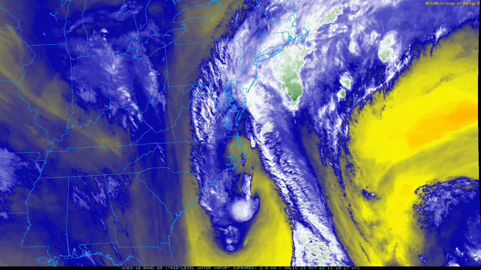
Alright, good morning Houston! Y’all good after last night’s Astros game? I mean, wow. For those that don’t know I (Matt) grew up a Phillies fan, so this series is both easy to watch and tremendously difficult. Last night was incredibly stressful across the board! The good news is that the weather forecast in Houston isn’t too stressful this weekend, except for maybe tonight. The primary weather story for probably the next 5 or 6 days will be that cold front tonight. It should be in and out of our area fairly quickly, but it may deliver some stronger storms before departing.
Today
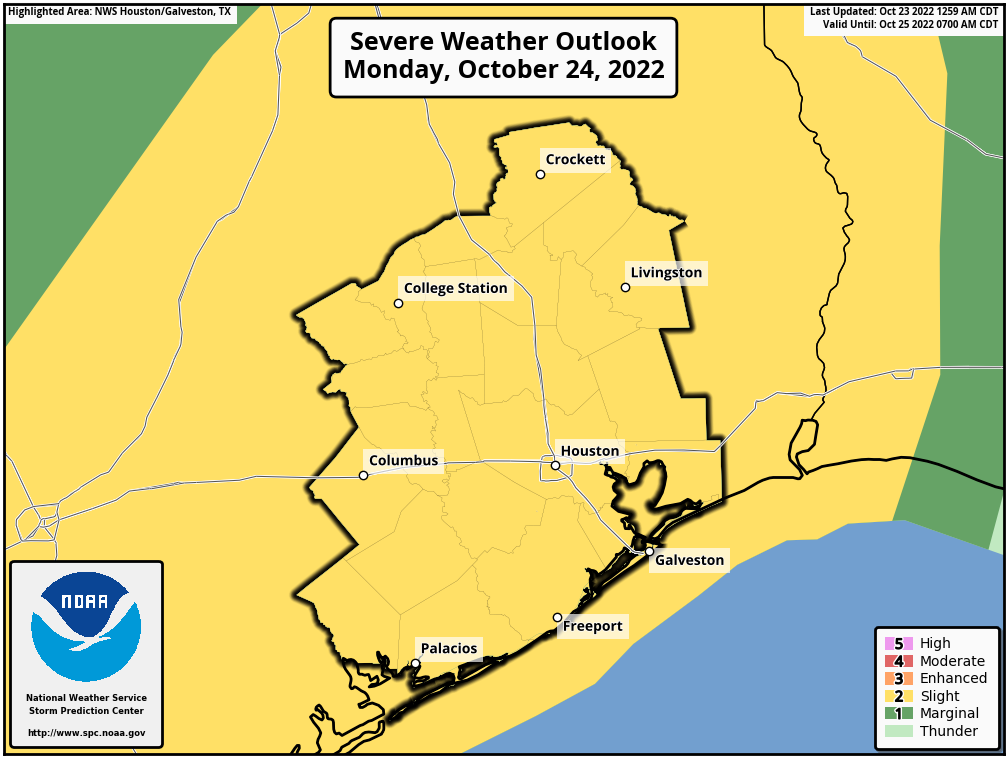
For the most part, we should see minimal issues during the daylight hours today in the Houston area. There should be a few showers around through early afternoon, but any rain would be fairly brief. I wouldn’t entirely rule out a rumble of thunder, but any severe storms during the daylight hours today will almost certainly be far to our north or west. I would be eyeing north of Huntsville through Dallas east to Tyler for the highest chance of severe weather before sunset.
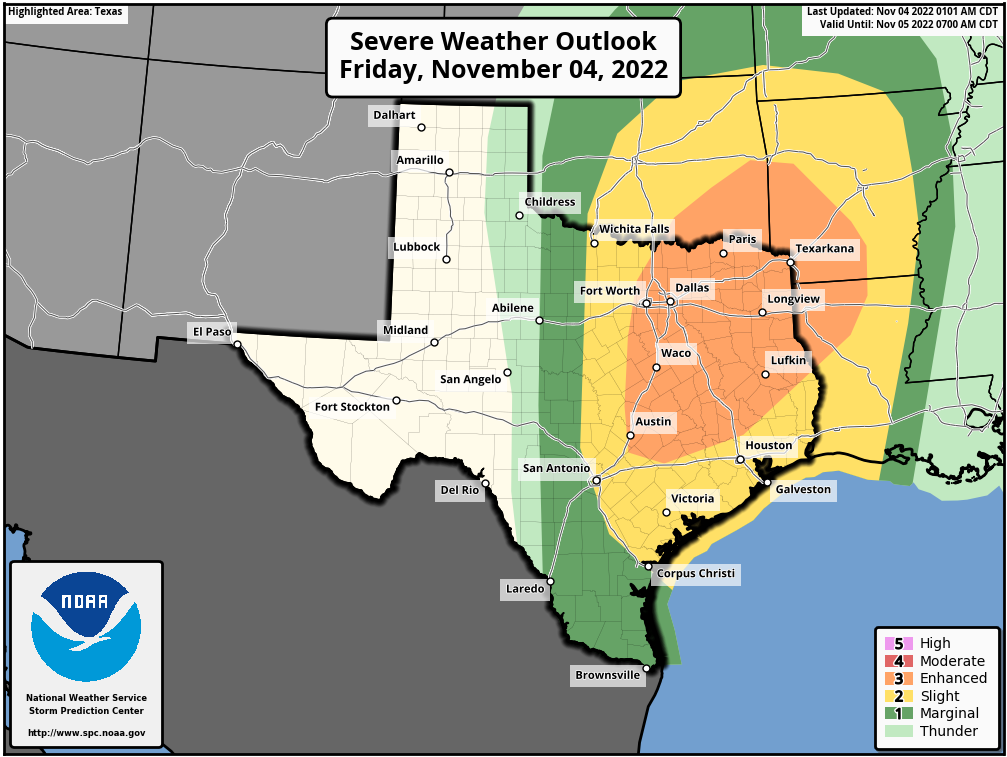
That area is in an enhanced risk (level 3/5) for severe weather today up that way. It does extend as far south as The Woodlands and extreme northwest Harris County, but that’s most likely a precaution. Places like College Station or Bryan will be close to seeing storms by evening, but more on that in a second.
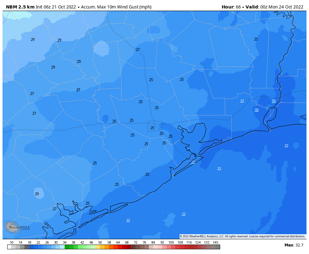
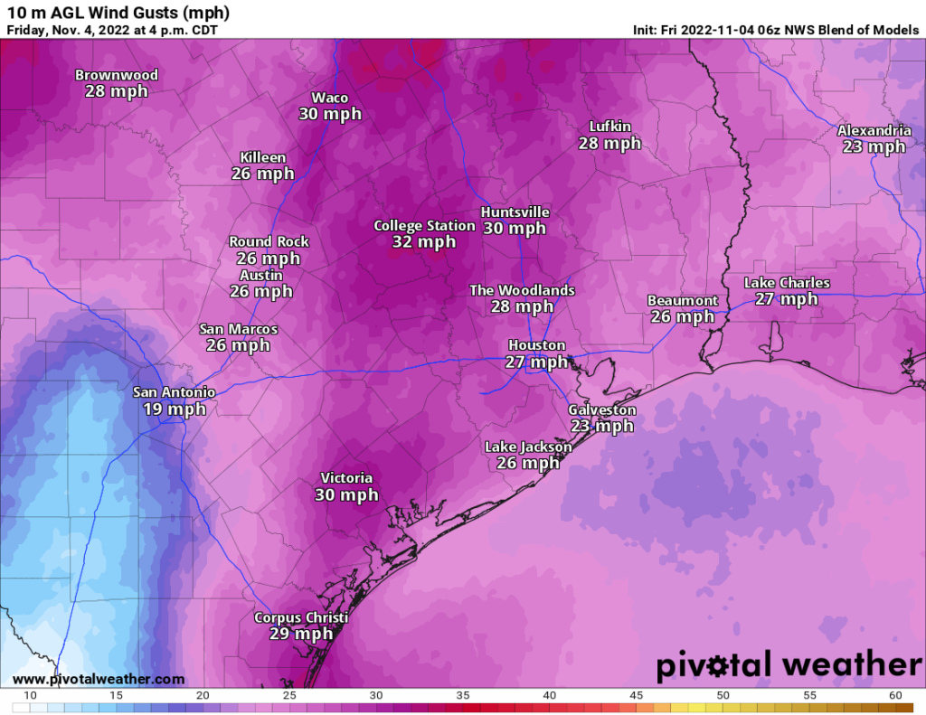
Outside of the slight shower chances in Houston today, it’s going to be rather breezy. We should see winds out of the south at 10 to 20 mph plus gusts, likely a bit higher over the water or along the coast.
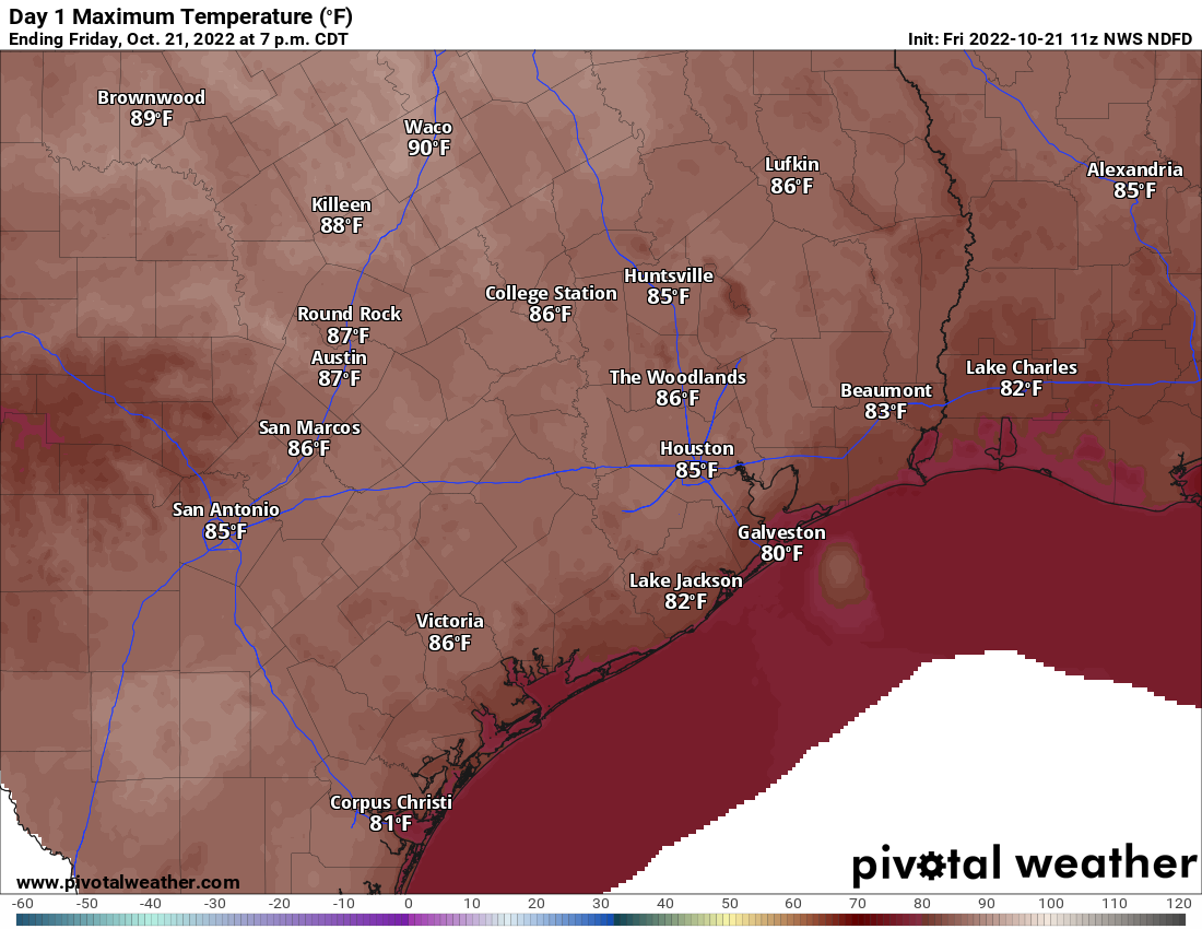
Back into the 80s we’ll go for highs today.
Tonight
There will be two areas of storms to watch for Houston. The first will come during the early evening. The tail end of that line of severe storms in northeast Texas could perhaps clip our northern readers from Conroe up through Madisonville east to Lake Livingston. That would occur between about 6 PM and 9 PM.
The second line of storms will develop back near I-35 in Central Texas during the early evening and arrive in the Brazos Valley by about 9 to 10 PM, the western part of our area up through Conroe and The Woodlands by about 10 to 11 PM and Houston shortly thereafter. Coastal areas will get the storms by Midnight or so. Give or take an hour or so on those time estimates. This is when we’ll have our severe weather risk, with strong, gusty winds being the primary concern.
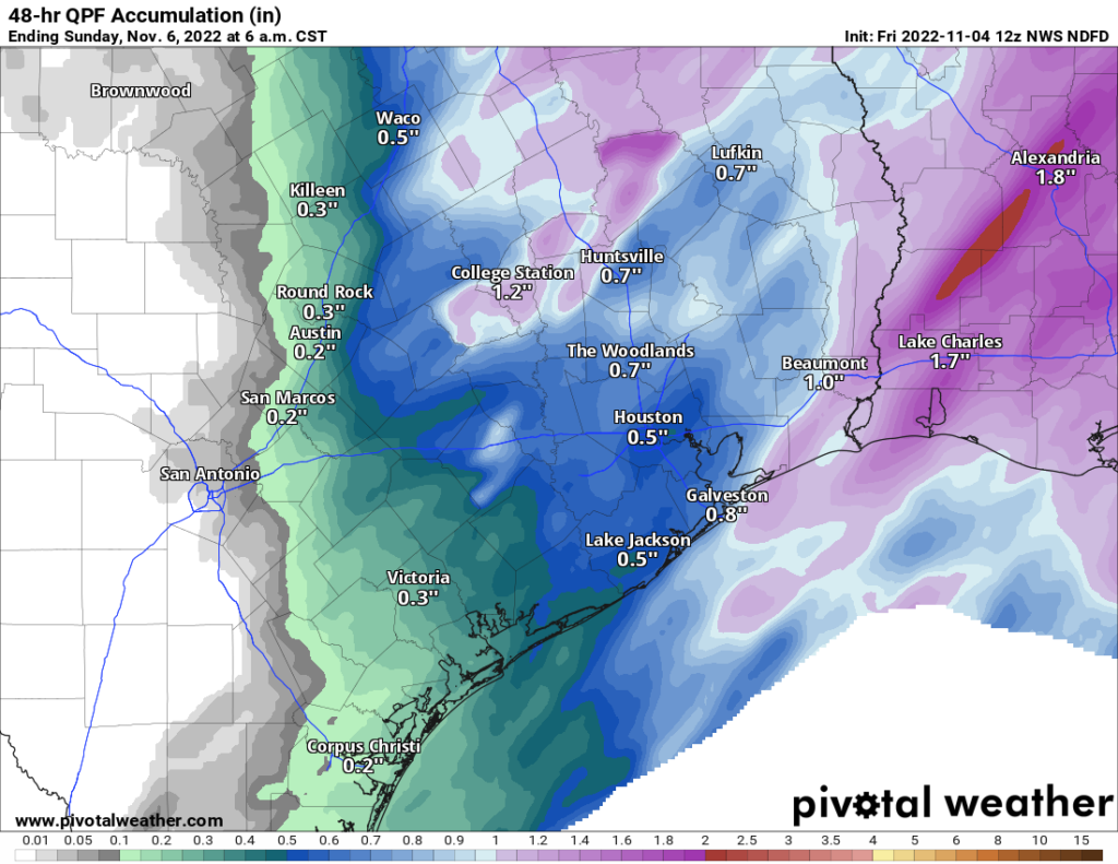
Again, these will move quick, so look for maybe 15 to 45 minutes of rough weather and then just some steady to moderate rain and rumbles of thunder for a couple hours after that. By sunrise on Saturday, virtually all the rain will be offshore and off to our east.
Temperatures will drop behind the front into the 60s and 50s. Winds will actually back down a bit behind the front as well.
Weekend
Overall, the weekend looks fine with no real weather issues. Clouds should clear out on Saturday morning. I know there’s been some confusion out there with Saturday morning’s outlook, but if you have any outdoor plans you should be able to confidently proceed with them tomorrow morning. It will be a bit cooler for sure though. Morning 60s will give way to the low or mid-70s. The turnaround to more humid weather will be rapid, however, and by Saturday night, after dropping into the 50s or low-60s, we may see temperatures begin to even rise a bit toward Sunday morning. Sunday itself will be fine with sun and clouds. But look for building humidity and highs well into the 70s, if not low-80s.
Astros Forecast

So, based on all that obviously, both days look just fine for any pregame or postgame festivities and/or celebrations. Your attire may be different for game 6 or (if necessary) game 7, however. Game 6 should be cool and only slightly humid with temperatures mostly in the 60s pregame and maybe even the upper 50s postgame. Will the roof be open? I’d argue MLB will say yes based on the weather. But we’ll see.
For a potential game 7, you would probably be dressing a bit lighter with mild temperatures and higher humidity. Temperatures should be in the 70s throughout. My guess is that the roof would almost certainly be open for a game 7. Somewhat chaotic winds would be blowing out to the Crawford Boxes, and with higher humidity a game 7 could be a slugfest. Whatever the case, Space City Weather says go Astros!
Next week
We could see a few isolated showers on Monday, but at this point it doesn’t look like much. The good news is that the higher humidity will probably peak on Monday or Tuesday before slowly declining some as the week goes on. Our next cold front is probably worth penciling in for about next Friday or Saturday. Details are TBD, but that may usher in a somewhat more prolonged cooler, less humid stretch than we’ve seen so far this autumn.