It’s tough to argue with the stretch of weather we’ve had this week. It’s been warm, certainly, but with pleasant mornings and evenings and generally low humidity, it’s been pretty outstanding. We will have changes beginning this weekend, and those will set the stage for our weather next week.
Today & Saturday
Both days should be sunny and warm. Look for highs near 90° today with generally low humidity. A similar story unfolds tomorrow with perhaps just a few more fair-weather clouds dotting the sky. Morning lows will be in the 60s or low 70s again. The dewpoint, or how much moisture is in the air will be a couple ticks higher tomorrow, so you may notice it feels a bit more humid, especially in the morning. Patchy fog is also possible in the morning.
Two other quick notes: Air quality has been atrocious this week. The combination is two-fold: An inversion (temperatures warming as you go up in the atmosphere) has trapped pollution and smog near the surface in the morning hours leading to an ugly haze. That should continue today and perhaps tomorrow. Secondly: The full sunshine has led to high levels of ozone each day in the area. This isn’t as visible to the eye, but it can trigger some respiratory ailments in people. On top of all this, if you’re a seasonal allergy sufferer (raises hand), you’ve felt it this week. Ragweed is a big problem, as are mold spores. But, I mean, aside from that, it’s been great!
Sunday
Our transition begins in earnest on Sunday. You’ll notice it a couple ways. First, expect sun and a few more clouds. Second, there could be a few light showers around, especially in the morning hours and especially southwest of Houston. The humidity will also be noticeably higher. In addition to all this, you’ll also notice the wind pick up Sunday. We’ve had a pretty lengthy stretch of light or calm winds this week, but onshore flow builds on Sunday with some 20 to 25 mph gusts possible, particularly near the coast. I don’t think this will be so much wind that it will impact Wings over Houston, but it’ll be a noticeable change.
Look for high temperatures on Sunday in the mid to upper-80s after morning lows in the 70s.
Monday
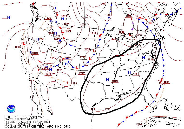
A cold front will take a swipe at the area on Monday, but it will likely come up short, fizzle, and/or quickly retreat back to the north. It will come close enough however to set off a few showers or storms Monday. We aren’t expecting anything too widespread, but some areas may see their first measurable rain in a good while. Look for warm and humid conditions with a continued onshore breeze. Expect mid to upper-80s after morning lows in the 70s.
Midweek
Tuesday through Thursday get a little more murky. The general expectation should be for warm, humid weather to continue. We’d likely see highs in the 80s and lows in the 70s. We would have at least a few showers in the area each day, but I am guessing the atmosphere will be fairly “capped” next week, meaning thunderstorm development would be tough to come by. That’s a typical Houston-area setup in autumn. Clouds and sun would take turns each day, aside from the isolated showers.
Late week
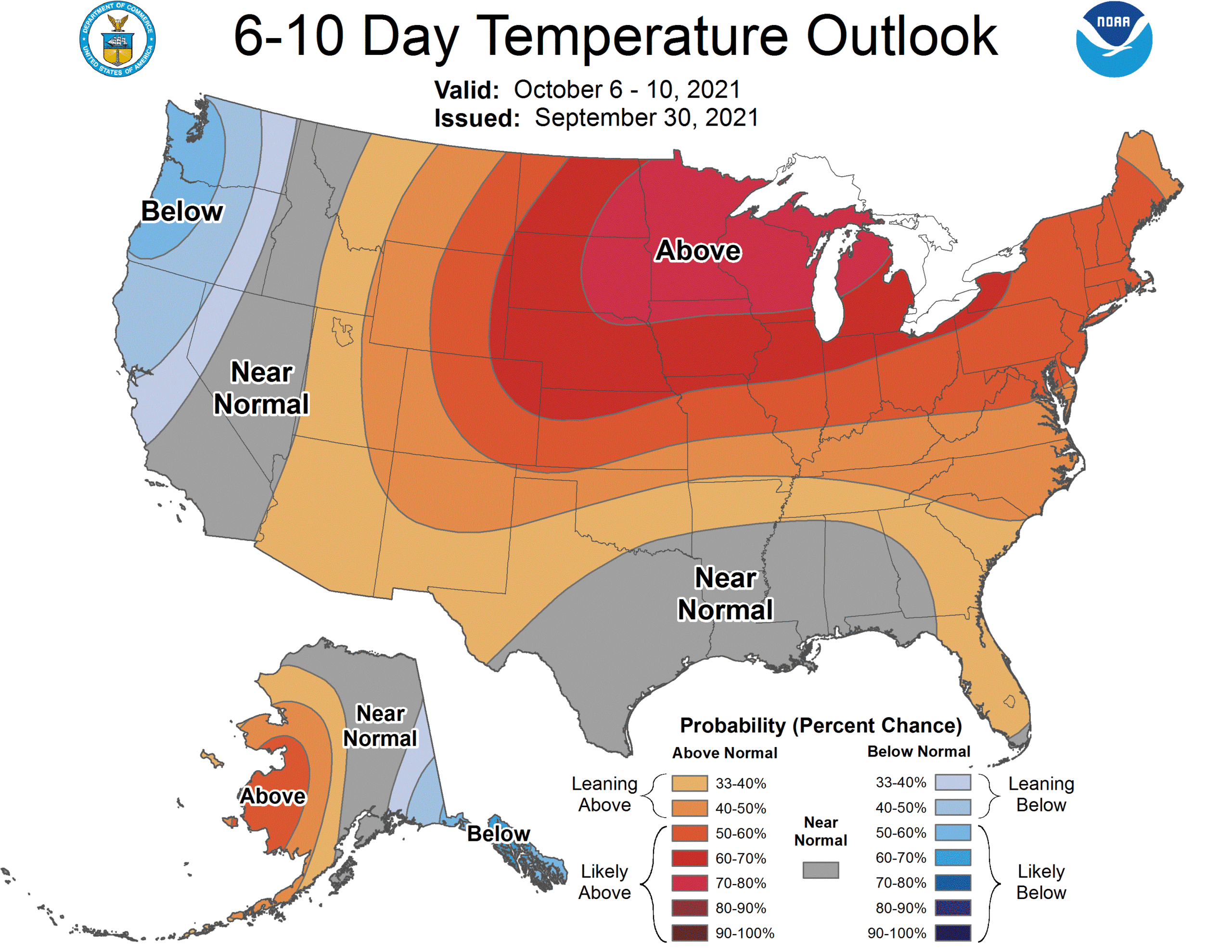
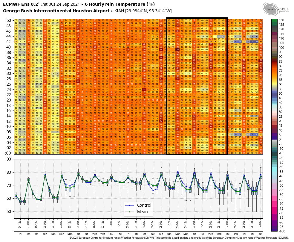
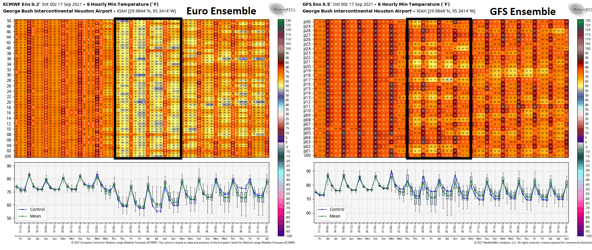
Here’s where the fun begins. When I wrote my post last Friday, I noted that there was no sign of a meaningful cold front for the foreseeable future. I cannot say that this week, however. Model support and evidence is building that a cold front, possibly a strong one, will push through the region sometime late next week or weekend. Over 90 percent of the Euro ensemble members (shown here) and over 50 percent of GFS ensemble members (not shown) have some sort of front pushing through next Saturday-ish.
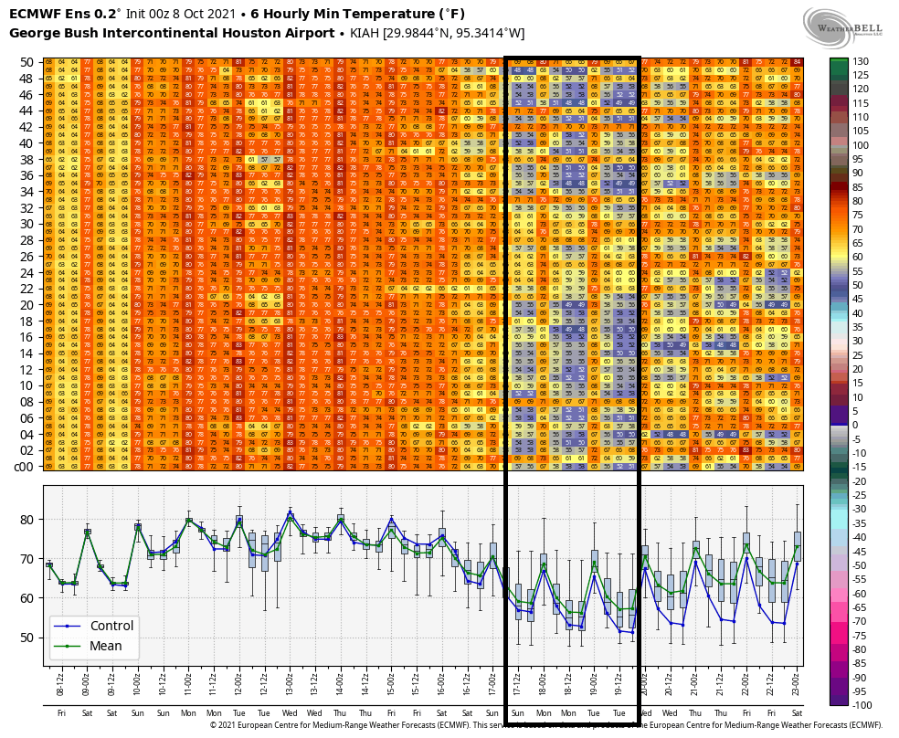
Of those Euro ensemble members, about 65% have lows in the mid-50s or cooler possible next Sunday or Monday the 18th. We will see if that can get us into our rhythm for the cool season here, which typically sees a front at least every week or so. Obviously, folks will be watching cold fronts with a little more urgency this year after February’s disaster. It’s still quite early, but we’ll be watching closely through the winter too.