In brief: The threat of storms and heavy rainfall today in Houston has diminished. But it’s still going to be an unpleasant day outdoors with intermittent showers, chilly air, and strong easterly winds.
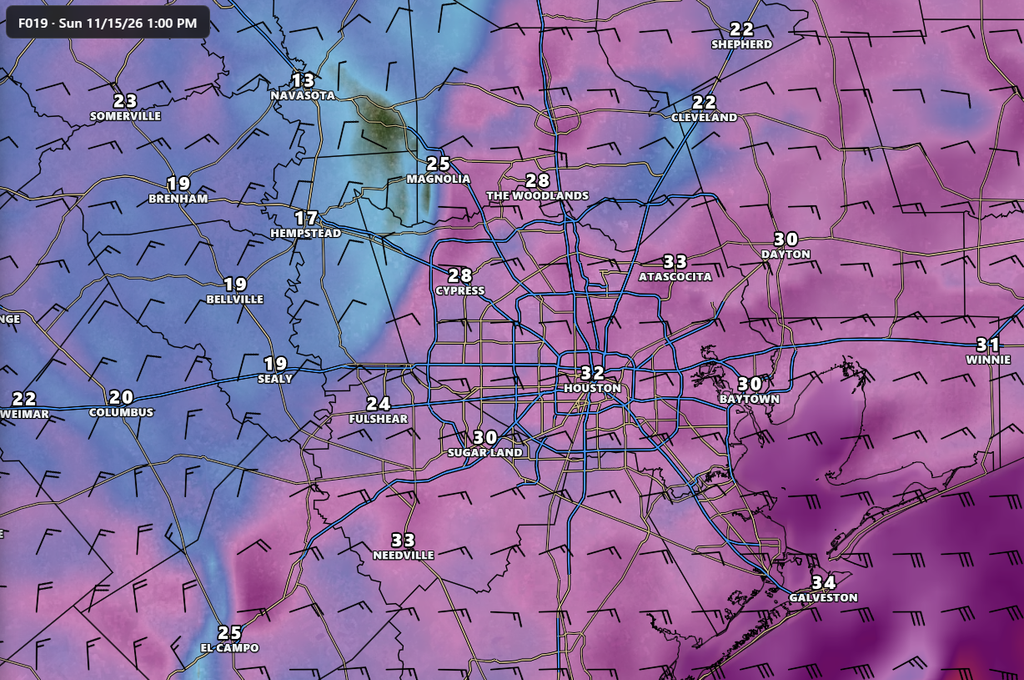
It is not a particularly nice Sunday outside this morning. The temperature at Bush Intercontinental Airport about an hour before sunrise was just 50 degrees, with light rain, and easterly winds gusting up to 28 mph. For many parts of Houston, conditions will not improve much throughout the day.
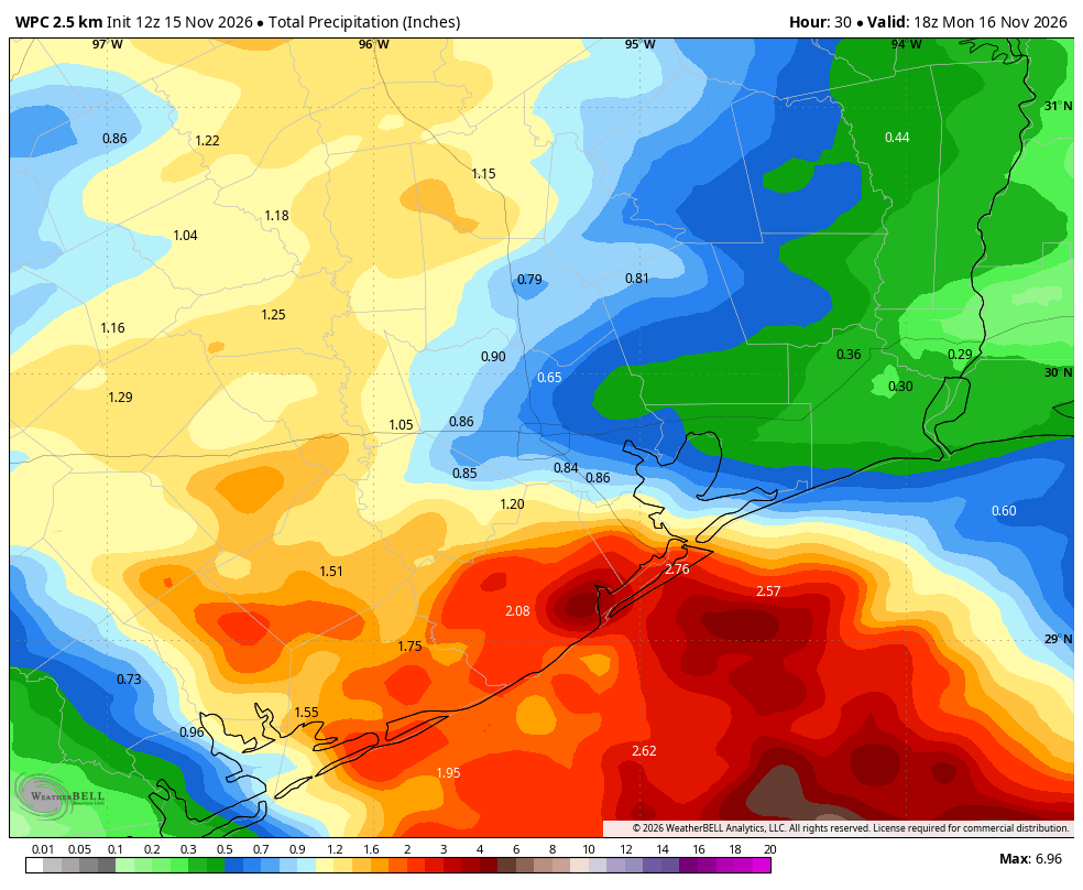
However, the forecast could be worse. There were some scenarios in which the coastal low today brought heavy rainfall into Houston. Although there remains the potential for some bullseyes of 3 inches or more for southern Brazoria County and other coastal areas, by and large the majority of the Houston region should pick up 0.5 to 1.5 inch of rain today, which should be totally manageable. The heaviest rain, and we are talking 6 to 10 inches, now looks set to fall well offshore today. Moreover, the threat of severe thunderstorms is lower in the Houston region than previously anticipated.
So yes, it’s going to be chilly today. Many areas north of Interstate 10 may well not climb out of the 50s. (Areas further south will get into the 60s today). There will be on-and-off rain showers from sunrise through about 9 pm or so this evening. And we will see strong winds from the east and northeast, gusting up to 30 or even 35 mph later today. But it could be worse!
After the rains end tonight, Monday should be a partly sunny day with highs in the upper 50s. Expect another chilly night on Monday night before we start warming somewhat this week. After today’s gloomy weather, if you’re missing the sunshine, you can circle Tuesday on your calendar for plenty of that.
We’ll be back in the morning with a full forecast. And also, thank you to everyone who has supported our ongoing, annual fundraiser!
