After emerging from Thursday’s storms mostly unscathed, Houston and Southeast Texas can look forward to much calmer weather as we go into the weekend.
TODAY
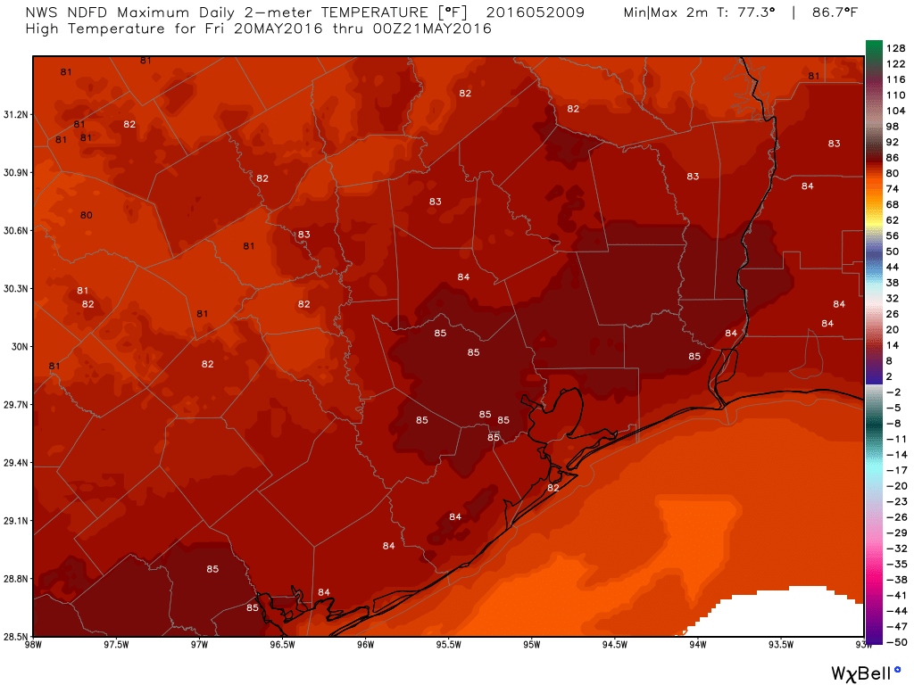
After days of “chance of thunderstorms,” we can pretty much finally take it out of the forecast. If I were a total stickler, I’d keep about a 10% chance of a shower south of I-10 and east of I-45 in, but I’m not, so we’ll call it partly to mostly sunny today after some morning low clouds or fog. Houston has yet to hit 90° this year, and today should be no exception. I expect us to max out in the mid 80s today.
It looks like a good evening, with the Astros back in town and the Dash in action at BBVA as well.
WEEKEND
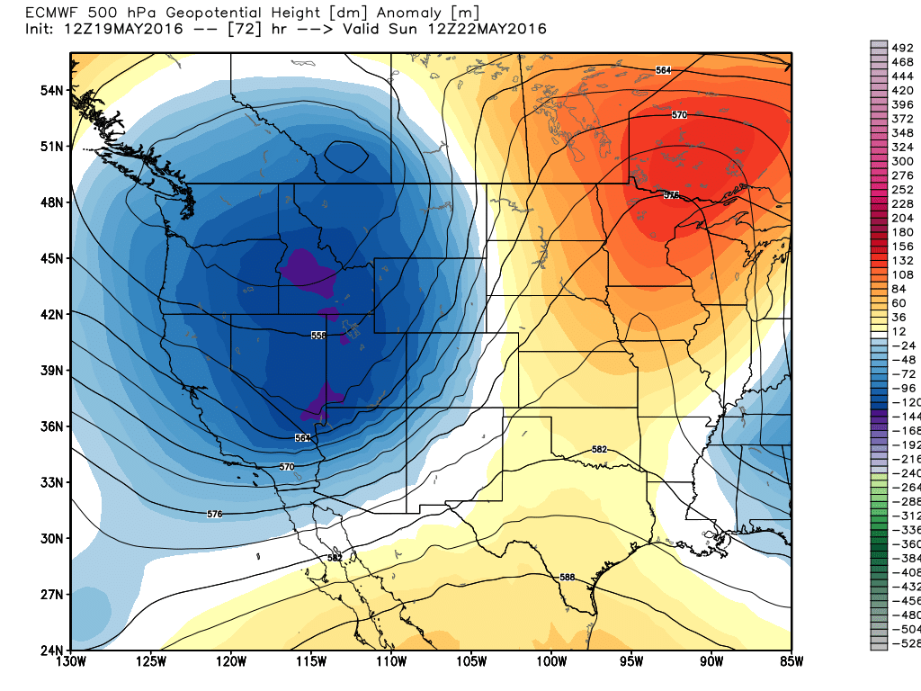
In a word? Not bad. Okay, that was two words. Really though, things look fine this weekend. Yes, there will be a “non-zero” chance of a downpour or rumble of thunder both Saturday and Sunday, but it would be very much the exception, not the rule. The overall weather pattern over Texas will transition from upper level trough (conducive for storms) to upper level ridge (sinking, drier air). This should keep a lid on any storms both days, especially Saturday.
So, we’ll call it a mix of sun and clouds both days and just that very, very slight chance of a brief downpour. High temperatures may push the upper 80s Saturday and mid to upper 80s Sunday. I think we’ve all earned a calmer weekend.
NEXT WEEK
The upper level ridge helping to keep us mostly quiet this weekend should weaken a bit early next week. So with sun and clouds, chances of afternoon and evening thunderstorms re-enter the forecast. Of Monday, Tuesday, and Wednesday, I think Monday stands the best chance at some scattered storms right now (nothing serious). By midweek, the ridge may flex once more before it gets kicked out of here. As that occurs, perhaps we could press toward our inaugural 90 degree day Wednesday with enough sunshine. We’ll see.
The pattern may shift back cooler and stormier once again later next week or next weekend.
Just an FYI…. HAPPY METEOROLOGY DAY!!!
Happy Meteorology Day! To recognize the signing of the Treaty of the Metre which took place in Paris in 1875, May 20th has been deemed “Meterology Day” in countries across the world. Seventeen nations met at the Metre Convention to set up guidelines and institutions for the measurement of weather and the metric system initially reliant upon French standards. The convention also served as the catalyst for the International Committee for
Weights and Measures, The International Bureau of Weights and Measures and the CGPM. The convention set new standards for global participation in the science behind measurement in its various applications.
High pressure is a good way to celebrate this day!
Nice job this week, gentlemen . . .
Thanks! Nice to have a (relatively) quiet period ahead.
Fingers crossed that we can make it to June without hitting 90, that would be pretty amazing for Houston!
When do we typically see our first 90 degree day?
Wrote about that earlier this month: http://spacecityweather.com/90-degree-days/
“The pattern may shift back cooler and stormier once again later next week or next weekend. ”
Do you mean we’ll back to floods, dangerous lightning and high winds later next week or nenxt weekend, Eric?