In brief: Quiet weather, (hopefully) less haze and smoke, and lower humidity will welcome us today and most of Saturday. Scattered to numerous showers and storms will bring a heavy rain chance back to the area on Sunday and Monday. We will be watching for flooding risks again to the north of Metro Houston.
I just want to start with a quick thank you to all that replied to our call for assistance earlier this week for our partners at the University of Houston working on weather messaging research. Nearly 200 of you responded, which is both amazing — and overwhelming! The small team of researchers at UH is working hard to get to everyone who replied. They should have more than enough response now to hopefully generate some interesting and useful results. Once again, you’re all awesome, so thank you!
Heavy rain update
While most of Houston saw little to no rain last night, areas to the north and west were clobbered with large hail or heavy downpours. There was another 1 to 4 inches of rain on the northern end of Lake Livingston. At this point, it does not appear that will do much to the Trinity River situation (which continues to slowly drop). But we’ll await updated forecasts later today. Meanwhile, the Brazos will begin to crest from north to south this weekend into next week.
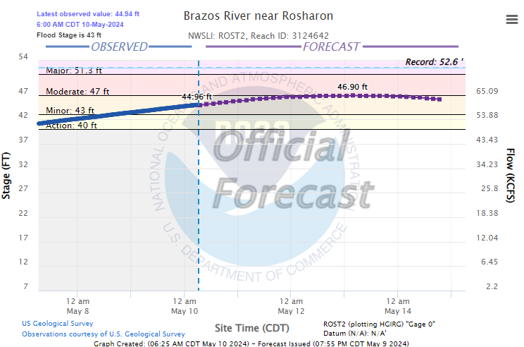
The crest should reach Rosharon by about Monday and then West Columbia by Tuesday, with minor to moderate flooding, which primarily affects the lowlands and perhaps a couple roads near the river. This is not currently expected to get worse.
Today
Update (10:05 AM): Some showers have developed across Wharton and Jackson Counties and will spread eastward through the morning. Brief heavy rain is possible, and a shower can’t be ruled out in Houston either.
Good news today. Air quality should improve. Yes, the last couple days have seen smoke from a lot, I mean a *lot* of agricultural fires in Mexico and Central America. It has degraded air quality and everyone’s mood. With a breeze today pointed offshore, that should hopefully push a lot of this smoke back south of here. Hopefully last night’s rain helped too. I won’t promise a super clean air quality day, but we are starting off much better than yesterday already.
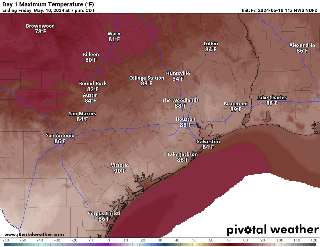
Will this end our streak of 90 degree-free days? Probably not. But it may be close. Drier air heats up more efficiently than humid air, and there may be just enough to push some of us over 90 today, particularly south of I-10. Maybe bet on Hobby Airport and not Bush Airport.
Saturday
This should be a mostly quiet day. Maybe a sprinkle or shower. But otherwise clouds, sun, still not terribly humid or hot. Morning lows will be in the 60s to near 70, with daytime highs in the mid-80s.
Mother’s Day & Monday
The word to your mother will be rain this year. Unfortunately we continue to see a soggy picture being painted for Sunday. I don’t think the entire day will be a washout everywhere, but an umbrella will be a required accessory for church or brunch or wherever your plans take you. Scattered to numerous showers and thunderstorms are likely on both Sunday and Monday. For the majority of metro Houston, most of the rain should be manageable. Some ponding or a stronger storm or two are possible. At this time, we don’t expect much worse than that. Again, that’s for most of Houston.
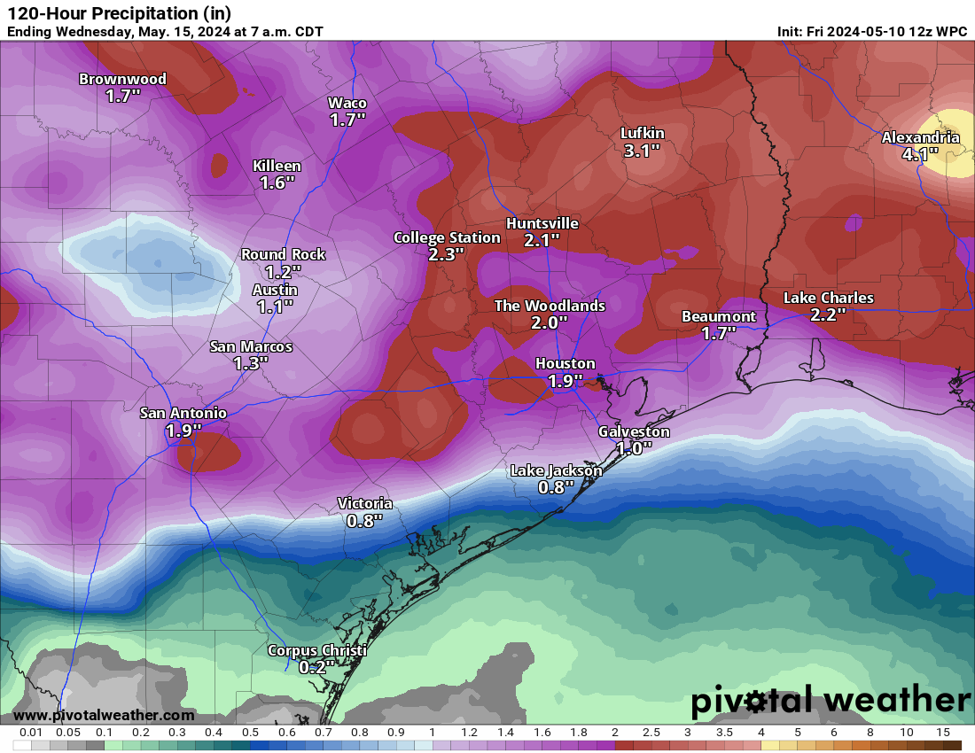
That said, atmospheric moisture is near the top of the charts for this time of year, which means that we could be talking about heavy rainfall rates in spots. If those rains end up north of I-10 in vulnerable areas up in Montgomery, northeast Harris, or Liberty Counties and points north, we may have flooding issues again. For now, let’s call it 1 to 3 inches of additional rain, with lower amounts possible south and higher amounts possible north. Keep tabs on the forecast this weekend. We will have at least one more update later tomorrow or Sunday morning with the latest.
Rest of next week
Quieter weather should follow for Tuesday or Wednesday before more storm chances return perhaps Wednesday night or Thursday. We have an opportunity to hit 90 on Tuesday, but then our next realistic chance won’t come until next weekend.

Having gone out for a walk at 6:10 this morning, I can attest to the lower humidity – – and the huge increase in skeeters….
“The word to your mother will be rain this year.”
I truly enjoy the strong dork vibe around this joint.
Same!
Yes! I laughed out loud. You guys are so clever 🤣🤣
Speaking of those agricultural fires, I can hope that it will be done by today since it wafts over here to make for poor air quality.
Very comfortable morning. I’ll take a dry 90 degrees any day!
In 2016 we did not get our first 90 degree day until June 9th. So I’m holding out hope this stretch of non 90 degree days continues…
Agreed because once the 90 degree days start they don’t know when to stop. Lol
What is the deal with every single storm centering on northeast Texas and skipping over areas southwest of Houston???